
The depopulated village of Al-‘Urayfiyya / District of Safed

Al-‘Urayfiyya
About the depopulated village of Al-‘Urayfiyya
- District
- Safed
- Date Al-‘Urayfiyya was occupied
- 01 April 1948
- Military operation
- Operation Yiftach
- Brigade that carried it out
- Palmach
- Distance from the governorate centre
- 21.5 (km) North East of Safad
- Elevation above sea level
- 175 m
Hover a dot to read the village name, or click to open its card.
Al-'Urayfiyya – Depopulated Palestinian Hamlet in Safad Subdistrict
Al-'Urayfiyya was a Palestinian hamlet in the Safad subdistrict of Galilee. It stood approximately 21.5 kilometers northeast of Safad at an average elevation of about 175 meters above sea level, on a slope at the foot of the Golan Heights overlooking the al-Hula Plain to the west.
During the British Mandate the Palestine Index Gazetteer classified Al-'Urayfiyya as a farm or hamlet rather than a large village. This helps explain why independent demographic and land statistics for the locality are extremely limited.
Walid Khalidi does not give a precise occupation date or an independent account of how the inhabitants were displaced. He places Al-'Urayfiyya among the eastern Galilee communities overrun during Operation Yiftach in April–May 1948 and suggests that its proximity to the Syrian border may have caused it to be attacked during an early stage of the operation.
Key Facts about Al-'Urayfiyya
| Field | Information |
|---|---|
| Name | Al-'Urayfiyya |
| Subdistrict | Safad |
| Distance from Safad | Approximately 21.5 km northeast |
| Average elevation | Approximately 175 m above sea level |
| Mandate classification | Farm / hamlet |
| Population, 1931 | No independently documented figure identified in the principal sources reviewed |
| Population, 1944/45 | No independently documented figure available |
| Registered land area | No independent official village-specific land table identified |
| Occupation date | Unknown precisely; during Operation Yiftach in April–May 1948 |
| Military operation | Operation Yiftach |
| Military unit | Palmach/Yiftach forces at the operation level; the village-specific unit is not established |
| Cause of depopulation | Uncertain at village level; Khalidi suggests flight or expulsion during the campaign, while Palestine Remembered classifies it as direct military assault |
| Extent of destruction | The built-up hamlet largely disappeared; remains of a stone water channel and watermill survived |
| Israeli settlements on village land | None documented |
Location
Al-'Urayfiyya stood on a slope at the foot of the Golan Heights in the northeastern part of the Safad subdistrict, close to the Palestine–Syria frontier.
The hamlet overlooked the al-Hula Plain to the west, while the higher terrain of the Golan rose to the east.
This position placed it in the transition zone between the Hula basin and the Syrian highlands.
Nearby Palestinian localities included Khiyam al-Walid, Ghuraba, al-Dirbashiyya, Baysamun, and al-Nabi Yusha', among the network of villages and small settlements surrounding the Hula Plain and the Syrian border.
Mandate-Era Classification
The Palestine Index Gazetteer classified Al-'Urayfiyya as a farm or hamlet.
This is important when interpreting the available historical data because the locality was not consistently represented in the detailed demographic and land tables available for larger villages.
Population
No independently documented population total for Al-'Urayfiyya in the 1931 census or the 1944/45 Village Statistics was identified in the principal sources reviewed.
Khalidi's village entry likewise provides no 1948 population estimate or later refugee total.
No population figures from neighboring localities such as al-Dirbashiyya, Khiyam al-Walid, or Ghuraba have therefore been transferred to Al-'Urayfiyya.
| Year | Population | Notes |
|---|---|---|
| 1931 | Not independently available | No separate figure established in the principal sources reviewed |
| 1944/45 | Not independently available | No separate figure appears in Khalidi/PalQuest |
| 1948 | Not reliably established | No estimate is used without a clear independent source |
Number of Houses
The principal sources reviewed provide no independently documented house count for Al-'Urayfiyya in 1931 or immediately before the Nakba.
No house total has therefore been inferred from maps, photographs, or the physical size of the site.
Village Lands
Khalidi and PalQuest do not provide an independent 1944/45 land-ownership table for Al-'Urayfiyya.
No separate land-use table identifying cereal acreage, orchards, irrigated plots, built-up land, or non-cultivable land has been established either.
Figures belonging to neighboring villages have therefore not been used to manufacture a land table for Al-'Urayfiyya.
Economic Life
Al-'Urayfiyya's position at the foot of the Golan overlooking the Hula Plain connected the hamlet with the agricultural and water-rich landscape of the northern Jordan Valley.
The principal sources, however, do not provide reliable village-specific acreage for crops or orchards.
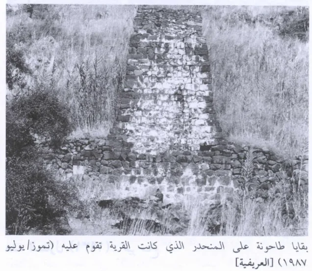
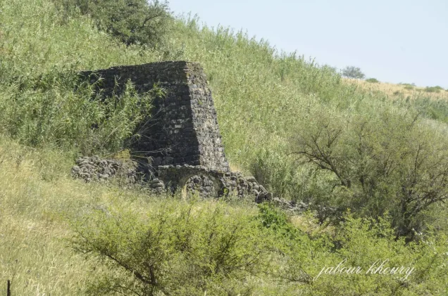
The most important surviving physical evidence of productive water use is the village's watermill and the masonry channel that carried water to power it.
Water and the Watermill
Al-'Urayfiyya possessed a water system used to power a mill.
A masonry channel carried water to the watermill, and remains of this channel were still visible in Khalidi's field survey.
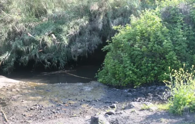
Palestine Remembered's community documentation also contains photographs of village springs and of the mill and its setting on the slope.
The principal sources reviewed do not provide a complete official inventory of the village's springs or their historical discharge.
Education and Public Institutions
Khalidi and PalQuest do not independently document a school, mosque, market, or other formal public institution within Al-'Urayfiyya.
Given its classification as a small hamlet, institutions belonging to larger neighboring villages have not been attributed to Al-'Urayfiyya without direct evidence.
Operation Yiftach
Operation Yiftach formally began on 15 April 1948 and continued until 25 May.
It was conducted within the framework of Plan Dalet and was designed by Palmach commander Yigal Allon to gain control of eastern Galilee and Safad before the end of the British Mandate and subsequently to secure routes toward the Syrian and Lebanese frontiers.
The Palmach carried out the main offensive, with its First Battalion spearheading the operation at the campaign level.
The campaign combined direct attacks, shelling, and psychological warfare. Between 10 and 15 May a “whispering campaign” was used in the Galilee panhandle and Hula region to encourage Palestinian villagers to leave.
Safad fell on 10–11 May, after which Yiftach forces moved northward to block routes through which Lebanese and Syrian forces might enter Palestine.
Occupation and Depopulation
Walid Khalidi states that the precise date on which Al-'Urayfiyya was occupied is unknown, as are the detailed circumstances of its depopulation.
He places the event within Operation Yiftach in April–May 1948.
Because the hamlet lay close to the Palestine–Syria border, Khalidi considers it probable that it was attacked during an early stage of the operation and that its inhabitants either fled or were expelled, as occurred at neighboring Khiyam al-Walid.
This remains a historical reconstruction rather than a confirmed village-specific date.
Correcting the 1 April Date
Palestine Remembered's automated statistical header gives 1 April 1948 as Al-'Urayfiyya's occupation date while simultaneously associating the event with Operation Yiftach.
Operation Yiftach did not formally begin until 15 April 1948.
Moreover, the Khalidi text reproduced on the same site explicitly states that the precise occupation date is unknown.
1 April should therefore not be treated as a confirmed occupation date.
Other secondary websites give 1 May or 10 May, but they do not provide independent evidence that overrides Khalidi's uncertainty. The occupation date is therefore best recorded as unknown precisely, during Operation Yiftach in April–May 1948.
Military Unit
The Palmach's First Battalion spearheaded Operation Yiftach at the campaign level.
Khalidi's Al-'Urayfiyya entry, however, does not identify the battalion or company that actually entered the hamlet.
The First Battalion's leading role in the operation should therefore not automatically be converted into a village-specific attribution.
The most accurate formulation is: Palmach/Yiftach forces at the operation level; the direct village-specific unit remains unconfirmed.
Cause of Depopulation
Khalidi does not establish a single definitive mechanism for Al-'Urayfiyya's depopulation.
He considers it likely that the inhabitants either fled or were expelled as Yiftach forces advanced through the frontier region.
Palestine Remembered classifies the cause as direct military assault.
Because no independent village-specific narrative of the moment of occupation survives in the principal source, the departure of the population should not be reduced to a single mechanism with unwarranted certainty.
Ethnic Cleansing
Palestine Remembered characterizes the final outcome at Al-'Urayfiyya as complete ethnic cleansing.
Khalidi establishes that the Palestinian community disappeared during Operation Yiftach but does not determine whether the inhabitants fled or were directly expelled when the hamlet was occupied.
The term “ethnic cleansing” is therefore retained as an attributed characterization used by Palestine Remembered, while the directly established descriptive fact is the complete depopulation of Al-'Urayfiyya during the military campaign.
Occupation Chronology
- 15 April 1948
Beginning of Operation Yiftach
Palmach forces began the campaign for eastern Galilee and Safad.
- Late April–early May 1948
Expansion of attacks in eastern Galilee
Numerous communities in the Safad and Hula areas came under attack or were depopulated.
- Unknown precisely
Probable occupation period of Al-'Urayfiyya
Khalidi suggests that its location near the Syrian frontier may have caused it to be attacked during an early stage of Operation Yiftach.
- April–May 1948
Depopulation
The inhabitants probably fled or were expelled; the village-specific mechanism remains uncertain.
- 10–15 May 1948
Psychological warfare campaign in the Hula region
Yiftach forces used a “whispering campaign” to encourage villagers in eastern Galilee and the Hula region to leave.
- 10–11 May 1948
Fall of Safad
The fall of the subdistrict center accelerated the departure of inhabitants from several surrounding communities.
- 25 May 1948
End of Operation Yiftach
Yiftach forces had gained control over most of eastern Galilee and the frontier zone.
- Precise date not documented
Destruction
Most of the hamlet disappeared, while remains of the masonry channel and watermill survived.
Israeli Settlements on Al-'Urayfiyya's Lands
Khalidi and PalQuest identify no Israeli settlement as having been established on Al-'Urayfiyya's village lands.
Settlements elsewhere in the Hula Valley or on neighboring Palestinian village lands should therefore not be assigned to Al-'Urayfiyya merely because of geographic proximity.
Al-'Urayfiyya Today
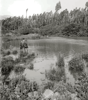
According to Walid Khalidi's field description, the former village site was deserted and overgrown with grass, thorns, several varieties of trees, and cactus plants.
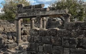
The most distinctive surviving feature was a masonry channel that had once carried water to power the village watermill.
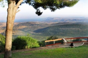
Palestine Remembered reproduces Khalidi's 1987 photograph of the ruined mill and also contains later community photographs of the watermill, village springs, and the site overlooking the Hula Plain.
Khalidi's description therefore documents the historical condition of the site during fieldwork conducted before the publication of All That Remains in 1992 and should not be treated as a comprehensive direct field verification of conditions in 2026.
Sources
- PalQuest – Interactive Encyclopedia of the Palestine Question: Al-'Urayfiyya
- PalQuest – Operation Yiftach
- Palestine Remembered – Al-'Urayfiyya, Safad District
- Walid Khalidi – All That Remains: Al-'Urayfiyya
- Institute for Palestine Studies – All That Remains, Walid Khalidi
- Palestinian Villages Encyclopedia – Al-'Urayfiyya, for comparison with secondary occupation-date claims
Photo gallery



Photos from the village's people
Photos sent in by visitors and published after review.
Add a photo of this village
Log in to add photos of this village.
Other villages from Safed


More from the archive


 Download Our Palestine App
The whole archive in the palm of your hand: depopulated villages, the Nakba, the massacres and Al-Aqsa — free, with no ads to erase the story.
Download Our Palestine App
The whole archive in the palm of your hand: depopulated villages, the Nakba, the massacres and Al-Aqsa — free, with no ads to erase the story.



Comments
No comments yet — be the first to write one.
Add your comment
Name and email are optional. Comments appear after review.