
The depopulated village of Jabbul / District of Baysan
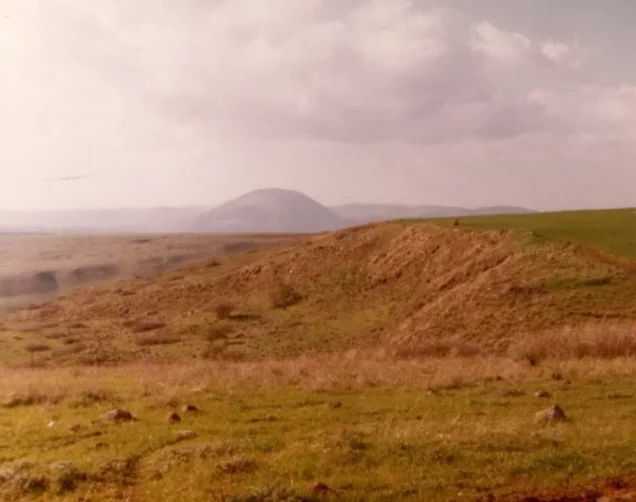
About the depopulated village of Jabbul
- District
- Baysan
- Date Jabbul was occupied
- 18 May 1948
- Population in 1948
- 290
- Military operation
- Operation Gideon
- Brigade that carried it out
- Golani Brigade
- Distance from the governorate centre
- 7 (km) North of Baysan
- Elevation above sea level
- 100 m
- Cause of displacement
- Fear of Jewish attack, or of being caught in the fighting
- Extent of destruction
- Jabbul was completely destroyed and only house rubble left behind.
- Ethnic cleansing
- Jabbul inhabitants were completely ethnically cleansed.
Hover a dot to read the village name, or click to open its card.
Borders of the depopulated village of Jabbul
Jabbul – Baysan Subdistrict
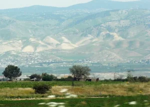
Jabbul was a depopulated Palestinian village in the Baysan subdistrict, situated approximately 7 km north of the town of Baysan at an average elevation of about 100 meters. It stood on a hill at the edge of the Baysan Valley, overlooking Wadi Yubla to the southwest, while Wadi al-'Ashsha crossed its lands to the south.
The official 1931 Census of Palestine recorded 218 inhabitants. In 1944/45, Jabbul itself had 250 Arab residents. The figure of 420 that appears in some statistical tables represents the combined statistical unit of Jabbul and the nearby Jewish settlement of Beyt Yosef: 250 Arabs and 170 Jews.
Jabbul was depopulated on 18 May 1948, shortly after Operation Gideon, the Golani Brigade campaign that established control over the Baysan Valley. Because Operation Gideon's formally recorded dates were 10–15 May, Jabbul's 18 May depopulation is best understood as occurring in the immediate aftermath of the operation during the consolidation of Golani control over the valley.
Location of Jabbul
Jabbul stood on a hill along the western edge of the Baysan Valley. Wadi Yubla lay to its southwest, while Wadi al-'Ashsha crossed the village lands to the south before descending eastward through the Baysan Valley toward the Jordan River.
A secondary road linked Jabbul with the Baysan–Jericho highway, while additional local roads and tracks connected it with neighboring villages and khirbas.
The village stood approximately 100 meters above sea level at the foot of the western uplands overlooking the valley.
Neighboring Villages and Areas
Palestinian village maps place the following localities around Jabbul:
| Direction | Nearby village / site |
|---|---|
| North | Khirbat al-Taqa |
| Northwest | Kafra |
| West | Yubla |
| East | Zab'a |
| Southwest | al-Murassas |
| South | al-Hamidiyya |
Kawkab al-Hawa was also important to the inhabitants as a nearby service and educational center, although geographical proximity should not automatically be treated as proof of a direct cadastral boundary.
Name and Earlier History
Walid Khalidi considers it possible that the site was known during the Roman period as Gebul or, more probably, Gebula.
The Crusaders also referred to the locality as Gebul. Khalidi suggests that the name may have been connected with an older term meaning “boundary.”
This identification remains a historical probability rather than proof of uninterrupted population continuity between the ancient settlement and modern Palestinian Jabbul.
In 1596, Jabbul was recorded as a farm paying taxes to the Ottoman government. The principal source does not provide a securely documented population figure for that entry, so none has been inferred here.
Jabbul in the Late Nineteenth Century
The Survey of Western Palestine described Jabbul in the late nineteenth century as a village situated on low ground, with houses built of stone and mud.
The village had a circular, radial layout. Houses extended outward from the center, while a network of narrow alleys connected the village core with roads leading toward surrounding settlements.
Agricultural land encircled the built-up area.
Population of Jabbul
- 1922231Official Census of Palestine: 230 Muslims and 1 Christian
- 1931218Official Census of Palestine; all inhabitants were Muslims
- 1944/45 – Jabbul250 ArabsPopulation of the Palestinian village itself
- 1944/45 – Beyt Yosef170 JewsPopulation of the settlement statistically combined with Jabbul, although the settlement was established on Zab'a land
- 1944/45 – combined statistical unit420250 in Jabbul + 170 in Beyt Yosef; not the population of Jabbul alone
- 1948 – Jabbul290Later Arab population estimate published by Palestine Remembered; not an official census
- 19981,781 refugees and descendantsLater demographic estimate published by Palestine Remembered
The figure of 420 should not therefore be presented as Jabbul's 1945 population. The village itself had 250 Arab inhabitants.
Number of Houses
- 193150Official Census of Palestine
- 194866Later Palestine Remembered estimate; not an official census figure
Land Ownership: Jabbul and Beyt Yosef in the 1945 Statistics
The land figures require an important qualification: the 1944/45 statistics combined Jabbul and Beyt Yosef into one land unit totaling 15,127 dunums.
- Arab5,407 dunums36%
- Jewish20 dunums<1%
- Public9,700 dunums64%
Using Palestine Remembered's simplified terminology, while preserving the qualification that this was a combined statistical unit:
- Palestinian5,407 dunums36%
- Transferred to Zionists20 dunums<1%
- Communal/Public9,700 dunums64%
The 15,127-dunum figure should not be presented without qualification as the land area of Jabbul alone, because the official table explicitly includes Beyt Yosef.
The Palestinian Encyclopedia gives a different figure of 30 dunums transferred to Zionists. The official 1945 Village Statistics/PalQuest table gives 20 Jewish dunums, which is therefore used here.
Land Use in 1944/45
- Arab
- Jewish
- Public
- Cereals5,697 dunums
- Plantations and irrigable land25 dunums
- Built-up land33 dunums
- Non-cultivable land9,372 dunums
In this form, the land-use categories balance exactly with the official ownership totals.
The current text rendering of PalQuest's table shifts the Public cereal figure out of its column. The 5,697-dunum cereal total balances only when the 4,367 Arab dunums are combined with 1,330 Public dunums.
Economic Life in Jabbul
Agriculture and livestock raising formed the principal basis of village life.
The inhabitants cultivated cereals, vegetables, and fruit. Most agriculture was rain-fed. In 1944/45, 4,367 Arab dunums were devoted to cereals and 5 dunums were irrigated or used as orchards.
The nearby uplands, covered with natural vegetation, were used for grazing livestock.
Several small shops operated in Jabbul, although the villagers relied heavily on Baysan and Kawkab al-Hawa for trade and other services.
Water
A spring east of Jabbul supplied the inhabitants with water.
The Palestinian Encyclopedia identifies it as 'Ayn al-Murra.
Agriculture itself remained predominantly dependent on rainfall, with only a small irrigated area recorded in the 1945 statistics.
Education and Services
No independent school is securely documented in Jabbul before the Nakba.
The villagers depended principally on Kawkab al-Hawa and Baysan for education, medical care, commerce, and other services.
Palestine Remembered specifically records that children from Jabbul attended school in Kawkab al-Hawa.
The Mosque and Shrine
The population was overwhelmingly Muslim by the late Mandate period.
Jabbul had a small mosque containing a domed shrine, located south of the village houses.
The principal source does not securely identify the person associated with the shrine, so no specific attribution has been added.
Archaeological Remains
Palestinian reference material records old tombs and remains of earlier buildings in the Jabbul area.
Khalidi considers it possible that the locality corresponded to Roman-period Gebul or Gebula, while Crusader sources also used the name Gebul.
These references indicate the antiquity of settlement in the area but do not by themselves prove uninterrupted population continuity into the modern Palestinian village.
Beyt Yosef and Its Relationship to Jabbul
Beyt Yosef was established in 1937 approximately 2 km southeast of Jabbul.
Khalidi clearly states that the settlement was built on land belonging to neighboring Zab'a rather than on Jabbul village land.
The 1944/45 statistical tables nevertheless combined Jabbul and Beyt Yosef into one population and land unit, explaining why Jewish population and ownership figures appear in the combined statistics.
This distinction between a statistical unit and the actual village lands on which the settlement stood is important.
Operation Gideon
Operation Gideon was the Haganah campaign designed to capture the Baysan Valley and depopulate its Palestinian communities.
The Golani Brigade carried out the operation between 10 and 15 May 1948. Baysan and several surrounding villages fell during the campaign, producing widespread displacement under the combined pressure of military assault and fear of further attacks.
PalQuest notes that the Irgun may have participated somewhere in the wider operation because it announced the capture of five Arab villages in the north on 14 May. There is no village-specific evidence establishing an Irgun role at Jabbul, and none is therefore assigned.
Occupation and Depopulation of Jabbul
Palestine Remembered and other Palestinian sources date Jabbul's depopulation to 18 May 1948.
Palestine Remembered associates the village with Operation Gideon and identifies the Golani Brigade as the responsible military formation. It classifies the immediate cause of departure as fear of attack or fear of being caught in the fighting.
A Palestinian local village encyclopedia gives a more direct formulation, stating that the village was attacked and its inhabitants expelled on 18 May.
Because Khalidi's electronically reproduced village entry does not provide a detailed narrative of the precise sequence of the assault and civilian departure, the safest conclusion is that Jabbul was depopulated on 18 May under the pressure of Golani's continued advance and military domination of the Baysan Valley.
Was Jabbul Captured “during” Operation Gideon?
The chronology requires precision.
PalQuest dates Operation Gideon from 10 to 15 May 1948, while Jabbul's indexed depopulation date is 18 May.
Jabbul clearly belongs to the military context created by Operation Gideon and Golani's takeover of the Baysan Valley, but its documented depopulation occurred three days after the operation's formal end date.
The more accurate formulation is therefore that Jabbul was depopulated in the immediate aftermath of Operation Gideon, during the consolidation of Golani control over the Baysan Valley.
Military Unit
The military formation securely associated with Jabbul's occupation is the Golani Brigade.
The village-specific sources do not identify a particular battalion or company.
The possible participation of the Irgun in Operation Gideon more generally does not establish that it took part in the occupation of Jabbul itself.
Occupation Chronology
- 10 May 1948
Beginning of Operation Gideon
The Golani Brigade began its campaign to capture the Baysan Valley and depopulate Palestinian communities.
- Around 12 May 1948
Capture of Baysan and advance through the valley
The fall of the district center and rapid military advance increased fear and displacement in surrounding villages.
- 15 May 1948
Formal end of Operation Gideon
PalQuest gives this as the formal end of the operation, although consolidation and displacement in the valley continued.
- 18 May 1948
Depopulation of Jabbul
Palestinian sources consistently index this date. The villagers left under the pressure of Golani's advance and fear of attack or being caught in the fighting.
- After 18 May 1948
Consolidation of control
The Palestinian population was no longer present in the village, and the surrounding lands were later cultivated.
- Later; exact date not established
Destruction of the built-up village
The village houses were reduced to rubble, but the core source does not provide a single documented demolition date.
Refugees from Jabbul
Palestine Remembered estimates Jabbul's Arab population in 1948 at approximately 290. This is a later demographic estimate rather than an official Mandate census figure.
The same source estimates that refugees from Jabbul and their descendants numbered approximately 1,781 in 1998.
Israeli Settlements on Jabbul Village Lands
Walid Khalidi and PalQuest state that no Israeli settlement was established on Jabbul's village lands.
| Settlement / facility | Established | Relationship to Jabbul |
|---|---|---|
| Beyt Yosef | 1937 | About 2 km southeast of Jabbul, but established on land belonging to Zab'a rather than Jabbul |
| Doshen | 1955 | A farm near the Jabbul site, also established on land belonging to Zab'a |
The Palestinian Encyclopedia states that residents of Beyt Yosef later cultivated some former Arab land of Jabbul. Subsequent agricultural use, however, is distinct from establishing the settlement itself on Jabbul village lands.
Jabbul Today
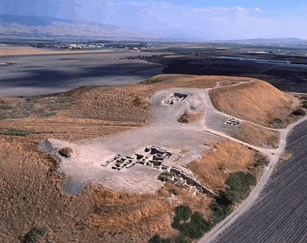
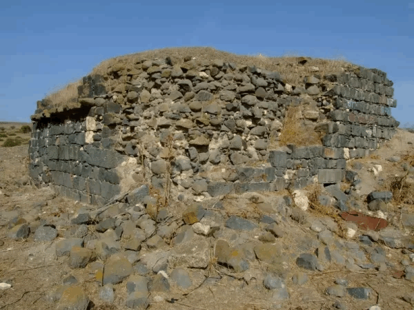
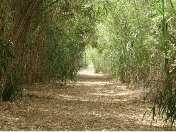
In Walid Khalidi's field description, the village houses had been reduced to rubble overgrown with trees, thorns, and wild grass.
The surrounding lands were being cultivated at the time of the survey.
This description does not constitute direct field verification of conditions in 2026. It derives from field research undertaken for All That Remains between 1987 and 1990, before the book's publication in 1992.
Palestine Remembered also hosts later photographs and community visits showing rubble and traces of the village site. Such material helps document subsequent change but does not by itself constitute a comprehensive contemporary field survey of all former Jabbul lands.
Sources
- PalQuestPalQuest – Jabbul
- PalQuestPalQuest – Operation Gideon
- Palestine RememberedPalestine Remembered – Jabbul, Baysan District
- Palestine RememberedPalestine Remembered – Jabbul entry from Walid Khalidi's All That Remains
- Institute for Palestine StudiesInstitute for Palestine Studies – Walid Khalidi, All That Remains
- pcbs.gov.psGovernment of Palestine – Census of Palestine 1922, historical PCBS copy
- pcbs.gov.psGovernment of Palestine – Census of Palestine 1931
- sabil.meVillage Statistics 1945 – Official population and land statistics
- palestinapedia.psPalestinian Encyclopedia – Jabbul
- palqura.comPalestinian Villages Encyclopedia – Jabbul; supplementary local documentation on depopulation
- PalQuestPalQuest – All That Remains: Methodology and Field Research
Photo gallery
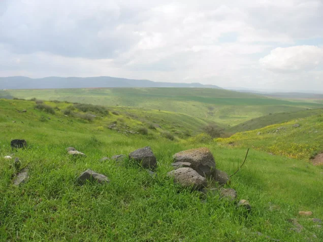
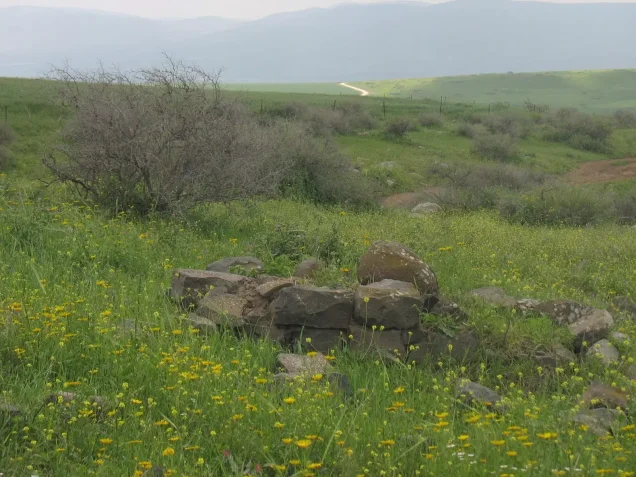


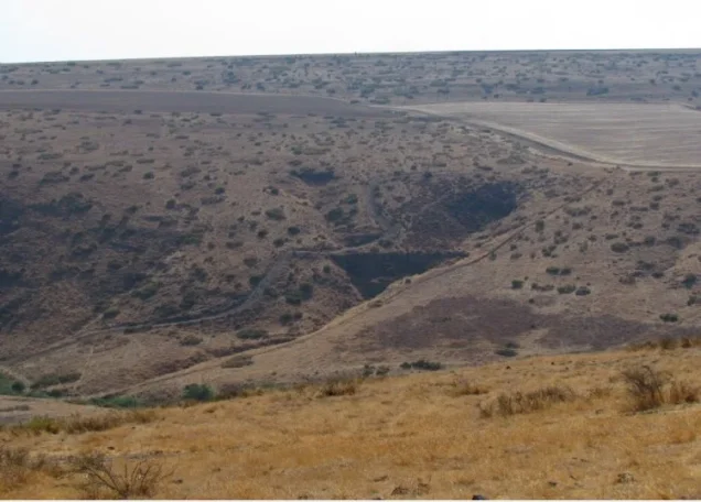
Photos from the village's people
Photos sent in by visitors and published after review.
Add a photo of this village
Log in to add photos of this village.
Other villages from Baysan
More from the archive



 Download Our Palestine App
The whole archive in the palm of your hand: depopulated villages, the Nakba, the massacres and Al-Aqsa — free, with no ads to erase the story.
Download Our Palestine App
The whole archive in the palm of your hand: depopulated villages, the Nakba, the massacres and Al-Aqsa — free, with no ads to erase the story.



Comments
No comments yet — be the first to write one.
Add your comment
Name and email are optional. Comments appear after review.