
The depopulated village of Barbara - Gaza / District of Gaza
Barbara - Gaza
About the depopulated village of Barbara - Gaza
- District
- Gaza
- Date Barbara - Gaza was occupied
- 04 November 1948
- Population in 1948
- 2,796
- Military operation
- Operation Yoav
- Brigade that carried it out
- Givati Brigade
- Who defended the village
- Egyptian Army
- Distance from the governorate centre
- 17 (km) North East of Gaza
- Elevation above sea level
- 50 m
- Cause of displacement
- Military assault by Zionist troops
- Extent of destruction
- The village was completely destroyed, and only house rubble left behind.
- Ethnic cleansing
- Barbara inhabitants were completely ethnically cleansed.
- Settlements built on the built-up area of Barbara - Gaza after 1948
- Mavqi'im , Talmei Yafe, Ge'a
Hover a dot to read the village name, or click to open its card.
Borders of the depopulated village of Barbara - Gaza
Barbara – Depopulated Palestinian Village of the Gaza District
Barbara was a depopulated Palestinian village in the Gaza District. It stood on the eastern edge of the coastal sand dunes running parallel to the Mediterranean Sea, approximately 17 kilometers northeast of Gaza, at an average elevation of about 50 meters above sea level.
Barbara was a relatively large agricultural village in northern Gaza District. It was especially renowned for its grapes, regarded as among the finest in Palestine, and also produced citrus, olives, figs, almonds, cereals, and other crops. Village women were known for weaving long rugs called al-mazawid.
The village experienced repeated attacks and clashes from January 1948 onward but remained outside Israeli control until the final phase of the war in the area. It fell on 4–5 November 1948 at the closing stage of Operation Yoav, shortly after al-Majdal. Its inhabitants were either expelled or fled under fire.
Location and Geography
Barbara stood on the eastern edge of the coastal sand hills and dunes running parallel to the Mediterranean Sea.
It lay approximately 17 kilometers northeast of Gaza at an average elevation of about 50 meters above sea level.
The center of the village occupied relatively flat ground, while some houses stood on more uneven terrain close to the dunes.
Barbara lay immediately west of the main coastal highway and railway line, providing access to towns and villages both north and south.
Secondary roads connected it with neighboring communities.
Ni'ilya lay to the north, al-Jiyya to the northeast, Bayt Tima to the east, Hulayqat to the southeast, Bayt Jirja to the south, Hiribya to the southwest, and al-Khisas to the northwest, while the Mediterranean Sea lay to the west.
Coastal Sand Dunes
Encroaching sand from the coast created a serious environmental problem for Barbara.
The dunes continued advancing toward cultivated and built-up land until the 1940s, when villagers succeeded in stabilizing them by constructing houses and planting trees in suitable locations.
Cactus hedges around gardens were also used to help stop the drifting sand.
Name and Earlier History
Walid Khalidi does not provide a conclusive linguistic derivation for the name Barbara.
Supporting Palestinian local sources offer several interpretations, including an Aramaic origin and another explanation relating the name to the village's elevated or outlying location.
Because these interpretations are not established in the principal source, they are treated as possible local explanations rather than settled linguistic facts.
Khalidi states that a village of the same name apparently existed on the site during the Roman period.
Shaykh Yusuf al-Barbarawi
The historian and geographer Mujir al-Din al-Hanbali recorded Barbara as the birthplace of Shaykh Yusuf al-Barbarawi, a local Muslim scholar and student of Ahmad ibn Dawud.
The memory of Shaykh Yusuf remained associated with the village into the twentieth century, and his tomb stood inside Barbara's old mosque.
Ottoman Period
In 1596, Barbara was a village in the nahiya of Gaza in the liwa' of Gaza.
Its population was approximately 402.
In the late nineteenth century, the village was described as rectangular in form and surrounded by gardens, with two ponds and olive groves to the east.
Most houses were constructed of adobe brick and separated by sandy lanes.
Mosque
An old mosque stood at the center of Barbara.
It was built during the reign of Ottoman Sultan Murad III, who ruled from 1574 to 1595/96, and contained the tomb of Shaykh Yusuf al-Barbarawi.
Together with the school and local shops, the mosque formed part of the village's social and built-up center.
Education
A boys' elementary school was established in Barbara in 1921.
Its enrollment reached approximately 252 pupils in 1947.
The school also served children from neighboring al-Jiyya, making Barbara an educational center for more than one village.
Population and Houses
Barbara's Mandate-era population was Muslim.
- 1596About 402Historical estimate based on Ottoman records
- 19221,369Official Census of Palestine; all inhabitants were Muslims
- 19311,546Official census; all inhabitants were Muslims
- 19452,410Official statistics; all inhabitants were Palestinian Arab Muslims
- 1948About 2,796Later demographic estimate, not an official Mandate census
- 1998About 17,168 refugees and descendantsLater estimate published by Palestine Remembered
The official 1931 census recorded 318 inhabited houses in Barbara.
The estimate of approximately 575 houses in 1948 is a later calculation rather than an official Government of Palestine census figure.
Water Resources
Agriculture in Barbara was primarily rainfed.
Several wells were nevertheless drilled to depths of approximately 35–40 meters to irrigate citrus groves and vegetable fields.
Late nineteenth-century descriptions also record two ponds in the village environment.
Economic Life and Agriculture
Agriculture formed the foundation of Barbara's economy.
The village was particularly famous for its grapes, which were considered among the finest varieties in Palestine and were marketed in numerous Palestinian towns and villages along the coast.
The inhabitants also cultivated almonds, figs, olives, oranges, guavas, watermelons, cantaloupes, and cereals.
Fruit trees were concentrated mainly west of the village, while cereal cultivation predominated to the east.
Barbara was also known for long woven rugs called al-mazawid, produced by village women.
Land Ownership, 1944/45
The total land area of Barbara was 13,978 dunams.
- Arab13,477 dunums96%
- Jewish0 dunums0%
- Public501 dunums4%
The official figures balance exactly: 13,477 + 501 = 13,978 dunams.
Palestine Remembered presents the corresponding figures using its own terminology: 13,477 dunams “Palestinian,” 0 dunams “Transferred to Zionists,” and 501 dunams “Communal/Public.”
The wording “Transferred to Zionists” should be preserved when reproducing that source's classification rather than automatically replacing it with the official “Jewish” category.
Land Use, 1944/45
- Arab
- Public
- Citrus and bananas132 dunums
- Plantations and irrigable land2,952 dunums
- Cereals9,615 dunums
- Total cultivable/cultivated land12,699 dunums
- Non-cultivable land1,209 dunums
- Built-up land70 dunums
- Total non-cultivable and built-up1,279 dunums
The official table balances exactly: 12,699 dunams of cultivated or cultivable land plus 1,279 dunams of built-up and non-cultivable land equal the total village area of 13,978 dunams.
Palestine Remembered's simplified table lists all 9,615 cereal dunams and 1,209 non-arable dunams under its Palestinian column. The official table shows that 2 cereal dunams and 499 non-cultivable dunams were Public land.
Early Clashes in 1948
Barbara experienced armed incidents from the opening weeks of 1948.
During the first half of January, people aboard a Jewish bus passing through the village opened fire on inhabitants, with no casualties reported.
At 7:00 a.m. on 12 January 1948, the village was fired upon again, breaking windows in the empty school building.
Clash of 10 April 1948
Another confrontation took place on 10 April 1948.
According to a report by Sudanese commander Tariq al-Ifriqi, villagers working in their fields came under fire from the direction of a nearby Jewish settlement, wounding one Palestinian farmer.
Village defenders returned fire and a battle lasting approximately two hours followed.
The account reported no additional Palestinian casualties and stated that villagers saw the attacking force carrying away its dead and wounded during withdrawal.
Operation Yoav
Operation Yoav began on 15 October 1948 as a major Israeli offensive intended to break Egyptian positions and link Israeli forces in the Negev with forces stationed farther north, south of Ramla.
At the operation-wide level, the participating Israeli formations included the Giv'ati, Yiftach, Negev, and Har'el brigades.
PalQuest explicitly lists Barbara among the Palestinian villages affected by Operation Yoav.
Occupation of Barbara
Barbara remained outside Israeli control until the final stage of the war in the area.
Walid Khalidi states that it fell on 4–5 November 1948 at the end of Operation Yoav, shortly after al-Majdal.
PalQuest's operation card formally dates Operation Yoav through 4 November, while the Barbara entry places the village's capture on 4–5 November.
The most precise formulation is therefore that Barbara was captured at the immediate closing stage of Operation Yoav, on the night of 4–5 November 1948.
Military Unit
Khalidi's village-specific account does not identify a particular brigade or battalion as the force that entered Barbara.
At the broader Operation Yoav level, the Giv'ati, Yiftach, Negev, and Har'el brigades participated.
Palestine Remembered tentatively suggests that the force attacking Barbara may have included elements of Giv'ati, Negev, and Yiftach.
Because this attribution is explicitly tentative and is not confirmed in the principal village account, the most accurate formulation is: Israeli occupation forces during the closing stage of Operation Yoav; the specific village-level attacking formation is not securely established.
Depopulation
Walid Khalidi states that Barbara's inhabitants were either expelled or fled under fire.
This wording preserves the possibility of different experiences among the villagers: some may have been directly expelled while others fled in response to the assault and ongoing fire.
The depopulation should therefore neither be reduced to “voluntary flight” nor described as an identical direct expulsion of every resident without further village-specific evidence.
Occupation Chronology
- First half of January 1948
Early shooting incident
People aboard a Jewish bus fired at villagers; no casualties were reported.
- 12 January 1948
Attack on the village and school
Barbara came under gunfire and windows in the empty school were broken.
- 10 April 1948
Field confrontation
One farmer was wounded, Palestinian defenders returned fire, and the battle lasted approximately two hours.
- 15 October 1948
Beginning of Operation Yoav
Israeli forces launched a broad southern offensive intended to break Egyptian lines and link the Negev with territory farther north.
- Early November 1948
Fall of al-Majdal
Al-Majdal fell shortly before Barbara during the closing phase of the campaign.
- 4–5 November 1948
Occupation of Barbara
The village fell to Israeli occupation forces at the immediate closing stage of Operation Yoav.
- During occupation
Depopulation
The inhabitants were expelled or fled under fire; the source does not quantify each category.
- After occupation; exact date not documented
Destruction
Most village structures were demolished, although walls, rubble, and sections of former lanes remained.
Israeli Settlements on Village Lands
Mavqi'im was established on 12 January 1949 immediately south of Barbara on village land.
Khalidi states that it was established for the purpose of preventing the Palestinian villagers from returning.
Talmei Yafe was established in 1950 southeast of the village site, also on Barbara's lands.
Ge'a, established in 1950 northeast of the site, lies close to Barbara but was not built on its land; it was established on the lands of neighboring al-Jiyya.
Barbara Today
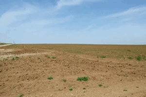
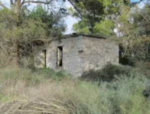
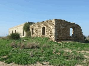
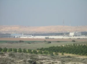
According to the field description published in Walid Khalidi's All That Remains, only crumbling walls and rubble from the village houses remained.
Thorns and brush covered much of the debris, while old eucalyptus and sycamore trees and cactuses grew across the site.
Some former village lanes remained clearly identifiable.
Part of the site was being used as a garbage dump and junkyard for damaged cars, while surrounding land was cultivated with corn.
This description should not be treated as a comprehensive field verification of conditions in 2026. Fieldwork for All That Remains was conducted between 1987 and 1990 and therefore documents the site's condition during that survey period.
Sources
- PalQuest – Interactive Encyclopedia of the Palestine Question: Barbara
- PalQuest – Operation Yoav
- Palestine Remembered – Barbara, Gaza District
- Palestine Remembered – Arabic documentation for Barbara
- Palestinian Villages Encyclopedia – Barbara; supporting Palestinian documentation
- Palestinian Encyclopedia – Barbara
- Government of Palestine – Census of Palestine 1931: Barbara, 1,546 inhabitants in 318 houses
Photos from the village's people
Photos sent in by visitors and published after review.
Add a photo of this village
Log in to add photos of this village.
Other villages from Gaza
More from the archive


 Download Our Palestine App
The whole archive in the palm of your hand: depopulated villages, the Nakba, the massacres and Al-Aqsa — free, with no ads to erase the story.
Download Our Palestine App
The whole archive in the palm of your hand: depopulated villages, the Nakba, the massacres and Al-Aqsa — free, with no ads to erase the story.



Comments
No comments yet — be the first to write one.
Add your comment
Name and email are optional. Comments appear after review.