
The depopulated village of Al-Jiyya / District of Gaza

Al-Jiyya
About the depopulated village of Al-Jiyya
- District
- Gaza
- Date Al-Jiyya was occupied
- 04 November 1948
- Population in 1948
- 1,430
- Military operation
- Operation Yoav
- Brigade that carried it out
- Givati Brigade
- Who defended the village
- Egyptian Army
- Distance from the governorate centre
- 19 (km) North East of Gaza
- Elevation above sea level
- 25 m
- Cause of displacement
- Military assault by Zionist troops
- Extent of destruction
- The village was completely obliterated.
- Ethnic cleansing
- al-Jiyya inhabitants were completely ethnically cleansed.
- Settlements built on the built-up area of Al-Jiyya after 1948
- Ge'a, Beit Shikma, Talmei Yaffe
Hover a dot to read the village name, or click to open its card.
Borders of the depopulated village of Al-Jiyya
al-Jiyya: A Depopulated Palestinian Village in the Gaza District
al-Jiyya was a Palestinian village in the Gaza District, located approximately 19 km northeast of Gaza city on the southern coastal plain. Its inhabitants were displaced and the village was destroyed during the Nakba and the occupation of Palestine in 1948. Israeli occupation forces took the village on 4–5 November 1948, at the end of Operation Yoav.
Location of al-Jiyya
al-Jiyya stood on a sandy site surrounded by hills on the southern coastal plain. Several wadis descended around the village and periodically exposed it to flooding.
The village was approximately 19 km northeast of Gaza. PalQuest records an average elevation of 50 metres above sea level, whereas Palestine Remembered gives an elevation of 25 metres. The two sources therefore differ on this figure.
The coastal highway and railway line ran close to the western side of the village. The lands of Ni'ilya lay to the west, Barbara to the south and southwest, Bayt Tima to the east and northeast, and al-Majdal to the northwest.
Name and History of al-Jiyya
Walid Khalidi associates the name al-Jiyya with the physical character of its site and the wadis surrounding it, noting a meaning related to a place where water collects. The village has also been identified with a settlement recorded in Crusader documents as Algie.
According to the villagers, al-Jiyya had once been destroyed and was later rebuilt during the period of Muhammad Abu Nabbut, who governed Jaffa and Gaza between 1807 and 1818.
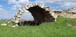
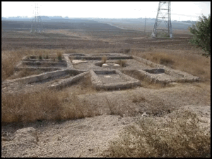
Archaeological remains found at al-Jiyya included a stone column and the remains of a Roman mill.
Community and Services in al-Jiyya
The inhabitants of al-Jiyya were Muslim, and the village had its own mosque. Children from al-Jiyya attended school in the neighbouring village of Barbara.
The villagers installed a pump on one of the wells in the area to draw water for domestic use.
Economic Life in al-Jiyya
Agriculture was the principal source of livelihood in al-Jiyya. The villagers cultivated cereals as well as citrus and other fruit crops, while livestock raising and dairy production also contributed to the local economy.
al-Jiyya was particularly known for cheese and other dairy products that were sold in Gaza and al-Majdal.
In the 1944/45 statistics, 8,004 dunums were allocated to cereals, 189 dunums to citrus and bananas, and 26 dunums were irrigated or used for plantations.
Land Ownership in al-Jiyya
The total land area of al-Jiyya was 8,506 dunums. PalQuest classifies 8,274 dunums as Arab-owned and 232 dunums as public land. Palestine Remembered presents the corresponding categories as Palestinian and communal land and records no land as having been transferred to Zionists.
Land ownership in al-Jiyya, 1944/45
- Arab / Palestinian8,274 dunums97%
- Transferred to Zionists0 dunums0%
- Public / communal232 dunums3%
Land Use in al-Jiyya, 1944/45
Land use in al-Jiyya
- Citrus and bananas189 dunums1%
- Plantations and irrigable land26 dunums<1%
- Cereals8,004 dunums48%
- Built-up area45 dunums<1%
- Cultivated / cultivable land8,219 dunums49%
- Non-cultivable land242 dunums1%
Population of al-Jiyya
Population of al-Jiyya in selected years
- 1922667Official British Mandate census
- 1931899Official British Mandate census
- 1944/451,230Official statistics
- 19481,427Later estimate published by Palestine Remembered
- Estimated refugees in 19988,762Later estimate published by Palestine Remembered
Number of Houses in al-Jiyya
Number of houses in al-Jiyya
- 1931188Official census figure
- 1948298Later estimate published by Palestine Remembered
Occupation and Depopulation of al-Jiyya during the Nakba
al-Jiyya fell to Israeli occupation forces at approximately the same time as the city of al-Majdal, on 4–5 November 1948, during the final stage of Operation Yoav, one of the major military operations carried out in southern Palestine during the Nakba.
Operation Yoav began on 15 October 1948 and ended on 4 November 1948. PalQuest lists al-Jiyya among the villages affected by the operation. The operation as a whole involved the Givati, Yiftach, Negev, and Harel brigades against Egyptian forces.
Walid Khalidi's dedicated entry for al-Jiyya does not identify a specific brigade as the unit that captured the village itself. Palestine Remembered, however, identifies the Givati Brigade as the attacking unit and the Egyptian Army as the defending force. This attribution is therefore presented with its source rather than as a detail unanimously stated by all references.
- Date of occupation and displacement: 4–5 November 1948; Palestine Remembered specifically lists 4 November.
- Military operation: Operation Yoav.
- Attacking unit: Palestine Remembered identifies the Givati Brigade, while Khalidi's dedicated village entry does not specify a brigade.
- Defending force: Palestine Remembered identifies the Egyptian Army; PalQuest lists Egyptian forces as the Arab military force opposing Operation Yoav as a whole.
- Fate of the inhabitants: Khalidi considers it likely that residents fled or were expelled toward the Gaza Strip, which was already receiving large numbers of Palestinian refugees.
- Fate of the village: its built-up features were subsequently destroyed.
Settlements Established on the Lands of al-Jiyya
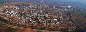
Two settlements were established on the lands of the village after the Nakba:
- Ge'a: established in 1949 on the lands of al-Jiyya.
- Beyt Shiqma: established in 1950 on the lands of al-Jiyya.
al-Jiyya Today
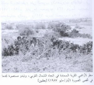
According to the field description published by Walid Khalidi in All That Remains, all visible traces of the built-up village had been obliterated, while some sycamore trees remained at the site. The surrounding lands were being cultivated, and the source specifically recorded cantaloupe cultivation by residents of Beyt Shiqma.
This description derives from field research published in Khalidi's book in 1992. The approved sources used here do not provide a comprehensive independent field verification of the condition of every part of al-Jiyya's site in 2026. It should therefore be treated as the latest available reference description rather than a real-time account of the site.
Sources
Photos from the village's people
Photos sent in by visitors and published after review.
Add a photo of this village
Log in to add photos of this village.
Other villages from Gaza
More from the archive


 Download Our Palestine App
The whole archive in the palm of your hand: depopulated villages, the Nakba, the massacres and Al-Aqsa — free, with no ads to erase the story.
Download Our Palestine App
The whole archive in the palm of your hand: depopulated villages, the Nakba, the massacres and Al-Aqsa — free, with no ads to erase the story.



Comments
No comments yet — be the first to write one.
Add your comment
Name and email are optional. Comments appear after review.