
The depopulated village of Khirbet al-Khisas / District of Gaza
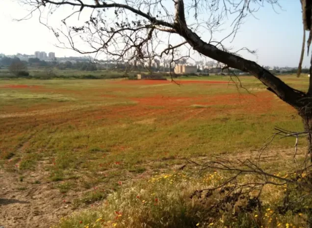
Khirbet al-Khisas
About the depopulated village of Khirbet al-Khisas
- District
- Gaza
- Date Khirbet al-Khisas was occupied
- 05 November 1948
- Population in 1948
- 170
- Military operation
- Operation Yoav
- Who defended the village
- Local militia
- Distance from the governorate centre
- 18.5 (km) North East of Gaza
- Elevation above sea level
- 25 m
- Extent of destruction
- The village has been completely destroyed, and only house rubble left behind.
- Ethnic cleansing
- al-Khisas inhabitants were completely ethnically cleansed.
- Settlements built on the built-up area of Khirbet al-Khisas after 1948
- Ashkelon's southern neighborhoods (Ganei Shikmim), Golda), Industrial Area south of Ashkelon
Hover a dot to read the village name, or click to open its card.
Borders of the depopulated village of Khirbet al-Khisas
Al-Khisas (Khirbat al-Khisas) – Depopulated Palestinian Village of the Gaza District
Al-Khisas, also known as Khirbat al-Khisas, was a depopulated Palestinian village in the Gaza District. It stood on level ground on the coastal plain approximately 18.5 kilometers northeast of Gaza, at an average elevation of about 25 meters above sea level.
Sand dunes surrounded the village on the north and west. The inhabitants planted trees to help stabilize the dunes and prevent the sand from advancing toward their homes and cultivated land.
Israeli occupation forces entered al-Khisas on 4–5 November 1948, at approximately the same time as they entered the city of al-Majdal, at the end of Operation Yoav. The village population was displaced, and the subsequent urban expansion of the Israeli city of Ashqelon eventually engulfed the former village site.
Location and Geography
Al-Khisas stood on flat ground in the coastal region of the Gaza District.
It lay approximately 18.5 kilometers northeast of Gaza at an average elevation of about 25 meters above sea level.
Sand dunes bordered the site on the northern and western sides, and villagers planted trees to stabilize them and restrict the movement of sand toward the settlement.
A secondary road connected al-Khisas with the main coastal highway approximately 4 kilometers to the east, through which the village was linked to Gaza and al-Majdal.
Other dirt roads connected it with nearby villages, particularly al-Jura and Ni'ilya, while Hiribya and Barbara lay in the broader area to the south.
Name
The village was known as both al-Khisas and Khirbat al-Khisas.
Palestine Remembered gives an etymological explanation deriving al-Khisas from the plural of khuss, a hut or dwelling made of reeds, and associates the term with Syriac.
This derivation does not appear in Walid Khalidi's principal village description and is therefore retained as a traditional linguistic explanation rather than a conclusively established etymology.
Origins of the Modern Village
The site was known as an older khirba before the establishment of the modern Palestinian settlement.
Remnants of wells, archaeological remains, and burial grounds indicate earlier habitation.
The modern village itself developed after World War I.
At first, farmers from surrounding areas constructed temporary huts on the site to shelter during the harvest season.
Some gradually settled permanently and built adobe houses, transforming the khirba into a stable rural community.
Built Environment
Al-Khisas was classified as a hamlet in the Mandate-era Palestine Index Gazetteer.
The village had an approximately square layout, with narrow lanes separating houses built mainly of adobe.
The official 1944/45 statistics classified approximately 10 dunams as built-up land.
Population and Houses
The inhabitants of al-Khisas during the Mandate period were Muslims.
- 1922102Official Census of Palestine; all inhabitants were Muslims
- 1931133Official census; all inhabitants were Muslims
- 1945150Official statistics; all inhabitants were Palestinian Arab Muslims
- 1948About 174Later demographic estimate, not an official Mandate census
- 1998About 1,069 refugees and descendantsLater estimate published by Palestine Remembered
The official 1931 census recorded 26 inhabited houses in al-Khisas.
The 1948 and 1998 figures are later demographic estimates rather than official Government of Palestine census results.
Education and Services
Al-Khisas was not a major service center.
Its inhabitants relied on al-Majdal and the neighboring villages of al-Jura and Ni'ilya for medical, educational, and administrative services.
Palestine Remembered states that village children attended a shared school in al-Jura.
The principal sources therefore do not document an independent school within al-Khisas itself.
Water Resources
The inhabitants obtained water from wells surrounding the village.
The wells served domestic needs and also supplied irrigation for vegetables, orchards, and fruit trees.
The availability of groundwater helped sustain an unusually large area of irrigated cultivation relative to the village's small population.
Economic Life and Agriculture
Agriculture formed the basis of the village economy.
The inhabitants cultivated vegetables and cereals and maintained irrigated orchards containing several kinds of fruit trees.
These included citrus, grapes, figs, almonds, and apricots.
In 1944/45, 191 dunams were devoted to citrus and bananas and 2,671 dunams to plantations and irrigable land.
Cereal cultivation totaled 423 dunams when 419 Arab-owned dunams and 4 Public dunams are combined.
Land Ownership, 1944/45
The total land area of al-Khisas was 6,269 dunams.
- Arab3,300 dunums53%
- Jewish0 dunums0%
- Public2,969 dunums47%
The official figures balance exactly: 3,300 + 2,969 = 6,269 dunams.
Palestine Remembered presents the corresponding figures using its own terminology: 3,300 dunams “Palestinian,” 0 dunams “Transferred to Zionists,” and 2,969 dunams “Communal/Public.”
The phrase “Transferred to Zionists” should be preserved when reproducing that source's terminology rather than automatically replacing it with the official “Jewish” category.
Land Use, 1944/45
- Arab
- Public
- Citrus and bananas191 dunums
- Plantations and irrigable land2,671 dunums
- Cereals423 dunums
- Total cultivable/cultivated land3,285 dunums
- Non-cultivable land2,974 dunums
- Built-up land10 dunums
- Total non-cultivable and built-up2,984 dunums
The official table balances exactly: 3,285 dunams of cultivated or cultivable land plus 2,984 dunams of built-up and non-cultivable land equal the village's total area of 6,269 dunams.
This differs from Palestine Remembered's simplified display, which places all 423 cereal dunams and 2,974 non-arable dunams in its Palestinian column without separating the Public component.
The official Arab/Public distinction is therefore retained above.
Archaeology
The modern village was established on an older khirba.
Walid Khalidi notes that archaeological remains, burial grounds, and old wells indicate habitation of the site in earlier periods.
The principal source does not securely date these remains, so they should not be collectively assigned to the Roman, Byzantine, or another specific period without specialist archaeological evidence.
Operation Yoav
Operation Yoav began on 15 October 1948 with the objective of breaking Egyptian lines on the southern front and connecting Israeli forces in the Negev with forces positioned farther north.
At the broader operational level, the participating Israeli formations included the Giv'ati, Yiftach, Negev, and Har'el brigades.
The offensive affected a wide area of southern Palestine, including numerous villages in the Gaza District.
PalQuest explicitly lists al-Khisas among the villages affected by Operation Yoav.
Occupation and Depopulation of Al-Khisas
Israeli occupation forces entered al-Khisas at approximately the same time as they entered the city of al-Majdal.
This occurred on 4–5 November 1948, at the end of Operation Yoav.
Palestine Remembered indexes 5 November as the single occupation date, while Khalidi gives the more precise range of 4–5 November.
The Palestinian population was ultimately completely displaced and prevented from returning to the village.
Was Al-Khisas Captured during Operation Yoav?
Yes, with an important chronological qualification.
PalQuest formally dates Operation Yoav from 15 October to 4 November 1948, while Israeli forces entered al-Khisas on 4–5 November.
The village's occupation therefore occurred at the end of Operation Yoav and in the immediate continuation of its final phase.
PalQuest's explicit inclusion of al-Khisas among the villages affected by the operation supports its classification under Yoav, while the one-day overlap in the chronology should not be concealed.
Military Unit
Khalidi's village-specific account does not identify a particular brigade or battalion as the formation that entered al-Khisas.
At the operation-wide level, PalQuest records the participation of the Giv'ati, Yiftach, Negev, and Har'el brigades.
Operation-wide participation is not sufficient to assign the village to one of those formations without village-specific evidence.
The most precise attribution is therefore: Israeli occupation forces during the final phase of Operation Yoav; the specific village-level formation is not identified in the principal source.
Occupation Chronology
- 15 October 1948
Beginning of Operation Yoav
Israeli forces launched a major offensive intended to break Egyptian lines and link the Negev with Israeli-held territory farther north.
- Late October–early November 1948
Egyptian withdrawal from the al-Majdal area
The collapse of Egyptian positions enabled Israeli forces to advance toward al-Majdal and surrounding villages.
- 4 November 1948
Formal end of Operation Yoav
PalQuest gives this as the official end date of the operation.
- 4–5 November 1948
Entry into al-Khisas
Israeli occupation forces entered the village at approximately the same time as they entered al-Majdal.
- 4–5 November 1948 and immediately afterward
Final depopulation
The Palestinian inhabitants were completely displaced and prevented from returning.
- After occupation
Demolition and later urban expansion
The village was gradually destroyed and its site was eventually engulfed by the urban expansion of Ashqelon.
Israeli Settlements on Village Lands
Walid Khalidi does not identify a separate Israeli settlement founded specifically on the former village site.
Instead, he states that the Israeli town of Ashqelon eventually engulfed the site of al-Khisas through urban expansion.
Some later Palestinian sources name individual southern Ashqelon neighborhoods and industrial zones as occupying parts of the village lands, but the principal source does not provide sufficient cadastral detail to assign each modern neighborhood separately.
The most precise formulation is therefore that the site of al-Khisas became incorporated into the urban expansion of Ashqelon.
Al-Khisas Today
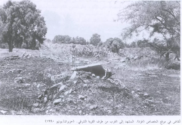
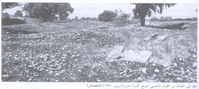
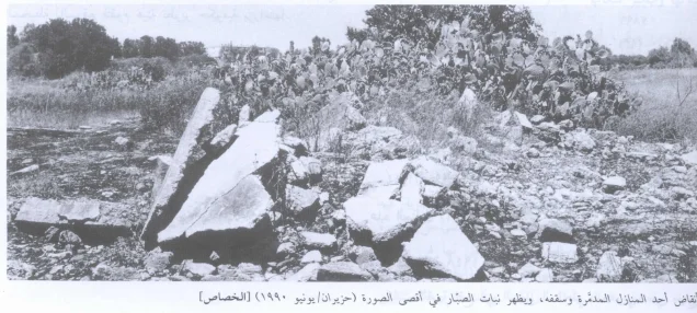
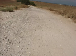
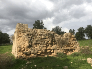
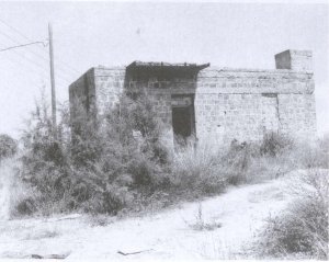
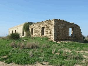
According to the field description published in Walid Khalidi's All That Remains, ruins of houses constructed of cement and plaster were still visible on the village site.
Clusters of cactus grew there together with doum palms and sycamore trees.
Six very tall eucalyptus trees also remained prominent on the site.
The surrounding land was being cultivated by a government development agency at the time of the survey.
This account should not be treated as a comprehensive field verification of conditions in 2026. Fieldwork for All That Remains was conducted between 1987 and 1990 and therefore records the condition of the site during that survey period.
Sources
- PalQuest – Interactive Encyclopedia of the Palestine Question: al-Khisas, Gaza
- PalQuest – Operation Yoav
- Palestine Remembered – al-Khisas, Gaza District
- Palestine Remembered – Walid Khalidi's account of al-Khisas
- Palestinian Villages Encyclopedia – Khirbat al-Khisas, Gaza; supporting Palestinian documentation
- Falastinuna – Khirbat al-Khisas, Gaza District
- Institute for Palestine Studies – Walid Khalidi, All That Remains
Photo gallery
Photos from the village's people
Photos sent in by visitors and published after review.
Add a photo of this village
Log in to add photos of this village.
Other villages from Gaza
More from the archive


 Download Our Palestine App
The whole archive in the palm of your hand: depopulated villages, the Nakba, the massacres and Al-Aqsa — free, with no ads to erase the story.
Download Our Palestine App
The whole archive in the palm of your hand: depopulated villages, the Nakba, the massacres and Al-Aqsa — free, with no ads to erase the story.



Comments
No comments yet — be the first to write one.
Add your comment
Name and email are optional. Comments appear after review.