
The depopulated village of Najd / District of Gaza
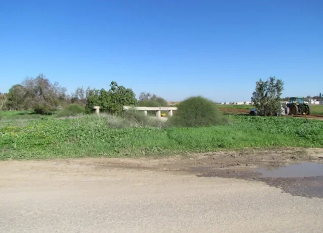
About the depopulated village of Najd
- District
- Gaza
- Date Najd was occupied
- 13 May 1948
- Population in 1948
- 719
- Brigade that carried it out
- Probably the Palmach's Negev Brigade – uncertain: according to Morris as cited by Khalidi, it expelled the people of nearby Simsim at the same time
- Distance from the governorate centre
- 14 km northeast of Gaza
- Elevation above sea level
- 50 m
- Cause of displacement
- Expulsion of the inhabitants by Zionist forces
- Extent of destruction
- The village has been completely defaced
- Ethnic cleansing
- Najd inhabitants were completely ethnically cleansed.
- Settlements built on the built-up area of Najd after 1948
- Sderot, founded in 1951 to the south of the village site; and Or ha-Ner, founded in 1957 near the site, to the northeast – both on village lands
Hover a dot to read the village name, or click to open its card.
Borders of the depopulated village of Najd
Najd: A Depopulated Palestinian Village in the Gaza District
Najd was a Palestinian village in the Gaza District, situated on a relatively elevated and level area of the southern coastal plain approximately 14 kilometres northeast of Gaza, at an average elevation of about 50 metres above sea level. Its population reached 620 in the 1944/1945 statistics. Its inhabitants were expelled on 13 May 1948 during the Zionist military advance in the area in the final days of the British Mandate, and the village was subsequently destroyed during the Nakba and the occupation of Palestine in 1948.
- Subdistrict
- Gaza
- Distance from district center
- 14 km northeast of Gaza
- Average Elevation
- 50 m above sea level
- Population in 1931
- 422
- Number of Houses in 1931
- 82
- Population in 1944/1945
- 620
- Estimated Population in 1948
- About 719 – a later demographic estimate, not an official census
- Total Land Area in 1945
- 13,576 dunams
- Attack and Depopulation
- The inhabitants of Najd were expelled on 13 May 1948, just before the establishment of the state of Israel. The available sources do not name the force that expelled them, but state, citing Benny Morris as quoted by Khalidi, that the Palmach's Negev Brigade expelled the inhabitants of nearby Simsim at the same time.
- Final Israeli Control
- 13 May 1948, the date of the expulsion of the inhabitants; the available sources give no separate date for the entry of Zionist forces into the village.
- Military Unit
- The Palmach's Negev Brigade – uncertain attribution: the available sources do not name the unit that expelled Najd's inhabitants, but state that this brigade expelled the inhabitants of nearby Simsim at the same time (according to Benny Morris as cited by Khalidi)
- Cause of Depopulation
- Expulsion of the inhabitants by Zionist forces
- Settlements Documented on Village Lands
- Sderot, founded in 1951 to the south of the village site; and Or ha-Ner, founded in 1957 near the site, to the northeast – both on village lands
Location
Najd stood approximately 14 kilometres northeast of Gaza on a relatively elevated and level area of the southern coastal plain, at an average elevation of about 50 metres above sea level.
Secondary roads connected the village with several points along the al-Majdal–Gaza highway and with nearby Palestinian villages.
Najd's lands bordered those of Simsim, Huj, Burayr, Dimra, and Bayt Hanun. Simsim was one of the nearest villages, approximately 2 kilometres to the northeast.
Najd Through History
The Arabic name “Najd” means elevated or high ground, reflecting the village's position above the surrounding agricultural land.
In 1596, Najd was a village in the nahiya of Gaza in the Gaza district, with an estimated population of approximately 215.
The villagers paid taxes on wheat, barley, fruit, goats, beehives, vineyards, and other forms of agricultural production.
In the late nineteenth century, Najd was described as a small village containing a well and a pond.
As its population increased during the British Mandate, the village expanded northwestward.
Architecture and Public Facilities
The inhabitants of Najd were Muslims, and the village houses occupied the elevated ground around its small built-up centre.
The built-up area covered approximately 26 dunams in the 1944/1945 statistics.
Najd did not have its own school. Village children attended the school in nearby Simsim, approximately 2 kilometres to the northeast.
Local Palestinian documentation also mentions a shrine known as Maqam al-Shaykh Hammad, although this detail derives primarily from local village accounts.
Population
The 1922 census recorded 305 inhabitants in Najd.
By the 1931 census, the population had increased to 422 people living in 82 houses.
According to the 1944/1945 statistics, the village population reached 620.
The estimate of approximately 719 inhabitants in 1948 is a later demographic estimate rather than an official British Mandate census figure.
Palestine Remembered estimates the number of refugees and their descendants at 4,417 in 1998.
Population of Najd
- 1596About 215Historical estimate based on Ottoman records
- 1922305Official census
- 1931422Official census
- 1944/1945620Government of Palestine statistics
- 1948About 719Later estimate
- 19984,417Estimate of refugees and their descendants
Number of Houses
The 1931 census recorded 82 houses in Najd.
The figure of approximately 139 houses for 1948 is a later estimate rather than an official census count.
Land of Najd
According to the 1944/1945 statistics, Najd had a total land area of 13,576 dunams.
Arab ownership amounted to 12,669 dunams, Jewish ownership to 495 dunams, while 412 dunams were classified as public land.
The official statistics reviewed do not provide sufficient support for describing exactly 264 dunams as roads and wadis, and this article therefore retains the official public-land classification.
Land Ownership in Najd in 1944/1945
- Arab ownership12,669 dunums93%
- Jewish ownership495 dunums4%
- Public land412 dunums3%
Agriculture and Economic Life
The inhabitants of Najd depended primarily on agriculture and animal husbandry. Grain fields and fruit orchards surrounded the village on nearly all sides.
Fruit trees were concentrated on the northern and northeastern sides, where irrigation water was available from wells, and were also planted in the beds of wadis crossing the village lands.
According to the 1944/1945 statistics, cereal cultivation covered 12,344 dunams: 11,916 Arab-owned dunams, 427 Jewish-owned dunams, and 1 dunam of public land.
Irrigated and plantation land covered 511 Arab-owned dunams, while 10 Arab-owned dunams were devoted to citrus and bananas.
Uncultivable land covered 685 dunams: 206 Arab-owned dunams, 68 Jewish-owned dunams, and 411 dunams of public land.
The Arab built-up area covered 26 dunams.
Land Use in Najd in 1944/1945, in Dunams
- Arab
- Jewish
- Public
- Citrus and bananas10 dunums
- Irrigated and plantation land511 dunums
- Cereals12,344 dunums
- Built-up area26 dunums
- Uncultivable land685 dunums
Khirbat Najd
Khirbat Najd was located south of the village.
The site contained rough stone foundations of ancient buildings, as well as caves or vaulted remains and cisterns.
These remains indicate earlier human activity in the area, although the principal sources reviewed do not provide precise dates for all of the archaeological features.
The Expulsion of Najd's Inhabitants
The inhabitants of Najd were expelled on 13 May 1948, one day before the end of the British Mandate and the declaration of the State of Israel.
The depopulation occurred amid Zionist military advances in the Gaza and northern Negev area during the first half of May, as the Palmach's Negev Brigade pushed northward and eastward while the Giv'ati Brigade expanded southward.
PalQuest and Walid Khalidi, transmitting an account by Israeli historian Benny Morris, state that the inhabitants of neighbouring Simsim were expelled at the same time by the Negev Brigade.
The detailed Najd account, however, does not explicitly identify the unit that directly entered Najd itself. This article therefore does not conclusively assign the village's capture to a particular brigade or battalion.
The account derived from Benny Morris is cited here only as transmitted through Walid Khalidi and PalQuest and not through direct reliance on the Israeli source.
Was Najd Occupied During Operation Barak?
Palestine Remembered's summary table classifies Najd among the villages occupied during Operation Barak and identifies the Negev Brigade as the attacking force.
Operation Barak took place from 9 to 13 May 1948 and involved forces from the Giv'ati and Negev Brigades.
However, PalQuest's detailed Operation Barak entry does not include Najd in its list of affected villages, even though Najd's documented depopulation date of 13 May falls within the operation's timeframe.
The detailed village account also confirms the expulsion on 13 May but does not explicitly name Operation Barak.
The most cautious formulation is therefore that Najd's depopulation occurred within the military and chronological context of Operation Barak and the simultaneous advances of the Negev and Giv'ati Brigades, while a definitive attribution of Najd's capture specifically to Operation Barak or directly to the Negev Brigade requires more precise documentation.
Occupation and Depopulation Chronology
- 13 May 1948
Depopulation of the village
The inhabitants of Najd were expelled just before the establishment of the state of Israel. Benny Morris, as cited by Khalidi, writes that the Palmach's Negev Brigade expelled the inhabitants of nearby Simsim at the same time, as part of a number of small pushes northwards and eastwards in coordination with the Giv'ati Brigade's southward expansion in the first half of May.
- 1951
Settlement on village lands
The settlement of Sderot was founded on village lands, to the south of the village site.
- 1957
Settlement on village lands
The settlement of Or ha-Ner was founded on village lands, near the village site to the northeast.
Israeli Settlements on Najd's Lands
Sderot
Sderot was established in 1951 south of the Najd village site on village lands.
Or ha-Ner
Or ha-Ner was established in 1957 on Najd's lands, close to and northeast of the former village site.
- 1951Sderot
Established south of the Najd village site on village lands
- 1957Or ha-Ner
Established on Najd's lands close to the site to the northeast
Najd After the Nakba
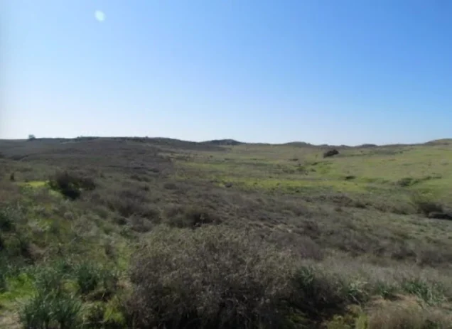
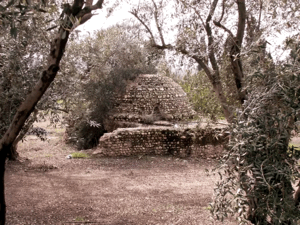
According to the field documentation relied upon by Walid Khalidi, the village site was fenced.
Old trees, cactus plants, Christ's-thorn bushes, and sycamore trees grew across the site, which also contained crumbled walls of buildings whose original functions were difficult to identify.
An irrigation canal also remained, while the surrounding village lands were cultivated.
Khalidi's field description suggested that the presence of old trees and the condition of the site might indicate that it had at some point been treated as a protected natural area, although this should not be interpreted as confirmation of its current administrative status without a contemporary source.
This description reflects the condition of the site during the field documentation relied upon by Walid Khalidi and should not necessarily be interpreted as a comprehensive survey updated to 2026.
Sources
- PalQuest – Interactive Encyclopedia of the Palestine Question: Najd.
- PalQuest: Najd.
- PalQuest: Operation Barak.
- Palestine Remembered: Najd, Gaza District.
- Walid Khalidi, All That Remains: Najd, as reproduced by Palestine Remembered.
- Walid Khalidi, All That Remains, entry on Najd.
- Government of Palestine, censuses of 1922 and 1931.
- Government of Palestine, Department of Statistics, Village Statistics, 1945.
Photo gallery



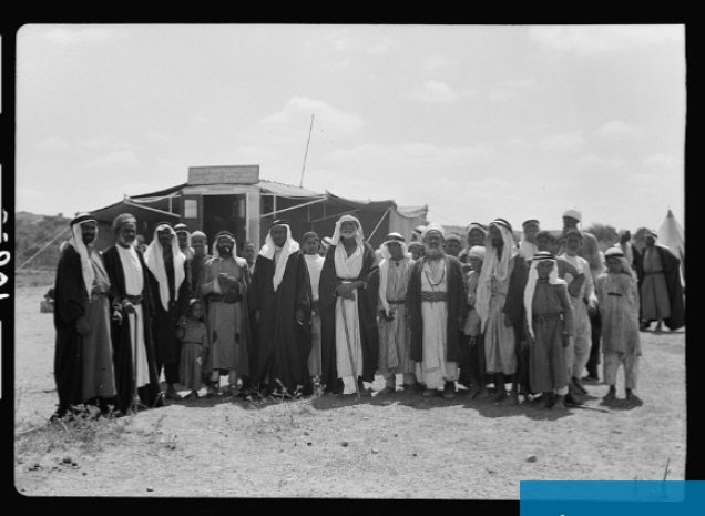

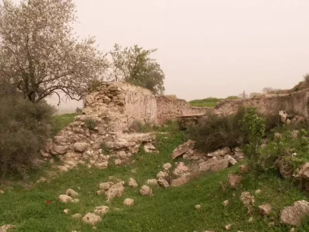
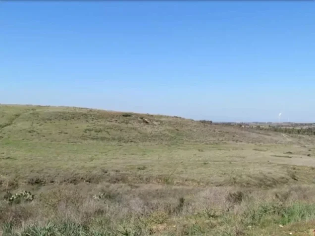
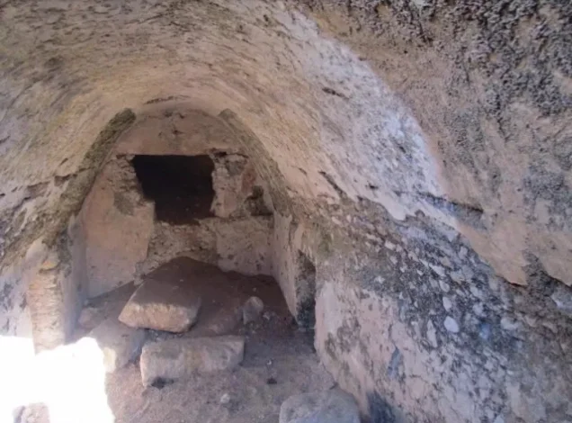

Photos from the village's people
Photos sent in by visitors and published after review.
Add a photo of this village
Log in to add photos of this village.
Other villages from Gaza
More from the archive


 Download Our Palestine App
The whole archive in the palm of your hand: depopulated villages, the Nakba, the massacres and Al-Aqsa — free, with no ads to erase the story.
Download Our Palestine App
The whole archive in the palm of your hand: depopulated villages, the Nakba, the massacres and Al-Aqsa — free, with no ads to erase the story.



Comments
No comments yet — be the first to write one.
Add your comment
Name and email are optional. Comments appear after review.