
The depopulated village of Dayr Rafat / District of Al-Quds (Jerusalem)

About the depopulated village of Dayr Rafat
- District
- Al-Quds (Jerusalem)
- Date Dayr Rafat was occupied
- 18 July 1948
- Population in 1948
- 500
- Military operation
- Operation Dani
- Brigade that carried it out
- Harel Brigade
- Distance from the governorate centre
- 26 (km) West of Jerusalem
- Elevation above sea level
- 300 m
- Cause of displacement
- Military assault by Zionist troops
- Extent of destruction
- Dayr Rafat was completely destroyed in the second half of October 1948, and only house rubble left behind.
- Ethnic cleansing
- Dayr Rafat inhabitants were completely ethnically cleansed.
- Settlements built on the built-up area of Dayr Rafat after 1948
- Givat Shemesh
Hover a dot to read the village name, or click to open its card.
Borders of the depopulated village of Dayr Rafat
Dayr Rafat – Depopulated Palestinian Village of the Jerusalem District
Dayr Rafat was a depopulated Palestinian village in the Jerusalem District. It stood on the western slope of a moderately high mountain in the westernmost part of the district, approximately 26 kilometers west of Jerusalem, at an average elevation of about 300 meters above sea level.
The village was distinguished by a large monastery belonging to the Latin Patriarchate, as well as a mixed Muslim and Christian population and a mosque known as the Mosque of al-Hajj Hasan. Israeli occupation forces captured Dayr Rafat on 17–18 July 1948 when units of the Har'el Brigade overran the area during the second stage of Operation Dani and expanded the Jerusalem corridor southward.
Location and Geography
Dayr Rafat stood on the western slope of a moderately high mountain at the western end of the Jerusalem hills, in the Wadi al-Sarar region.
The village lay approximately 26 kilometers west of Jerusalem and at an average elevation of about 300 meters above sea level.
Dirt roads connected it with nearby villages, particularly Sar'a, Ishwa', Khirbat Ism Allah, and Dayr Aban.
Its lands bordered Khirbat Ism Allah and localities in the Ramla District to the north, al-Burayj to the southwest, Dayr Aban to the south, and Sar'a to the east.
Name
The name Dayr Rafat was associated with the large monastery in the area, a property of the Latin Patriarchate.
Supporting Palestinian local documentation states that the village had earlier been known as Rafat or Rafat Wadi al-Sarar and that the word Dayr helped distinguish it from another Rafat in the Jerusalem area.
The same local source records early Ottoman references to neighboring settlements called Rafat al-Jabal and Rafat al-Sahl.
These latter details are treated as supporting local documentation, while the principal source directly establishes the village's association with the large monastery.
Built Environment
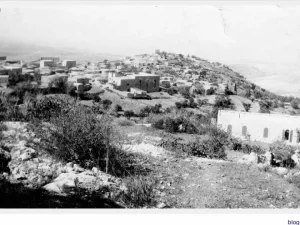
In the late nineteenth century, Dayr Rafat was described as a small hamlet on a ridge with a spring at its western edge.
The settlement later expanded along the slope and around its local roads.
The official 1944/45 statistics classified approximately 10 dunams as built-up land.
Population and Houses
Dayr Rafat had both Muslim and Christian inhabitants.
- 1931218Figure used by PalQuest and Palestine Remembered from the official Mandate census
- 1945430330 Muslims and 100 Christians
- 1948About 499Later demographic estimate, not an official Government of Palestine census
- 1998About 3,063 refugees and descendantsLater estimate published by Palestine Remembered
The official 1931 census recorded 69 houses in Dayr Rafat.
Some Palestinian local documentation gives a different 1931 population figure of 320 and states that it included villagers, clergy, monks, and monastery workers. PalQuest and Palestine Remembered, however, use 218 as the official census figure, so this article adopts 218 while recording the local discrepancy.
The estimate of approximately 157 houses for 1948 is a later calculation rather than an official Mandate census figure.
Mosque and Monastery
Dayr Rafat had one mosque, known as the Mosque of al-Hajj Hasan.
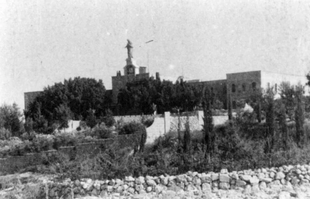
The area was also associated with a large monastery belonging to the Latin Patriarchate, the landmark from which the village derived the first part of its name.
The Palestinian village site should be distinguished from the monastery complex. According to Khalidi's field description, the monastery stood approximately two kilometers west of the village site and survived the destruction of the village.
In 1945, the population included 100 Christians alongside 330 Muslims.
Education
Walid Khalidi does not document a separate school inside Dayr Rafat.
Supporting Palestinian local documentation states that children from the village attended the joint Ishwa' Government School, established in 1944 for pupils from Ishwa', 'Artuf, 'Islin, and Sar'a, where instruction reached the seventh grade.
This is treated as supporting local evidence and does not indicate that Dayr Rafat itself had an independent school.
Water Resources
Dayr Rafat was supplied by three springs.
A late nineteenth-century description also records a spring at the western edge of the village.
Supporting local Palestinian documentation names several springs and wells, including 'Ayn al-Balad, 'Ayn Tarif, 'Ayn al-Malih, 'Uyun al-Khalla, Bir al-Tablawi, and Bir Bourguiba.
Because the sources differ in level of detail, the principal documented figure remains three village springs, while the named sources are presented as additional local documentation.
Economic Life and Agriculture
The inhabitants depended primarily on agriculture, especially cereals, orchards, and fruit trees.
In 1944/45, 10,563 dunams were devoted to cereals and 216 dunams were classified as plantations or irrigable land.
Of the latter, approximately 25 dunams were planted with olive trees.
Local Palestinian documentation also records figs, grapes, apples, almonds, cactus fruit, and various vegetables cultivated with the benefit of local water resources.
Land Ownership, 1944/45
The total land area of Dayr Rafat was 13,242 dunams. Under the official Government of Palestine classification, ownership was distributed as follows:
- Arab12,966 dunums98%
- Jewish0 dunums0%
- Public276 dunums2%
The figures balance exactly: 12,966 + 276 = 13,242 dunams.
Palestine Remembered presents the same figures using its simplified terminology: 12,966 dunams “Palestinian,” 0 dunams “Transferred to Zionists,” and 276 dunams “Communal/Public.”
The phrase “Transferred to Zionists” should be preserved when reproducing that source's classification rather than automatically replacing it with the official “Jewish” category.
Land Use, 1944/45
- Arab
- Public
- Cereals10,563 dunums
- Plantations and irrigable land216 dunums
- Total cultivable/cultivated land10,779 dunums
- Non-cultivable land2,453 dunums
- Built-up land10 dunums
- Total non-cultivable and built-up2,463 dunums
The official table balances exactly: 10,779 dunams of cultivated or cultivable land plus 2,463 dunams of built-up and non-cultivable land equal the total village area of 13,242 dunams.
Of the 216 dunams classified as plantations and irrigable land, approximately 25 dunams were planted with olives. This is a crop-specific subset and should not be added again to the total land-use figure.
Archaeological Sites
Three archaeological khirbas were situated around Dayr Rafat.
They contained ruined building foundations, grape presses, rock-cut cisterns, wells, a millstone, and burial grounds.
Khalidi does not securely date all of these remains, so they should not collectively be assigned to the Roman, Byzantine, or any other single period without specialist archaeological evidence.
Operation Dani
Operation Dani began on 9 July and ended on 18 July 1948.
It was the largest Israeli offensive launched during the Ten Days between the two truces and was carried out in two stages.
During the first stage, from 9 to 12 July, Lydda and Ramla were captured. The second stage, from 13 to 18 July, expanded toward the Jerusalem corridor and the al-Latrun area.
Several brigades participated at the operation-wide level, including Har'el, Yiftach, Kiryati, Alexandroni, and Etzioni.
At Dayr Rafat itself, the village-specific source identifies units of the Har'el Brigade as the force that captured the village.
Occupation and Depopulation
Israeli occupation forces overran Dayr Rafat on 17–18 July 1948, near the end of the second stage of Operation Dani.
The Har'el Brigade was tasked during this phase with occupying villages and widening the Jerusalem corridor southward.
As Har'el columns approached Dayr Rafat and mortar fire began, most of those who still remained in or around the village departed.
Khalidi records that those who remained after Israeli forces entered were subsequently forced to leave.
The source does not clearly establish what happened to the residents of the nearby Latin monastery or whether their circumstances were identical to those of the Palestinian village population.
Military Unit
The military formation securely identified with the occupation of Dayr Rafat was the Har'el Brigade.
The source refers to “units of the Har'el Brigade” without identifying a specific battalion.
A battalion number should therefore not be transferred from nearby villages such as 'Artuf simply because a particular Har'el battalion operated there during the same period.
Destruction of the Village
Dayr Rafat was not destroyed immediately after its occupation on 17–18 July.
According to Khalidi, its demolition occurred several weeks later during the Second Truce, which began on 19 July and continued until mid-October 1948.
The source describes a broader process during which Israeli forces gradually demolished depopulated Palestinian villages on stated military grounds, with many villages in central Palestine blown up during September.
The occupation of Dayr Rafat on 17–18 July should therefore be distinguished from the later destruction of the village during the Second Truce.
Occupation Chronology
- 9 July 1948
Beginning of Operation Dani
The large Israeli offensive began in the Lydda–Ramla region and toward the Jerusalem corridor.
- 9–12 July 1948
First stage
Lydda, Ramla, and surrounding Palestinian villages were captured.
- 13 July 1948
Beginning of the second stage
The offensive extended toward the Jerusalem corridor and al-Latrun, with the Har'el Brigade assigned villages in this sector.
- 17–18 July 1948
Attack on Dayr Rafat
Har'el columns approached and mortar fire began, prompting most remaining villagers to leave.
- 17–18 July 1948
Occupation and final displacement
Units of the Har'el Brigade occupied the village; those who remained were subsequently forced to leave.
- 18 July 1948
End of Operation Dani
The operation ended as the Second Truce came into effect.
- 19 July 1948
Beginning of the Second Truce
The village remained standing for a time after its occupation.
- Several weeks later during the Second Truce
Destruction of the village
The village was demolished as part of the subsequent destruction of depopulated Palestinian villages; the source does not provide an exact demolition date.
Israeli Settlements on Village Lands
Giv'at Shemesh was established in 1954 on Dayr Rafat village land, immediately west of the former village site.
It is the settlement explicitly identified by Walid Khalidi and PalQuest as having been built on the village's land.
Dayr Rafat Today
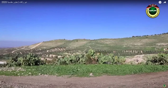
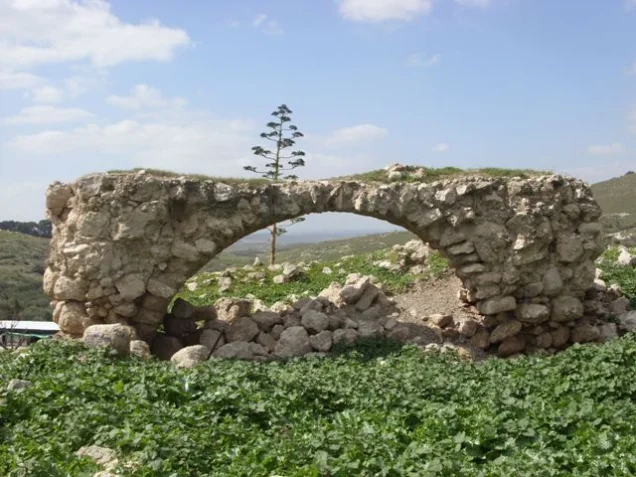
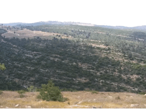
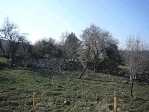
According to the field description published in Walid Khalidi's All That Remains, the village site was covered by stone rubble and agricultural terraces, some of which remained intact while others had collapsed and become mixed with the ruins of the houses.
Cactuses grew along the northwestern edge of the site.
A spring remained at the western edge, while a cemetery lay at the southern end and contained one prominent large grave.
An olive grove also stood west of the former village site.
The Latin monastery, approximately two kilometers west of the village site, survived. A statue of the Virgin Mary stood above its facade and red tiles covered parts of the monastery building.
Khalidi's field description also recorded that members of the al-Sani' tribe, Bedouins from the Negev, had rented a tract of land from the Latin monastery and pitched tents there at the time of the survey.
This account should not be treated as a comprehensive field verification of conditions in 2026. Fieldwork for All That Remains was conducted between 1987 and 1990 and therefore records the condition of the site during that survey period.
Sources
- PalQuest – Interactive Encyclopedia of the Palestine Question: Dayr Rafat
- PalQuest – Operation Dani
- Palestine Remembered – Dayr Rafat, Jerusalem District
- Palestine Remembered – Walid Khalidi's account of Dayr Rafat
- Palestinian Villages Encyclopedia – Dayr Rafat / Wadi al-Sarar; supporting Palestinian local documentation
- Institute for Palestine Studies – Walid Khalidi, All That Remains
- PalQuest – All That Remains: Methodology
Photo gallery





Photos from the village's people
Photos sent in by visitors and published after review.
Add a photo of this village
Log in to add photos of this village.
Other villages from Al-Quds (Jerusalem)
More from the archive
 Al-Quds (Jerusalem)
The depopulated village of Khirbat al-Tannur - Allar al-Sifla / District of Al-Quds (Jerusalem)
 Al-Quds (Jerusalem)
The depopulated village of Jarash / District of Al-Quds (Jerusalem)
 Al-Quds (Jerusalem)
The depopulated village of al-Burayj (Bayarat Burayj) / District of Al-Quds (Jerusalem)
 Download Our Palestine App
The whole archive in the palm of your hand: depopulated villages, the Nakba, the massacres and Al-Aqsa — free, with no ads to erase the story.
Download Our Palestine App
The whole archive in the palm of your hand: depopulated villages, the Nakba, the massacres and Al-Aqsa — free, with no ads to erase the story.



Comments
No comments yet — be the first to write one.
Add your comment
Name and email are optional. Comments appear after review.