
The depopulated village of Al-Qastal / District of Al-Quds (Jerusalem)
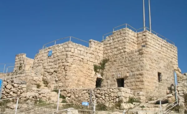
About the depopulated village of Al-Qastal
- District
- Al-Quds (Jerusalem)
- Date Al-Qastal was occupied
- 03 April 1948
- Population in 1948
- 100
- Military operation
- Operation Nachshon
- Brigade that carried it out
- Harel Brigade
- Who defended the village
- Arab Liberation Army (ALA) headed by 'Abd al-Qadir al-Husseini.
- Distance from the governorate centre
- 8 (km) West of Jerusalem
- Elevation above sea level
- 790
- Cause of displacement
- Military assault by Zionist troops
- Extent of destruction
- al-Qastal was completely destroyed, only house rubble left behind
- Ethnic cleansing
- al-Qastal inhabitants were completely ethnically cleansed.
- Settlements built on the built-up area of Al-Qastal after 1948
- Ma'oz Zion, later incorporated with Mevaseret Yerushalayim into Mevaseret Zion
Hover a dot to read the village name, or click to open its card.
Borders of the depopulated village of Al-Qastal
Al-Qastal
Al-Qastal was a Palestinian village located approximately eight kilometres west of Jerusalem. It occupied a commanding position above the principal paved Jerusalem–Jaffa road. While the road passed the area at an elevation of approximately 525 metres above sea level, the village stood on a hill rising to roughly 725–790 metres. This elevated position made al-Qastal the strategic western gateway to Jerusalem.
In April 1948, al-Qastal became the site of one of the most consequential battles on the approaches to Jerusalem. Palestinian forces led by Abd al-Qadir al-Husayni fought to defend and recapture the village after it was attacked by Zionist forces seeking control of the Jerusalem–Jaffa road. Al-Husayni was killed during the battle on 8 April. The Palmach ultimately reoccupied al-Qastal on 9 April, after which the village's houses were largely destroyed and its Palestinian inhabitants were prevented from returning.
| Field | Information |
|---|---|
| District | Jerusalem. |
| Historical Administrative Location | Jerusalem Subdistrict, Mandatory Palestine. |
| Distance from District Center | Approximately 8 km from Jerusalem. |
| Direction | West of Jerusalem. |
| Average Elevation | Approximately 790 meters above sea level. |
| Population in 1922 | 43 inhabitants according to the official census; all were Muslims. |
| Population in 1931 | 59 inhabitants according to the official census: 55 Muslims and 4 Christians. |
| Houses in 1931 | 14 inhabited houses according to the official census. |
| Arab Population in 1944/1945 | 90 inhabitants. |
| Jewish Population in 1944/1945 | 0. |
| Total Population in 1944/1945 | 90 inhabitants. |
| Estimated Population in 1948 | 104 inhabitants according to Salman Abu Sitta's estimate. |
| Total Land Area | 1,446 dunums. |
| Land Ownership | Palestinian: 1,415 dunums; Transferred to Zionists: 7 dunums; Public/Common: 24 dunums. |
| Date of First Occupation | 3 April 1948; the Palmach's Fourth Battalion attacked and occupied the village. |
| Palestinian Recapture | 8 April 1948; Palestinian fighters recaptured al-Qastal during the battle in which Abd al-Qadir al-Husseini was killed. |
| Date of Final Occupation | Night of 8–9 April 1948; Palmach forces reoccupied al-Qastal, with final control established on 9 April. |
| Military Operation | Operation Nachshon. The first seizure occurred at the opening of, or immediately before the full formal launch of, the operation; the final occupation took place directly within its military context. |
| Military Unit | Palmach Fourth Battalion during the 3 April attack; Palmach forces during the final assault on the night of 8–9 April. |
| Cause of Depopulation | Repeated military attacks and fighting around the village. The Palestinian newspaper Filastin reported that residents left after an attack in mid-March 1948, while a number of village men remained to defend it. |
| Extent of Destruction | Very extensive destruction. After the final occupation, Palmach units began demolishing the village houses; Aref al-Aref states that all village buildings, including the mosque and shrine, were destroyed. |
| Settlements Established before 1948 on Village Land | No pre-1948 settlement on al-Qastal land was confirmed in the sources used. |
| Settlements Established after 1948 on Village Land | Ma'oz Tziyyon – 1951, established on al-Qastal land. It was later joined with Mevasseret Yerushalayim, founded in 1956 on Qalunya land, to form Mevasseret Tziyyon. |
Historical and Geographical Overview
Al-Qastal's strategic importance derived from its control over the Jerusalem–Jaffa road. A network of secondary roads also connected it to Suba, Khirbat al-'Umur, Bayt Naqquba, Bayt Surik, Ayn Karim, Sataf, and Qalunya.
Wadi Qalunya, the upper section of Wadi al-Sarar, flowed approximately two kilometres east of the village. The shrine of Shaykh al-Karki stood on its western side. The village's stone houses followed a circular or semicircular layout. Although construction extended along the eastern slopes of al-Qastal Hill, the built-up area covered only five dunams in 1945. Public facilities and services were limited, and residents depended heavily on nearby Jerusalem for many of their needs.
The village stood on the summit of a high, rounded hill that offered extensive views in every direction. It overlooked the Jerusalem–Jaffa road to the north and northeast, giving the site exceptional military and strategic significance.
Architecture and Built Environment
In the late nineteenth century, al-Qastal stood on the summit of a rocky hill, with several springs located to its east. The British Mandate government's Palestine Index Gazetteer classified al-Qastal as a hamlet. Its overall layout resembled a semicircle, and most houses were built of stone. More recent construction extended along the eastern slopes and curved around al-Qastal Hill.
Origin of the Name
The name al-Qastal is derived from the Latin word castellum, meaning a small castle or fortified place. The name referred to the ancient fortress that once stood at the site.
Economic Life
The inhabitants of al-Qastal depended on nearby Jerusalem for many essential goods and services. Their economy was also based on rain-fed cereal cultivation and the growing of vegetables, fruit, and olive trees. Most cultivated land lay within a rectangular strip extending southeast of the village.
In 1944–1945, 42 dunams were allocated to cereals and 169 dunams were irrigated or used as orchards, including 50 dunams planted with olive trees.
Land Ownership in Al-Qastal
- Palestinian ownership1,415 dunums98%
- Jewish ownership7 dunums<1%
- Public land24 dunums2%
Land Use in 1945
- Palestinian-owned land (dunams)
- Jewish-owned land (dunams)
- Irrigated land and orchards169 dunums
- Cereal cultivation42 dunums
- Built-up area5 dunums
- Total cultivable land211 dunums
- Uncultivated land1,230 dunums
* One dunam equals approximately 1,000 square metres.
Population of Al-Qastal
- 192243
- 193159
- 194590
- 1948104
- Estimated refugee population in 1998641
Number of Houses in Al-Qastal
- 193114
- 194824
The Battle, Occupation, and Depopulation of Al-Qastal
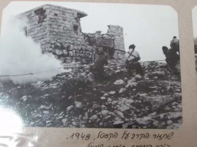
The Palmach's 4th Battalion attacked and occupied al-Qastal on 3 April 1948 during Operation Nachshon. Palestinian historian Arif al-Arif reported that approximately fifty Palestinian fighters defended the village and withdrew only after exhausting their ammunition. According to contemporary reporting, Haganah forces fortified their positions with barbed wire on 5 April. Two days later, training aircraft were used to bomb Palestinian forces surrounding the village.
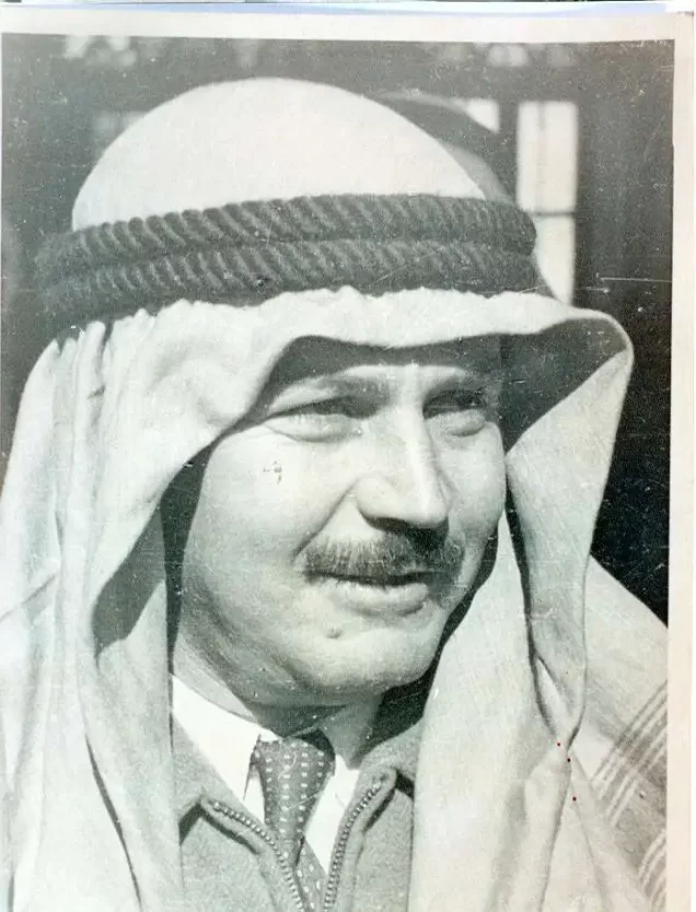
On 8 April, Palestinian forces recaptured al-Qastal in a battle during which Abd al-Qadir al-Husayni, commander of Palestinian forces in the Jerusalem district, was killed. The loss of al-Husayni was a decisive moment in the battle and had a profound effect on Palestinian military organization and morale in the Jerusalem area.
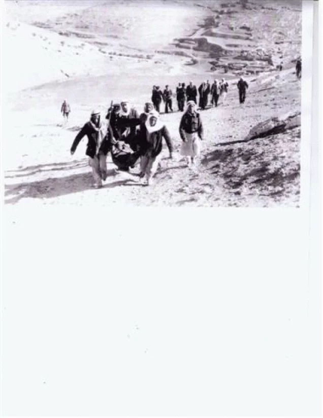
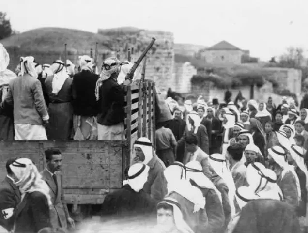
Palmach forces retook the village in an assault launched during the night of 8–9 April. Palestinian positions had been substantially depleted as many fighters left to attend al-Husayni's funeral in Jerusalem. Palmach units surrounded the village with armoured vehicles to prevent reinforcements from arriving and then advanced into the site. The final assault coincided with the massacre at Dayr Yasin, located approximately five kilometres from al-Qastal.
Occupation Chronology
| Date | Stage | Details |
|---|---|---|
| Mid-March 1948 | Attack and departure of residents | According to the Palestinian newspaper Filastin, as cited by Walid Khalidi and PalQuest, the residents left al-Qastal following an attack in mid-March, while a number of village men remained to defend it. |
| Night of 16 March 1948 | Destruction of the mosque | A New York Times account states that the village mosque was destroyed on this night; Aref al-Aref, however, associates the destruction of the village buildings, including the mosque, with the later occupation. |
| 3 April 1948 | Attack and first occupation | The Palmach's Fourth Battalion attacked al-Qastal before dawn and occupied it. PalQuest places the seizure at the opening of Operation Nachshon while noting that it preceded the operation's full formal launch. |
| 5 April 1948 | Fortification of the position | Haganah forces fortified their positions in al-Qastal and surrounded them with barbed wire as fighting and Palestinian counterattacks continued. |
| 7 April 1948 | Bombing of Palestinian forces | The occupying forces used training aircraft to drop bombs on Palestinian forces surrounding al-Qastal. |
| 8 April 1948 | Battle of al-Qastal and death of Abd al-Qadir al-Husseini | Abd al-Qadir al-Husseini led the fighting to recapture al-Qastal and was killed during the battle on this date. |
| 8 April 1948, approximately 3:00 p.m. | Palestinian recapture | Groups of Palestinian fighters entered al-Qastal following a counterattack supported by mortar and machine-gun fire and regained control of the village. |
| Night of 8–9 April 1948 | Final assault | Palmach forces launched another assault to retake the village and surrounded it with armored vehicles to prevent Palestinian reinforcements from reaching it. |
| 9 April 1948 | Final occupation | Palmach forces reoccupied al-Qastal permanently while many of the Palestinian fighters who had retaken it were attending the funeral of Abd al-Qadir al-Husseini in Jerusalem. |
| From 9 April 1948 onward | Destruction of the village | After the final occupation, Palmach units began demolishing the village houses and leveling much of the built-up area to prevent the position from being retaken. |
| 1951 | Establishment of a settlement on village land | Ma'oz Tziyyon was established on al-Qastal land and was later joined with Mevasseret Yerushalayim to form Mevasseret Tziyyon. |
Israeli Settlements Established on the Lands of Al-Qastal
Ma'oz Zion was established in 1951 at the foot of al-Qastal Hill and on land associated with the village. Mevaseret Yerushalayim was established in 1956, principally on land belonging to Qalunya. In 1963, the two settlements were united under a single local council named Mevaseret Zion, which now encompasses parts of al-Qastal's former lands.
Al-Qastal Today
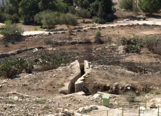
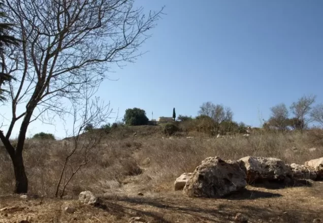
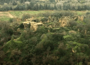
Rubble from destroyed houses and the remains of stone terraces cover the southern, northern, and eastern slopes of the village site, much of it partly concealed by wild vegetation. Remnants of the old fortress remain visible on the summit. An underground shelter was constructed southwest of the fortress, while military trenches remain to its north and east.
Carob, fig, and olive trees grow along the northern and western edges of the site, and cactus plants remain along its southern edge. The site, including portions of the fortress and the surviving military landscape, has been incorporated into an Israeli national park and tourism complex.
Photo gallery










Photos from the village's people
Photos sent in by visitors and published after review.
Add a photo of this village
Log in to add photos of this village.
Other villages from Al-Quds (Jerusalem)
More from the archive
 Al-Quds (Jerusalem)
The depopulated village of Khirbat al-Tannur - Allar al-Sifla / District of Al-Quds (Jerusalem)
 Al-Quds (Jerusalem)
The depopulated village of Jarash / District of Al-Quds (Jerusalem)
 Al-Quds (Jerusalem)
The depopulated village of al-Burayj (Bayarat Burayj) / District of Al-Quds (Jerusalem)
 Download Our Palestine App
The whole archive in the palm of your hand: depopulated villages, the Nakba, the massacres and Al-Aqsa — free, with no ads to erase the story.
Download Our Palestine App
The whole archive in the palm of your hand: depopulated villages, the Nakba, the massacres and Al-Aqsa — free, with no ads to erase the story.




Comments
No comments yet — be the first to write one.
Add your comment
Name and email are optional. Comments appear after review.