
The depopulated village of Jarash / District of Al-Quds (Jerusalem)
About the depopulated village of Jarash
- District
- Al-Quds (Jerusalem)
- Date Jarash was occupied
- 21 October 1948
- Population in 1948
- 220
- Military operation
- Operation Ha-Har
- Brigade that carried it out
- Harel Brigade
- Distance from the governorate centre
- 21 (km) West of Jerusalem
- Elevation above sea level
- 425 m
- Cause of displacement
- Military assault by Zionist troops
- Extent of destruction
- Jarash was completely defaced, and only house rubble left behind.
- Ethnic cleansing
- Jarash inhabitants were completely ethnically cleansed.
Hover a dot to read the village name, or click to open its card.
Borders of the depopulated village of Jarash
Jarash – Depopulated Palestinian Village of Jerusalem
Jarash, also rendered in Arabic as Jarash/Jarash with variant local spelling جراش, was a Palestinian village of the 'Arqub area in the Jerusalem Subdistrict. It stood on the lower western slope of a mountain approximately 21 kilometers west of Jerusalem, at an average elevation of about 425 meters above sea level.
Wadis surrounded the village on the north, west, and south. A secondary road passing through neighboring Sufla connected Jarash with the Jerusalem-Bethlehem highway, while another road linked it to Dayr Aban, the largest nearby village.
The population reached 190 in the official 1944/45 statistics and the village lands covered 3,518 dunums. The inhabitants relied primarily on rain-fed agriculture, cultivating cereals on valley floors and olives and grape vines on the mountain slopes, while using the surrounding uplands for grazing and firewood.
Israeli forces attacked Jarash between 19 and 21 October 1948 during Operation ha-Har. The Sixth Battalion of the Har'el Brigade was specifically identified as the unit responsible for occupying the village, and 21 October is commonly used as the final occupation date.
Basic Information
| Field | Information |
|---|---|
| Name | Jarash |
| Arabic forms | جرش / جراش |
| Subdistrict | Jerusalem |
| Region | 'Arqub villages |
| Distance from Jerusalem | Approximately 21 km west |
| Average elevation | Approximately 425 m above sea level |
| Population in 1922 | 115, all Muslims |
| Population in 1931 | 164, all Muslims |
| Houses in 1931 | 33 |
| Population in 1944/45 | 190 |
| 1948 population estimate | 220 – later estimate, not an official census |
| Total land area | 3,518 dunums |
| Attack period | 19–21 October 1948 |
| Commonly cited occupation date | 21 October 1948 |
| Military operation | Operation ha-Har |
| Military unit | Sixth Battalion, Har'el Brigade |
| Cause of depopulation | Military assault; the precise circumstances of every resident's departure are not independently documented |
| Destruction | Most village houses were destroyed, leaving rubble, terrace stones, cemetery remains, and trees |
| Post-1948 settlements | No Israeli settlement is documented on village lands |
Name
The Palestinian village name appears in Arabic in the forms جرش and جراش.
PalQuest uses the form Jarash corresponding to جرش, while Palestine Remembered and Palestinian local sources also preserve جراش.
The village should not be confused with the much larger historic city of Jerash east of the Jordan River.
Location and Geography
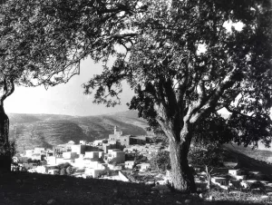
Jarash stood on the lower western slope of a mountain in a landscape cut by wadis.
Valleys surrounded the settlement on the south, west, and north.
A secondary road passed through Sufla and connected the village with the Jerusalem-Bethlehem highway. Another linked Jarash directly with Dayr Aban.
Nearby Palestinian localities included Dayr Aban, Dayr al-Hawa, Sufla, Bayt Nattif, Khirbat al-Tannur, and Bayt Jimal, with Bayt 'Itab and 'Allar in the broader surrounding area.
Jarash in the Late Nineteenth Century
The Survey of Western Palestine described Jarash as a village built on a projecting spur of a hill, with olive trees growing below it.
The village plan was rectangular and most houses were constructed of stone.
Older construction extended along a northwest-southeast axis, while by the end of the Mandate newer houses had expanded southeastward along the road to Sufla.
The Palestine Index Gazetteer classified Jarash as a hamlet or small farm settlement late in the Mandate period.
Population
- 1922115Official Government of Palestine census; all Muslims
- 1931164Official census; all Muslims
- 1944/45190Official Mandate-period estimate
- 1948220Later demographic estimate, not an official census
- 19981,354Later Palestine Remembered estimate of refugees and descendants
Number of Houses
- 193133Official census figure
- 194844Later estimate, not an official government house census
Land Ownership, 1944/45
- Palestinian3,517 dunums100%
- Transferred to Zionists0 dunums0%
- Public1 dunums<1%
The figures balance exactly: 3,517 + 1 = 3,518 dunums.
No land was recorded in the Jewish ownership category.
Land Use, 1944/45
- Palestinian
- Public
- Cereals1,335 dunums
- Plantations and irrigable land5 dunums
- Built-up area5 dunums
- Non-cultivable land2,173 dunums
The categories reconcile exactly with the village's total land area.
Correction to the Cereal Acreage
PalQuest contains a small internal discrepancy.
Its statistical table gives 1,335 dunums under cereals, while the narrative paragraph states 1,355.
The 1,335 figure agrees with Palestine Remembered and the 1945 village statistics and is therefore used here. The 1,355 figure is treated as a transcription error in the narrative text.
Olives and Vineyards
The inhabitants cultivated olives and grape vines on the mountain slopes.
Palestine Remembered lists approximately thirty-eight dunums of olive groves.
This is treated as a subcategory of cultivated land rather than an additional land-use category added on top of the official total.
Economy and Agriculture
The villagers relied primarily on rain-fed agriculture.
Cereals were planted on valley floors and low ground, while olive trees and vineyards grew on the slopes.
Wild herbs and trees covered large sections of the surrounding mountain slopes and peaks, particularly east of the village.
These upland areas were used for grazing and as a source of firewood.
Water
The inhabitants obtained domestic water from several wells and a nearby spring.
The Palestine Encyclopedia identifies the nearby spring as 'Ayn al-Dalba.
Agriculture itself depended mainly on rainfall.
Services and Shops
Jarash contained several small shops that served daily village needs.
For administrative, medical, and other services, however, the villagers relied on neighboring Dayr Aban.
Education
No independent village school is documented in Khalidi's profile or PalQuest.
No securely sourced pupil or teacher figures are therefore included.
Shrine of Shaykh Ahmad
The population was Muslim.
The village maintained a shrine dedicated to a local religious figure known as Shaykh Ahmad.
Khalidi does not provide a construction date or a detailed architectural description of the shrine.
Archaeology – Khirbat Sira
Khirbat Sira lay east of Jarash.
Khalidi and PalQuest identify it as the site of a village dating to the Mamluk/Ottoman period.
Local Palestinian sources record additional ruins in the surrounding area, but these remains should not all be assigned automatically to a single archaeological period.
Operation ha-Har
Operation ha-Har began on 19 October 1948 and ended on 24 October.
The Israeli army launched it after the second truce in order to widen the corridor under its control toward Jerusalem and connect it with territory captured in the Hebron hills.
Har'el, Etzioni, and Giv'ati brigades participated at the operational level, while Egyptian forces were the principal Arab military force opposing the offensive in this sector.
Affected Palestinian villages included Jarash, Sufla, Dayr Aban, Dayr al-Hawa, Dayr al-Shaykh, 'Allar, Bayt 'Itab, and Bayt Nattif.
Occupation of Jarash – 19–21 October 1948
Israeli forces attacked Jarash between 19 and 21 October 1948 in the course of Operation ha-Har.
Palestine Remembered uses 21 October as the occupation date, while Khalidi describes the attack and capture within the broader 19–21 October period.
The most precise chronology is therefore: attack between 19 and 21 October, with final occupation on or by 21 October 1948.
Military Unit
Although several brigades participated in Operation ha-Har overall, the unit responsible for Jarash is identified more specifically.
The History of the War of Independence, as cited by Khalidi, states that the Sixth Battalion of the Har'el Brigade was responsible for occupying Jarash.
Etzioni and Giv'ati should therefore not automatically be listed as direct village-level occupying units merely because they participated in the broader operation.
Cause of Depopulation
Palestine Remembered classifies the cause as direct military assault.
Khalidi confirms the attack on the village during Operation ha-Har but does not provide a separate detailed account of how every resident left.
The surviving evidence therefore does not establish whether all villagers fled during the assault or whether some were expelled after the troops entered.
The most cautious formulation is: depopulation as a result of the military assault and occupation during Operation ha-Har; the exact circumstances of every resident's departure remain undocumented.
Destruction
Jarash's built environment was destroyed after its Palestinian population was displaced.
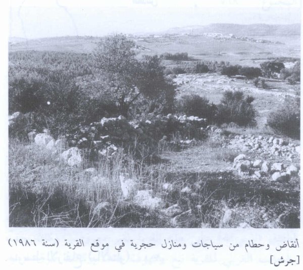
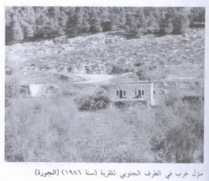
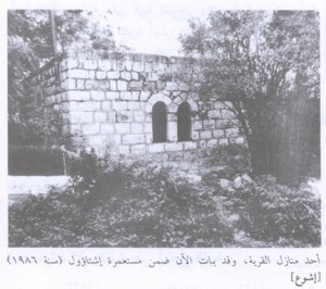
Khalidi's later field description records house rubble, ruined agricultural terraces, and cemetery remains across the former site.
No precise independent date is provided for the demolition of all houses.
The October 1948 occupation and subsequent destruction should therefore be treated as distinct stages.
Ethnic Cleansing in Source Classification
Palestine Remembered classifies Jarash using the term “complete ethnic cleansing.” The phrase is retained here only as an attributed source classification.
The more specifically documented facts are the military assault during Operation ha-Har, disappearance of the Palestinian community from the village, absence of permanent collective return, and later destruction of most of the village's houses.
Occupation Chronology
| Date | Event |
|---|---|
| 19 October 1948 | Operation ha-Har begins against Palestinian villages in the southern Jerusalem corridor. |
| 19–21 October 1948 | Israeli forces attack Jarash during Operation ha-Har. |
| 21 October 1948 | Palestine Remembered's commonly cited date for the final occupation of Jarash. |
| During the attack | The Sixth Battalion of the Har'el Brigade is identified as the unit responsible for occupying the village. |
| 24 October 1948 | Operation ha-Har formally ends. |
| Later period | Most village houses are destroyed; no separate precise demolition date is documented. |
Israeli Settlements Established on Jarash's Lands
According to Walid Khalidi and PalQuest, no Israeli settlement was established on Jarash's village lands.
Zanoach, founded in 1950, lies approximately two kilometers west of the village site but is not on Jarash's lands.
It should therefore be described as a nearby settlement rather than as a settlement established on village property.
Jarash Today
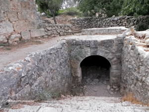
According to the field description used by Walid Khalidi before the publication of All That Remains in 1992, the former village site was overgrown with grass.
House rubble and stones from former agricultural terraces were scattered across the site.
The ruins of the village cemetery lay northwest of the former settlement.
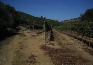
Groves covered two hills west of the site, separated by a valley, with carob, fig, almond, and olive trees growing there.
This description should be understood as historical field documentation from before 1992 rather than as a comprehensive archaeological or cadastral survey of Jarash's entire former territory in 2026.
Sources
- PalQuest – Interactive Encyclopedia of the Palestine Question: Jarash
- PalQuest – Operation ha-Har
- Government of Palestine – 1922 Census of Palestine: Jarash
- Palestine Remembered – Jarash, Jerusalem Subdistrict
- Palestine Remembered – Jarash entry from Walid Khalidi's All That Remains
- Palestine Encyclopedia – Jarash
- Palestinian Villages Encyclopedia – Jarash / Jarash of the 'Arqub Villages
Photo gallery

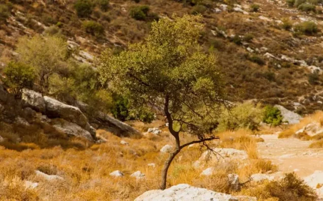


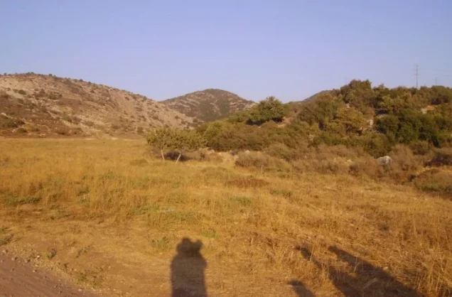
Photos from the village's people
Photos sent in by visitors and published after review.
Add a photo of this village
Log in to add photos of this village.
Other villages from Al-Quds (Jerusalem)
More from the archive
 Download Our Palestine App
The whole archive in the palm of your hand: depopulated villages, the Nakba, the massacres and Al-Aqsa — free, with no ads to erase the story.
Download Our Palestine App
The whole archive in the palm of your hand: depopulated villages, the Nakba, the massacres and Al-Aqsa — free, with no ads to erase the story.



Comments
No comments yet — be the first to write one.
Add your comment
Name and email are optional. Comments appear after review.