
The depopulated village of Suba / District of Al-Quds (Jerusalem)

About the depopulated village of Suba
- District
- Al-Quds (Jerusalem)
- Date Suba was occupied
- 13 July 1948
- Population in 1948
- 719
- Military operation
- Operation Dani
- Brigade that carried it out
- Harel Brigade
- Distance from the governorate centre
- 10 km from Jerusalem
- Elevation above sea level
- 750 m
- Cause of displacement
- Direct military assault and bombardment by Israeli occupation forces; according to Benny Morris, as cited by Khalidi, the remaining inhabitants fled the bombardment or were expelled
- Extent of destruction
- Suba was mostly destroyed with the exception few deserted and partially destroyed houses.
- Ethnic cleansing
- Suba inhabitants were completely ethnically cleansed.
- Settlements built on the built-up area of Suba after 1948
- Ameilim, established in 1948 on village lands 1 km southwest of the village site; later renamed Kibbutz Tzova
Hover a dot to read the village name, or click to open its card.
Borders of the depopulated village of Suba
Suba: A Depopulated Palestinian Village in the Jerusalem District
Suba was a Palestinian village in the Jerusalem District, located approximately 10 kilometres west of the city of Jerusalem on a mountain summit at an average elevation of about 750 metres above sea level. The village was subjected to several attacks beginning in April 1948 but remained outside Zionist control until the Har'el Brigade occupied it on the night of 12–13 July 1948 during Operation Dani. Its inhabitants were displaced during the Nakba and the occupation of Palestine in 1948.
- Subdistrict
- Jerusalem
- Distance from district center
- 10 km from Jerusalem
- Average Elevation
- 750 m above sea level
- Population in 1931
- 434 – includes Dayr Amr
- Number of Houses in 1931
- 110 – includes Dayr Amr
- Population in 1944/1945
- 620
- Estimated Population in 1948
- About 719 – a later demographic estimate, not an official census
- Total Land Area in 1945
- 4,102 dunams
- Attack and Depopulation
- Haganah forces attacked Suba on 3 April 1948, according to the newspaper Filastin, but were driven back despite air support, and two further attempts to seize the village failed in mid-April; the Harel Brigade then occupied it on the night of 12–13 July 1948 during Operation Dani, using two companies backed by artillery and mortars. According to Benny Morris, as cited by Khalidi, many inhabitants had already left the village, and those who remained fled the bombardment or were expelled.
- Final Israeli Control
- Night of 12–13 July 1948, by the Harel Brigade in the course of Operation Dani
- Military Operation
- Operation Dani
- Military Unit
- Harel Brigade (Palmach)
- Cause of Depopulation
- Direct military assault and bombardment by Israeli occupation forces; according to Benny Morris, as cited by Khalidi, the remaining inhabitants fled the bombardment or were expelled
- Settlements Documented on Village Lands
- Ameilim, established in 1948 on village lands 1 km southwest of the village site; later renamed Kibbutz Tzova
Location
Suba stood on the summit of a steep mountain overlooking the surrounding hills, approximately 10 kilometres west of Jerusalem.
The village had an average elevation of about 750 metres above sea level, while Wadi al-Sarar ran approximately 3 kilometres to its south.
A secondary road about 3 kilometres long connected Suba with the Jerusalem–Jaffa highway to the north. Dirt roads and paths also linked it with nearby villages and sites, including Ayn Karim, Sataf, Khirbat al-Lawz, Khirbat al-'Umur, and al-Qastal.
Suba Through History
Some scholars have identified Suba with an ancient town known as Rabba and associated it with “Rubute” mentioned in the Egyptian Amarna letters.
However, the archaeological excavations cited by Walid Khalidi indicate that the earliest confirmed settlement at the site dates to the Persian and Hellenistic periods. The identification with Rabba or Rubute should therefore be treated as a historical hypothesis rather than a conclusively established archaeological fact.
During the Roman period, the site was referred to in some sources as Seboim, while Greek and Roman forms of its name included Soba and Sobetha.
The status of the site during the early Islamic centuries remains uncertain in the archaeological material cited by Khalidi.
Belmont Castle
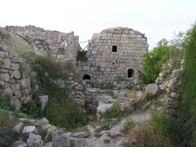
The Crusaders established a fortress at Suba known as Belmont, remains of which are still present at the site.
In the mid-nineteenth century, the powerful Abu Ghawsh family controlled Suba as part of its wider influence in the Jerusalem hills. The family constructed a fort within the walls of the Crusader fortress. Sources state that the fort and parts of the Crusader walls were destroyed during the Egyptian campaign of Ibrahim Pasha in Palestine.
Suba During the Ottoman Period
In 1596, Suba was a village in the Jerusalem subdistrict of the Jerusalem district, with an estimated population of approximately 369.
The inhabitants paid taxes on wheat, barley, olives, goats, beehives, molasses, and other products.
Architecture
In the late nineteenth century, Suba was described as a medium-sized stone-built village situated on the summit of a steep conical hill and surrounded by olive groves and vineyards.
The earliest village houses were concentrated within a small area inside the enclosure of the Crusader fortress. Later construction extended southward along the road leading to the Jerusalem–Jaffa highway, giving the village a more rectangular layout.
The houses were built of stone, while an unusually tall house stood prominently near the centre of the village alongside the remains of the fortress.
The built-up area amounted to approximately 16 dunams according to the 1944/1945 statistics.
The inhabitants of Suba were Muslims and maintained a shrine dedicated to Shaykh Ibrahim south of the village site.
Population
The official 1922 Census of Palestine recorded 307 inhabitants in Suba.
In the 1931 census, the population reached 434, living in 110 houses. The sources note that both figures include Dayr 'Amr.
According to the 1944/1945 Village Statistics, Suba had a population of 620 Arabs.
The estimate of approximately 719 inhabitants for 1948 and 4,417 refugees and descendants in 1998, published by Palestine Remembered, are later estimates rather than official British Mandate censuses.
Population of Suba
- 1596About 369Historical estimate based on Ottoman records
- 1922307Official census
- 1931434Official census; includes Dayr 'Amr
- 1944/1945620Government of Palestine statistics
- 1948About 719Later estimate
- 19984,417Estimate of refugees and their descendants
Number of Houses
The 1931 census recorded 110 houses in the population unit that included Suba and Dayr 'Amr.
Land of Suba
According to the 1944/1945 statistics, the lands of Suba covered a total of 4,102 dunams.
Arab ownership amounted to 4,082 dunams, Jewish ownership to 15 dunams, while 5 dunams were classified as public land.
Land Ownership in Suba in 1944/1945
- Arab ownership4,082 dunums100%
- Jewish ownership15 dunums<1%
- Public land5 dunums<1%
Agriculture and Economic Life
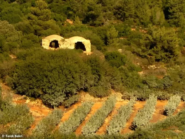
The inhabitants of Suba depended primarily on agriculture. Cereals were grown mainly in the valley floors, while fruit and olive trees were cultivated on the mountain slopes.
Several springs around the village supplied water for domestic use and irrigation.
According to the 1944/1945 statistics, 712 dunams were devoted to cereals, all of them Arab-owned.
Irrigated and plantation land covered 1,446 dunams, including 1,435 Arab-owned dunams and 11 Jewish-owned dunams.
Approximately 150 dunams were planted with olive trees. This was a crop category within the cultivated and plantation land and should not be added separately to the overall land-use totals.
Land Use in Suba in 1944/1945, in Dunams
- Arab
- Jewish
- Public
- Cereals712 dunums
- Irrigated and plantation land1,446 dunums
- Built-up area16 dunums
- Uncultivable land1,928 dunums
Archaeology and Historical Landmarks
Suba is an important archaeological site in the Jerusalem hills, containing remains from several historical periods.
Among its most prominent features are the remains of the Crusader Belmont fortress and stone walls and gateways uncovered during excavations.
The shrine of Shaykh Ibrahim was located south of the village site.
The Nakba and the Attacks on Suba
The Attack of 3 April 1948
According to the Palestinian newspaper Filastin, as reproduced by Walid Khalidi and PalQuest, Suba was attacked on 3 April 1948 following the assault on nearby al-Qastal.
Despite air support for the attacking forces, the defenders repelled the assault, and Suba remained outside Zionist control for approximately three more months.
Two further attempts to capture the village in mid-April also failed.
Operation Dani and the Occupation of Suba
Operation Dani
Operation Dani began on 9 July 1948 and continued until 18 July. It was the largest offensive launched during the Ten Days between the two truces.
The operation aimed to expand the Israeli-controlled corridor toward Jerusalem. Its first stage resulted in the occupation of Lydda and Ramla, while its second stage extended operations toward the Jerusalem corridor and al-Latrun area.
Several brigades participated in Operation Dani, with the Har'el Brigade assigned an important role in its eastern sector and the occupation of villages in the Jerusalem hills.
The Occupation of Suba
Suba was occupied by the Har'el Brigade on the night of 12–13 July 1948 during Operation Dani.
PalQuest and Walid Khalidi reproduce Israeli military accounts stating that two companies supported by field artillery and mortars were used in the assault.
The accounts transmitted through the Palestinian sources indicate that bombardment caused the defenders to withdraw. Many inhabitants had already left before the final attack, while those who remained either fled under bombardment or were expelled.
These Israeli military claims are cited here only as transmitted through Walid Khalidi and PalQuest and not through direct reliance on the original Israeli sources.
The principal Palestinian sources reviewed do not identify a specific battalion of the Har'el Brigade as responsible for capturing Suba.
Occupation and Depopulation Chronology
- 3 April 1948
First attack on the village
According to the newspaper Filastin, Suba was attacked after an attack on nearby al-Qastal; despite air support, the Haganah forces were driven back, and the village remained beyond the occupiers' grasp for three months.
- Mid-April 1948
Two failed attempts to occupy the village
Two further attempts to seize the village were made during the battles around al-Latrun, but both failed.
- 9 July 1948
Beginning of the military operation
Operation Dani (9–18 July 1948), the largest offensive of the Ten Days between the two truces, began; in its second stage, which extended to the Jerusalem corridor, the Harel Brigade was charged with occupying a number of villages further east.
- 12–13 July 1948
Final occupation
Suba fell to the Harel Brigade in the course of Operation Dani; according to the History of the War of Independence, as cited by Khalidi, two companies backed by field artillery and mortars were used. The Associated Press reported that Palmach storm troops took the village without combat after a bombardment that drove out the Arab defenders.
- 12–13 July 1948
Depopulation of the village
According to Israeli historian Benny Morris, as cited by Khalidi, many of Suba's inhabitants had already left, while those who remained fled the bombardment or were expelled.
- 1948
Settlement on village lands
The settlement of Ameilim was established on village lands, 1 km southwest of the village site; it was later renamed Kibbutz Tzova.
Displacement and Fate of the Village
The final occupation of Suba resulted in the displacement of its remaining Palestinian inhabitants, who were not permitted to return and re-establish their village community.
A large part of the village was destroyed or damaged, although a number of houses and the remains of the Crusader fortress survived. It is therefore inaccurate to describe Suba as having been completely erased from the site.
Israeli Settlements on the Lands of Suba
Ameilim – Tzova
The settlement of Ameilim was established in 1948 on the lands of Suba, approximately 1 kilometre southwest of the village site.
It was later renamed Kibbutz Tzova.
Yedida School
Yedida School was established northwest of Suba in 1964, but it stood on lands traditionally belonging to Abu Ghawsh. It should therefore not be classified as a settlement or institution established on Suba's lands.
- 1948Ameilim / Tzova
Established on Suba's lands, approximately 1 kilometre southwest of the village site
The Site of Suba After the Nakba
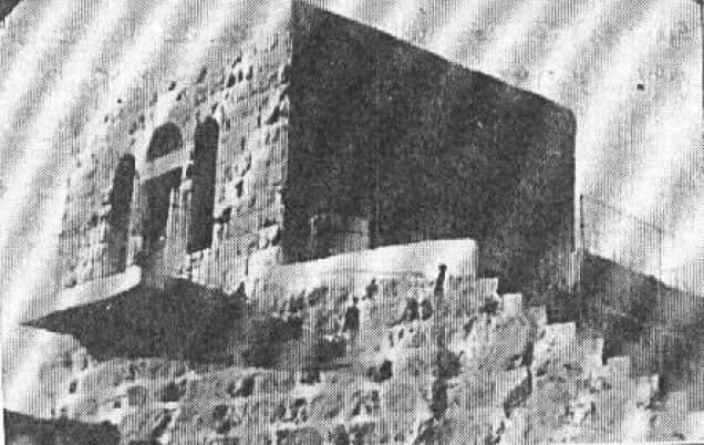
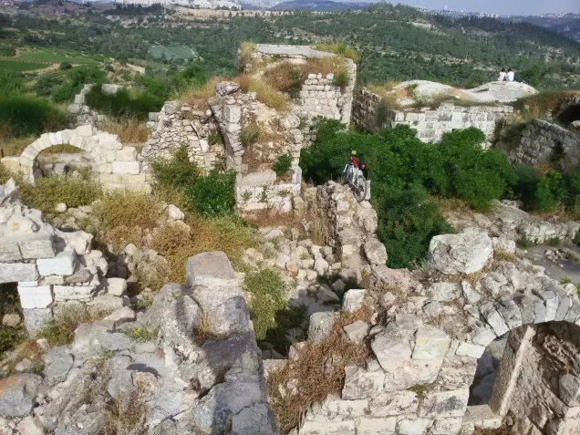
According to the field documentation relied upon by Walid Khalidi, many village buildings remained standing, although some had lost portions of their walls or roofs.
Arched doors and gateways remained visible on several houses, while other buildings were almost completely destroyed, leaving only wall foundations.
The remains of the Crusader fortress were still present, and archaeological excavations uncovered a large stone gateway and sections of walls.
The village cemetery lay at the southern base of the mountain, while networks of trenches remained visible on the northeastern side of the summit.
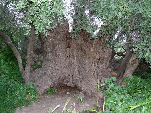
A water reservoir was constructed at the site with a pipe descending the northern slope. Fig, almond, and cypress trees, together with cactus plants, grew on the terraces surrounding the lower slopes.
This description reflects the condition of the site during the field documentation relied upon by Walid Khalidi and should not necessarily be interpreted as a comprehensive survey updated to 2026.
Sources
- PalQuest – Interactive Encyclopedia of the Palestine Question: Suba.
- PalQuest: Suba.
- PalQuest: Operation Dani.
- Palestine Remembered: Suba, Jerusalem District.
- Walid Khalidi, All That Remains: Suba, as reproduced by Palestine Remembered.
- Walid Khalidi, All That Remains, entry on Suba.
- Government of Palestine, censuses of 1922 and 1931.
- Government of Palestine, Department of Statistics, Village Statistics, 1945.
Photo gallery










Photos from the village's people
Photos sent in by visitors and published after review.
Add a photo of this village
Log in to add photos of this village.
Other villages from Al-Quds (Jerusalem)

More from the archive
 Al-Quds (Jerusalem)
The depopulated village of Khirbat al-Tannur - Allar al-Sifla / District of Al-Quds (Jerusalem)
 Al-Quds (Jerusalem)
The depopulated village of al-Burayj (Bayarat Burayj) / District of Al-Quds (Jerusalem)
 Al-Quds (Jerusalem)
The depopulated village of Sufla / District of Al-Quds (Jerusalem)
 Download Our Palestine App
The whole archive in the palm of your hand: depopulated villages, the Nakba, the massacres and Al-Aqsa — free, with no ads to erase the story.
Download Our Palestine App
The whole archive in the palm of your hand: depopulated villages, the Nakba, the massacres and Al-Aqsa — free, with no ads to erase the story.



Comments
No comments yet — be the first to write one.
Add your comment
Name and email are optional. Comments appear after review.