
The depopulated village of al-Kunayyisa / District of Al-Quds (Jerusalem)
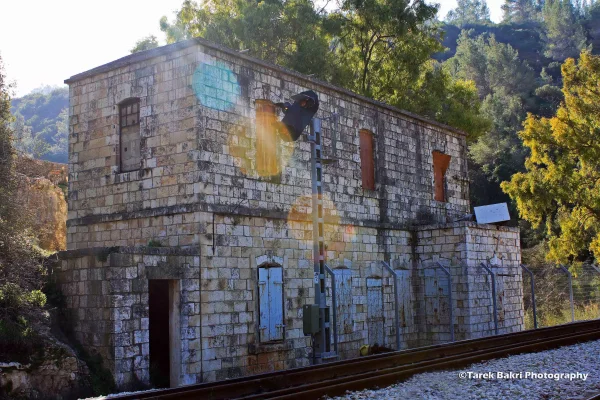
al-Kunayyisa
About the depopulated village of al-Kunayyisa
- District
- Al-Quds (Jerusalem)
- Date al-Kunayyisa was occupied
- 21 October 1948
- Population in 1948
- 260
- Military operation
- Operation Ha-Har
- Brigade that carried it out
- Harel Brigade
- Who defended the village
- Egyptian Muslim Brotherhoods, Jordanian Army, and some ALA and local Palestinian militia.
- Distance from the governorate centre
- 16 (km) West of Jerusalem
- Elevation above sea level
- 475 m
- Cause of displacement
- Military assault by Zionist troops
- Extent of destruction
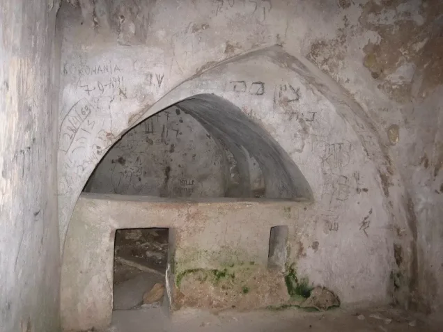
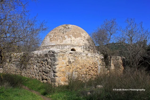
- Deir al-Sheikh was mostly destroyed and defaced with the exception of few houses including the village shrine which is being used as tourist attraction by Israelis.
- Ethnic cleansing
- Dayr al-Shaykh inhabitants were completely ethnically cleansed.
Hover a dot to read the village name, or click to open its card.
Borders of the depopulated village of al-Kunayyisa
al-Kunayyisa – Depopulated Palestinian Village of Ramla
Al-Kunayyisa was a Palestinian village in the Ramla Subdistrict and the Lydda administrative district during the British Mandate. It stood on a hill sloping gently northward at the eastern edge of Palestine's coastal plain, at an average elevation of approximately 175 meters above sea level.
PalQuest places the village approximately 8.5 kilometers from Ramla, while Palestine Remembered gives about 12 kilometers southeast of the city. Al-Kunayyisa lay less than two kilometers northeast of the Ramla-Jerusalem highway and was connected with it and neighboring villages by dirt roads.
Al-Kunayyisa was a small settlement. Its independently recorded population was only forty in the official 1944/45 statistics, while its village lands covered 3,872 dunums. Most inhabitants had originally come from nearby 'Innaba and al-Qubab to farm the land and gradually settled permanently.
Israeli forces entered al-Kunayyisa on 10 July 1948 at the beginning of the first phase of Operation Dani, as part of the military advance preparing for the capture of Lydda and Ramla. Houses were subsequently blown up and much of the village's built environment was destroyed.
Basic Information
| Field | Information |
|---|---|
| Name | al-Kunayyisa |
| Arabic name | الكُنَيِّسَة / الكنيسة |
| Subdistrict | Ramla |
| Administrative district | Lydda |
| Location | Eastern edge of the coastal plain, southeast of Ramla |
| Distance from Ramla | 8.5 km according to PalQuest; Palestine Remembered gives approximately 12 km |
| Average elevation | Approximately 175 m above sea level |
| Palestine Grid | 146/144 |
| Population in 1922 | No independently documented figure located in the principal sources used |
| Population in 1931 | No independent figure; 1,135 is the combined total for al-Kunayyisa and 'Innaba |
| Houses in 1931 | No independent figure; 288 houses is the combined al-Kunayyisa-'Innaba total |
| Population in 1944/45 | 40, all Muslims |
| 1948 population estimate | 46 – later estimate, not an official census |
| Total land area | 3,872 dunums |
| Occupation and depopulation date | 10 July 1948 |
| Military operation | Operation Dani – first phase |
| Military unit | Yiftach Brigade is the strongest village-level attribution based on its report concerning al-Kunayyisa and Kharruba; no battalion is independently identified |
| Cause of depopulation | Depopulation in the course of military assault; the precise mechanism of the inhabitants' departure is not documented |
| Destruction | Extensive demolition and house-blowing, while more than thirty partially ruined buildings remained in Khalidi's field survey |
| Post-1948 settlements | No Israeli settlement is identified by Khalidi or PalQuest as established on village land |
Name and Formation of the Village
The Arabic form al-Kunayyisa is linguistically a diminutive of the word for church.
The village stood over an older inhabited site with ruined building foundations, masonry, cisterns, and rock-cut tombs.
The principal Palestinian sources used here do not, however, establish that the modern name definitively derived from one particular ancient church structure. The linguistic association should therefore not be treated as a proven archaeological identification.
Formation of the Modern Community
Al-Kunayyisa was a relatively small settlement.
Khalidi records that most inhabitants originally came from the neighboring villages of 'Innaba and al-Qubab to cultivate local land and gradually settled beside their farms.
The village consequently retained close economic and social ties with 'Innaba and relied on the larger neighboring community for a number of daily services.
Location and Geography
The village stood on a hill sloping gently northward at the eastern edge of the coastal plain.
Hills surrounded it on most sides except the south, where al-Kunayyisa overlooked a wadi.
The Ramla-Jerusalem highway passed less than two kilometers southwest of the village, and a dirt road connected the settlement with the highway.
Other tracks led to 'Innaba, Kharruba, Barfiliya, Bir Ma'in, Bayt Shanna, al-Qubab, al-Barriyya, and neighboring localities.
Neighboring Villages
'Innaba lay to the northwest, Kharruba to the north, Barfiliya to the northeast, Bir Ma'in to the east, Bayt Shanna to the southeast, al-Qubab to the south and southwest, and al-Barriyya to the west.
This location placed al-Kunayyisa within a network of rural villages linked to the Ramla-Jerusalem highway and the wider Latrun region.
Built Environment
The village houses were clustered closely together and separated by narrow alleys.
Most houses were built of adobe, with stone elements in some structures.
The built-up area covered approximately twenty dunums in the 1944/45 statistics.
The Palestine Encyclopedia describes al-Kunayyisa as a small settlement with a limited number of attached residential buildings and no major public-service infrastructure.
Population
| Year | Population | Status |
|---|---|---|
| 1922 | No independently documented figure | No figure is inferred from 'Innaba or neighboring villages |
| 1931 | 1,135 | Combined census total for al-Kunayyisa and 'Innaba; not a separate al-Kunayyisa figure |
| 1944/45 | 40 | Independent official figure; all Muslims |
| 1948 | 46 | Later demographic estimate, not an official census |
| 1998 | 285 | Later Palestine Remembered estimate of refugees and descendants |
The 1,135 figure should not be presented as al-Kunayyisa's 1931 population because the census entry includes 'Innaba.
Number of Houses
The 1931 census gives 288 houses for the combined 'Innaba-al-Kunayyisa census entry.
No separate official house count for al-Kunayyisa can therefore be extracted from that total.
No house number is inferred from later population estimates.
Land Ownership, 1944/45
- Palestinian3,804 dunums98%
- Transferred to Zionists0 dunums0%
- Public68 dunums2%
The figures balance exactly: 3,804 + 68 = 3,872 dunums.
No land was recorded in the Jewish ownership category in the 1945 statistics.
Land Use, 1944/45
- Palestinian
- Public
- Cereals2,432 dunums
- Plantations and irrigable land64 dunums
- Built-up area20 dunums
- Non-cultivable land1,356 dunums
The categories reconcile exactly with the total village area.
Economy and Agriculture
Rain-fed agriculture formed the economic basis of al-Kunayyisa.
Cereals dominated cultivation, covering 2,432 dunums in 1944/45.
The villagers also cultivated citrus and olive trees in the northern and southern sections of their lands, irrigating some of them from nearby wells.
Sixty-four dunums were classified as plantations or irrigable land.
Water
Most farming relied on rainfall, while nearby wells were used to irrigate citrus and olive trees.
The Palestine Encyclopedia also records rainwater-collection reservoirs west of the village.
No securely documented list of named village wells or springs appears in Khalidi's profile.
Education and Services
No independently documented school was located in the principal Khalidi/PalQuest material for al-Kunayyisa.
The Palestine Encyclopedia describes the village as lacking major public services and notes that residents depended on neighboring 'Innaba for many everyday needs.
No pupil, teacher, or school figures are therefore supplied without direct documentation.
Religious Buildings
All recorded villagers in 1944/45 were Muslims.
The principal Palestinian sources used here do not document a specific mosque or shrine in the modern village.
Likewise, the name al-Kunayyisa alone does not establish that a functioning church existed in the twentieth-century Palestinian settlement.
Archaeology
Al-Kunayyisa stood on a site that had been inhabited in earlier periods.
Its ruins included former building foundations, fallen masonry, cisterns, and rock-cut tombs.
A khirba east of the village contained rough stone walls, building foundations, and rock-cut cisterns.
The principal sources do not provide a sufficiently precise archaeological chronology to assign all of these remains to one period.
Operation Dani
Operation Dani began on 9 July 1948 and continued until 18 July.
At the operational level it involved several brigades, including Har'el, Yiftach, Kiryati, Alexandroni, and Etzioni.
The first phase sought to encircle and capture Lydda and Ramla together with their rural approaches.
PalQuest explicitly lists al-Kunayyisa among the localities affected by Operation Dani.
Occupation of al-Kunayyisa – 10 July 1948
Israeli forces entered al-Kunayyisa on 10 July 1948, at the beginning of Operation Dani and as part of the preparations for the capture of Lydda and Ramla.
Several villages east of the two cities were attacked in the same period, including Kharruba, 'Innaba, Daniyal, Jimzu, and others.
The wider military aim was to secure roads, high ground, and approaches surrounding Lydda and Ramla.
Military Unit
The village-level unit attribution requires caution.
A Palestine Remembered summary field lists Giv'ati, but its English version presents that attribution only as “possibly Giv'ati.”
Khalidi's village narrative instead records a Yiftach Brigade report concerning al-Kunayyisa and neighboring Kharruba, stating that after houses were blown up and the village was “cleaned up,” the troops occupied strongpoints overlooking the locality.
Palestinian documentation for Kharruba independently confirms that Yiftach units were operating in the same sector on 10 July and directly occupied that neighboring village.
The strongest village-level formulation is therefore: Yiftach Brigade is the most probable directly involved formation at al-Kunayyisa, although no specific battalion is independently documented.
Cause of Depopulation
Palestine Remembered classifies the cause as direct military assault.
Khalidi, however, explicitly states that the fate of al-Kunayyisa's inhabitants was not recorded in the available military report.
The evidence therefore does not establish whether every villager fled during the assault, was expelled after entry, or experienced a combination of both.
The most cautious formulation is: depopulation in the context of the 10 July military assault and occupation; the precise mechanism of the inhabitants' departure remains undocumented.
Demolition
A Yiftach Brigade report records the blowing up of houses during the capture of al-Kunayyisa.
Some secondary summaries call the village “completely destroyed,” but Khalidi's later field description demonstrates that this should not be understood literally.
More than thirty partially destroyed buildings, including houses, remained standing.
Remnants of arched doors and windows were still visible.
The most accurate formulation is therefore: extensive destruction and demolition of much of the village, while dozens of structures and walls survived in partial form.
Ethnic Cleansing in Source Classification
Palestine Remembered classifies al-Kunayyisa using the term “complete ethnic cleansing.” The phrase is retained here only as an attributed source classification.
The more specifically documented facts are the 10 July military assault, demolition of houses, disappearance of the Palestinian community from the village, absence of permanent collective return, and extensive destruction of the built environment.
Occupation Chronology
| Date | Event |
|---|---|
| 9 July 1948 | Operation Dani begins with the objective of capturing Lydda, Ramla, and their surrounding approaches. |
| 10 July 1948 | Israeli forces enter al-Kunayyisa during the first phase of Operation Dani. |
| 10 July 1948 | A Yiftach Brigade report concerning al-Kunayyisa and Kharruba records houses being blown up and strongpoints being occupied around the village. |
| 10–11 July 1948 | Operation Dani forces continue advancing through villages east of Lydda and Ramla. |
| 11–12 July 1948 | Lydda and Ramla fall during the first phase of Operation Dani. |
| Later period | The site remains heavily ruined, although more than thirty partially destroyed structures survive in Khalidi's field documentation. |
Israeli Settlements Established on al-Kunayyisa's Lands
According to Walid Khalidi and PalQuest, no Israeli settlement was established on al-Kunayyisa's village lands.
Mishmar Ayalon lies nearby to the south but was established on the lands of al-Qubab rather than al-Kunayyisa.
Secondary material concerning later use of al-Kunayyisa's lands does not outweigh Khalidi's direct village-level cadastral identification.
al-Kunayyisa Today
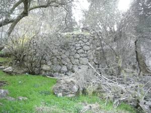
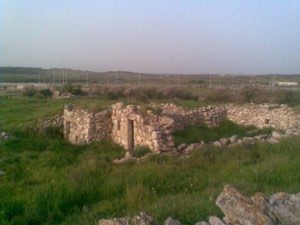
According to the field description used by Walid Khalidi before the publication of All That Remains in 1992, the former village looked from a distance like a large heap of stones covered by thorny growth.
More than thirty partially destroyed structures, including houses, were still standing.
The remains of arched doors and windows were visible, while fig, almond, olive, pomegranate, and cactus plants grew among the ruins.
Land around the site was being cultivated by residents of the nearby kibbutz, with some fields planted in cotton.
Palestine Remembered also contains later Palestinian community documentation and visits from 2020, 2025, and 2026.
These later materials are useful community documentation but do not constitute a comprehensive archaeological or cadastral survey. Khalidi's account remains historical field documentation from before 1992 rather than a complete direct survey of the village territory in 2026.
Sources
- PalQuest – Interactive Encyclopedia of the Palestine Question: al-Kunayyisa
- PalQuest – Operation Dani
- Palestine Remembered – al-Kunayyisa, Ramla Subdistrict
- Palestine Remembered – al-Kunayyisa entry from Walid Khalidi's All That Remains
- Palestine Encyclopedia – al-Kunayyisa
- Palestinian Villages Encyclopedia – al-Kunayyisa
Photo gallery
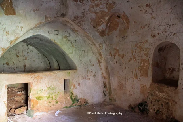


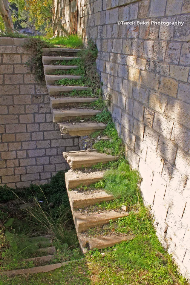


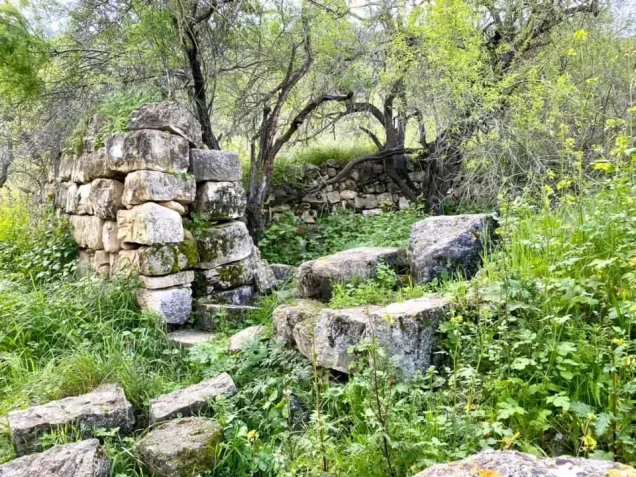





Photos from the village's people
Photos sent in by visitors and published after review.
Add a photo of this village
Log in to add photos of this village.
Other villages from Al-Quds (Jerusalem)

More from the archive


 Download Our Palestine App
The whole archive in the palm of your hand: depopulated villages, the Nakba, the massacres and Al-Aqsa — free, with no ads to erase the story.
Download Our Palestine App
The whole archive in the palm of your hand: depopulated villages, the Nakba, the massacres and Al-Aqsa — free, with no ads to erase the story.



Comments
No comments yet — be the first to write one.
Add your comment
Name and email are optional. Comments appear after review.