
The depopulated village of al-Qabu / District of Al-Quds (Jerusalem)
About the depopulated village of al-Qabu
- District
- Al-Quds (Jerusalem)
- Date al-Qabu was occupied
- 21 October 1948
- Population in 1948
- 300
- Military operation
- Operation Ha-Har
- Brigade that carried it out
- Harel Brigade
- Who defended the village
- Egyptian Muslim Brotherhoods, Jordanian Army, and some ALA and local Palestinian militia.
- Distance from the governorate centre
- 12 (km) West of Jerusalem
- Elevation above sea level
- 775 m
- Cause of displacement
- Military assault by Zionist troops
- Extent of destruction
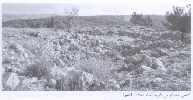
- al-Qabu was mostly destroyed (in the second half of 1949) with the exception of the mosque and the cemetery.
- Settlements built on the land of al-Qabu before 1948
- al-Qabu inhabitants were completely ethnically cleansed.
- Refugees' migration routes
- al-Qabu's inhabitants were either ethnically cleansed or fled towards Bethlehem and the Hebron hills.
Hover a dot to read the village name, or click to open its card.
Borders of the depopulated village of al-Qabu
al-Qabu – Depopulated Palestinian Village of Jerusalem
Al-Qabu was a Palestinian village in the Jerusalem Subdistrict, situated on the summit of a high mountain in the Jerusalem hills at an average elevation of approximately 775 meters above sea level. PalQuest places it about 12 kilometers from Jerusalem, while Palestinian geographical sources give longer road distances of approximately 17–18 kilometers southwest of the city.
The mountain descended steeply on its northern, eastern, and western sides. Secondary roads linked the village to the Bayt Jibrin-Jerusalem highway, which passed approximately 1.5 kilometers to the south. Al-Qabu was also connected geographically with Battir, Husan, Wadi Fukin, al-Walaja, and Ras Abu 'Ammar.
The population reached 260 in the official 1944/45 statistics, and the village lands covered 3,806 dunums. Agriculture combined rain-fed and irrigated cultivation, with cereals, olives, grapes, and other fruit trees supported by local springs.
Israeli forces first occupied al-Qabu during Operation ha-Har in October 1948. The account used by Walid Khalidi dates the entry of the Har'el Brigade's Sixth Battalion to 21 October, while another source cited by Khalidi gives 22–23 October. Control did not remain settled, however. Al-Qabu later changed hands and came under final Israeli control without fighting in the weeks following the Israeli-Jordanian Armistice Agreement signed on 3 April 1949.
Basic Information
| Field | Information |
|---|---|
| Name | al-Qabu |
| Arabic name | القبو |
| Subdistrict | Jerusalem |
| Region | Jerusalem hills, southwest of Jerusalem |
| Distance from Jerusalem | 12 km according to PalQuest; approximately 17–18 km by some road measurements in Palestinian geographical sources |
| Average elevation | Approximately 775 m above sea level |
| Population in 1922 | 129 |
| Population in 1931 | 192 |
| Houses in 1931 | 31 |
| Population in 1944/45 | 260 |
| 1948 population estimate | 302 – later estimate, not an official census |
| Total land area | 3,806 dunums |
| First occupation | 21 October 1948 in Khalidi's principal account; another cited chronology gives 22–23 October |
| Military operation | Operation ha-Har |
| Village-level military unit | Sixth Battalion, Har'el Brigade |
| Cause of depopulation | Expulsion or flight under attack toward Bethlehem and the Hebron hills; the village account does not conclusively distinguish the fate of all residents |
| Change of control | The village changed hands again after the October occupation |
| Final Israeli control | Israeli forces entered without fighting in the weeks following the 3 April 1949 armistice agreement with Jordan |
| Destruction | Most of the village was subsequently demolished; the mosque, cemetery, shrine, wells, and other remains survived |
| Post-1948 settlement | Mevo Betar, established on village land in 1950 |
Name and Earlier History
Walid Khalidi derives the village name al-Qabu from Qobi, the name associated with the locality in the Roman period.
Palestinian local tradition also offers an alternative explanation connecting the Arabic name with caves, underground chambers, and other subterranean spaces in the area.
The latter remains local oral interpretation rather than a conclusively established historical etymology.
Location and Geography
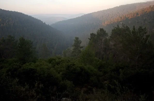
Al-Qabu stood on the summit of a high mountain whose northern, eastern, and western sides fell away steeply.
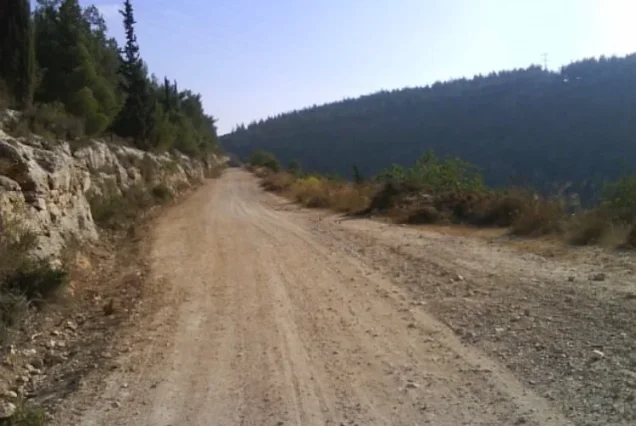
The main Bayt Jibrin-Jerusalem road passed approximately 1.5 kilometers south of the village and was linked to al-Qabu by a secondary road.
Palestinian local geography places Battir to the east, Husan and Wadi Fukin to the south and southwest, Ras Abu 'Ammar toward the west or northwest, and al-Walaja to the northeast, with 'Allar and Sataf in the broader surrounding landscape.
Built Environment
The village had a rectangular plan extending north-south along its internal road.
Most houses were constructed of stone, while several small shops stood around the village square.
The built-up area covered 12 dunums in the 1944/45 statistics.
The official 1931 census recorded thirty-one occupied houses.
Population
- 1922129Official Mandate-period census
- 1931192Official census; 31 houses
- 1944/45260Official Mandate-period estimate
- 1948302Later estimate, not an official 1948 census
- 19981,852Later Palestine Remembered estimate of refugees and descendants
Number of Houses
- 193131Official census figure
- 194848Later Palestine Remembered estimate, not a new official house census
Land Ownership, 1944/45
- Palestinian3,801 dunums100%
- Transferred to Zionists0 dunums0%
- Public5 dunums<1%
The figures balance exactly: 3,801 + 5 = 3,806 dunums.
No land was recorded in the Jewish ownership category.
Land Use, 1944/45
- Palestinian
- Public
- Cereals1,233 dunums
- Plantations and irrigable land436 dunums
- Built-up area12 dunums
- Non-cultivable land2,125 dunums
The land-use categories reconcile exactly with the total village area.
Olive Groves and Double Counting
Khalidi records approximately thirty dunums of olive trees.
This figure should be understood as a subcategory of cultivated orchard land rather than an additional category added on top of the 436 dunums classified as plantations and irrigable land.
Economy and Agriculture
The villagers practiced both rain-fed and irrigated agriculture.
Cereals were the principal field crop, while olive trees, grape vines, almonds, figs, and other fruit trees were also cultivated.
In 1944/45, 1,233 dunums were allocated to cereals and 436 to plantations or irrigable cultivation.
Palestinian local history additionally records maize, sesame, legumes, melons, cucumbers, tomatoes, and other vegetables grown near springs and wadis.
Livestock raising also formed part of the local economy, and agricultural produce was marketed in Jerusalem.
Water and Springs
Springs were central to both village life and irrigated farming.
Khalidi specifically identifies 'Ayn Tuz and 'Ayn al-Bayda.
Local Palestinian documentation additionally records 'Ayn al-Balad near the mosque, the eastern spring, 'Ayn Taza, and several seasonal springs.
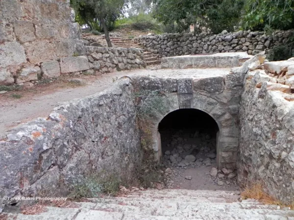
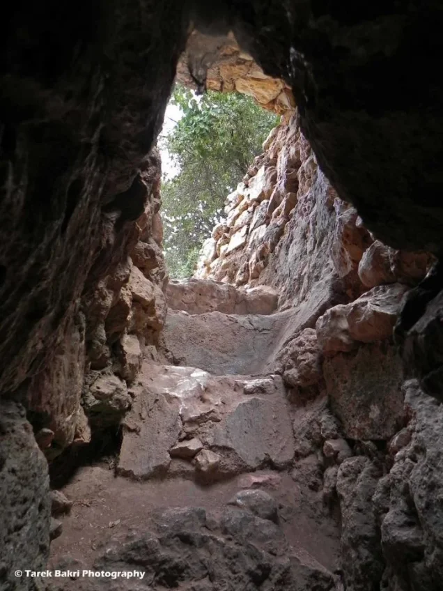
Three wells remained behind the village mosque in Khalidi's later field description, while stone steps led to the arched entrance of the ancient 'Ayn al-Qabu spring.
Education and Services
No independently documented village school was located in the principal sources reviewed.
The Palestine Encyclopedia describes al-Qabu as lacking public services apart from several small shops in the village center.
No pupil or teacher totals are therefore supplied without direct documentation.
Mosque and the Shrine of Shaykh Ahmad al-'Umari
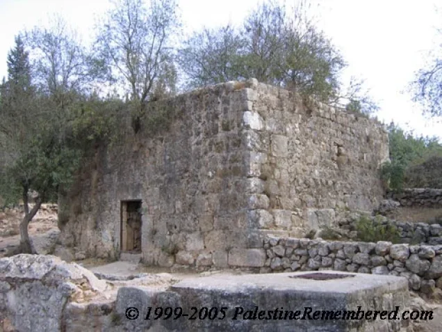
Al-Qabu had a documented mosque that survived the destruction of most of the village.
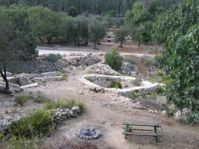
Its courtyard contained an artificial stepped pool, and three wells stood behind it.
The shrine of Shaykh Ahmad al-'Umari stood southeast of the village and remained visible in later fieldwork beside an old network of irrigation channels.
Archaeology
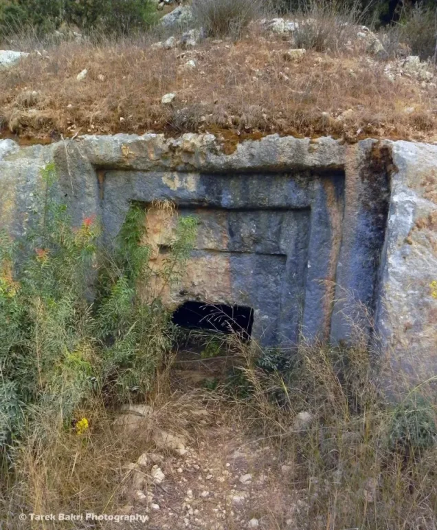
The village landscape contained several important archaeological remains.
Khalidi records the ruins of a Crusader church southwest of the village, along with an old water channel.
Two khirbas east of the village contained ruins and fragments of stone arches.
Palestinian local documentation additionally names Khirbat Taza, Khirbat Abu 'Adas, and other archaeological localities.
The presence of Roman and Crusader remains should not be interpreted as proof of uninterrupted settlement through every historical period without additional archaeological evidence.
Operation ha-Har
Operation ha-Har began on 19 October 1948 and ended on 24 October.
The offensive was led principally by the Har'el and Etzioni brigades in an effort to widen the Israeli-held Jerusalem corridor and connect it with territory captured toward the Hebron hills.
Giv'ati units also participated at the wider operational level, while Egyptian forces were the principal Arab military force opposing the offensive in this sector.
For al-Qabu specifically, however, Khalidi identifies the Sixth Battalion of the Har'el Brigade as the force that entered the village.
First Occupation – October 1948
The sources differ slightly over the precise date of al-Qabu's first occupation.
The History of the War of Independence, as cited by Khalidi, states that the Har'el Brigade's Sixth Battalion entered the village on 21 October 1948.
Khalidi also cites Benny Morris, who dates the capture to 22–23 October.
Palestine Remembered uses 22 October in its statistical summary, while Palestinian local documentation often uses 21 October.
This article therefore uses 21 October as the principal documented date while explicitly preserving the 22–23 October alternative.
Cause of Depopulation
Khalidi's account describes an offensive in which the occupying forces sought not to leave Palestinian civilian communities in the captured sector.
For al-Qabu itself, he gives two possibilities: the inhabitants were expelled or they fled under attack toward Bethlehem and the Hebron hills.
The village-level evidence does not establish that every resident experienced the same form of removal.
The most precise formulation is therefore: depopulation under military assault, through expulsion and/or flight toward Bethlehem and the Hebron hills, with the exact balance between the two remaining unresolved.
Why October 1948 Was Not the Final Transfer of Control
Al-Qabu requires a distinction between its first occupation and final Israeli control.
Khalidi states that the village apparently changed hands again before the end of the war.
This is confirmed by its later appearance among the Jerusalem-area villages brought under Israeli control through the armistice arrangements with Jordan.
Final Israeli Control in 1949
The Israeli-Jordanian General Armistice Agreement was signed in Rhodes on 3 April 1949.
According to the account used by Khalidi, al-Qabu was one of four Jerusalem-area villages affected by the resulting adjustment of control.
Israeli forces entered the village without fighting in the weeks following the agreement.
The adjustment also placed the Jerusalem-coast railway line within the Israeli side of the armistice boundary.
The most accurate chronology is therefore: first Israeli occupation on 21–23 October 1948, a subsequent change of control, and final Israeli entry without fighting in the weeks after 3 April 1949.
Destruction
Most of al-Qabu's built environment was destroyed after the displacement of its inhabitants and the consolidation of final Israeli control.
A Palestine Remembered summary places most demolition in the second half of 1949 and notes that the mosque and cemetery survived.
Khalidi's principal village narrative, however, does not provide a precise day or month for the demolition.
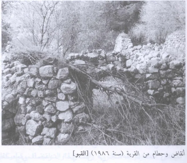
Later fieldwork confirms that most houses had become rubble while the mosque, cemetery, shrine, wells, irrigation features, and other remains survived.
Ethnic Cleansing in Source Classification
Palestine Remembered classifies al-Qabu using the term “complete ethnic cleansing.” The phrase is retained here only as an attributed source classification.
The more specifically documented sequence consists of the Operation ha-Har assault, expulsion and/or flight of the inhabitants, subsequent changes in military control, final Israeli control after the 1949 armistice agreement, absence of permanent collective return, and later destruction of most village houses.
Occupation Chronology
| Date | Event |
|---|---|
| Night of 18–19 October 1948 | The attack opening Operation ha-Har begins against Egyptian positions west of Dayr Aban. |
| 19 October 1948 | Formal start of Operation ha-Har. |
| 21 October 1948 | According to the principal account cited by Khalidi, the Har'el Brigade's Sixth Battalion enters al-Qabu. |
| 22–23 October 1948 | Alternative date given by Benny Morris and cited by Khalidi for the first occupation. |
| 24 October 1948 | Operation ha-Har formally ends. |
| After October 1948 | Control of al-Qabu changes again; the October occupation does not remain continuous and final. |
| 3 April 1949 | The Israeli-Jordanian Armistice Agreement is signed in Rhodes. |
| Following weeks | Israeli forces enter al-Qabu without fighting and final Israeli control is established. |
| 1949 | Most of the village is subsequently demolished; the principal source does not provide a precise demolition date. |
| 1950 | Mevo Betar is established on al-Qabu's village lands. |
Israeli Settlements Established on al-Qabu's Lands
According to Walid Khalidi and PalQuest, Mevo Betar was established on al-Qabu's lands in 1950.
It is the settlement directly documented by the principal village source as having been founded on the village lands.
al-Qabu Today
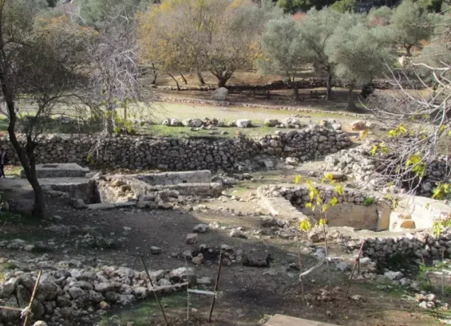
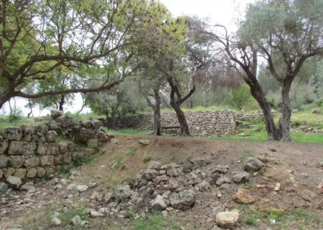
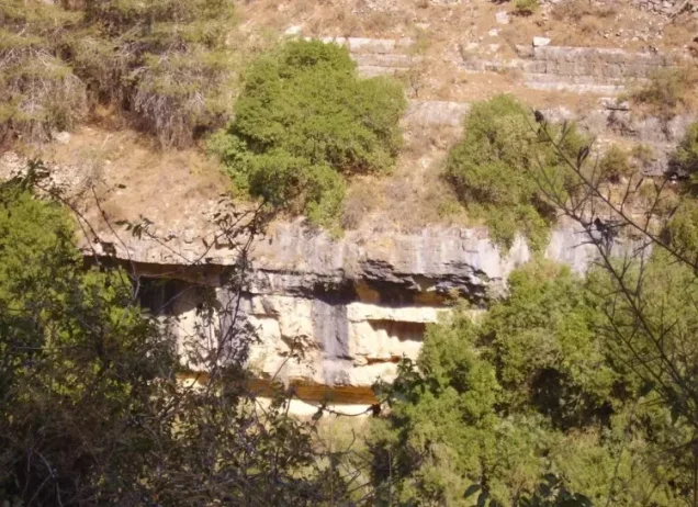
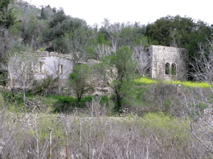
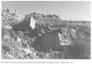
According to the field description used by Walid Khalidi before the publication of All That Remains in 1992, the former village site was filled with house rubble and architectural remains.
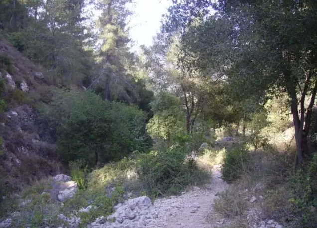
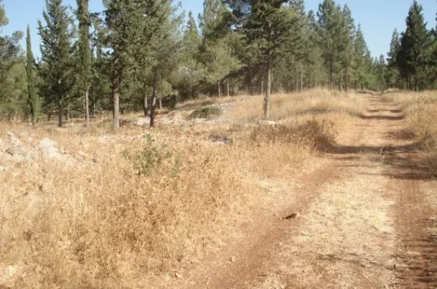
Olive, almond, and pine trees continued to grow on and around the site.
The cemetery remained visible on the southeastern edge. Seven graves could be seen, and some had been disturbed.
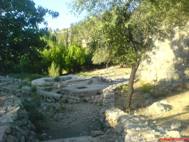
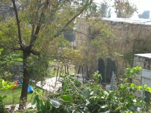
The village mosque was still standing, although abandoned and neglected. Its courtyard contained an artificial stepped pool, with three wells behind the building.
The shrine of Shaykh al-'Umari survived beside an old irrigation network, while stone steps descended to the arched entrance of the ancient 'Ayn al-Qabu spring.
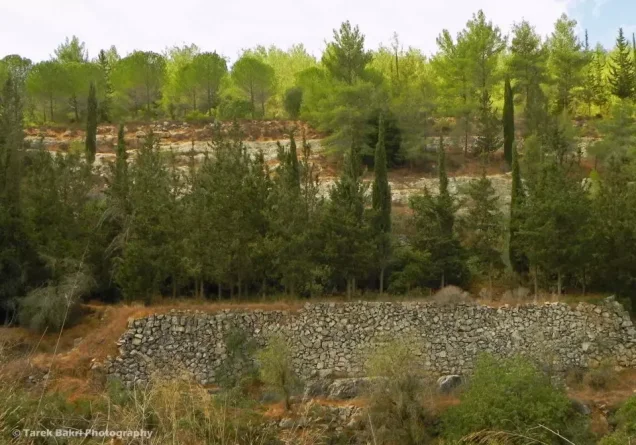
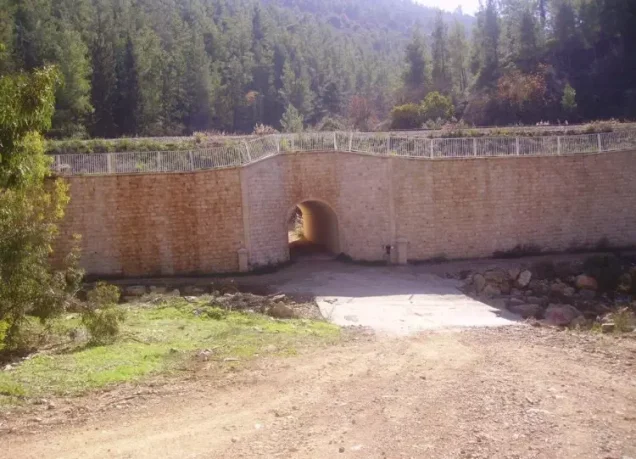
Much of the surrounding land had been covered by a planted forest.
Palestine Remembered also contains later Palestinian community documentation, including photographs posted in 2024 of the former olive press and video visits in 2025 documenting the village site, spring, mosque, and other remains.
These later materials are valuable community documentation rather than a comprehensive archaeological or cadastral survey. Khalidi's description likewise represents historical fieldwork from before 1992 rather than a full direct survey of al-Qabu's entire territory in 2026.
Sources
Photo gallery
Photos from the village's people
Photos sent in by visitors and published after review.
Add a photo of this village
Log in to add photos of this village.
Other villages from Al-Quds (Jerusalem)

More from the archive


 Download Our Palestine App
The whole archive in the palm of your hand: depopulated villages, the Nakba, the massacres and Al-Aqsa — free, with no ads to erase the story.
Download Our Palestine App
The whole archive in the palm of your hand: depopulated villages, the Nakba, the massacres and Al-Aqsa — free, with no ads to erase the story.



Comments
No comments yet — be the first to write one.
Add your comment
Name and email are optional. Comments appear after review.