
The depopulated village of Jusayr / District of Gaza

About the depopulated village of Jusayr
- District
- Gaza
- Date Jusayr was occupied
- 17 July 1948
- Population in 1948
- 1,370
- Military operation
- Operation An-Far
- Brigade that carried it out
- Givati Brigade
- Who defended the village
- Egyptian Army
- Distance from the governorate centre
- 35 (km) North East of Gaza
- Elevation above sea level
- 100 m
- Cause of displacement
- Military assault by Zionist troops
- Extent of destruction
- The village was mostly destroyed with the exception of a single house.
- Ethnic cleansing
- Jusayr inhabitants were completely ethnically cleansed.
- Settlements built on the built-up area of Jusayr after 1948
- Zavdiel
Hover a dot to read the village name, or click to open its card.
Borders of the depopulated village of Jusayr
Jusayr: A Depopulated Palestinian Village in the Gaza District
Jusayr was a Palestinian village in the Gaza District, approximately 35 km northeast of Gaza city. It stood on flat ground in the southern coastal plain at an average elevation of about 100 metres above sea level. Its inhabitants were displaced during the Nakba and the occupation of Palestine in 1948. Walid Khalidi and PalQuest consider 17–18 July 1948 the most probable date of its final occupation.
Location and Name of Jusayr
Jusayr stood on flat ground in the southern coastal plain between two bridges crossing Wadi al-Jira. By the late nineteenth century, the village extended along a northwest-southeast axis.
Linguistically, the Arabic name Jusayr is a diminutive form of jisr, meaning “bridge,” which is consistent with the village's location between two bridges. The more specific local account that the settlement was once called “the Station of the Two Bridges” and that this name was subsequently transformed into Jusayr is not sufficiently documented in the approved sources used for this article to present it as an established historical fact.
The inhabitants relied on nearby al-Faluja, approximately 4 km to the southeast, for many services.
Jusayr during the Ottoman Period
In 1596, Jusayr was a village in the nahiya of Gaza within the liwa of Gaza, with an estimated population of approximately 330. It paid taxes on wheat, barley, fruit, goats, beehives, vineyards, and other forms of agricultural production.
Walid Khalidi also records elderly villagers' recollection that Jusayr once served as a stopping place for pilgrims travelling toward the Muslim holy cities.
Community and Services in Jusayr
The inhabitants of Jusayr were Muslim, and the village had its own mosque.
A well approximately 32 metres deep supplied residents with water for domestic use.
Education in Jusayr
An elementary school was established in Jusayr in 1937. It served the village's boys and had an enrolment of 74 pupils by the mid-1940s.
Economic Life in Jusayr
Some villagers wove rugs and carpets, although agriculture provided the principal livelihood for most inhabitants.
Grain was the most important crop, while villagers also cultivated fruit trees. Orchards bordered the village on its northeastern and southeastern sides.
In the 1944/45 statistics, 11,852 dunums of Arab land were devoted to cereals, together with 11 dunums of public land, producing a total cereal area of 11,863 dunums.
Land Ownership in Jusayr
The total land area of Jusayr was 12,361 dunums according to the 1944/45 statistics.
Land ownership in Jusayr, 1944/45
- Arab12,015 dunums97%
- Jewish0 dunums0%
- Public346 dunums3%
Palestine Remembered presents the corresponding Arabic categories as 12,015 Palestinian dunums, zero dunums “transferred to Zionists,” and 346 dunums of communal land.
Land Use in Jusayr, 1944/45
Land use in Jusayr
- Arab
- Public
- Cereals11,863 dunums
- Built-up area54 dunums
- Non-cultivable land444 dunums
A total of 11,863 dunums, approximately 96 percent of the village lands, was cultivated or cultivable. Built-up and non-cultivable areas together amounted to 498 dunums.
Population of Jusayr
Population of Jusayr in selected years
- 1596330Estimate based on Ottoman records
- 1922579Official British Mandate census
- 1931839Official British Mandate census
- 1944/451,180Official statistics
- 19481,369Later estimate published by Palestine Remembered
- Estimated refugees in 19988,406Later estimate published by Palestine Remembered
Number of Houses in Jusayr
Number of houses in Jusayr
- 1931246Official census figure
- 1948401Later estimate published by Palestine Remembered
Occupation and Depopulation of Jusayr during the Nakba
Walid Khalidi and PalQuest associate the occupation of Jusayr with a southward offensive conducted by the Givati Brigade in July 1948, as Israeli occupation forces attempted to break through Egyptian lines and establish a connection with the Negev.
As the first truce ended, Givati commander Shim'on Avidan ordered his forces to break through the Egyptian lines and to expel civilians from areas they occupied. Although the brigade failed to establish the intended connection with the Negev, it seized a large arc of territory south of Ramla and displaced more than 20,000 Palestinians from villages in the area.
Jusayr was among the southernmost villages targeted in this offensive. Khalidi considers it probable that the final occupation of the village was not completed until 17–18 July 1948, while Palestine Remembered gives 17 July as the occupation date.
The offensive was closely connected in timing and military context with Operation An-Far, conducted by the First Battalion of the Givati Brigade between 8 and 15 July 1948. Since Khalidi places Jusayr's probable final occupation on 17–18 July, after the formal end date of An-Far, the most accurate formulation is that Jusayr was occupied in the context of Givati's offensive associated with Operation An-Far and its final stages or immediate aftermath.
Khalidi also records a conflicting account from two Egyptian sources that places the fall of Jusayr approximately one month earlier, during the first truce. One of these sources is the memoir of Gamal Abdel Nasser, who wrote about Israeli occupation forces using the truce to improve their positions and criticized the Egyptian high command's lack of awareness of developments at several positions.
These sources do not state that Gamal Abdel Nasser personally commanded an Egyptian withdrawal from Jusayr, and that claim should therefore not be made.
- Most probable final occupation date: 17–18 July 1948.
- Palestine Remembered date: 17 July 1948.
- Documented attacking unit: Givati Brigade.
- Operational context: Givati's July offensive associated with Operation An-Far and its immediate aftermath.
- Arab military force on this front: Egyptian forces.
- Fate of the inhabitants: Jusayr's Palestinian population was displaced during the Nakba as a result of the military assault and occupation of the village.
- Alternative account: Egyptian sources cited by Khalidi place the fall of the village approximately one month earlier, during the first truce.
Settlements Established on the Lands of Jusayr
Two settlements were established on Jusayr's lands after the Nakba. Both also occupy land that had belonged to the neighbouring village of Summil:
- Menuha: established in 1953.
- Wardon: established in 1968.
Jusayr Today
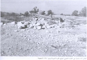
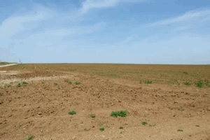
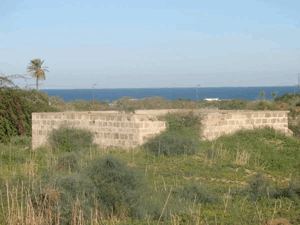
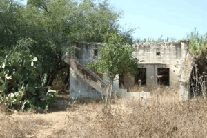
According to the field description published by Walid Khalidi in All That Remains, one concrete flat-roofed house remained standing in the middle of a peach orchard. Its facade had two rectangular windows and a rectangular central entrance. Debris from village houses could also be seen among tall grasses and wild vegetation.
The description further recorded a garbage dump at the site and several buildings belonging to a neighbouring settlement, while surrounding lands were under cultivation.
Khalidi does not identify the surviving concrete house as the former village school. That identification therefore cannot be confirmed from the approved source.
This description derives from field research published in 1992. The approved sources used here do not provide a sufficiently comprehensive, independent, up-to-date field survey to verify the precise condition of every part of the Jusayr site in 2026.
The People of Jusayr after the Nakba
The inhabitants of Jusayr were dispersed after the depopulation of the village during the Nakba. Accounts from the village community refer to descendants living in the Gaza Strip, Jordan, and elsewhere. However, the approved sources used in this article do not provide a reliable current census of all descendants of Jusayr in exile and displacement.
Palestine Remembered provides a dated estimate of 8,406 Jusayr refugees in 1998. This figure should not be presented as a current population estimate.
Sources
Photo gallery


Photos from the village's people
Photos sent in by visitors and published after review.
Add a photo of this village
Log in to add photos of this village.
Other villages from Gaza
More from the archive


 Download Our Palestine App
The whole archive in the palm of your hand: depopulated villages, the Nakba, the massacres and Al-Aqsa — free, with no ads to erase the story.
Download Our Palestine App
The whole archive in the palm of your hand: depopulated villages, the Nakba, the massacres and Al-Aqsa — free, with no ads to erase the story.



Comments
No comments yet — be the first to write one.
Add your comment
Name and email are optional. Comments appear after review.