
The depopulated village of Ni'ilya / District of Gaza
Ni'ilya
About the depopulated village of Ni'ilya
- District
- Gaza
- Date Ni'ilya was occupied
- 04 November 1948
- Population in 1948
- 1,520
- Military operation
- Operation Yoav
- Brigade that carried it out
- Givati Brigade
- Who defended the village
- Egyptian Army
- Distance from the governorate centre
- 19 (km) North East of Gaza
- Elevation above sea level
- 25 m
- Cause of displacement
- Military assault by Zionist troops
- Extent of destruction
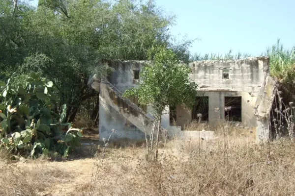
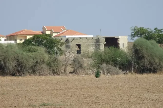
- The village has been mostly destroyed with the exception of a single village house.
- Ethnic cleansing
- Ni'ilya inhabitants were completely ethnically cleansed.
- Settlements built on the built-up area of Ni'ilya after 1948
- Giv'at HaPerahim (Ashkelon)
Hover a dot to read the village name, or click to open its card.
Borders of the depopulated village of Ni'ilya
Ni'ilya: A Depopulated Palestinian Village in the Gaza District
Ni'ilya was a Palestinian village in the Gaza District, located approximately 19 km northeast of Gaza city and about 3 km south-southwest of al-Majdal. Its inhabitants were displaced during the Nakba and the occupation of Palestine in 1948. The village was most probably occupied on 4–5 November 1948, during the final stage or immediate aftermath of Operation Yoav.
Location of Ni'ilya
Ni'ilya was built on flat ground in the coastal plain, at an average elevation of approximately 25 metres above sea level. It stood north of an earlier settlement site that had been engulfed by sand dunes.
As dunes began to encroach upon the village from the south, residents attempted to halt their advance by planting fruit trees. Secondary roads connected Ni'ilya with al-Majdal, approximately 3 km to its north-northeast, and with the main coastal highway a short distance to the east.
Nearby villages and towns included al-Jura, al-Majdal, Julis, al-Khisas, Hiribya, Barbara, and al-Jiyya.
Ni'ilya during the Ottoman Period
Ni'ilya appears in the Ottoman tax records of 1596 as a village in the nahiya of Gaza, within the liwa of Gaza. Its population at the time has been estimated at approximately 440.
The village paid taxes on crops including wheat, barley, sesame, and fruit, as well as on goats, beehives, vineyards, and other forms of agricultural production.
Architecture of Ni'ilya
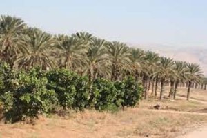
By the late nineteenth century, Ni'ilya was surrounded by fruit orchards and olive groves that extended toward al-Majdal. Cactus hedges were used to help stop the advance of coastal sand dunes.
The village had a roughly trapezoidal layout whose long base extended toward the northeast. Narrow alleys separated the houses, some of which were constructed of adobe brick and others of cement. Some homes were also built among the fruit orchards, and the village expanded along the road leading toward al-Majdal.
The Mosque and Burial Places of Ni'ilya
A mosque decorated with inscriptions stood on the southern side of the village, surrounded by remains of older buildings and several burial places. The Muslim inhabitants of Ni'ilya believed that these tombs contained the remains of people who had died in fighting against the Crusaders. This is recorded as a local belief rather than as an independently verified archaeological conclusion.
Education in Ni'ilya
Children from Ni'ilya attended school in al-Majdal. A school building for the village itself was completed during the winter of 1948, but it never opened because of the Nakba and the occupation of Palestine in 1948.
Economic Life in Ni'ilya
The village contained several small shops, although agriculture provided the principal livelihood for most inhabitants.
Residents cultivated rainfed cereals as well as citrus fruit, grapes, figs, apricots, and other fruits. The fruit orchards were irrigated with water drawn from artesian wells.
In the 1944/45 statistics, 1,084 dunums were devoted to citrus and bananas, 2,215 dunums to cereals, and 1,436 dunums were irrigated or used for plantations.
Land Ownership in Ni'ilya
The total land area of Ni'ilya was 5,233 dunums. Palestine Remembered describes 304 dunums as communal/public land, while PalQuest classifies the same area as public land.
Land ownership in Ni'ilya, 1944/45
- Palestinian4,929 dunums94%
- Transferred to Zionists0 dunums0%
- Public / communal304 dunums6%
Land Use in Ni'ilya
Land use in Ni'ilya, 1944/45
- Citrus and bananas1,084 dunums11%
- Plantations and irrigable land1,436 dunums14%
- Cereals2,215 dunums22%
- Built-up area29 dunums<1%
- Cultivated / cultivable land4,735 dunums48%
- Non-cultivable land469 dunums5%
Population of Ni'ilya
Population of Ni'ilya in selected years
- 1596440Estimate derived from Ottoman tax records
- 1922687Official British Mandate census
- 1931863Official British Mandate census
- 1944/451,310Official statistics
- 19481,520Later estimate published by Palestine Remembered
- Estimated refugees in 19989,332Later estimate published by Palestine Remembered
Number of Houses in Ni'ilya
Number of houses in Ni'ilya
- 1931169Official census figure
- 1948297Later estimate published by Palestine Remembered
Occupation and Depopulation of Ni'ilya during the Nakba
Ni'ilya was among the last Palestinian villages in the south to be occupied by Israeli occupation forces. Walid Khalidi, as reproduced by PalQuest, considers it most likely that the village was occupied around the time al-Majdal and a number of its surrounding villages fell on 4–5 November 1948.
The occupation of the area was connected with Operation Yoav, which began on 15 October and ended on 4 November 1948. PalQuest describes the entry of Israeli occupation forces into al-Majdal and neighbouring villages on 4–5 November as occurring in the immediate aftermath of the operation, while Palestine Remembered gives 4 November as the occupation date for Ni'ilya and categorizes it under Operation Yoav.
- Date of occupation and depopulation: most probably 4–5 November 1948; Palestine Remembered specifies 4 November.
- Military operation: Operation Yoav, or its final stage and immediate aftermath, depending on the wording of the source.
- Attacking unit: Palestine Remembered states that the attack was possibly carried out by a combined force from the Givati and Negev brigades. Walid Khalidi's dedicated entry does not identify a specific brigade for Ni'ilya.
- Defenders: Palestine Remembered identifies the Egyptian Army as the defending force. Egyptian forces were the principal Arab military force opposing Operation Yoav in this sector.
- Fate of the population: Ni'ilya's inhabitants were displaced during the Nakba. Khalidi's dedicated village entry does not provide a documented route or destination for the entire population after displacement.
- Fate of the buildings: the overwhelming majority of the village's structures were destroyed, although at least one house was subsequently documented as still standing.
Settlement and Urban Expansion on the Lands of Ni'ilya
According to Walid Khalidi and PalQuest, the centre of the city of Ashkelon, established in 1948, lies northwest of the former village site. The city subsequently expanded onto lands that had belonged to Ni'ilya.
Ni'ilya Today
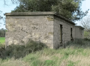
According to the field description published in Walid Khalidi's All That Remains in 1992, the village had largely disappeared and its site was covered with wild vegetation and several sycamore trees. One house, probably originally built among the fruit orchards, was still standing at the time and was inhabited by a Palestinian family. It had a flat roof and rectangular doors and windows. Nearby land was being cultivated.
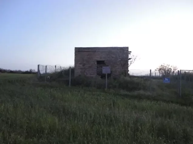
Palestine Remembered also contains more recent photographs and contributions concerning the site, including material added in June 2025 describing Ni'ilya as almost completely obliterated apart from a small number of surviving remains. Because this material is a contributed photographic record rather than a comprehensive independent field survey, neither the 1992 description nor the newer photographs should be treated as a complete verification of the condition of every part of the village site in 2026.
Sources

Photos from the village's people
Photos sent in by visitors and published after review.
Add a photo of this village
Log in to add photos of this village.
Other villages from Gaza
More from the archive


 Download Our Palestine App
The whole archive in the palm of your hand: depopulated villages, the Nakba, the massacres and Al-Aqsa — free, with no ads to erase the story.
Download Our Palestine App
The whole archive in the palm of your hand: depopulated villages, the Nakba, the massacres and Al-Aqsa — free, with no ads to erase the story.



Comments
No comments yet — be the first to write one.
Add your comment
Name and email are optional. Comments appear after review.