
The depopulated village of Iraq Suwaydan / District of Gaza
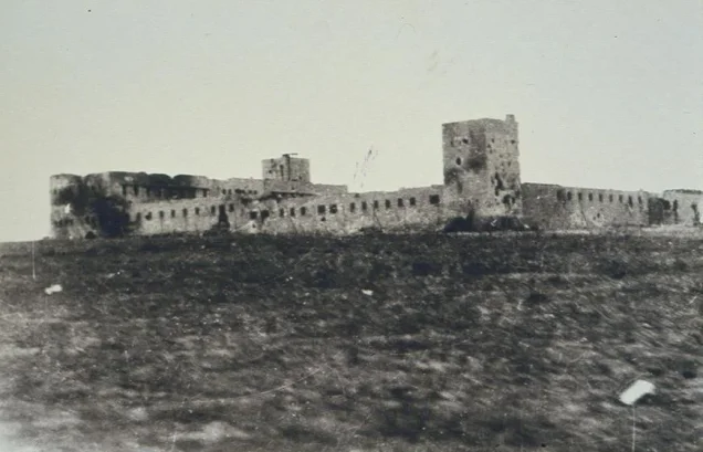
Iraq Suwaydan
About the depopulated village of Iraq Suwaydan
- District
- Gaza
- Date Iraq Suwaydan was occupied
- 09 November 1948
- Population in 1948
- 766
- Military operation
- Operation Yoav
- Brigade that carried it out
- The Ninth Battalion of the Armored Brigade
- Who defended the village
- Egyptian Army
- Distance from the governorate centre
- 27 km northeast of Gaza
- Elevation above sea level
- 100 m
- Cause of displacement
- Repeated military attacks and bombardment by Israeli occupation forces, ending in the occupation of the village in November 1948
- Extent of destruction
- The village was mostly destroyed with the exception of the British Police Station.
- Ethnic cleansing
- 'Iraq Suwaydan inhabitants were completely ethnically cleansed.
- Settlements built on the built-up area of Iraq Suwaydan after 1948
- Yad Natan, an agricultural settlement founded in 1953 on village lands east of the village site; Otzem, established in 1955 on village land southeast of the village site
Hover a dot to read the village name, or click to open its card.
Borders of the depopulated village of Iraq Suwaydan
'Iraq Suwaydan: A Depopulated Palestinian Village in the Gaza District
'Iraq Suwaydan was a depopulated Palestinian village in the Gaza District, located approximately 27 kilometers northeast of Gaza on a small plateau of reddish-brown soil in the coastal plain, at an average elevation of about 100 meters above sea level. The al-Faluja–al-Majdal highway passed along the village's southern edge, while the British Mandate authorities constructed a fortified police station west of the village.
- Subdistrict
- Gaza
- Distance from district center
- 27 km northeast of Gaza
- Average Elevation
- 100 m above sea level
- Population in 1931
- 440
- Number of Houses in 1931
- 81
- Population in 1944/1945
- 660
- Estimated Population in 1948
- About 766 – a later demographic estimate, not an official census
- Total Land Area in 1945
- 7,529 dunams
- Attack and Depopulation
- The Fourth Battalion of the Givati Brigade briefly captured the village on the night of 8–9 July 1948 and then evacuated it almost immediately because the Negev Brigade had failed to occupy its police station; the Israeli air force later bombed the site. On 9 November 1948 the police station fell to the Ninth Battalion of the Armored Brigade, and on 10 November an Israeli communiqué announced that Egyptian troops had withdrawn from the village and that it had been occupied, without saying whether any of its inhabitants remained.
- Final Israeli Control
- 9–10 November 1948: the village police station fell on 9 November, and an Israeli communiqué issued on 10 November stated that Egyptian troops had withdrawn from the village following the surrender of the station and that Israeli soldiers had occupied it; the sources do not give the day on which the village itself was entered. The village had been occupied temporarily on the night of 8–9 July 1948
- Military Operation
- Operation Yoav: PalQuest lists the village among those affected by it, while the attack that brought down the police station on 9 November 1948 was launched during the truce in the wake of the operation (15 October – 4 November 1948)
- Military Unit
- The village police station fell to the Ninth Battalion of the Armored Brigade on 9 November 1948, and the sources do not name the unit that entered the village after the Egyptian withdrawal; the Fourth Battalion of the Givati Brigade had temporarily occupied the village on the night of 8–9 July 1948
- Cause of Depopulation
- Repeated military attacks and bombardment by Israeli occupation forces, ending in the occupation of the village in November 1948
- Settlements Documented on Village Lands
- Yad Natan, an agricultural settlement founded in 1953 on village lands east of the village site; and Otzem, established in 1955 on village land southeast of the village site
The Government of Palestine's 1944/1945 statistics recorded 660 inhabitants, all Muslims, and a total land area of 7,529 dunums. During the Nakba and the occupation of Palestine in 1948, the village and its fortified police station became the focus of repeated fighting between Israeli and Egyptian forces. The police fortress fell to the Ninth Battalion of the Armored Brigade on 9 November 1948, and on the following day an Israeli communiqué announced that Egyptian troops had withdrawn from the village and that Israeli forces had occupied it.
Key Facts About 'Iraq Suwaydan
- Subdistrict: Gaza.
- Distance from Gaza: approximately 27 kilometers northeast according to Walid Khalidi/PalQuest.
- Average elevation: approximately 100 meters above sea level.
- Population in 1944/1945: 660, all Muslims.
- Estimated population in 1948: 766 according to Palestine Remembered.
- Total land area: 7,529 dunums.
- Temporary Israeli occupation: night of 8–9 July 1948, followed almost immediately by withdrawal.
- Fall of the police fortress: 9 November 1948.
- Final occupation of the village: 10 November 1948 following the Egyptian withdrawal.
- Military context: the final attack occurred during the truce in the aftermath of Operation Yoav.
- Unit that captured the police fortress: Ninth Battalion of the Armored Brigade.
- Israeli settlements established on village land: Yad Natan and Otzem.
Location of 'Iraq Suwaydan
'Iraq Suwaydan stood on a small plateau in the southern coastal plain, characterized by reddish-brown soil.
The al-Faluja–al-Majdal highway crossed the southern edge of the village, while a fortified British police station stood to the west on the same road.
The slightly elevated position and the police fortress gave the locality major strategic importance, because the site controlled the road between al-Majdal and Bayt Jibrin as well as the inland route toward the Negev.
Neighboring Palestinian Villages
'Iraq Suwaydan lay among several Palestinian villages in the northeastern part of the Gaza District, including:
- 'Ibdis to the north.
- Bayt 'Affa to the northeast.
- Karatiyya to the east.
- Al-Faluja to the southeast.
- Kawkaba to the south and southwest.
- Al-Majdal Asqalan to the west.
- Julis to the northwest.
The Name 'Iraq Suwaydan
The village name consists of two elements. Walid Khalidi explains that the Arabic word "'Iraq" is related to "'irq," here carrying the meaning of a small hill or elevation, an appropriate description of the village's position on a low plateau.
The origin of the second element, "Suwaydan," is not established in the principal sources, and this article therefore avoids assigning it an unsupported historical etymology.
The Built Environment of 'Iraq Suwaydan
In the late nineteenth century, 'Iraq Suwaydan was described as a moderate-sized village situated on a plain.
During the British Mandate, the built-up area occupied the small plateau and covered approximately 35 dunums according to the 1944/1945 statistics.
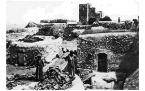
The fortified British police station west of the village became the area's most prominent military structure, alongside the village school, houses, wells, and agricultural facilities.
Population of 'Iraq Suwaydan
The 1922 Census of Palestine recorded 349 inhabitants in 'Iraq Suwaydan, all Muslims.
The official 1931 census recorded 440 inhabitants: 229 males and 211 females, all Muslims, living in 81 houses.
A figure of 460 for 1931 is widely reproduced by Palestine Remembered and several Palestinian secondary sources. However, the official 1931 census reproduced by the Palestinian Central Bureau of Statistics, as well as PalQuest, records 440. This article therefore uses the official figure.
The Government of Palestine's 1944/1945 statistics recorded 660 inhabitants, all Muslims.
The figures of 766 inhabitants for 1948 and 4,702 refugees for 1998 published by Palestine Remembered are later demographic estimates rather than official censuses.
Population of 'Iraq Suwaydan
- 1922349Official census; all Muslims
- 1931440Official census; 229 males and 211 females in 81 houses
- 1944/1945660Government of Palestine statistics; all Muslims
- 1948766Later estimate published by Palestine Remembered
- 19984,702Later refugee-population estimate published by Palestine Remembered
Number of Houses in 'Iraq Suwaydan
The official 1931 Census of Palestine recorded 81 houses in 'Iraq Suwaydan.
The figure of 134 houses for 1948 published by Palestine Remembered is a later estimate rather than an official census figure.
Number of Houses in 'Iraq Suwaydan
- 193181Official census
- 1948134Later estimate published by Palestine Remembered
Education in 'Iraq Suwaydan
The inhabitants of 'Iraq Suwaydan established a private elementary school in the village in 1942.
After 1947, the school was also shared with pupils from the neighboring villages of 'Ibdis and Bayt 'Affa.
Total enrollment from the three villages reached approximately 104 pupils during the final years of the Mandate.
The date 1942 is therefore the more accurate founding date for the school. The year 1947 relates to the expansion of its role in serving neighboring villages rather than the school's original establishment.
Water Sources in 'Iraq Suwaydan
The villagers obtained domestic water from two wells.
Agriculture was predominantly rainfed, giving the village economy a strongly dry-farming character.
Local Palestinian accounts preserve additional names and memories associated with village wells, but the principal historical source used here confirms two wells without naming both of them.
Land Ownership in 'Iraq Suwaydan
The Government of Palestine's 1944/1945 statistics recorded a total land area of 7,529 dunums for 'Iraq Suwaydan.
Arab ownership accounted for 7,380 dunums, while 149 dunums were classified as public land. No Jewish land ownership was recorded.
The Arabic Palestine Remembered table uses the categories “Palestinian,” “Transferred to Zionists,” and “Masha'.” These terms are preserved below as the terminology of that source.
Land Ownership in 'Iraq Suwaydan, 1944/1945, Using Palestine Remembered Terminology
- Palestinian7,380 dunums98%
- Transferred to Zionists0 dunums0%
- Masha' (source terminology)149 dunums2%
Land Use in 'Iraq Suwaydan in 1944/1945
A total of 7,338 dunums was cultivated or classified as cultivable, approximately 97 percent of the village's total land area. All of this cultivable land was classified as Arab land.
Cereals occupied 7,329 dunums, while plantations and irrigable land covered 9 dunums.
The built-up area covered 35 dunums of Arab land.
Non-cultivable land totaled 156 dunums, consisting of 7 dunums of Arab land and 149 dunums of public land.
Land Use in 'Iraq Suwaydan According to the 1944/1945 Statistics
- Arab
- Jewish
- Public
- Plantations and Irrigable Land9 dunums
- Cereals7,329 dunums
- Built-up Area35 dunums
- Non-Cultivable Land156 dunums
Economic Life in 'Iraq Suwaydan
The economy of 'Iraq Suwaydan depended primarily on rainfed agriculture.
Cereals, particularly wheat and barley, dominated agricultural production, with 7,329 dunums allocated to cereal cultivation in 1944/1945.
Small areas were also planted with fruit trees, including almonds, as well as grapevines.
The village's position on the al-Faluja–al-Majdal road facilitated its connections with surrounding markets and communities.
Archaeological Sites in 'Iraq Suwaydan
Two important archaeological sites lay west of 'Iraq Suwaydan along the main road: Khirbat al-Shaykh Muhammad and Khirbat al-Shaykh 'Abdallah.
Surface evidence cited by Walid Khalidi indicates that both sites were intensively inhabited during the Byzantine period.
The remains included burial grounds, man-made caves cut into the rock, mosaic flooring, and other architectural traces.
The British Police Fortress at 'Iraq Suwaydan
The fortified British police station became the most prominent military landmark associated with 'Iraq Suwaydan in 1948.
It stood west of the village on the al-Faluja–al-Majdal highway and controlled both the route between al-Majdal and Bayt Jibrin and an inland road leading toward the Negev.
On the eve of the British withdrawal on 15 May 1948, the Mandate authorities transferred control of the police station to the local population.
After Egyptian forces entered Palestine, an Egyptian unit took up positions in the area and the police fortress became a major defensive position on the southern front.
The Temporary Occupation of 8–9 July 1948
'Iraq Suwaydan did not fall permanently during the first Israeli attempt to occupy the village.
After the first truce ended and the Ten Days of fighting began, units of the Negev Brigade were assigned to capture the police fortress while the Giv'ati Brigade was assigned to occupy the village itself.
During the night of 8–9 July 1948, the Fourth Battalion of the Giv'ati Brigade briefly captured 'Iraq Suwaydan.
The Negev Brigade, however, failed to capture the police station. Israeli forces therefore withdrew from the village almost immediately because it was considered difficult to defend while the fortress remained in Egyptian hands.
Egyptian control of the area was consequently restored, and the police fortress remained in Egyptian hands for the following months.
The Battles for the Police Fortress
The police fortress became one of the most heavily contested positions on the southern front.
According to the military account transmitted through Walid Khalidi, Israeli forces attempted to capture the position in eight separate attacks during the following months and repeatedly failed.
The fortress's importance derived from its commanding position over strategic roads linking al-Majdal, Bayt Jibrin, al-Faluja, and the Negev.
Information originating in Israeli military accounts is presented here through the Palestinian intermediary sources Walid Khalidi and PalQuest rather than through independent reliance on Israeli sources.
Operation Yoav and 'Iraq Suwaydan
'Iraq Suwaydan again became a focal point of fighting during Operation Yoav, an Israeli offensive against Egyptian forces in southern Palestine carried out between 15 October and 4 November 1948.
The operation sought to break Egyptian lines and connect Israeli forces in the Negev with areas farther north. Participating Israeli formations included the Giv'ati, Yiftach, Negev, and Har'el Brigades.
PalQuest lists 'Iraq Suwaydan among the Palestinian villages affected by Operation Yoav.
The police fortress itself, however, did not fall during the formal dates of Operation Yoav. It remained under Egyptian control until 9 November, five days after the operation formally ended.
The Fall of the Police Fortress on 9 November 1948
On 9 November 1948, Israeli forces launched a major assault specifically aimed at capturing the fortified police station at 'Iraq Suwaydan.
The attack took place during the truce in the aftermath of Operation Yoav, and the Ninth Battalion of the Armored Brigade succeeded in storming and capturing the fortress.
The fall of the police station was militarily significant because it eliminated one of the strongest Egyptian defensive positions outside the Faluja Pocket.
The attack also produced a confrontation involving United Nations observers. According to the account transmitted by Walid Khalidi, the UN protested the arrest of its observers and described it as a deliberate attempt to obstruct truce supervision.
The Final Occupation of 'Iraq Suwaydan on 10 November 1948
A distinction should be made between the fall of the police fortress and the final occupation of the village itself.
The fortress fell on 9 November. On the following day, 10 November, an Israeli communiqué stated that, following the surrender of the fortress, Egyptian forces had withdrawn from the villages of 'Iraq Suwaydan and Bayt 'Affa and that Israeli troops had occupied both villages.
This article therefore uses 10 November 1948 as the date of the final occupation of 'Iraq Suwaydan, while recording 9 November as the date on which the police fortress fell.
Palestine Remembered gives 9 November as the village's occupation date, an understandable classification if the fall of the fortress is treated as the decisive military event. Khalidi's account, however, preserves the one-day distinction between the two developments.
The Displacement of 'Iraq Suwaydan's Inhabitants
The successive military operations resulted in the displacement of the Palestinian inhabitants of 'Iraq Suwaydan, but the principal source does not establish a single precise date on which the entire population left.
The village had already experienced temporary occupation and bombardment in July, and the surrounding area remained a major battlefield between Egyptian and Israeli forces until November.
When the final occupation was announced on 10 November, the communiqué quoted in contemporary reporting did not state whether any villagers still remained in 'Iraq Suwaydan.
It is therefore more accurate to state that the population was displaced in the course of the successive military operations culminating in the final occupation of the village and police fortress in November 1948, rather than claiming that all inhabitants were expelled on either 9 or 10 November specifically.
Occupation and Depopulation Chronology
- Eve of 15 May 1948 and shortly afterwards
Handover of the police station to the villagers and deployment of Egyptian forces in the village
On the eve of their evacuation on 15 May 1948, the British authorities gave the local population control over the village police station. Soon afterwards Egyptian forces entered Palestine, and the First Battalion was ordered to take up positions in 'Iraq Suwaydan.
- The months following May 1948
Failed attacks on the village police station
Because of the strategic importance of the police station, which controlled the road between al-Majdal and Bayt Jibrin as well as the inland road to the Negev, Israeli occupation forces tried but failed to capture it in eight separate attacks, according to Khalidi. The History of the War of Independence, as cited by Khalidi, states that there was no position in the country attacked as many times as that 'beast on the hill'.
- Night of 8–9 July 1948
Temporary occupation
After the first truce ended, units of the Negev Brigade were ordered to capture the police station and units of the Givati Brigade to occupy the village, and the Fourth Battalion of the Givati Brigade briefly captured the village, according to the History of the War of Independence as cited by Khalidi. But it had to evacuate it almost immediately, because the Negev Brigade units failed to occupy the police station and the village was indefensible without it.
- July 1948
Aerial bombing of the village
Two days after the temporary occupation, the New York Times reported that the Israeli air force had bombed the site, as well as other targets in the Gaza subdistrict.
- 15 October 1948
Beginning of the military operation
As the second truce ended, Israeli occupation forces launched Operation Yoav with the Givati, Negev and Yiftach brigades, aiming to link Israeli forces in the Negev with those positioned to the north of them; the operation lasted until 4 November 1948. PalQuest lists 'Iraq Suwaydan among the villages affected by the operation, but its police station fell only after the operation had ended.
- 9 November 1948
Attack on the village police station and its fall
The police station fell to the Ninth Battalion of the Armored Brigade after a massive attack launched during the truce in the wake of Operation Yoav, expressly designed to occupy it, which opened with 'unequalled' artillery bombardment, whereupon its Egyptian defenders, who had held out for almost six months, surrendered, according to the History of the War of Independence as cited by Khalidi; UN truce observers reported that the position was also bombed from the air with B-17 aircraft. Israeli military police arrested two UN observers who witnessed the attack, and the UN called this a 'deliberate attempt to thwart effective truce supervision'.
- 9–10 November 1948
Final occupation
On 10 November 1948 an Israeli communiqué stated that, following the surrender of the police station, Egyptian troops had withdrawn from 'Iraq Suwaydan and the nearby village of Bayt 'Affa, and the New York Times quoted it as saying that Israeli soldiers had occupied both villages, without saying whether any of the inhabitants remained. The sources do not specify the day on which the village itself was entered, between the fall of the station on 9 November and the communiqué of 10 November.
- 1953
Settlement on village lands
Yad Natan, an agricultural settlement, was founded on village lands east of the village site.
- 1955
Settlement on village lands
The settlement of Otzem was established on village land, southeast of the village site.
'Iraq Suwaydan and the Faluja Pocket
The fall of 'Iraq Suwaydan and its police fortress directly affected the Egyptian forces and Palestinian civilians in the neighboring area.
After the position was captured, Israeli forces tightened the encirclement of what became known as the Faluja Pocket, centered on the Palestinian villages of al-Faluja and 'Iraq al-Manshiyya.
Thousands of Egyptian military personnel and Palestinian civilians remained inside the pocket until after the major fighting had ended and the Egyptian-Israeli Armistice Agreement was signed in February 1949.
Israeli Settlements on the Lands of 'Iraq Suwaydan
Israeli settlements were subsequently established on parts of 'Iraq Suwaydan's lands and in the immediate surrounding area:
- Yad Natan: an agricultural settlement established in 1953 east of the former village site on the lands of 'Iraq Suwaydan.
- Otsem (Otzem): established in 1955 southeast of the village site on 'Iraq Suwaydan's lands.
- Sde Yoav: established in 1956 west of the site and originally called Beyt Yo'av. Walid Khalidi describes it as being close to the village lands, and it is therefore not classified here with the same certainty as Yad Natan and Otsem as standing directly on 'Iraq Suwaydan's lands.
'Iraq Suwaydan After the Nakba
According to Walid Khalidi's historical field description in All That Remains, the rubble of the village houses was largely concealed within a eucalyptus grove covering the village center.
Cactus plants and the remains of a pool were still visible, while two old village roads could be clearly identified, one passing through the site and another across the village lands.
The fortified British police station remained standing and continued to be used under the name Metzudat Yoav.
The surrounding lands were used for agriculture.
Khalidi's description derives from historical fieldwork undertaken for All That Remains and should not necessarily be treated as a comprehensive, updated survey of the site in 2026.
Sources
- PalQuestPalQuest – Interactive Encyclopedia of the Palestine Question: 'Iraq Suwaydan
- PalQuestPalQuest – Interactive Encyclopedia of the Palestine Question: Operation Yoav
- Palestine RememberedPalestine Remembered: 'Iraq Suwaydan – Gaza District
- palestinapedia.psPalestinian Encyclopedia: 'Iraq Suwaydan
- palqura.comPalestinian Villages Encyclopedia: 'Iraq Suwaydan
- pal48.psFilastunna: The Depopulated Village of 'Iraq Suwaydan
- pcbs.gov.psPalestinian Central Bureau of Statistics: Historical Censuses and Reports
Photo gallery


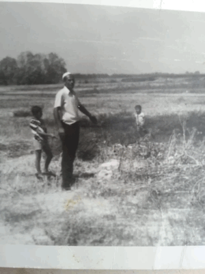
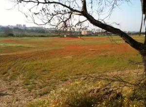
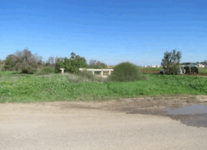
Photos from the village's people
Photos sent in by visitors and published after review.
Add a photo of this village
Log in to add photos of this village.
Other villages from Gaza
More from the archive


 Download Our Palestine App
The whole archive in the palm of your hand: depopulated villages, the Nakba, the massacres and Al-Aqsa — free, with no ads to erase the story.
Download Our Palestine App
The whole archive in the palm of your hand: depopulated villages, the Nakba, the massacres and Al-Aqsa — free, with no ads to erase the story.



Comments
No comments yet — be the first to write one.
Add your comment
Name and email are optional. Comments appear after review.