
The depopulated village of Iraq al-Manshiyya / District of Gaza
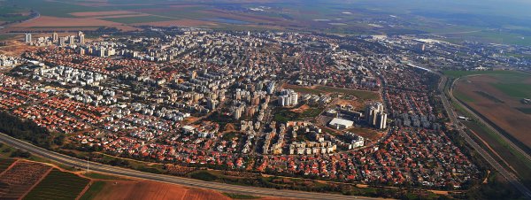
Subdistrict: Gaza
Estimated Palestinian population in 1948: approximately 2,122. A later demographic estimate gives a combined population of 2,332 when the 210 Jewish residents of the neighbouring kibbutz of Gat are included.
Occupation and depopulation: Israeli forces assumed control of the area following the Egyptian withdrawal on 26 February 1949. The Palestinian inhabitants were displaced during the following weeks, with the depopulation largely completed by 21 April 1949.
Settlement established before 1948 on land traditionally belonging to Iraq al-Manshiyya: Gat, founded in 1941.
Settlements established on village land after the Nakba: Qiryat Gat, established in 1954, and Sde Moshe, established in 1956 east of the village site.
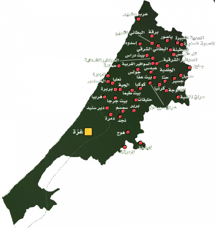
Iraq al-Manshiyya was a Palestinian village in the Gaza Subdistrict, located approximately 32 kilometres northeast of Gaza. It stood in an area of rolling hills where the southern coastal plain met the western foothills of the Hebron mountains.
The village lay south of the road connecting al-Faluja in the northwest with Bayt Jibrin in the east. Its location was strategically important because it stood near routes leading toward Gaza, Hebron, Beersheba, al-Faluja, and Isdud.
The village’s registered lands covered 17,901 dunams, not 17,901 square kilometres. They were bordered by the lands of Zayta and other villages of the Hebron Subdistrict to the north and east, al-Faluja to the west, and lands used by Bedouin communities of the Beersheba Subdistrict to the south.
The Palestinian population was estimated at approximately 2,122 in 1948. A later demographic calculation estimated that the number of refugees originating from the village and their descendants had reached 14,319 by 1998. Such later figures are demographic estimates rather than contemporary census results.
Boundaries of Iraq al-Manshiyya
Iraq al-Manshiyya was surrounded by the following villages, localities, and tribal lands:
- North: Summil.
- Northwest: Jusayr.
- West: al-Faluja.
- South and southeast: lands used by Bedouin communities of the Beersheba Subdistrict.
- Southeast: al-Qubayba.
- East: Bayt Jibrin.
- Northeast: Zayta.
The Name and Historical Background of Iraq al-Manshiyya
The name Iraq al-Manshiyya reflected both the village’s geography and its history. In this context, the Arabic word “Iraq” referred to a small hill, while “al-Manshiyya,” meaning “the built settlement,” distinguished the village from another nearby locality from which some of its inhabitants were said to have moved.
An Ottoman tax register from 1596 recorded a village under the name Iraq Hatim in the nahiya of Gaza, part of the Gaza Sanjak. It consisted of 11 Muslim households, conventionally estimated at approximately 61 people. The inhabitants paid taxes on wheat, barley, goats, and beehives.
Architecture and Village Layout
In the late nineteenth century, Iraq al-Manshiyya consisted primarily of adobe-brick houses surrounded by cultivable land. The village had a radial layout, with smaller streets branching from the intersection of two main roads that crossed at approximately right angles. This intersection formed the village centre.
Three wells supplied the inhabitants with water for domestic use. As the village expanded, new construction extended toward the main road and northeast in the direction of Tall al-Shaykh Ahmad al-'Urayni.
The large archaeological mound rose approximately 32 metres above its immediate surroundings to the north of the village. A religious shrine dedicated to Shaykh Ahmad al-'Urayni stood at its summit.
The village had two mosques. The newer mosque was regarded as architecturally distinguished among the mosques of Palestinian villages and included several rooms, a portico, and a courtyard.
Education in Iraq al-Manshiyya
Before the establishment of a formal school, local shaykhs provided traditional elementary instruction through the kuttab system. According to Palestinian historian Mustafa al-Dabbagh, 294 men in the village were able to read and write during the late Ottoman and British Mandate periods. Some residents also pursued religious studies at al-Azhar in Cairo.
A boys’ elementary school was established in 1934. It initially enrolled approximately 80 pupils divided among six classes and taught by four teachers, with the village contributing to the salaries of three of them. By the mid-1940s, enrollment had increased to 201 pupils.
Economic Life in Iraq al-Manshiyya
- The inhabitants worked primarily in agriculture. They cultivated grain, grapes, olives, almonds, and other fruit trees. Most cultivation was rainfed, particularly where the coastal plain met the western foothills.
- In 1944/45, 13,449 dunams under Palestinian ownership were allocated to cereal cultivation, while 53 dunams were irrigated or planted with orchards. Across all ownership categories, cereal cultivation covered 16,896 dunams.
- Sheep and goats supplied hair and wool used in domestic rug weaving. The villagers took their rugs to nearby al-Faluja for dyeing and also relied on the town for medical treatment, transportation, and other services.
- The village contained a small commercial area composed of grocery shops selling essential goods such as sugar, rice, clarified butter, tea, halva, and Turkish delight.
- Local grain merchants traded wheat, barley, vetch, sesame, and other agricultural products. Iraq al-Manshiyya also had butchers, carpenters, blacksmiths, barbers, and small textile shops.
- A flour mill served the village and neighbouring communities, including Bedouin communities north of Beersheba. Two privately owned trucks were used to transport crops and commercial goods, particularly between Iraq al-Manshiyya and al-Faluja.
- Residents travelling to other parts of Palestine generally went first to al-Faluja, where they could board buses to their intended destinations.
Land Ownership in Iraq al-Manshiyya
| Ownership category | Land area (dunams)* |
|---|---|
| Palestinian ownership | 13,838 |
| Jewish ownership | 3,468 |
| Public land | 595 |
| Total | 17,901 |
* One dunam equals approximately 1,000 square metres. The 1945 statistical unit included the neighbouring kibbutz of Gat.
Land Use in Iraq al-Manshiyya in 1945
| Land-use category | Palestinian ownership (dunams)* | Jewish ownership (dunams)* | Public land (dunams)* | Total (dunams)* |
|---|---|---|---|---|
| Irrigated land and orchards | 53 | 0 | 0 | 53 |
| Cereal cultivation | 13,449 | 3,433 | 14 | 16,896 |
| Built-up area | 169 | 35 | 0 | 204 |
| Cultivable land | 13,502 | 3,433 | 14 | 16,949 |
| Uncultivated land | 167 | 0 | 581 | 748 |
* One dunam equals approximately 1,000 square metres. The figures follow the 1945 Village Statistics and include the neighbouring kibbutz of Gat.
Families of Iraq al-Manshiyya
Families and extended kinship groups associated with Iraq al-Manshiyya included the al-Titi clan and its branches, the al-Jawabira clan and its branches, and the families of Abu Sall, Abu Muhaysin, al-Badawi, Abu Dawud, Abu Rayya, Abu 'Arish, Abu Mahfuz, Abu Hashhash, Abu Warda, al-Bathishi, al-Balasi, al-Ja'afira or al-Ja'fari, al-Janazira, al-Jundi, al-Hammami, al-Ra'i, al-Sharif, al-Tarsha, al-'Attar, al-'Afifi, al-'Isawi, al-Qurayqi, al-Muzayyin, al-Ma'yuwi, Thalji, Habush, Dukhan, Samur, Sha'fut, 'Ayish, 'Aqil, Muqbil, Nassar, al-Jabr, Salah, Abu Khayran, al-Jabiri, 'Awkal, and 'Abd al-'Ati.
* The transliteration of family names may vary because many families use different English spellings.
Population of Iraq al-Manshiyya
The 1922 census conducted by the British Mandate authorities recorded 1,132 inhabitants, all Muslims. In 1931, the population had increased to 1,347 Muslims living in 299 houses.
The 1945 Village Statistics counted Iraq al-Manshiyya together with the neighbouring kibbutz of Gat. The combined population was 2,220, comprising 2,010 Palestinian Muslims and 210 Jewish residents of Gat.
A later estimate placed the combined population at approximately 2,332 in 1948. If the 210 residents of Gat are excluded, the estimated Palestinian population of Iraq al-Manshiyya was approximately 2,122. Estimates vary between sources.
| Year | Population* |
|---|---|
| 1596 | Approximately 61 |
| 1922 | 1,132 Palestinian Muslims |
| 1931 | 1,347 Palestinian Muslims |
| 1945 | 2,010 Palestinian Muslims; 2,220 including 210 Jewish residents of Gat |
| 1948 estimate | Approximately 2,122 Palestinians; approximately 2,332 including 210 residents of Gat |
| Estimated refugee population in 1998 | 14,319 |
* The figure for 1596 is an estimate derived from an Ottoman register of 11 households. The 1922 and 1931 figures are official census results, while the 1945 figure is an official British Mandate estimate. The figures for 1948 and 1998 are later demographic estimates.
Number of Houses in Iraq al-Manshiyya
| Year | Number of houses |
|---|---|
| 1931 | 299 |
| 1948 estimate | 517 |
* The 1931 figure comes from the British Mandate census. The 1948 figure is a later estimate rather than an official census count.
Archaeological and Historical Sites
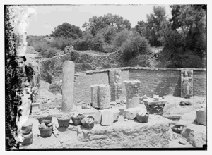
Iraq al-Manshiyya and its surroundings contained archaeological remains from several historical periods. These remains document the long history of human settlement in the area, although individual sites must be interpreted according to archaeological evidence rather than later political or religious claims.
- Tall al-Shaykh Ahmad al-'Urayni: The large mound north of the village contained remains of a settlement established during the fourth millennium BCE and occupied during several later periods. Earlier researchers incorrectly identified it with the Philistine city of Gath, but excavations conducted between 1956 and 1961 found no evidence supporting that identification. A shrine dedicated to Shaykh Ahmad al-'Urayni stood on the summit.
- The village pool: Local accounts describe an old water-collection pool in which rainwater and seasonal runoff accumulated. The stored water was used to support agricultural activity during the dry season. Its exact construction date has not been securely established.
- The railway station: A railway station was established near Iraq al-Manshiyya during the late Ottoman period. Available historical accounts indicate that the station was destroyed during the First World War. The claim that trains travelling directly between Africa, Mecca, and Asia stopped there could not be verified and has therefore not been presented as an established fact.
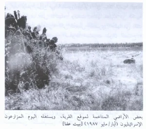
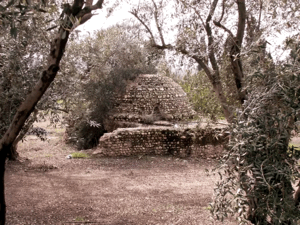
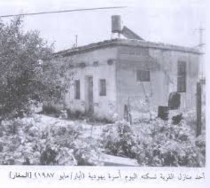
Following Israel’s occupation and depopulation of Iraq al-Manshiyya, most of the village’s houses and community buildings were demolished. Some elements of the historical landscape survived, including the archaeological mound, sections of the village wadi, scattered cactus plants, traces of orchards, sycamore trees, and a limited number of graves.
Occupation and Depopulation of Iraq al-Manshiyya
Iraq al-Manshiyya remained inhabited and defended beyond the principal phase of the Nakba in 1948 because it lay within the Faluja Pocket, an area held by an Egyptian army brigade and containing several thousand Palestinian civilians.
The Israeli Giv'ati Brigade attempted to occupy Iraq al-Manshiyya at the end of July 1948 but failed. Palestinian historian 'Arif al-'Arif reported that the village was subjected to repeated attacks during the following weeks, including a notable attack on 22 August.
On 16 October 1948, at the beginning of Operation Yoav, Israeli forces launched a large-scale assault on Iraq al-Manshiyya. An armoured column entered the village and caused damage before Egyptian forces repelled the assault. Israeli accounts acknowledged the loss of three tanks during the operation.
Units of the Alexandroni Brigade launched another assault on 27–28 December 1948. They entered parts of the village but were again driven out after Egyptian reinforcements arrived.
Iraq al-Manshiyya and neighbouring al-Faluja subsequently remained inside the besieged Faluja Pocket. Approximately 3,000 Palestinian civilians and an Egyptian army brigade were trapped in the enclave. Gamal Abdel Nasser, who later became president of Egypt, was among the Egyptian officers stationed there.
Egypt and Israel signed an armistice agreement on 24 February 1949. The agreement provided for the withdrawal of the Egyptian forces and included assurances intended to protect the Palestinian civilian population, its property, and its right to remain in the villages.
The Egyptian forces withdrew on 26 February 1949, after which Israeli forces assumed control of Iraq al-Manshiyya. According to accounts cited by the Institute for Palestine Studies, Israel violated the protections contained in the agreement and subjected the inhabitants of Iraq al-Manshiyya and al-Faluja to intimidation intended to force them to leave.
Reports submitted to United Nations mediator Ralph Bunche stated that Israeli soldiers beat civilians, robbed them of their property, and committed reported attempted sexual assaults. Restrictions on movement, shooting, threats, and entry into homes also contributed to the forced displacement of the remaining population.
The displacement took place over several weeks rather than on a single date. Although some sources use 1 March 1949 as the date of occupation, documentation indicates that the forced departure of the inhabitants continued until approximately 21 April 1949. The village’s final depopulation was part of the continuing Nakba and Israel’s occupation of Palestine.
Settlements Established on the Land of Iraq al-Manshiyya
The kibbutz of Gat was established in 1941 on land traditionally associated with Iraq al-Manshiyya. It acquired additional land after the displacement of the village’s Palestinian inhabitants in 1949.
Qiryat Gat was established in 1954 on the lands of Iraq al-Manshiyya, between the former village site and al-Faluja. Sde Moshe was established in 1956 on village land east of the original built-up area.
- Gat, established in 1941.
- Qiryat Gat, established in 1954.
- Sde Moshe, established in 1956.
Iraq al-Manshiyya Today
Most of Iraq al-Manshiyya’s houses and community structures were demolished after its occupation and depopulation. Only traces of the former streets and scattered cactus plants remain visible at the village site.
A eucalyptus forest was planted over part of the site. Signs in Hebrew and English identify it as the “Margolin Peace Forest.” Sections of the surrounding village land are cultivated by Israeli farmers, while other areas have been incorporated into the urban and industrial expansion of Qiryat Gat.
Sources and References
- Institute for Palestine Studies and PalQuest, “Iraq al-Manshiyya.” Consulted for the village’s location, population, land ownership, land use, architecture, economy, education, archaeology, Israeli military assaults, forced displacement, and present condition.
- Government of Palestine, Palestine: Report and General Abstracts of the Census of 1922. Consulted for the official 1922 population figure.
- Government of Palestine, Census of Palestine, 1931. Consulted for the official population figure and the number of occupied houses recorded in 1931.
- Government of Palestine, Department of Statistics, Village Statistics, April 1945. Consulted for population, land ownership, and land-use figures. The statistical entry combines Iraq al-Manshiyya with Gat.
- Hadawi, Sami, Village Statistics 1945: A Classification of Land and Area Ownership in Palestine. Palestine Liberation Organization Research Centre, 1970.
- Khalidi, Walid, ed., All That Remains: The Palestinian Villages Occupied and Depopulated by Israel in 1948. Institute for Palestine Studies, 1992.
- United Nations, “United Nations Supervises Evacuation of the Faluja Area,” 26 February 1949. Consulted for contemporary United Nations documentation concerning the transfer of control and the civilian population of the Faluja Pocket.
- Palestine Remembered, “Iraq al-Manshiyya, Gaza Subdistrict.” Consulted for supplementary demographic estimates, family and village documentation, oral history material, and the names of nearby localities.
- Palestine Remembered, “Nakba Oral History Interview with Mahmoud al-Titti.” Consulted as an oral-history source concerning village life and displacement.
Photo gallery


Photos from the village's people
Photos sent in by visitors and published after review.
Add a photo of this village
Log in to add photos of this village.
Other villages from Gaza
 Download Our Palestine App
The whole archive in the palm of your hand: depopulated villages, the Nakba, the massacres and Al-Aqsa — free, with no ads to erase the story.
Download Our Palestine App
The whole archive in the palm of your hand: depopulated villages, the Nakba, the massacres and Al-Aqsa — free, with no ads to erase the story.



Comments
No comments yet — be the first to write one.
Add your comment
Name and email are optional. Comments appear after review.