
The depopulated village of Huj / District of Gaza
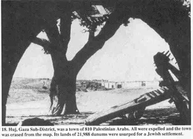
About the depopulated village of Huj
- District
- Gaza
- Date Huj was occupied
- 31 May 1948
- Population in 1948
- 940
- Military operation
- Operation Barak
- Brigade that carried it out
- Negev Brigade
- Who defended the village
- Egyptian Army
- Distance from the governorate centre
- 15 km from Gaza
- Elevation above sea level
- 100 m
- Cause of displacement
- Expulsion by Israeli occupation forces: the Negev Brigade ordered the villagers to leave their homes on 31 May 1948 and expelled them westwards, after which their houses were looted and blown up
- Extent of destruction
- The village was completely destroyed, and only house rubble left behind.
- Ethnic cleansing
- Despite the inhabitants friendly relationship with the Zionists, the village has been completely ethnically cleansed.
- Settlements built on the land of Huj before 1948
- Dorot, established in 1941 on land that had traditionally belonged to the village, which took over more of the village lands after 1948
- Refugees' migration routes
- Huj refugees were forced to Dimra, however, many refugees attempted to go back during the truce, but they were terrorized into fleeing again.
Hover a dot to read the village name, or click to open its card.
Borders of the depopulated village of Huj
Huj – A Depopulated Palestinian Village in the Gaza Subdistrict
Huj was a Palestinian village in the Gaza Subdistrict, located approximately 15 km northeast of Gaza city and about 100 metres above sea level. The village stood in a hilly area on the northern edge of the Negev. Its Palestinian inhabitants were expelled on 31 May 1948 during the Nakba and the occupation of Palestine in 1948.
- Subdistrict
- Gaza
- Distance from district center
- 15 km from Gaza
- Average Elevation
- 100 m above sea level
- Population in 1931
- 618
- Number of Houses in 1931
- 118
- Population in 1944/1945
- 810 – Arab population; the same statistical unit also recorded 230 Jews (total 1,040), who lived in their own settlement, not in the village
- Estimated Population in 1948
- About 940 – a later demographic estimate, not an official census
- Total Land Area in 1945
- 21,988 dunams – figure for the statistical unit, which includes Dorot: of which 16,741 dunams Arab-owned, 4,236 dunams Jewish-owned and 1,011 dunams public land
- Attack and Depopulation
- On 31 May 1948, during one of its pushes northwards, the Negev Brigade of the Israeli occupation forces ordered the villagers of Huj to leave their homes; they were expelled westwards and their houses were then looted and blown up, according to Israeli historian Benny Morris as cited by Khalidi. PalQuest's chronology lists Huj among the villages conquered by the Haganah in the second stage of Operation Barak (15 May–1 June 1948).
- Final Israeli Control
- 31 May 1948, when the Negev Brigade ordered the villagers to leave and expelled them westwards
- Military Operation
- Operation Barak (its second stage, 15 May–1 June 1948), according to PalQuest's chronology; the village entry names no operation, and the Operation Barak entry does not list Huj among the affected villages
- Military Unit
- Negev Brigade
- Cause of Depopulation
- Expulsion by Israeli occupation forces: the Negev Brigade ordered the villagers to leave their homes on 31 May 1948 and expelled them westwards, after which their houses were looted and blown up
- Settlements Documented on Village Lands
- Dorot, established in 1941 on land that had traditionally belonged to the village, which took over more of the village lands after 1948
Location of Huj
- Subdistrict: Gaza.
- Distance from Gaza city: approximately 15 km northeast.
- Elevation: approximately 100 metres above sea level.
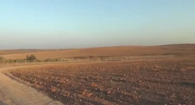
Huj was situated in a hilly area on the northern edge of the Negev desert and was dominated by two hills, one to the east and the other to the west. It stood at the intersection of several secondary roads linking it with Gaza, Bir al-Sabi', and other population centres in the region.
Name and Historical Background of Huj
The sources used by Walid Khalidi suggest that Huj may have corresponded to the ancient village of Oga, which appears on the sixth-century Madaba Map. They further suggest that the final Arabic consonant in the village name may once have been pronounced like a hard “g,” making the earlier pronunciation “Hug” and possibly reflecting an Arabicized form of the ancient name.
Modern Huj was established in the early nineteenth century during the administration of Mustafa Bey, governor of Gaza and Jaffa between 1818 and 1820. According to the historical account, he offered land free of charge to encourage people from Gaza to settle there and established a police post to provide security.
The American biblical scholar Edward Robinson visited Huj in 1838. He described its houses as being constructed of mud and estimated its population at between 200 and 300. By the late nineteenth century, the village had a rectangular layout and adobe-brick houses.
Huj was close to fighting between Ottoman and British forces in 1917. In subsequent years, the village expanded first eastward and then westward while preserving agricultural land situated mainly to its east and northeast.
Education in Huj
Palestine Remembered records that Huj had a boys' school established in 1935. The reviewed sources do not provide sufficiently documented figures for the number of pupils or teachers at the school.
Population of Huj
The Palestinian inhabitants of Huj were Muslims. The official 1922 census recorded 426 inhabitants, while the 1931 census recorded 618 inhabitants living in 118 houses.
The 1944/45 statistics treated Huj and the nearby settlement of Dorot as a single statistical unit. They recorded 810 Arab Muslims and 230 Jews, for a combined total of 1,040. Walid Khalidi and PalQuest explicitly note that the 230 Jewish residents lived in their own settlement and were not inhabitants of the Palestinian village of Huj itself.
Population Statistics for Huj
Population figures for Huj
- 1838Approximately 200–300Estimate recorded by Edward Robinson
- 1922426Official Mandate census; all Muslims
- 1931618Official Mandate census; all Muslims
- 1944/45810 Palestinians + 230 Jews = 1,040Official statistical unit combining Huj and Dorot
- 1948940, with 230 Jews indicated by the sourceLater estimate reported by Palestine Remembered; not an official census of the Palestinian village alone
- Estimated refugees in 19985,770Estimate reported by Palestine Remembered
Number of Houses in Huj
Number of houses in Huj according to the 1931 census
- 1931118
Economic Life in Huj
Agriculture formed the basis of Huj's economy, supported by abundant groundwater. Water for domestic use came from a well inside the village approximately 200 feet, or about 61 metres, deep. Additional wells were located in the beds of the surrounding wadis.
The villagers cultivated cereals and fruit, particularly grapes, figs, and apricots, as well as almonds. In 1944/45, 16,236 dunums of Arab-owned land were devoted to cereals, while 93 dunums were irrigated or used for orchards.
The statistical unit comprising Huj and Dorot contained a total of 21,988 dunums of land.
Land Ownership in Huj in 1945
Land ownership in the Huj statistical unit, 1944/45
- Palestinian16,741 dunums76%
- Transferred to Zionists4,236 dunums19%
- Public1,011 dunums5%
Palestine Remembered uses the category “Transferred to Zionists,” while the official Government of Palestine statistics and PalQuest classify the same holdings as Arab, Jewish, and public land. The statistical figures include Dorot.
Land Use in Huj in 1945
Land use in the Huj statistical unit, 1944/45
- Arab / Palestinian (dunums)
- Jewish (dunums)
- Public (dunums)
- Plantations and irrigable land109 dunums
- Cereals20,271 dunums
- Built-up land74 dunums
- Cultivable land20,380 dunums
- Non-cultivable land1,534 dunums
The figure of 1,389 dunums that appears in some published tables does not represent Arab non-cultivable land alone. It combines 378 dunums of Arab land with 1,011 dunums of public land. PalQuest's detailed classification records 378 Arab, 145 Jewish, and 1,011 public dunums as non-cultivable land.
Archaeological Sites
Palestine Remembered lists an archaeological site at Khirbat al-Namus, approximately 4 km east of Huj. The proposed identification of Huj with the ancient settlement of Oga on the Madaba Map is presented by Walid Khalidi as a possible identification rather than as a conclusively established archaeological fact.
Occupation and Depopulation of Huj during the Nakba
On 31 May 1948, during the Nakba and the occupation of Palestine in 1948, the Negev Brigade ordered the Palestinian inhabitants of Huj to leave their homes during one of its military advances northward.
Walid Khalidi, as reproduced by PalQuest and Palestine Remembered, cites Israeli historian Benny Morris as stating that the villagers were expelled westward and that their houses were subsequently looted and blown up. The same cited account states that a number of Zionist officials regarded Huj as a “friendly” village, but the prevailing military position was that its inhabitants could not remain on a front line facing the Egyptian army.
The available account therefore identifies direct expulsion by Israeli forces as the cause of the village's depopulation, rather than a voluntary departure before the forces reached Huj.
In September 1948, the displaced villagers appealed for permission to return, arguing that the truce had stabilized the situation. According to the account reproduced by Khalidi, several Israeli officials supported their case, but the military authorities refused permission on security grounds and because of concern that allowing their return might establish a precedent.
Israeli Minister of Minority Affairs Bechor Shitrit reportedly recommended allowing the villagers to return to a location deeper inside Israeli-held territory, though not necessarily to Huj itself. The villagers were ultimately not allowed to return to their homes.
Occupation and Depopulation Chronology
- 1941
Settlement on village lands
The settlement of Dorot was established on land that had traditionally belonged to the village. The 1944/45 statistics record some 230 Jews within the administrative unit known as Huj, who lived in their own settlement, not in the village.
- 15 May 1948
Beginning of the second stage of Operation Barak
As British forces withdrew from Palestine, the Haganah launched the second stage of Operation Barak in the south of the country; PalQuest's chronology lists Huj among the villages it conquered in this stage (15 May–1 June 1948).
- 31 May 1948
Expulsion of the inhabitants and destruction of the village
During one of its pushes northwards, the Negev Brigade of the Israeli occupation forces ordered the villagers of Huj to leave their homes; they were expelled westwards and their houses were then looted and blown up, according to Israeli historian Benny Morris as cited by Khalidi. Although many Zionist officials considered the village 'friendly', the prevailing opinion was that it was 'unreliable' on the front line with the Egyptian army, according to Morris.
- September 1948
Prevention of return
The exiled villagers appealed to Israel to be allowed to return, on the grounds that the truce was holding; their case was argued by a couple of Israeli officials, who were overruled by the military authorities on grounds of security or precedent. Minister of Minority Affairs Bechor Shitrit had recommended that they be allowed to go back, not to their village but to a location deeper inside Israeli-held territory.
- After 1948
Seizure of more village land by a settlement
The settlement of Dorot, established in 1941, took over more of the village lands.
Military Operation and Attacking Unit
- Date of occupation and expulsion: 31 May 1948.
- Attacking unit: Negev Brigade.
- Cause of depopulation: direct expulsion by Israeli forces.
- Military operation: the reviewed core sources do not identify a specific named operation directly responsible for Huj's expulsion.
Accordingly, this article does not attribute Huj's occupation to a named military operation without explicit documentation. The sources clearly identify the Negev Brigade as the unit that ordered and carried out the villagers' removal.
Fate of the Villagers and Village Buildings
The Palestinian inhabitants of Huj were expelled westward, and many moved toward the Gaza area. They were not allowed to return despite their appeals later in 1948.
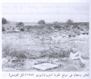
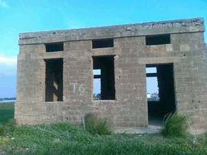
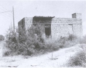
The village houses were looted and demolished or blown up according to the account cited by Walid Khalidi. A later field description recorded only one dilapidated concrete building and a small number of other physical remains at the site.
Israeli Settlement on Huj's Lands
Dorot was established in 1941 on land traditionally belonging to Huj. This is why the Government of Palestine's 1945 statistics included Dorot's population and land within the statistical unit designated as Huj.
Following the displacement of Huj's Palestinian inhabitants in 1948, Dorot took over additional village lands.
Huj Today
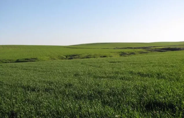
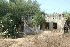
The reviewed core sources do not provide a verified field survey of Huj's site as of 2026. Walid Khalidi's documented field description records one surviving dilapidated concrete building with rectangular doors and windows and a flat roof. Its original use was unclear, while at the time of documentation it was being used as a farm storehouse.
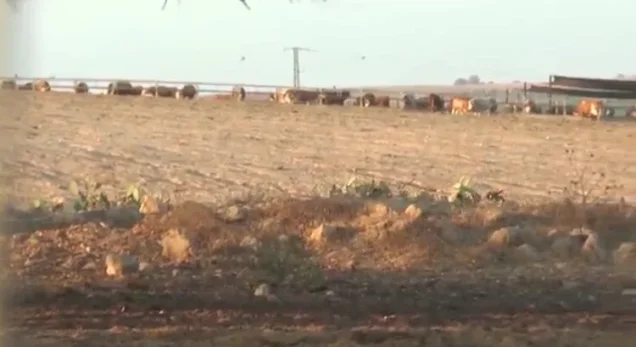
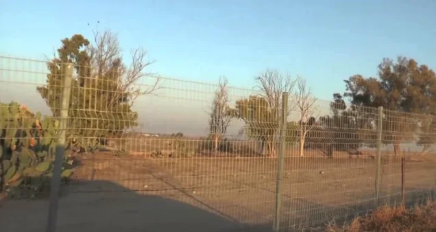
The remnants of a watering trough could also be identified. Sycamore trees and cactuses grew along the eastern and western edges of the site, and an Israeli sheep farm had been established there.
This description reflects the condition recorded during the field research used for All That Remains and should not be treated as a verified on-site description of Huj in 2026.
Sources
- PalQuestPalQuest – Interactive Encyclopedia of the Palestine Question: Huj
- Palestine RememberedPalestine Remembered – Huj, Gaza District
- Institute for Palestine StudiesInstitute for Palestine Studies – Walid Khalidi, All That Remains
- Palestine RememberedGovernment of Palestine – Village Statistics, 1945
- Palestine RememberedGovernment of Palestine – Census of Palestine, 1931
Photo gallery
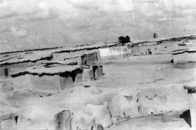
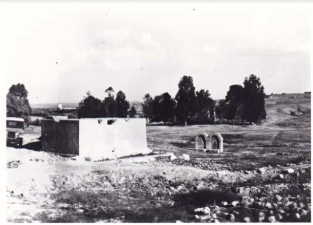
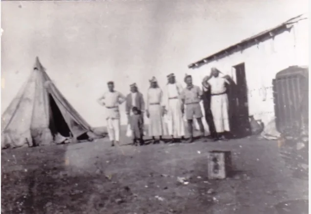


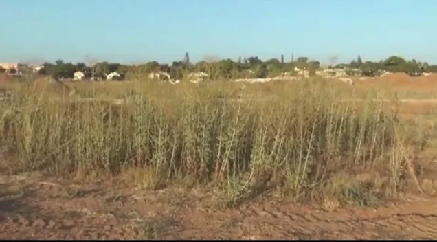
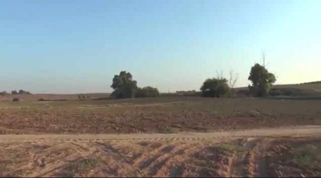

Photos from the village's people
Photos sent in by visitors and published after review.
Add a photo of this village
Log in to add photos of this village.
Other villages from Gaza
More from the archive

 Download Our Palestine App
The whole archive in the palm of your hand: depopulated villages, the Nakba, the massacres and Al-Aqsa — free, with no ads to erase the story.
Download Our Palestine App
The whole archive in the palm of your hand: depopulated villages, the Nakba, the massacres and Al-Aqsa — free, with no ads to erase the story.



Comments
No comments yet — be the first to write one.
Add your comment
Name and email are optional. Comments appear after review.