
The depopulated village of Hawsha / District of Haifa

About the depopulated village of Hawsha
- District
- Haifa
- Date Hawsha was occupied
- 16 April 1948
- Population in 1948
- 464
- Military operation
- The Battle of Mishmar ha-'Emeq
- Brigade that carried it out
- The Carmeli Brigade
- Who defended the village
- Local militia & Arab Liberation Army
- Distance from the governorate centre
- 13 (km) East of Haifa
- Elevation above sea level
- 100 m
- Cause of displacement
- Military assault by Zionist troops
- Extent of destruction
- The village has been completely destroyed, and only house rubble left behind.
- Ethnic cleansing
- Hawsha inhabitants were completely ethnically cleansed.
Hover a dot to read the village name, or click to open its card.
Borders of the depopulated village of Hawsha
Hawsha – Haifa Subdistrict
Hawsha was a depopulated Palestinian village in the Haifa subdistrict, situated approximately 13 km east of Haifa at an average elevation of about 100 meters above sea level, on the low hills separating the Haifa Plain from Marj ibn 'Amir.
A broad wadi west of the village separated Hawsha from neighboring Khirbat al-Kasayir. The two settlements remained distinct Palestinian communities but were closely linked geographically, socially, statistically, and during the fighting of April 1948. They also shared a cemetery.
The official 1922 Census of Palestine recorded 165 Muslim inhabitants in Hawsha. In 1931, Hawsha and Khirbat al-Kasayir together had 202 Muslim inhabitants living in 53 houses. In 1944/45, Hawsha itself had 400 Arab Muslim inhabitants.
Hawsha and al-Kasayir became the center of an intense battle between the Arab Liberation Army and the Haganah in April 1948. After several stages of fighting, two companies of the Carmeli Brigade secured final control of both villages on 16 April 1948.
Location of Hawsha
Hawsha stood on low hills separating the Haifa Plain from Marj ibn 'Amir, overlooking the wider area between Haifa and Shafa 'Amr.
The village was oriented along an east–west axis, with its houses clustered around a small center containing a water cistern.
A broad wadi immediately to the west formed the natural dividing line between Hawsha and Khirbat al-Kasayir.
Hawsha and Khirbat al-Kasayir
Hawsha and Khirbat al-Kasayir should be understood as two neighboring Palestinian communities rather than two names for one village.
Al-Kasayir stood immediately west or northwest of Hawsha, across the wadi.
Their relationship was nevertheless close: they shared a cemetery, were combined in the 1931 census, and were drawn into the same major battle in April 1948.
Palestinian community testimony also explicitly distinguishes the families of Hawsha from those of al-Kasayir, even though the paired name “Hawsha and al-Kasayir” became common in collective memory.
Neighboring Areas
Palestinian local documentation places the village approximately within the following geographical setting:
| Direction | Village / Area |
|---|---|
| East | Shafa 'Amr |
| West / Northwest | Khirbat al-Kasayir |
| South | Wadi Saffuriyya and the Ras 'Ali area |
| Farther west | Haifa Plain |
These descriptions indicate the general geographical neighborhood. Original Mandate cadastral maps remain the best source for exact land boundaries.
The Name and the Ancient Site
Some scholars historically associated Hawsha with an older settlement known as Usha or Hosha, although the archaeological and biblical identification has not been universally accepted.
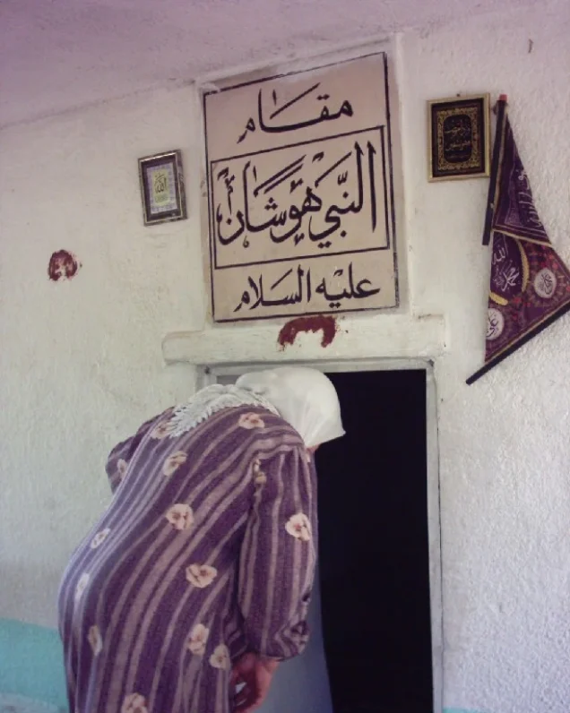
A Palestinian local tradition also associates the village name with the shrine of Nabi Hushan located at the site.
This article therefore distinguishes the modern Palestinian village from the much older archaeological layers and does not present a single etymology as conclusively established.
Formation of the Modern Community and Algerian Origins
The formation of the modern Palestinian community at Hawsha was closely connected with Maghrebi migrants, particularly Algerians who settled in northern Palestine during the nineteenth century.
Palestinian documentation and recent academic research record Algerian families settling at Hawsha during the 1880s, including migrants associated with the regions of Constantine, Guelma, and Oum el-Bouaghi.
Local memory also links a number of Hawsha families with migrants associated with Amir 'Abd al-Qadir al-Jaza'iri.
This Algerian background concerns the modern Palestinian community and should not be confused with the site's much older archaeological history.
Built Environment
The Palestine Index Gazetteer classified Hawsha as a hamlet.
Its houses formed a dense cluster around the village center and its water cistern.
The built-up area followed a generally east–west orientation.
The 1944/45 land-use statistics record 50 dunums of built-up land, but the statistical unit also included the settlement of Usha; the full 50 dunums should therefore not automatically be attributed to the Palestinian built-up area alone.
Population of Hawsha
- 1922165Official Census of Palestine; Hawsha alone, all inhabitants Muslim
- 1931202Combined Hawsha and Khirbat al-Kasayir; all inhabitants Muslim
- 1944/45400 ArabsPalestinian Muslim population of Hawsha
- 1944/45180 JewsResidents of Usha included in the same statistical unit
- 1944/45 – combined unit580400 Arabs + 180 Jews; not the population of Palestinian Hawsha alone
- 1948464Later Palestine Remembered demographic estimate; not an official census
- 19982,850 refugees and descendantsLater demographic estimate published by Palestine Remembered
Number of Houses
- 193153 occupied housesCombined total for Hawsha and Khirbat al-Kasayir
- 1948121Later Palestine Remembered estimate; not an official house census
Land Ownership in 1944/45
Hawsha's land statistics require particular care because the official 1944/45 statistical unit included the Jewish settlement of Usha, established in 1937.
The combined unit totaled 901 dunums:
- Arab0 dunums0%
- Jewish894 dunums99%
- Public7 dunums<1%
The absence of registered Arab-owned dunums in this table does not mean that Hawsha's Palestinian inhabitants were not farmers or did not use agricultural land. Khalidi explicitly describes agriculture and animal husbandry as the basis of the village economy.
The figures instead reflect formally registered ownership within a statistical unit that included Usha by 1945.
Palestine Remembered's current simplified ownership display is incomplete because it omits the 894 dunums registered in the official Jewish ownership category. This article therefore follows the official categories reproduced by PalQuest.
Land Use in 1944/45
The following land-use figures also refer to the statistical unit that included Hawsha and Usha:
- Cultivable / cultivated land717 dunums80%
- Built-up land50 dunums6%
- Remainder of statistical unit134 dunums15%
PalQuest's main table does not provide an Arab/Jewish breakdown of the 717 cultivable dunums, so none has been inferred.
Khalidi's qualitative account is clearer regarding Hawsha's Palestinian economy: grain was the principal crop, with a small northern area devoted to fruit and olive trees.
Economic Life in Hawsha
Agriculture and animal husbandry formed the basis of the Palestinian village economy.
Grain was the principal crop and was concentrated in the lands southwest of the village.
A small area north of the built-up village was planted with fruit and olive trees.
Livestock raising and grazing supplemented cultivation and formed an important part of household livelihoods.
Water
A water cistern stood at the center of Hawsha, around which the houses clustered.
The archaeological site also contained an old well and other water-related features.
The core source does not provide a detailed list of other late-Mandate village springs or wells, so none has been added without documentation.
Education
No independent school in Hawsha is securely documented in Khalidi or PalQuest.
The principal sources reviewed do not provide a school founding year or verified pupil enrollment.
No educational institution has therefore been added without evidence.
Religious Life and the Shrine of Nabi Hushan
The Palestinian inhabitants of Hawsha were Muslims.
The village site contained a shrine known as Maqam Nabi Hushan, one of Hawsha's best documented religious and archaeological landmarks.
Hawsha and neighboring Khirbat al-Kasayir shared a cemetery south of the village site.
That cemetery was still being used by nearby Bedouin communities at the time of Khalidi's later field survey.
Archaeological Remains
Hawsha occupied a site rich in earlier archaeological remains.
Documented features included ancient building foundations, a well, rock-cut tombs, a mosaic floor, and the shrine of Nabi Hushan.
Some scholars historically associated the site with ancient Usha or Hosha, but the identification is not treated here as an uncontested archaeological fact.
Hawsha before the Nakba
By the spring of 1948, the area between Shafa 'Amr and the Jewish settlements east of Haifa had become an active military zone involving the Haganah and the Arab Liberation Army.
The fighting at Hawsha and al-Kasayir developed within the wider military context of the battle around Mishmar ha-'Emeq farther south.
Arab Liberation Army Positions – 12 April 1948
On 12 April 1948, an Arab Liberation Army force composed largely of Druze fighters from Syria and Palestine took positions at Hawsha and Khirbat al-Kasayir.
Its snipers began firing on nearby Jewish settlements in an attempt to relieve pressure on Arab Liberation Army forces fighting at Mishmar ha-'Emeq.
The deployment transformed Hawsha and al-Kasayir into the center of a major confrontation over the following days.
Carmeli Brigade Attack – Around 14 April
Two days later, around 14 April, a unit of the Haganah's Carmeli Brigade attacked Hawsha and Khirbat al-Kasayir.
Intense fighting followed with the Arab Liberation Army, including close-quarter combat and the use of edged weapons.
The attacking Zionist force lost this first round, after which the Carmeli command decided to mount another assault and take both villages.
Final Occupation – 16 April 1948
At dawn on 16 April 1948, two companies of the Carmeli Brigade entered Hawsha and al-Kasayir.
According to the account relayed by Khalidi, only a small number of guards were present in the villages at that moment.
The Arab Liberation Army immediately mounted a counterattack that continued throughout the day.
Fighting took place at extremely close range. The Druze ALA force reportedly came close to turning the battle in its favor before an additional machine gun reached the Zionist force and shifted the balance.
By evening, the Carmeli Brigade had consolidated control of Hawsha and Khirbat al-Kasayir. The ALA did not renew its counterattack the following day.
Casualties in the Battle
The battle of Hawsha and al-Kasayir was one of the fiercest engagements in the area during April 1948.
A contemporary New York Times correspondent reported that many Arabs were killed in the fighting.
The following day, the Haganah claimed that it had killed 130 Druze fighters in the seizure of Hawsha.
This figure is presented here specifically as a Haganah claim relayed through the sources used by Khalidi, not as an independently verified final casualty count.
Depopulation of Hawsha
Khalidi does not establish the exact day on which every Palestinian inhabitant left Hawsha.
He considers it probable that depopulation began as the battle opened, if the report that the village was already largely empty on 16 April is accepted.
The chronology should therefore distinguish between the beginning of civilian flight during the battle and the final military occupation securely dated to 16 April 1948.
Palestine Remembered classifies the cause of depopulation as direct Zionist military assault, a characterization consistent with the overall military context, although the sources do not document the departure of each family individually.
The Battle of Hawsha and al-Kasayir and Mishmar ha-'Emeq
Some statistical summaries describe the military context as the “Mishmar ha-'Emeq operation.”
A more precise formulation is that the battle at Hawsha and al-Kasayir was connected to the broader fighting around Mishmar ha-'Emeq. The ALA deployed forces in the two Palestinian villages partly to relieve pressure on its troops farther south.
The engagement is also referred to in later literature as the Battle of Hawsha and al-Kasayir or the Battle of Ramat Yohanan, after the nearby Jewish settlement bloc.
Military Units
The Zionist formation that carried out the final occupation was the Carmeli Brigade of the Haganah.
At dawn on 16 April, two Carmeli companies occupied Hawsha and Khirbat al-Kasayir and then defended them against the ALA counterattack.
The principal Arab defenders were forces of the Arab Liberation Army, particularly a Druze contingent containing fighters from Syria and Palestine.
Occupation Chronology
- Early April 1948
Escalation of the Mishmar ha-'Emeq fighting
Fighting south of Hawsha directly influenced the Arab Liberation Army's deployment toward Hawsha and al-Kasayir.
- 12 April 1948
ALA takes positions in Hawsha and al-Kasayir
A Druze ALA force composed of Syrian and Palestinian fighters occupied positions in the two villages and fired on nearby Jewish settlements to relieve pressure at Mishmar ha-'Emeq.
- Around 14 April 1948
First Carmeli attack
A Carmeli Brigade unit attacked the villages. Intense close-quarter fighting followed, and the attacking force lost that round.
- After the 14 April battle
Decision to seize both villages
Following the failure of the first assault, the Carmeli command decided to launch a renewed attack and establish permanent control.
- 15 April 1948
Alternative local date
Some Palestinian local sources index this as the occupation date, but Khalidi's detailed chronology places the final takeover at dawn the following day.
- Dawn, 16 April 1948
Carmeli companies enter the villages
Two Carmeli Brigade companies occupied Hawsha and al-Kasayir, where only a small number of guards reportedly remained.
- 16 April 1948
ALA counterattack
The Druze ALA force launched a counterattack lasting throughout the day, with extremely close-range fighting.
- Evening, 16 April 1948
Battle decided
After additional machine-gun support reached the Zionist force, Carmeli consolidated control of both villages.
- During or before the completion of the battle
Palestinian civilian flight
The precise date is unknown. Khalidi considers it probable that most villagers left as fighting began because Hawsha was reportedly largely empty by 16 April.
- 16 April 1948
Final military occupation
Haganah control became permanent and the Arab Liberation Army did not launch another attempt to retake the villages.
- Later; exact date not established
Destruction of the village
Hawsha's houses were demolished, although portions of the walls of about twenty buildings remained.
Refugees from Hawsha
Palestine Remembered estimates Hawsha's Palestinian population in 1948 at approximately 464. This is a later demographic estimate rather than an official Mandate census.
The same source estimates that Hawsha refugees and their descendants numbered approximately 2,850 in 1998.
Community testimony documents families from Hawsha in Lebanon and Syria after the Nakba. The core sources, however, do not provide a complete official distribution of all displaced village families.
Settlements and Land after Hawsha
The relationship between Hawsha's land and surrounding settlements requires a distinction between the Palestinian village site and the combined 1945 statistical unit.
| Settlement / Area | Established | Relationship to Hawsha |
|---|---|---|
| Usha | 1937 | Established approximately 2 km west of the Palestinian village site and included in the official Hawsha/Usha statistical land unit by 1945 |
| Ramat Yohanan | 1932 | Located nearby; Khalidi's Hawsha entry does not specifically state that it was founded on Hawsha village land |
| Shafa 'Amr | Existing Palestinian town | Khalidi states that Hawsha's village lands were later incorporated into the lands of Shafa 'Amr |
Because Usha already existed before the Nakba and was included in the 1945 statistical land unit, the 894 Jewish-owned dunums should not be presented as a post-1948 settlement created after Hawsha's depopulation.
Hawsha Today
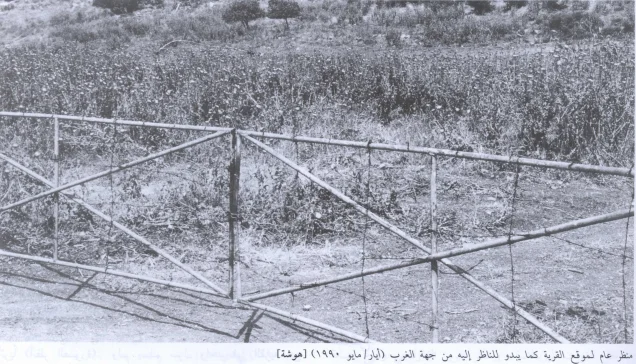
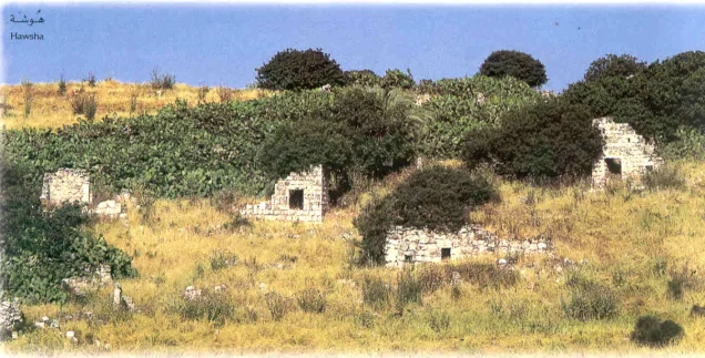
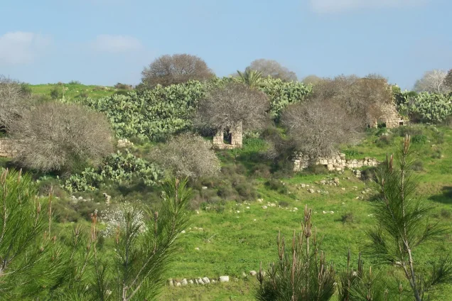
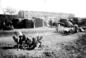
In Walid Khalidi's field description, Hawsha had been almost completely destroyed, fenced off, and declared an archaeological site.
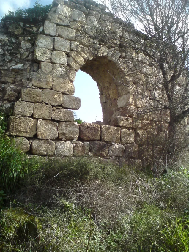
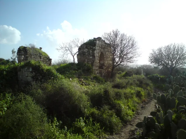
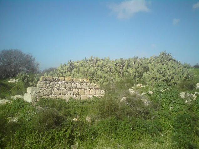
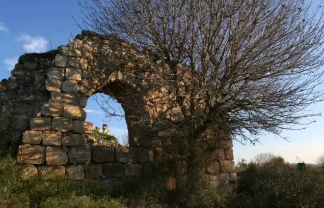
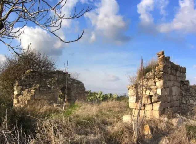
No complete village house remained, although portions of the walls of roughly twenty houses were still standing and the outlines of doors and windows could be seen in the masonry.
A single palm tree stood among fig trees and cactus.
The cemetery south of the village continued to be used by nearby Bedouin communities, while a shrine remained nearby. A cypress grove stood north of the site and an avocado orchard to the south.
This core description derives from the field research conducted for All That Remains between 1987 and 1990 and is not direct field verification of conditions in 2026.
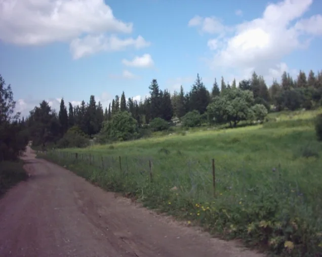
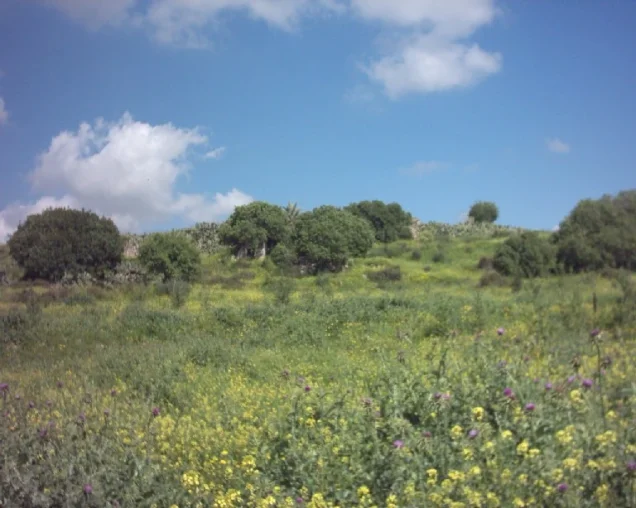
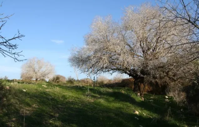
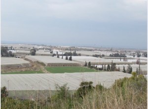
Palestine Remembered contains later Palestinian photographs and site visits from 2003–2007 showing cactus, figs, olives, rubble, and surviving wall remains. These materials help trace later conditions but do not constitute a comprehensive contemporary cadastral and field survey of all former Hawsha lands.
Sources
- PalQuestPalQuest – Hawsha
- Palestine RememberedPalestine Remembered – Hawsha, Haifa District
- Palestine RememberedPalestine Remembered – Hawsha entry from Walid Khalidi's All That Remains
- Institute for Palestine StudiesInstitute for Palestine Studies – Walid Khalidi, All That Remains
- pcbs.gov.psGovernment of Palestine – Census of Palestine 1922
- pcbs.gov.psPalestinian Central Bureau of Statistics – Historical Census Archive
- palqura.comPalestinian Villages Encyclopedia – Hawsha; supplementary Palestinian documentation on boundaries and Algerian origins
- palqura.comPalestinian Villages Encyclopedia – Khirbat al-Kasayir; distinction between the two villages and their shared military history
- carep-paris.orgCAREP Paris – Academic study of Algerians in Palestine, Hawsha, and the 1948 exile
- PalQuestPalQuest – All That Remains: Methodology and Field Research
Photo gallery

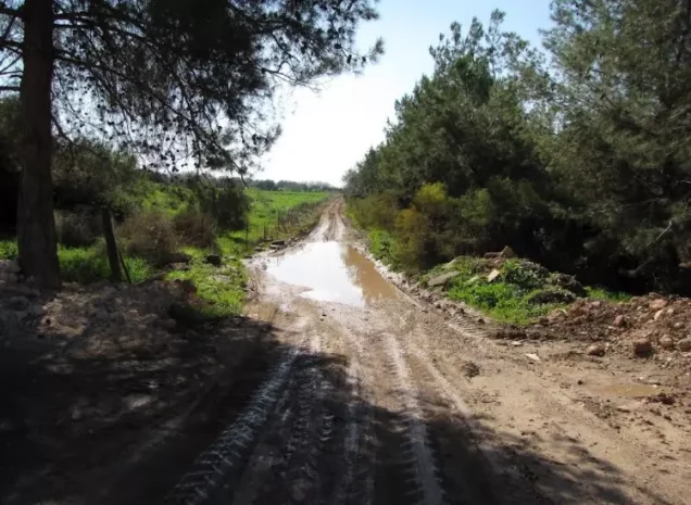
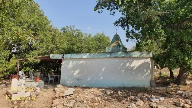
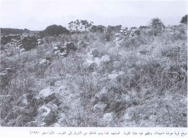

Photos from the village's people
Photos sent in by visitors and published after review.
Add a photo of this village
Log in to add photos of this village.
Other villages from Haifa

More from the archive


 Download Our Palestine App
The whole archive in the palm of your hand: depopulated villages, the Nakba, the massacres and Al-Aqsa — free, with no ads to erase the story.
Download Our Palestine App
The whole archive in the palm of your hand: depopulated villages, the Nakba, the massacres and Al-Aqsa — free, with no ads to erase the story.



Comments
No comments yet — be the first to write one.
Add your comment
Name and email are optional. Comments appear after review.