
The depopulated village of Al-Rihaniyya / District of Haifa
Al-Rihaniyya
About the depopulated village of Al-Rihaniyya
- District
- Haifa
- Date Al-Rihaniyya was occupied
- 30 April 1948
- Population in 1948
- 280
- Military operation
- Operation Bi'ur Hametz
- Who defended the village
- Arab Liberation Army headed by Fawzi al-Qawuqji
- Distance from the governorate centre
- 25 (km) South East of Haifa
- Elevation above sea level
- 225 m
- Cause of displacement
- Expulsion by Zionist troops
- Extent of destruction
- The village has been completely destroyed, and only house rubble left behind.
- Ethnic cleansing
- al-Rihaniyya inhabitants were completely ethnically cleansed.
- Settlements built on the built-up area of Al-Rihaniyya after 1948
- Part of Ein HaEmek
Hover a dot to read the village name, or click to open its card.
Borders of the depopulated village of Al-Rihaniyya
Al-Rihaniyya – A Depopulated Palestinian Village in the Haifa Subdistrict
Al-Rihaniyya was a Palestinian village in the Haifa Subdistrict, situated approximately 25 km southeast of Haifa on a hilltop in a generally hilly area, at an average elevation of about 225 meters above sea level.
It should not be confused with the Circassian village of Rihaniya in the Safad Subdistrict. This article concerns the depopulated Palestinian village of al-Rihaniyya in the Haifa Subdistrict, within the broader Bilad al-Rawha region.
The hills east of the village rose sharply, while the western slopes were gentler and descended toward the Wadi al-Milh road, approximately 3 km northwest of the village.
Al-Rihaniyya came under attack in April 1948 following the battle of Mishmar ha-'Emeq. A contemporary report stated that it was occupied on 14 April, but Walid Khalidi suggests that firm Haganah control may not have been established until late April, after the fall of Haifa and in the context of operations that included Operation Bi'ur Hametz.
- Subdistrict
- Haifa
- Region
- Bilad al-Rawha
- Distance from Haifa
- Approximately 25 km southeast
- Elevation
- Approximately 225 m above sea level
- Population, 1944/45
- 240
- Estimated population, 1948
- 278
- Total land area
- 1,930 dunums
- Earliest reported occupation
- 14 April 1948
- Firm military control
- Probably established in late April 1948
- Military force
- Haganah; Carmeli Brigade at the Operation Bi'ur Hametz level
- Military context
- Operation Bi'ur Hametz following the fall of Haifa, preceded by fighting around Mishmar ha-'Emeq
- Settlements originally established on village land
- Khalidi does not identify a settlement originally founded on al-Rihaniyya's land
Location and Geography of Al-Rihaniyya
Al-Rihaniyya stood on a hilltop in a generally hilly landscape. The hills immediately east of the village rose steeply, while those to the west were gentler and descended toward the Wadi al-Milh road.
The Wadi al-Milh highway lay approximately 3 km northwest of the village and linked the surrounding region with Haifa, the coastal area, and Marj ibn 'Amir.
Al-Rihaniyya formed part of Bilad al-Rawha, a rural region between Mount Carmel and Marj ibn 'Amir characterized by agricultural villages, springs, and local road networks.
Neighboring Villages and Localities
Palestinian maps and local documentation indicate the following approximate geographical relationships:
- North: Umm al-Zinat.
- Northeast: Qira wa Qamun.
- East: the Abu Zurayq area.
- South: Daliyat al-Rawha'.
- Southwest: al-Kafrayn.
- West and northwest: the Khirbat Qumbaza area and lands toward Umm al-Zinat and the Wadi al-Milh road.
These are approximate geographical relationships rather than substitutes for detailed historical cadastral boundaries.
Name of Al-Rihaniyya
The village name derives from rihan, the Arabic word for sweet basil, an aromatic plant widely known throughout Palestine and the Mediterranean region.
Local documentation further associates the name with the area's vegetation and abundant water sources, although Khalidi's principal entry simply links the name to the basil plant.
Al-Rihaniyya in the Late Ottoman Period
Late nineteenth-century sources indicate an established population at al-Rihaniyya. A population estimate from around 1887 gives approximately 190 inhabitants, all Muslims.
A boys' elementary school was established around 1887 during Ottoman rule but was later closed during the British Mandate.
The village also had a mosque, reflecting its established Muslim community before the Mandate period.
Built Form
Al-Rihaniyya was relatively small and compact. The official 1931 census recorded 55 occupied houses.
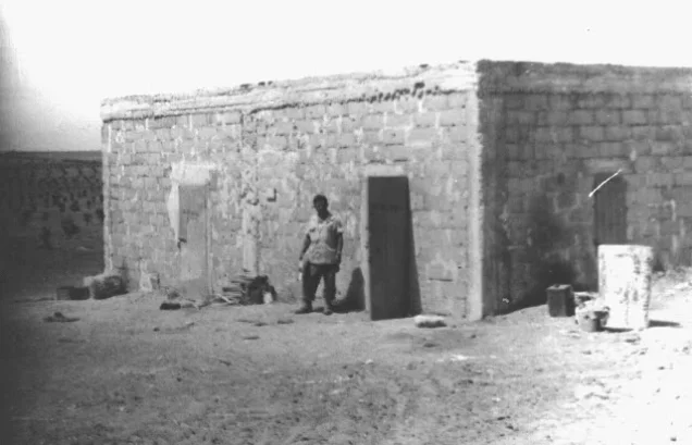
Local Palestinian documentation describes houses built of stone and cement or stone and mud, while the mosque and school were among the village's principal public structures.
The 1944/45 Village Statistics classified approximately 46 dunums as built-up Arab land.
Population of Al-Rihaniyya
The official 1922 Census of Palestine recorded 266 inhabitants in al-Rihaniyya, all Muslims.
By the 1931 census, the population had risen to 293, again all Muslims, living in 55 occupied houses.
The 1944/45 Village Statistics recorded 240 Arabs.
Later local accounts attribute the decline between 1931 and 1945 partly to the departure of several families from the village. This explanation derives from local history rather than the official statistical records themselves.
Palestine Remembered later estimated the population at 278 in 1948 and the number of refugees and their descendants at 1,710 in 1998. These are retrospective estimates rather than official British Mandate census counts.
- c. 1887Approximately 190Historical estimate; all Muslims
- 1922266Official census; all Muslims
- 1931293Official census; all Muslims
- 1944/45240Official statistics; all Arabs
- 1948278Later Palestine Remembered estimate, not an official census
- 19981,710 refugeesLater estimate of refugees and their descendants
Number of Houses
- 193155Occupied houses recorded in the official census
- 194855Later Palestine Remembered figure repeating the 1931 count; not an independent official census
Education
Al-Rihaniyya had a boys' elementary school established around 1887 during Ottoman rule.
The school was closed during the British Mandate and was therefore no longer functioning during the final years before the Nakba.
Some secondary sources give 1888 rather than 1887 as the founding year, so “around 1887” is the safest formulation.
The Mosque
The Muslim village had a mosque serving its inhabitants.
Khalidi's principal account does not provide sufficient documentation concerning its construction date, architecture, or dimensions to support more detailed claims.
Land Ownership in Al-Rihaniyya
The total village land area in the 1944/45 Village Statistics was 1,930 dunums.
Palestine Remembered presents the simplified ownership categories as follows:
- Palestinian1,885 dunums98%
- Transferred to Zionists0 dunums0%
- Communal/Public45 dunums2%
The official Village Statistics use the categories Arab and Public: 1,885 dunums were classified as Arab land and 45 as public land. No land was recorded under the Jewish category.
Some later local sources give a total of 6,930 dunums, but this conflicts with both the official Village Statistics and PalQuest. This article therefore uses the official total of 1,930 dunums.
Land Use in 1944/45
- Arab
- Public
- Cereals1,761 dunums
- Plantations and irrigable land73 dunums
- Built-up land46 dunums
- Non-cultivable land50 dunums
Cultivable land totaled 1,834 dunums, approximately 95 percent of the village area.
Built-up and non-cultivable land totaled 96 dunums: 51 Arab and 45 public dunums.
Economic Life
Agriculture and livestock raising were the principal sources of livelihood in al-Rihaniyya.
Cereals and fruit were the most important crops. In 1944/45, 1,761 dunums were devoted to cereals and 73 dunums to plantations and irrigable land.
Springs and the nearby wadi supplied water for household use and supported part of the village's agricultural activity.
Water and Springs
Several springs bordered the village from the north and west. Villagers obtained water both from the wadi and from these springs.
Later local Palestinian documentation preserves names including 'Ayn al-Rihaniyya, 'Ayn al-Hawd, and 'Ayn al-Mahshura.
Wadi al-Sitt began north of the village and flowed eastward before joining other streams in the drainage system leading toward the Muqatta' River.
These detailed names derive from local geographical documentation, while Khalidi's principal account confirms more generally that the wadi and numerous springs supplied the village with water.
Archaeological Sites and Khirbas
Khirbat Furayr was one of the principal archaeological sites associated with al-Rihaniyya. Khalidi records that it had been classified as an archaeological site but had not yet been securely dated.
The English PalQuest entry places Khirbat Furayr approximately 1.5 km northwest of the village. Some Arabic reproductions give 15 km, which appears to result from a missing decimal point.
Later local sources also identify Khirbat Qutayna east of the village, Khirbat Qumbaza, Khirbat al-Qasr, Khirbat al-Shaqaq, Khirbat al-Buwayda, and Khirbat al-Najasa.
Some local accounts associate Khirbat Qutayna with an ancient Canaanite settlement, but this attribution should not be treated as established without independent archaeological confirmation.
The Mishmar ha-'Emeq Fighting
The area around al-Rihaniyya witnessed major fighting in April 1948 following the battle of Mishmar ha-'Emeq between the Haganah and the Arab Liberation Army under Fawzi al-Qawuqji.
During the Haganah counteroffensive that followed, a number of Palestinian villages southeast of Haifa were overrun.
Khalidi describes al-Rihaniyya as apparently among the last villages occupied in the aftermath of that fighting.
Occupation and Depopulation of Al-Rihaniyya
The precise date on which al-Rihaniyya came under firm military control is disputed.
A contemporary newspaper report cited by Khalidi stated that al-Rihaniyya, Daliyat al-Rawha', and al-Butaymat were occupied on 14 April 1948, after Arab Liberation Army forces in the area had been defeated and approximately ten other villages had been overrun.
Khalidi, however, adds that al-Rihaniyya may not have been securely under Haganah control on that date. Firm control may only have been established a couple of weeks later, when villages to its north and west were occupied after the fall of Haifa.
During this period the Haganah launched Operation Bi'ur Hametz from 22 to 24 April 1948 to consolidate control over Haifa's hinterland and approaches.
PalQuest explicitly lists al-Rihaniyya among the villages affected by this operation and identifies the Carmeli Brigade as the principal Zionist formation involved.
Palestine Remembered and the Palestinian Villages Encyclopedia use 30 April 1948 as the village's occupation date. Khalidi's narrative, however, does not establish that specific date conclusively.
The most careful chronology is therefore: an initial reported occupation on 14 April, followed by probable firm Haganah control in late April in the context of Operation Bi'ur Hametz and the consolidation of Israeli control around Haifa.
- April 1948
Mishmar ha-'Emeq fighting and aftermath
Haganah counteroffensive against Palestinian villages following fighting with the Arab Liberation Army
- 14 April 1948
First reported occupation of al-Rihaniyya
Contemporary report stated that al-Rihaniyya, Daliyat al-Rawha', and al-Butaymat were occupied
- 22 April 1948
Fall of Haifa
Followed by efforts to consolidate control over the city's hinterland
- 22–24 April 1948
Operation Bi'ur Hametz
Haganah operation led largely by the Carmeli Brigade; PalQuest lists al-Rihaniyya among affected villages
- Late April 1948
Probable firm control
Khalidi suggests secure Haganah control may not have been achieved until several weeks after the 14 April report
- 30 April 1948
Date used by later Palestinian secondary sources
Commonly listed date, but not conclusively established by Khalidi's detailed account
Military Unit
The securely documented military organization is the Haganah.
At the operation level, PalQuest identifies the Carmeli Brigade as the principal force carrying out Operation Bi'ur Hametz and lists al-Rihaniyya among the villages affected by that operation.
The village-specific Khalidi entry does not identify a particular battalion or assault unit that entered al-Rihaniyya. The most precise formulation is therefore: Haganah; Carmeli Brigade at the Operation Bi'ur Hametz level.
Zionist and Israeli Settlements and Al-Rihaniyya's Lands
Ramat ha-Shofet: Established in 1941 close to al-Rihaniyya.
'En ha-'Emeq: Established in 1944 close to the village site.
Together, the two settlements formed an arc partly surrounding al-Rihaniyya from the north, east, and south.
Khalidi explicitly states that neither settlement was originally founded on al-Rihaniyya's village lands. They were, however, extremely close to the village—approximately half a kilometer away.
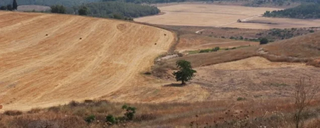
After the depopulation of al-Rihaniyya, residents of these settlements made use of the village lands for agriculture. A distinction should therefore be maintained between a settlement originally established on village land and a neighboring settlement that later used depopulated village land.
Al-Rihaniyya Today
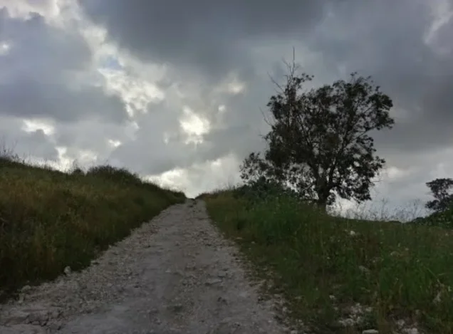
According to Walid Khalidi's field description in All That Remains, the village houses had been reduced to piles of rubble covered with soil, bushes, and thorns.
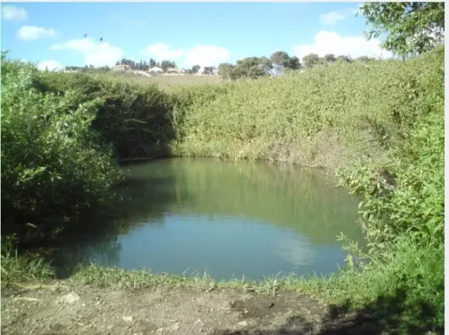
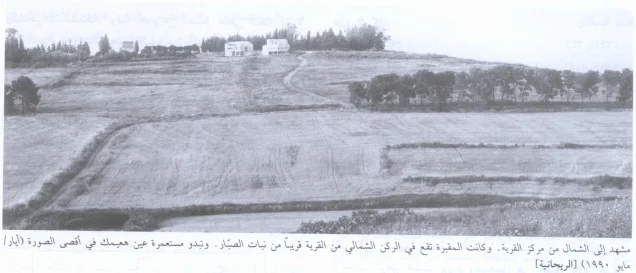
The village cemetery remained visible, covered with cactus, as did a well at the foot of a hill north of the site.
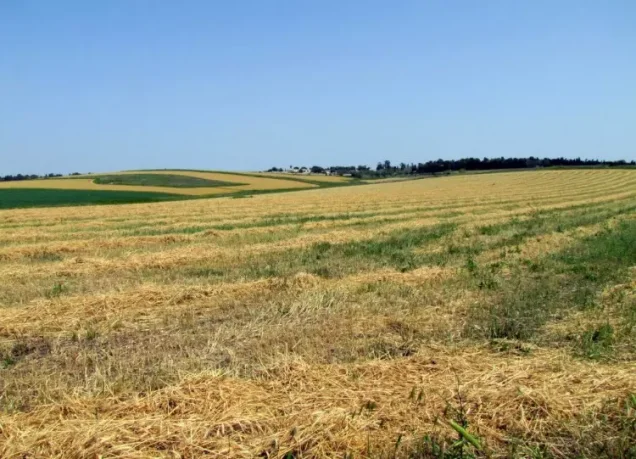
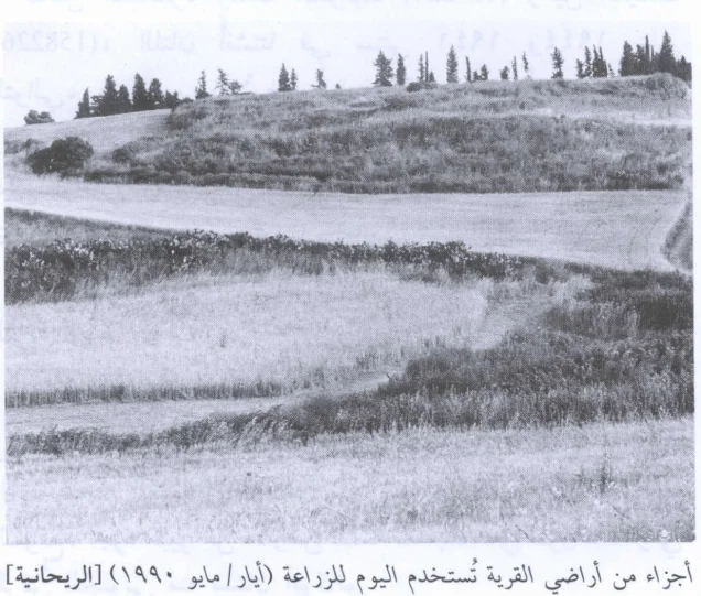
Large parts of the surrounding land were being cultivated, and an avocado orchard occupied the southern part of the area.
The description is associated with field documentation and photographs from around 1990, before the 1992 publication of All That Remains. It should therefore not be treated as direct field verification of every feature in 2026.
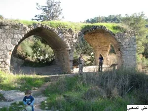
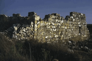
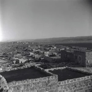
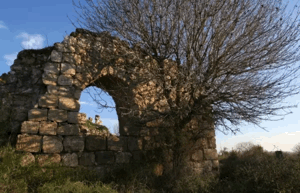
Later Palestinian community documentation on Palestine Remembered and the Palestinian Villages Encyclopedia includes material showing the ruins, 'Ayn al-Rihaniyya, the cemetery, and village lands. These materials provide useful later documentation but do not constitute a comprehensive modern archaeological or architectural survey of the site.
Sources
- PalQuestPalQuest – Interactive Encyclopedia of the Palestine Question: al-Rihaniyya
- PalQuestPalQuest – Operation Bi'ur Hametz
- Palestine RememberedPalestine Remembered – al-Rihaniyya, Haifa
- Palestine RememberedPalestine Remembered – al-Rihaniyya entry from All That Remains
- Institute for Palestine StudiesInstitute for Palestine Studies – Walid Khalidi, All That Remains
- pcbs.gov.psGovernment of Palestine – Census of Palestine 1922
- fada.birzeit.eduBirzeit University Repository – Census of Palestine 1931
- maktabatsabil.comGovernment of Palestine – Village Statistics 1945: Haifa Sub-District, Population and Land Ownership
- palqura.comPalestinian Villages Encyclopedia – al-Rihaniyya / Bilad al-Rawha
Photo gallery
Photos from the village's people
Photos sent in by visitors and published after review.
Add a photo of this village
Log in to add photos of this village.
Other villages from Haifa
More from the archive



 Download Our Palestine App
The whole archive in the palm of your hand: depopulated villages, the Nakba, the massacres and Al-Aqsa — free, with no ads to erase the story.
Download Our Palestine App
The whole archive in the palm of your hand: depopulated villages, the Nakba, the massacres and Al-Aqsa — free, with no ads to erase the story.



Comments
No comments yet — be the first to write one.
Add your comment
Name and email are optional. Comments appear after review.