
The depopulated village of Balad al-Shaykh / District of Haifa
Subdistrict: Haifa
Estimated Palestinian population in 1948: approximately 4,779
Occupation and depopulation: 24–25 April 1948
Military unit: Carmeli Brigade, operating within the framework of Operation Bi'ur Hametz
Settlement established on part of the village lands before 1948: Nesher developed during the British Mandate around a cement factory built on leased land.
Construction on the village site and lands after 1948: Tel Hanan and the subsequent expansion of Nesher. Claims concerning the exact cadastral relationship of Ramot Yitzhak, Giv'at Amos, Ben-Dor, Giv'at Nesher, and Kiryat HaTechnion require detailed boundary-map verification.
Balad al-Shaykh
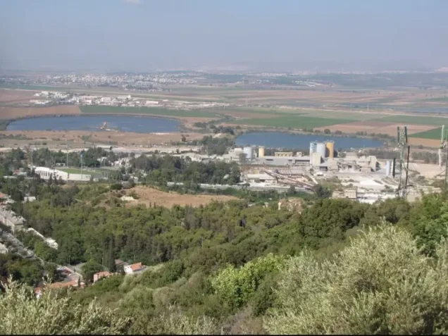
Balad al-Shaykh was a depopulated Palestinian village in the Haifa Subdistrict, situated approximately 7 kilometres southeast of Haifa at the foot of the northwestern extension of Mount Carmel. Its average elevation was approximately seventy-five metres above sea level.
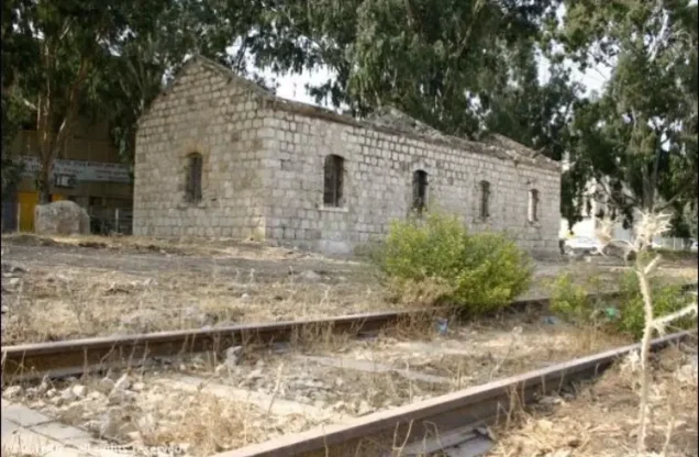
- The village stood on the Haifa Plain. The Haifa–Jenin highway passed to its east, as did the Haifa–Samakh railway, which ran approximately half a kilometre from the village.
- An airstrip was located along the northern edge of the village lands, approximately two kilometres from the built-up area.
- In 1945, Balad al-Shaykh was the second-largest Palestinian village in the Haifa Subdistrict by population. British Mandate statistics recorded all 4,120 residents as Muslims.
Boundaries of Balad al-Shaykh
Balad al-Shaykh lay among the following Palestinian villages, towns, and localities:
- North: Wa'arat al-Sarris.
- Northwest: Haifa.
- West: al-Tira.
- South: Isfiya.
- Southeast: Yajur.
- East: Shafa Amr and the lands extending towards the eastern Haifa plain.

Architectural Structure of Balad al-Shaykh
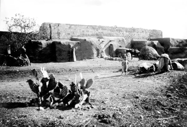
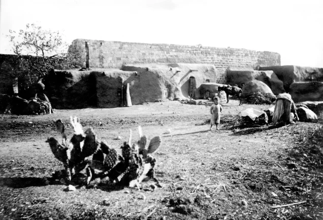
Balad al-Shaykh had a generally rectangular plan. Its houses stood close together and were constructed mainly of stone and cement. The village expanded considerably during the British Mandate as its population increased and employment opportunities developed in nearby Haifa and around the cement works.
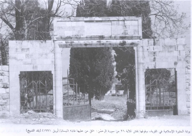
Coffeehouses and two petrol stations stood along the Haifa–Jenin highway. The village also contained schools, shops, religious sites, and a large Islamic cemetery.
Origin of the Name Balad al-Shaykh
The village was named Balad al-Shaykh—“the town of the shaykh”—after the renowned Sufi Shaykh Abdallah al-Sahli. Palestinian academic sources state that Sultan Selim I granted him the village’s tax revenues during the early years of Ottoman rule in Palestine.
Sultan Selim I reigned from 1512 to 1520. The dates 1017–1570 given in the original article were incorrect and appear to have resulted from a confusion between Selim I and Selim II.
Economic Life in Balad al-Shaykh
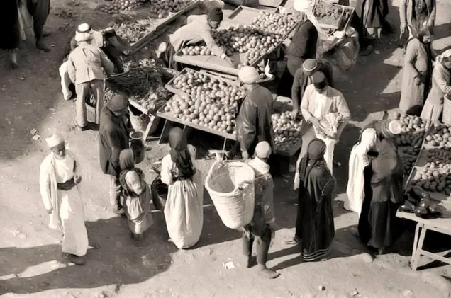
The village economy depended substantially on agriculture and livestock raising. Grain, olives, fruit, and vegetables were among its principal products. Some of the harvested olives were processed in a manually operated olive press.
In 1944/45, 4,410 dunams of Palestinian-owned land were devoted to cereal cultivation, while 368 dunams were irrigated or used for orchards. Local village compilations also report approximately 418 dunams of olive groves. This olive figure appears to fall within the wider agricultural categories and should not be added separately to the official cultivable-land total.
Paid employment provided another important source of income, and many villagers worked in Haifa. The coffeehouses, petrol stations, railway, and highway also supported commercial and service occupations.
During the British Mandate, Zionist investors leased part of the village land and constructed a cement factory and associated buildings. These facilities subsequently formed the nucleus of Nesher.
Land Ownership in Balad al-Shaykh, 1944/45
| Ownership category | Area (dunams)* |
|---|---|
| Palestinian ownership | 5,844 |
| Jewish ownership | 285 |
| Public land | 3,720 |
| Total | 9,849 |
* One dunam equals approximately 1,000 square metres.
Land Use in Balad al-Shaykh, 1944/45
| Land-use category | Palestinian-owned land (dunams)* | Jewish-owned land (dunams)* | Public land (dunams)* | Total (dunams)* |
|---|---|---|---|---|
| Irrigated land and orchards | 368 | 0 | 0 | 368 |
| Cereal cultivation | 4,410 | 78 | 153 | 4,641 |
| Built-up area | 221 | 0 | 20 | 241 |
| Total cultivable land | 4,778 | 78 | 153 | 5,009 |
| Uncultivated land | 845 | 207 | 3,547 | 4,599 |
| Total cadastral area | 5,844 | 285 | 3,720 | 9,849 |
* One dunam equals approximately 1,000 square metres.
The original table combined public land with Palestinian-owned land in several rows. The figures above preserve the separate ownership categories recorded in the 1944/45 statistics.
Population of Balad al-Shaykh
A British consular account estimated that Balad al-Shaykh had approximately 350 residents in 1859. The British census of 1922 recorded 406 people—405 Muslims and one Christian—although some later compilations give 407.
In 1931, Balad al-Shaykh and several nearby communities included in its census unit had a population of 747 Muslims. The census recorded 144 houses for the village itself, while other secondary tabulations give a larger number for the combined statistical locality.
British Mandate statistics recorded 4,120 Muslim residents in 1945. The population immediately before the village’s final depopulation has been retrospectively estimated at approximately 4,779, commonly rounded to 4,780.
A further demographic projection placed the number of refugees from Balad al-Shaykh and their descendants at approximately 29,349 in 1998. The 1948 and 1998 figures are estimates rather than contemporaneous census counts.
Population Record for Balad al-Shaykh
| Year | Recorded or estimated population | Nature of figure |
|---|---|---|
| 1859 | Approximately 350 | Contemporary consular estimate. |
| 1922 | 406 | British Mandate census; some secondary tables give 407. |
| 1931 | 747 | British Mandate census, including specified nearby communities. |
| 1945 | 4,120 | British Mandate village statistics. |
| 1948 | Approximately 4,779 | Retrospective demographic estimate, commonly rounded to 4,780. |
| 1998 | Approximately 29,349 refugees and descendants | Retrospective demographic projection, not a census count. |
Number of Houses in Balad al-Shaykh
| Year | Number of houses | Nature of figure |
|---|---|---|
| 1931 | 144 | Village figure reproduced by Palestinian academic sources. |
| 1948 | Approximately 921 | Retrospective estimate; no contemporaneous 1948 housing census has been identified. |
Education in Balad al-Shaykh
Accounts of education in Balad al-Shaykh refer to the following schools:
The elementary school: A boys’ elementary school was established in 1887 during Ottoman rule. This is the school whose existence is most clearly documented in the Palestinian academic sources. During the British Mandate, the education authorities supervised its operation, expenses, and appointment of teachers.
Shaykh Abdallah School: Local village accounts describe the Ottoman-period school as a privately financed institution associated with Abdallah al-Sahli and located near the Haifa–Jenin road north of the village. Available sources do not establish clearly whether this was a separate institution or the earlier form of the elementary school founded in 1887.
The girls’ school: Local accounts report that a girls’ school operated during the British Mandate, possibly from the 1930s, and provided education through approximately the third or fourth elementary grade. Its precise administrative relationship with the other school has not been conclusively documented.
The Tomb of Izz al-Din al-Qassam
Shaykh Izz al-Din al-Qassam was killed on 20 November 1935 during an armed confrontation with British forces near Ya'bad in the Jenin Subdistrict—not on 15 November, as stated in the original article.
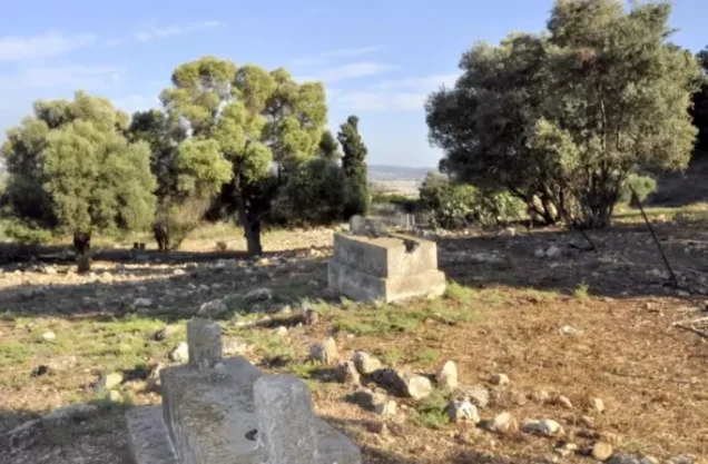
He was buried in the Islamic cemetery at Balad al-Shaykh, which also served Muslims from Haifa. His death and funeral became important mobilising events in the development of Palestinian resistance to British rule and Zionist colonisation before the Great Palestinian Revolt of 1936–1939.
The cemetery and al-Qassam’s tomb survived the village’s depopulation, although they subsequently suffered neglect and repeated damage.
Shrines and Archaeological Remains
North of the village stood the shrine of Shaykh Abdallah al-Sahli. An adjacent khan probably dated to the Mamluk period. Archaeological remains found nearby included a rock-cut wine press and several cisterns attributed, with some uncertainty, to the Byzantine period.
The Balad al-Shaykh Massacre
During the night of 31 December 1947–1 January 1948, a Haganah force that included approximately 170 Palmach personnel attacked Balad al-Shaykh. Palestinian academic documentation records that more than sixty villagers were killed and that women and children were among the victims. Several dozen houses were also destroyed.
The assault followed events at the Haifa oil refinery on 30 December. According to the Palestinian newspaper Filastin, an Irgun bomb thrown at Palestinian workers waiting outside the refinery killed six and wounded forty-two. Palestinian workers inside the refinery subsequently attacked Jewish workers. The Haganah then presented its assault on Balad al-Shaykh as retaliation, although the village’s civilian population bore the consequences.
The number of Palestinians killed in Balad al-Shaykh varies between sources, with estimates generally exceeding sixty. Because a definitive nominal list has not been established in the sources consulted, the figure should not be presented more precisely than the available evidence permits.
The massacre prompted part of the village population to leave by 7 January 1948, but Balad al-Shaykh was not fully occupied and depopulated until late April.
Occupation and Final Depopulation of Balad al-Shaykh
Balad al-Shaykh was targeted for occupation by the Carmeli Brigade as part of Operation Bi'ur Hametz, launched after the occupation of Haifa. Following Haifa’s fall on 22 April 1948, some women and children were moved from the village in anticipation of another attack.
At dawn on 24 April, Haganah forces surrounded Balad al-Shaykh and demanded that its residents surrender their weapons. The villagers handed over twenty-two old rifles and requested a truce. The attacking forces rejected the request and demanded that additional weapons be surrendered.
At approximately 5:00 a.m., the Haganah opened fire with mortars and machine guns. A British unit arrived at about 6:00 a.m. and reported receiving virtually no return fire from the village. The British then negotiated and supervised the evacuation of the remaining residents, some of whom were transported towards Acre.
Sources differ by one day in dating the final depopulation. Palestinian village records and Palestine Open Maps generally use 24 April 1948, while other accounts identify 25 April as the date on which the British-supervised evacuation was completed. It is therefore most accurate to describe Balad al-Shaykh as occupied and depopulated on 24–25 April 1948.
Construction on Balad al-Shaykh’s Lands
Nesher had developed during the British Mandate around the cement factory and associated buildings erected by Zionist investors on leased land. It was therefore not founded after 1948, although it expanded considerably across additional village land after Balad al-Shaykh was depopulated.
In 1949, Jewish immigrants were settled in surviving Palestinian houses in the village. The occupied area was named Tel Hanan and subsequently incorporated into Nesher.
Modern neighbourhoods associated with the later expansion of Nesher include Ramot Yitzhak, Giv'at Amos, Ben-Dor, and Giv'at Nesher. Kiryat HaTechnion in Haifa is also sometimes listed in local accounts as having been built partly on land associated with Balad al-Shaykh. However, the precise relationship of each modern neighbourhood to the village’s cadastral boundaries requires verification against detailed land-demarcation maps; they should not all be presented as conclusively established on the built-up village site.
Balad al-Shaykh Today
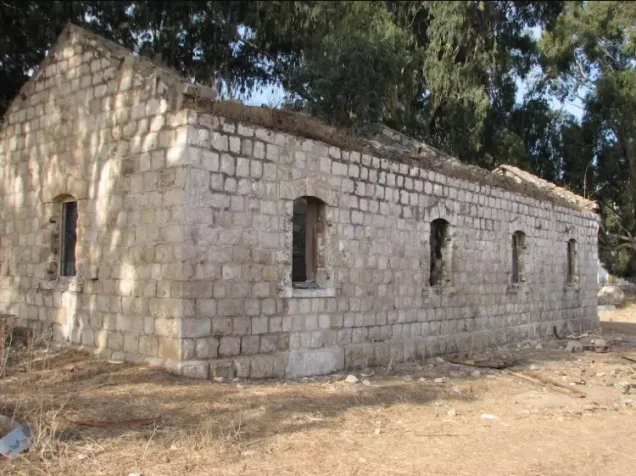
Many Palestinian houses and shops remain standing and are occupied or used within Tel Hanan and Nesher. The survival of these structures distinguishes Balad al-Shaykh from villages whose built-up areas were entirely demolished.
The Islamic cemetery remains visible but has suffered neglect and damage. It contains the tombs of Shaykh Abdallah al-Sahli and Izz al-Din al-Qassam, alongside the graves of other Palestinians from the village and Haifa.
Sources
- PalQuest: Balad al-Shaykh — location, population, land, massacre, occupation, and present condition.
- PalQuest: Operation Bi'ur Hametz.
- PalQuest: Overall chronology of the Nakba and the attack on Balad al-Shaykh.
- Palestine Remembered: Balad al-Shaykh, Haifa Subdistrict.
- Palestine Open Maps: Balad al-Shaykh.
- Institute for Palestine Studies: Walid Khalidi, All That Remains.
- Sami Hadawi, Village Statistics of 1945: A Classification of Land and Area Ownership in Palestine.
Photo gallery









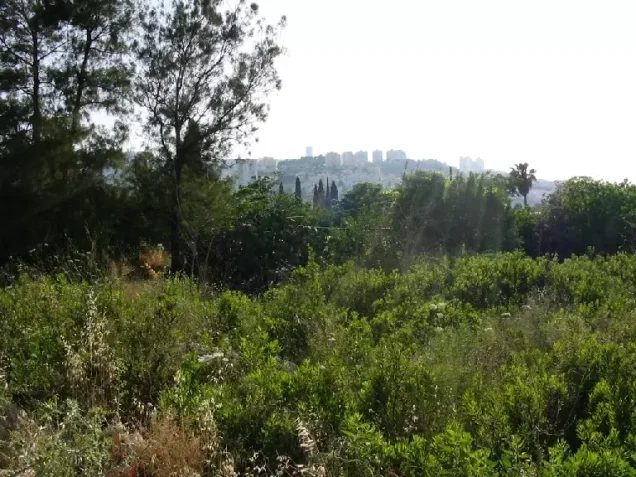
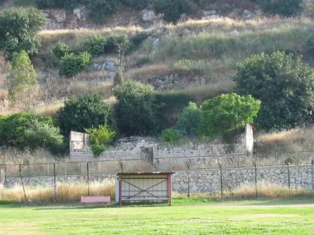

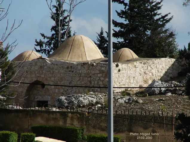
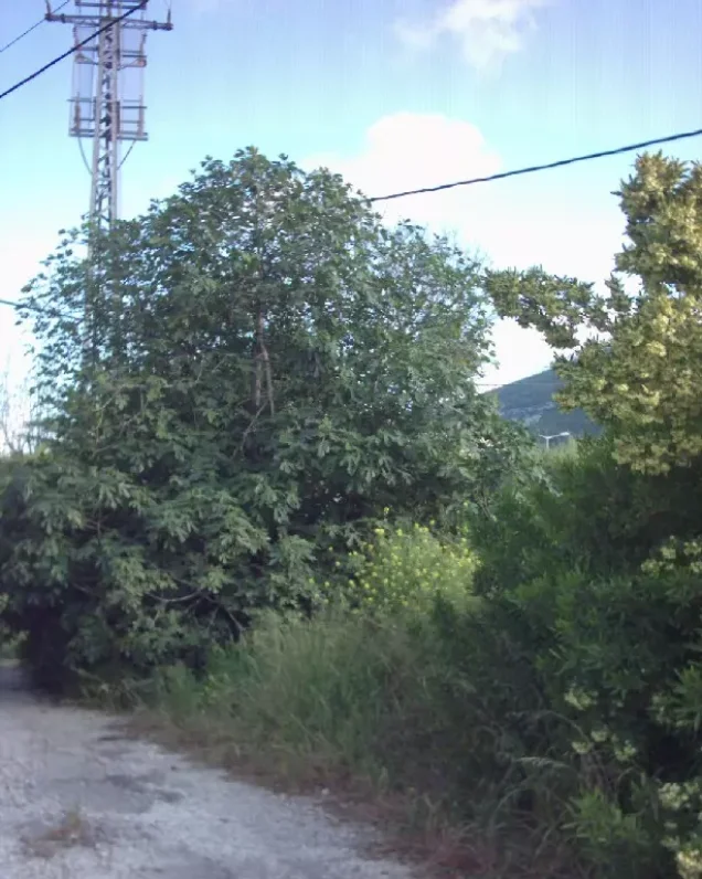


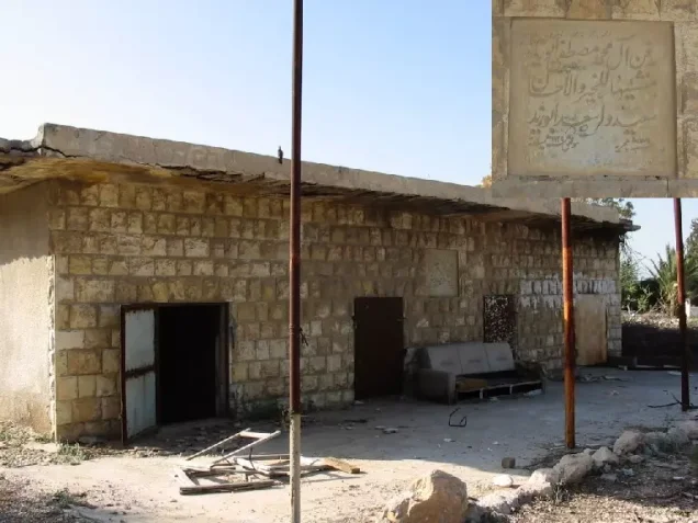
Photos from the village's people
Photos sent in by visitors and published after review.
Add a photo of this village
Log in to add photos of this village.
Other villages from Haifa

 Download Our Palestine App
The whole archive in the palm of your hand: depopulated villages, the Nakba, the massacres and Al-Aqsa — free, with no ads to erase the story.
Download Our Palestine App
The whole archive in the palm of your hand: depopulated villages, the Nakba, the massacres and Al-Aqsa — free, with no ads to erase the story.



Comments
No comments yet — be the first to write one.
Add your comment
Name and email are optional. Comments appear after review.