
The depopulated village of Al-Tira (Haifa) / District of Haifa

Al-Tira (Haifa)
About the depopulated village of Al-Tira (Haifa)
- District
- Haifa
- Date Al-Tira (Haifa) was occupied
- 16 July 1948
- Population in 1948
- 6,113
- Brigade that carried it out
- The Irgun (raid of 12 December 1947) and the Alexandroni Brigade (failed attack of 13 May 1948); the units of the final occupation on 16 July 1948 are not named
- Who defended the village
- Local Palestinian militia, Arab Liberation Army volunteers, and some assistance from the Iraqi army in Tulkarm and Jinin.
- Distance from the governorate centre
- 7 km south of Haifa
- Elevation above sea level
- 60 m
- Cause of displacement
- Direct military assault by Israeli occupation forces, followed by the expulsion of most of the remaining inhabitants, after months of Zionist attacks during which some of the women and children and some 600 other inhabitants were evacuated
- Extent of destruction
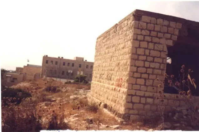
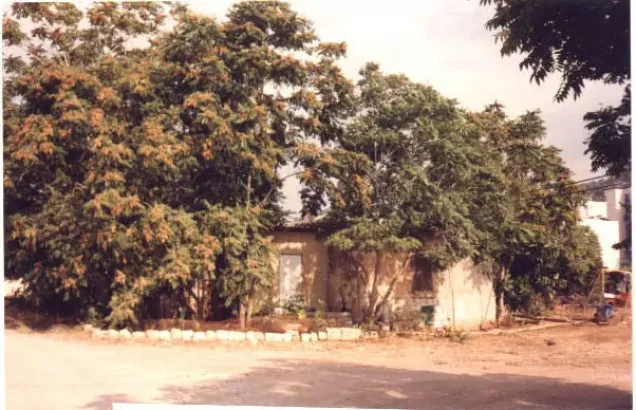
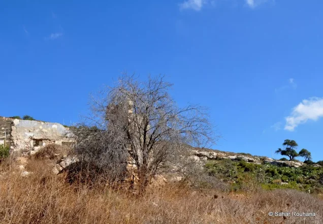
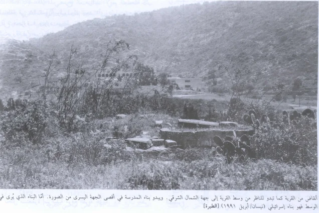
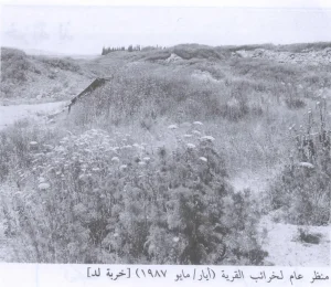
- The village has been mostly destroyed with the exception of the village school and three village houses (one of the houses belongs to 'Irsan al-Dhib).
- Ethnic cleansing
- Between 24th April and 3rd May 1948, al-Tira women and children (about 600) were bused out by the British troops to Jinin and Nablus areas, but the fighting men successfully defended their village until second half of July 1948.
- Settlements built on the built-up area of Al-Tira (Haifa) after 1948
- Ha-Chotrim, established in June 1948 just south of the village site; Tirat Karmel (1949), on the village site; Megadim (1949), farther away on village land; Kefar Gallim (1952), on village land; and Beyt Tzvi, added in 1953
Hover a dot to read the village name, or click to open its card.
Borders of the depopulated village of Al-Tira (Haifa)
al-Tira: A Depopulated Palestinian Village in the Haifa District
Al-Tira, also known as Tirat Haifa, Tirat al-Lawz, and Tirat al-Karmil, was one of the most important Palestinian villages in the Haifa District. It stood on the lower western slopes of Mount Carmel, approximately 7 kilometers south of Haifa, at an average elevation of about 60 meters above sea level.
- Subdistrict
- Haifa
- Distance from district center
- 7 km south of Haifa
- Average Elevation
- 60 m above sea level
- Population in 1931
- 3,191 – includes Tira Station, Neuhardhof, Kafr Samir Station and al-Kababir, not the village alone
- Number of Houses in 1931
- 624 – includes Tira Station, Neuhardhof, Kafr Samir Station and al-Kababir, not the village alone
- Population in 1944/1945
- 5,270 – 5,240 Muslims and 30 Christians
- Estimated Population in 1948
- About 6,113 – a later demographic estimate, not an official census
- Total Land Area in 1945
- 45,262 dunams
- Attack and Depopulation
- The village suffered repeated attacks, beginning with the Irgun raid of 12 December 1947 in which 13 villagers were killed (12 according to PalQuest's entry on the Nakba), followed by two failed attempts to capture it on 25–26 April and 13 May 1948, during which some of the women and children, and then some 600 people, were evacuated to Jenin and Nablus. It fell on 16 July 1948 after the warship Eilat bombarded it before land units moved in, and most of the remaining inhabitants were expelled to the Jenin–Nablus–Tulkarm triangle or held in prisoner-of-war camps.
- Final Israeli Control
- 16 July 1948, during the Ten Days of fighting between the two truces, according to the History of the Haganah as cited by Khalidi
- Military Unit
- The Irgun (raid of 12 December 1947); the Haganah's Alexandroni Brigade (failed attack of 13 May 1948); the final occupation on 16 July 1948 was supported by the warship Eilat before land units moved in, and the available sources do not name the land units that carried it out
- Cause of Depopulation
- Direct military assault by Israeli occupation forces, followed by the expulsion of most of the remaining inhabitants, after months of Zionist attacks during which some of the women and children and some 600 other inhabitants were evacuated
- Settlements Documented on Village Lands
- Ha-Chotrim, established in June 1948 just south of the village site; Tirat Karmel (1949), on the village site; Megadim (1949), farther away on village land; Kefar Gallim (1952), on village land; and Beyt Tzvi, added in 1953
Al-Tira was the most populous village in the Haifa District and the second largest in land area after Ijzim, with a total of 45,262 dunums. During the Nakba and the occupation of Palestine in 1948, the village endured a prolonged series of attacks beginning in late 1947 and remained outside Zionist control until its final capture on 16 July 1948 in a combined land and naval assault. Most of the remaining Palestinian inhabitants were subsequently displaced.
Location of al-Tira
- Al-Tira was located approximately 7 kilometers south of Haifa.
- Its average elevation was about 60 meters above sea level.
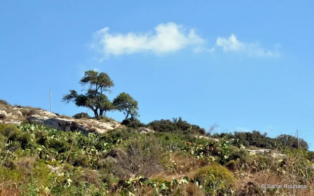
- The village spread across the lower western slopes of Mount Carmel overlooking the coastal plain.
- A secondary road linked it with the coastal highway to the northwest.
- It was the most populous village in the Haifa District and the second largest in land area after Ijzim.
al-Tira Through History
The Crusaders referred to the village as St. Yohan de Tire.
In 1596, al-Tira was a village in the nahiya of Shafa within the liwa' of Lajjun and had an estimated population of 286. Its inhabitants paid taxes on wheat, barley, goats, beehives, vineyards, and other agricultural products.
By the late nineteenth century, al-Tira was described as a village of stone and mud houses situated on a mountain slope surrounded by olive groves. Nearby hills contained numerous caves, and the population was estimated at approximately 1,200.
The Built Environment of al-Tira
Al-Tira had a roughly cruciform layout. Its stone houses were initially clustered together and the built-up area gradually expanded as the population increased.
The village contained several springs as well as schools, religious institutions, and commercial facilities. Its proximity to Haifa and the coastal road strengthened its economic and educational connections with the city.
Population of al-Tira
The 1922 census recorded 2,346 inhabitants in al-Tira. In 1931, the population was 3,191, although this statistical figure also included Tira Station, Neuhardhof, Kafr Samir Station, and al-Kababir.
The Government of Palestine's 1944/1945 statistics recorded 5,270 inhabitants, consisting of 5,240 Muslims and 30 Christians.
The figures of 6,113 inhabitants for 1948 and 37,542 refugees for 1998 published by Palestine Remembered are later estimates and are not official Government of Palestine censuses.
Population of al-Tira
- 1596286Historical estimate based on Ottoman records
- Late 19th centuryAbout 1,200Historical estimate
- 19222,346Official census under the British Mandate
- 19313,191Official census; includes Tira Station, Neuhardhof, Kafr Samir Station, and al-Kababir
- 1944/19455,270Government of Palestine statistics: 5,240 Muslims and 30 Christians
- 19486,113Later estimate published by Palestine Remembered
- 199837,542Later refugee-population estimate published by Palestine Remembered
Number of Houses in al-Tira
The 1931 census recorded 624 houses. Like the population figure for that year, however, this total included Tira Station, Neuhardhof, Kafr Samir Station, and al-Kababir.
Number of Houses in al-Tira in 1931
- 1931624Official census; includes statistical localities attached to al-Tira
Land Ownership in al-Tira
The total land area recorded for al-Tira in the 1944/1945 statistics was 45,262 dunums.
The Arabic Palestine Remembered table uses the categories “Palestinian,” “Transferred to Zionists,” and “Masha'.” These terms are preserved below to reflect that source's terminology. The Government of Palestine statistics use the official categories “Arab,” “Jewish,” and “Public.”
Land Ownership in al-Tira, 1944/1945, Using the Terminology of Palestine Remembered
- Palestinian23,940 dunums53%
- Transferred to Zionists6,553 dunums14%
- Masha' / Communal14,769 dunums33%
Land Use in al-Tira in 1944/1945
A total of 20,941 dunums was cultivated or classified as cultivable, including 19,762 dunums of Arab land, 1,094 dunums of Jewish land, and 85 dunums of public land.
Cereals covered 17,332 dunums: 16,219 dunums of Arab land, 1,028 dunums of Jewish land, and 85 dunums of public land. Plantations and irrigable land covered 3,609 dunums, consisting of 3,543 dunums of Arab land and 66 dunums of Jewish land.
Land Use in al-Tira According to the 1944/1945 Statistics
- Arab
- Jewish
- Public
- Cereals17,332 dunums
- Plantations and Irrigable Land3,609 dunums
- Built-up Area901 dunums
- Non-Cultivable Land23,420 dunums
Palestinian sources separately record approximately 4,600 dunums planted with olive trees. This figure is supplementary agricultural information and should not be added again as an independent category to the official land-use totals above.
Economic Life in al-Tira
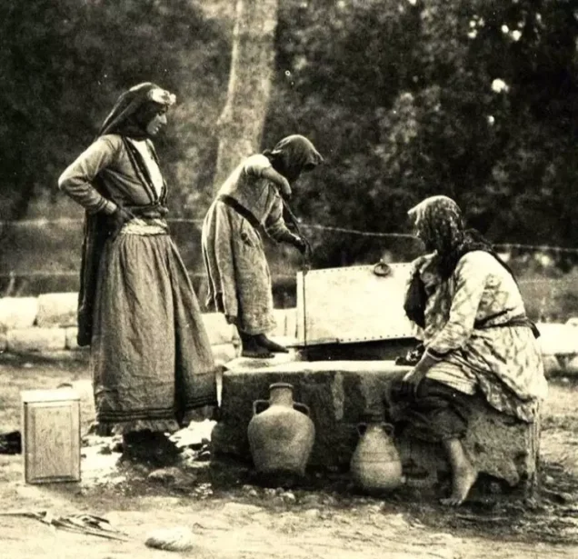
Agriculture formed the foundation of al-Tira's economy. The principal crops included cereals, vegetables, fruit, olives, and almonds, while some inhabitants also raised poultry.
In 1943, al-Tira led the villages of the Haifa District in olive and olive-oil production and contained three mechanized olive presses.
The abundance of almond trees also gave rise to the name Tirat al-Lawz, or “Tira of the Almonds.”
Education in al-Tira
Al-Tira had two elementary schools, one for boys and another for girls. Palestinian local documentation describes the boys' school as a complete elementary school reaching the seventh grade, while the girls' school taught through the fourth elementary grade.
Oral-history documentation states that the boys' school building was erected in 1931 and the girls' school in 1934. Pupils wishing to pursue secondary education continued their studies in Haifa, Nablus, or Jerusalem, while some villagers later attended universities in Egypt.
Local Palestinian sources estimate that the girls' school had approximately 200 pupils shortly before the Nakba. This is a local historical figure rather than an official Government of Palestine statistical total.
Archaeological Sites in al-Tira
The lands of al-Tira contained five archaeological khirbas indicating a long history of settlement. The best documented was Khirbat al-Dayr, which contained remains associated with the monastery of St. Brocardus, formerly inhabited caves, and a vaulted stone tunnel.
Palestinian local sources also identify Khirbat al-Kanisa, Khirbat 'Ayn Umm al-Faraj, Khirbat Ra's Mithiliyya and Khan Mithiliyya, and Khirbat Kafr Samir among sites in the village lands.
An exposed archaeological site south of the village dated to the Mesolithic period and was later excavated.
The Irgun Attack of December 1947
On 12 December 1947, the Irgun attacked al-Tira with grenades and gunfire as part of a series of attacks carried out in different parts of Palestine.
According to Walid Khalidi and PalQuest, citing the History of the Haganah and contemporary reports in the Palestinian newspaper Filastin and The New York Times, approximately twenty attackers approached a house on the edge of the village, threw grenades, and fired on nearby houses before withdrawing through the olive groves.
The sources differ over the casualty toll. Khalidi's al-Tira entry gives 13 killed and 10 wounded, while a Palestinian study by historian Mustafa Kabha gives 12 killed and 6 wounded, most of them members of the Hujayr family. Some Palestinian oral accounts give a figure of 17 dead from the same family.
Because these accounts differ, the figure of 17 should not be treated as an uncontested casualty total.
Attacks in February and April 1948
Attacks on al-Tira continued during the following months. On 5 February 1948, an assault lasting approximately ninety minutes was reported, with a contemporary British communiqué recording no casualties.
On the morning of 22 April, a major attack coincided with the Haganah offensive against Haifa. One apparent objective was to prevent Arab reinforcements from reaching the city.
At approximately 1:40 a.m. on 25 April, another attempt was made to capture al-Tira using mortars and machine guns. Fighting stopped after a British unit intervened, then resumed the following morning after the British withdrew.
During this period, British forces assisted in evacuating some women and children. On 5 May, approximately 600 additional people were transferred to the Jenin and Nablus areas, according to the account cited by Khalidi.
The Failed Alexandroni Attack of 13 May 1948
Despite repeated assaults, al-Tira remained outside Zionist control. On 13 May 1948, the Alexandroni Brigade launched another attempt to capture the village but failed.
Walid Khalidi, citing the History of the Haganah, states that a major reason for the failure was inadequate intelligence about the village's defensive system.
Al-Tira consequently remained in Palestinian hands for more than two months after the fall of Haifa.
The Occupation of al-Tira on 16 July 1948
Al-Tira was finally captured on 16 July 1948 during the “Ten Days” of fighting between the First and Second Truces.
The attack formed part of a limited offensive that also resulted in the capture of Kafr Lam and al-Sarafand, and possibly 'Ayn Hawd. It was notable for the use of naval fire to support the ground assault, among the earliest such combined operations against Palestinian villages in the area.
Before the ground forces advanced, the warship Eilat shelled al-Tira, while naval vessels also participated in the broader attack on nearby villages.
Palestine Remembered identifies the attacking force at al-Tira as a special formation drawn from the Israeli Navy and the Golani, Carmeli, and Alexandroni Brigades. Khalidi and PalQuest confirm the combined naval and land assault without presenting the same detailed brigade list in the village entry.
Was al-Tira Captured During Operation Shoter?
No. The capture of al-Tira should not be classified as part of Operation Shoter, also known as Operation Policeman.
Al-Tira was captured on 16 July 1948. Operation Shoter began on 24 July, after the Second Truce had begun, and primarily targeted the “Little Triangle” villages of Ijzim, Jaba', and 'Ayn Ghazal.
The principal Palestinian sources used here therefore do not give a separate formal operation name for the final attack on al-Tira. Instead, they describe it as a limited combined land-and-naval assault during the Ten Days between the two truces that also resulted in the capture of Kafr Lam and al-Sarafand.
The Displacement of al-Tira's Inhabitants
Many women and children had already left or been evacuated during the April and May attacks, while village defenders and other inhabitants remained until the final assault in July.
Following the occupation, most of those who remained were expelled toward the Jenin–Nablus–Tulkarm triangle, while others were detained in prisoner-of-war camps.
Palestinian oral testimonies also document arrests and forced transfers and contain accounts of the killing of some elderly villagers after the occupation. Because the testimonies differ in numbers and details, they are treated here as local oral evidence rather than as a single conclusively established casualty total.
Occupation and Depopulation Chronology
- 12 December 1947
Irgun raid on the village
The Irgun carried out a bombing raid on the village on the Jewish holiday of Chanukka, in conjunction with six other attacks across the country: a party of around 20 men approached a secluded house at the edge of the village and firebombed it, then shot at houses and fled through the olive groves, and the Palestinian daily Filastin listed children and elderly people among the casualties. The History of the Haganah gives 13 villagers killed and the New York Times added 10 wounded and one house destroyed, while PalQuest's entry on the Nakba gives 12 killed and 6 injured.
- 5 February 1948
Attack on the village
The village was attacked without casualties, according to a British communiqué, which added that there was no response from the village.
- 22 April 1948
Major attack on the village
A major attack was made on al-Tira in the early morning in conjunction with the Haganah's offensive against Haifa, ostensibly aimed at preventing Arab reinforcements from reaching the city.
- 25–26 April 1948
First attempt to capture the village and its shelling
The village was attacked at 1:40 a.m. on 25 April with mortars and machine guns until a British unit arrived and helped to evacuate some of the women and children; the Haganah resumed the attack early the next morning until another British unit arrived and arranged a further evacuation, according to Morris as cited by Khalidi. The New York Times reported that the village had been 'severely mortared'.
- 5 May 1948
Further evacuation of inhabitants
In a third effort to lead more of the inhabitants to safety, some 600 people were taken to Jenin and Nablus, according to Morris as cited by Khalidi.
- 13 May 1948
Failed attack to capture the village
The Haganah's Alexandroni Brigade launched an unsuccessful strike on the village; the History of the Haganah attributes the failure to the lack of 'detailed information about the enemy's system of defense in the village'. This failure led to the cancellation of the occupation of Qalqilya set out in Plan Dalet.
- June 1948
Settlement on village lands
Zionists established the settlement of ha-Chotrim just south of the village site, before the village fell.
- 16 July 1948
Final occupation
The village fell during the Ten Days of battles between the two truces, according to the History of the Haganah as cited by Khalidi, after the warship Eilat bombarded it before land units moved in. The attack was part of a wider naval operation that captured Kafr Lam and al-Sarafand at the same time, and it was the first time that naval firepower was called in to aid land forces.
- July 1948 (after the occupation)
Expulsion of the remaining inhabitants
Most of the remaining villagers, who had held out under siege for over two months, were expelled to the Jenin–Nablus–Tulkarm triangle or incarcerated in prisoner-of-war camps, according to Morris as cited by Khalidi.
- Late July 1948
Fate of al-Tira refugees in 'Ayn Ghazal (disputed account)
Some villagers apparently sought refuge in neighbouring 'Ayn Ghazal, and the Secretary General of the Arab League reported that 28 refugees from al-Tira were burned alive there in late July. UN mediator Count Folke Bernadotte, however, stated that a UN observer visited the area on 28 July and found 'no evidence to support claims of a massacre', and Morris cites an Israeli claim that the charred bodies were corpses found in an advanced state of decomposition and burned by Israeli troops, adding that there was no indication of where they had come from or how the victims had died.
- 1949
Settlements on village lands
Tirat Karmel was built on the village site, and Megadim farther away on village land.
- 1952 and 1953
Settlements on village lands
Kefar Gallim was built on village land in 1952, and Beyt Tzvi was added in 1953.
Settlements and Institutions Established on the Lands of al-Tira
Several Israeli settlements and institutions were established on the site and lands of al-Tira:
- Ha-Hotrim: established in June 1948 south of the village site.
- Tirat Carmel: established in 1949 on the site of the Palestinian village itself.
- Megadim: established in 1949 on al-Tira's lands, some distance from the original village site.
- Kfar Galim: established in 1952 on village land.
- Beit Tzvi: added in 1953 on the lands of al-Tira.
The Site of al-Tira After the Nakba
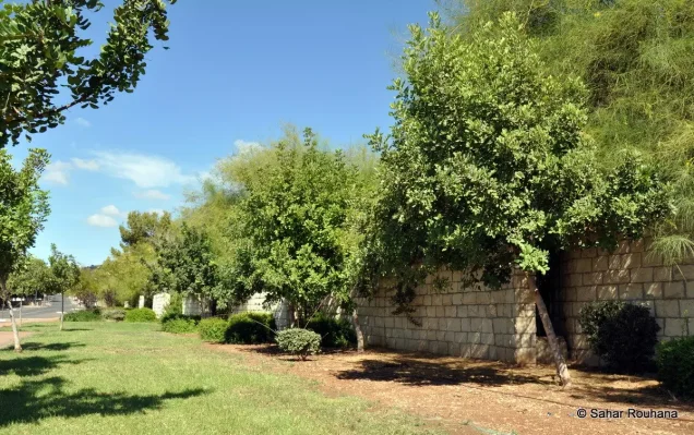
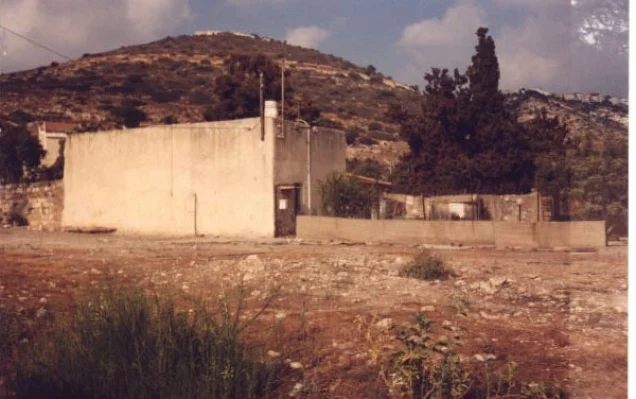
According to Walid Khalidi's field description, Tirat Carmel occupies part of the former village site. Several Palestinian houses remained standing, including the house of 'Irsan al-Dhib.
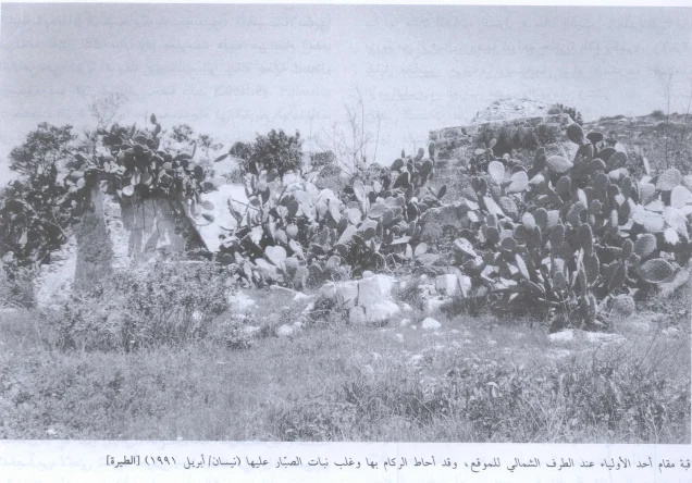
Remains of two shrines were also visible, while the village cemetery had fallen into serious neglect and many stone grave markers had been broken. At the time of Khalidi's field survey, the former school building was being used by Israeli pupils, both Arab and Jewish.
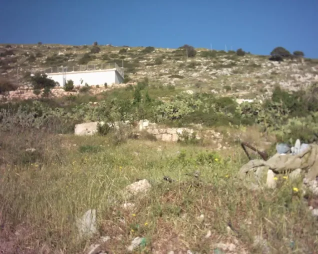
Woodland and housing spread over the mountainous portion of the village lands, while the coastal plain was used for agriculture.
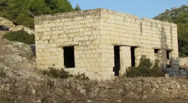
Later Palestinian oral-history documentation records the continued survival of a small number of historical structures, including sections of the school buildings and several houses. These descriptions date from different periods and should not necessarily be treated as an updated field survey of the site today.
Sources
- PalQuestPalQuest – Interactive Encyclopedia of the Palestine Question: al-Tira, Haifa
- Institute for Palestine StudiesInstitute for Palestine Studies: Walid Khalidi, All That Remains
- Palestine RememberedPalestine Remembered: al-Tira – Haifa District
- PalQuestPalQuest: Ijzim – Operation Shoter and the Little Triangle
- PalQuestPalQuest: Kafr Lam – the 15–16 July 1948 land-and-naval assault
- badil.orgBADIL: The Story of Tirat Haifa – Palestinian Oral History
- palestinapedia.psPalestinian Encyclopedia: al-Tira – Population, Agriculture, and Education
Photo gallery







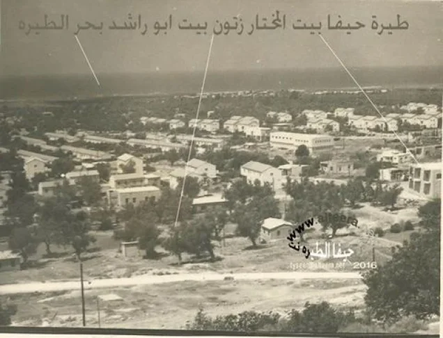
Photos from the village's people
Photos sent in by visitors and published after review.
Add a photo of this village
Log in to add photos of this village.
Other villages from Haifa
More from the archive



 Download Our Palestine App
The whole archive in the palm of your hand: depopulated villages, the Nakba, the massacres and Al-Aqsa — free, with no ads to erase the story.
Download Our Palestine App
The whole archive in the palm of your hand: depopulated villages, the Nakba, the massacres and Al-Aqsa — free, with no ads to erase the story.



Comments
No comments yet — be the first to write one.
Add your comment
Name and email are optional. Comments appear after review.