
The depopulated village of Umm al-Zinat / District of Haifa
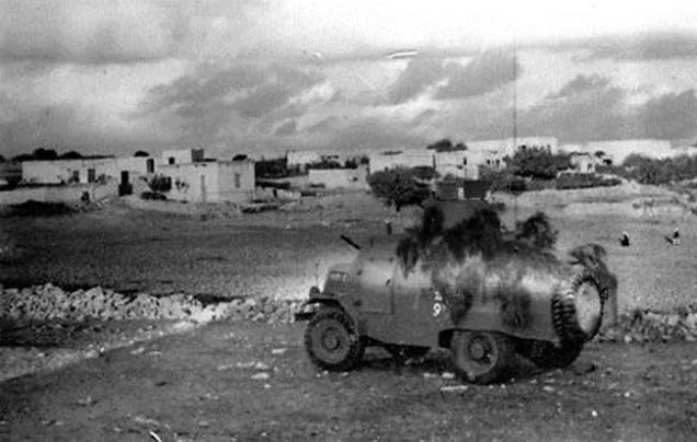
Umm al-Zinat
About the depopulated village of Umm al-Zinat
- District
- Haifa
- Date Umm al-Zinat was occupied
- 15 May 1948
- Population in 1948
- 1,705
- Military operation
- Operation Bi'ur Hametz (22–24 April 1948), according to PalQuest, although the village was occupied on 15 May 1948
- Brigade that carried it out
- Golani Brigade
- Distance from the governorate centre
- 20.5 km southeast of Haifa
- Elevation above sea level
- 325 m
- Cause of displacement
- Military occupation of the village by Israeli occupation forces; the available sources do not describe how its inhabitants left
- Extent of destruction
- The village has been completely destroyed, and only house rubble left behind.
- Ethnic cleansing
- Umm al-Zinat inhabitants were completely ethnically cleansed.
- Settlements built on the built-up area of Umm al-Zinat after 1948
- Elyaqim, established in 1949 on the southern side of the village site
Hover a dot to read the village name, or click to open its card.
Borders of the depopulated village of Umm al-Zinat
Umm al-Zinat: A Depopulated Palestinian Village in the Haifa District
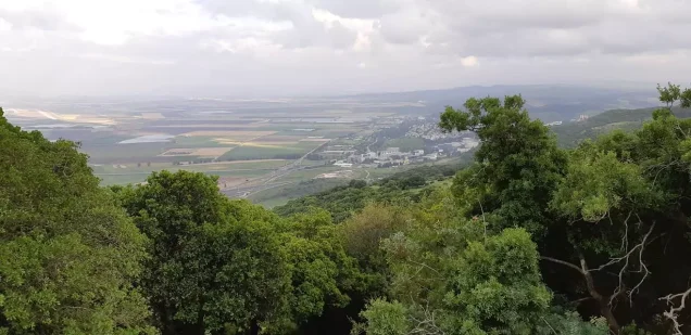
Umm al-Zinat was a Palestinian village in the Haifa District, situated on a rocky cliff in the southeastern part of Mount Carmel, approximately 20.5 kilometres southeast of the city of Haifa, at an average elevation of about 325 metres above sea level. The Fourth Battalion of the Golani Brigade occupied the village on 15 May 1948, and its inhabitants were displaced during the Nakba and the occupation of Palestine in 1948.
- Subdistrict
- Haifa
- Distance from district center
- 20.5 km southeast of Haifa
- Average Elevation
- 325 m above sea level
- Population in 1931
- 1,029
- Number of Houses in 1931
- 209
- Population in 1944/1945
- 1,470 – 1,450 Muslims and 20 Christians
- Estimated Population in 1948
- About 1,705 – a later demographic estimate, not an official census
- Total Land Area in 1945
- 22,156 dunams
- Attack and Depopulation
- On the night of 19–20 January 1948 the village was raided by a Zionist unit of ten militiamen dressed in British army uniforms; the raid was driven back, according to the newspaper Filastin. The Golani Brigade's Fourth Battalion then occupied the village on 15 May 1948, according to the History of the War of Independence as cited by Khalidi; the available sources do not describe how its inhabitants left.
- Final Israeli Control
- 15 May 1948, according to the History of the War of Independence as cited by Khalidi
- Military Operation
- Operation Bi'ur Hametz – PalQuest lists Umm al-Zinat among the villages affected by this operation (22–24 April 1948), but the village was occupied on 15 May 1948, and the available sources name no other operation for its occupation
- Military Unit
- The Golani Brigade's Fourth Battalion, according to the History of the War of Independence as cited by Khalidi
- Cause of Depopulation
- Military occupation of the village by Israeli occupation forces; the available sources do not describe how its inhabitants left
- Settlements Documented on Village Lands
- Elyaqim, established in 1949 on the southern side of the village site
Location
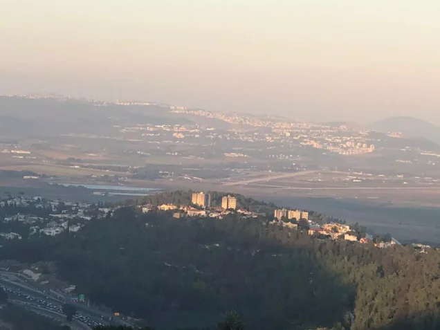
Umm al-Zinat stood on a rocky cliff in the southeastern part of Mount Carmel overlooking Bilad al-Rawha'.
The village had an average elevation of approximately 325 metres above sea level and lay about 20.5 kilometres southeast of Haifa.
A secondary road connected it with both the coastal highway and the Haifa–Jenin road, giving the village an important position along inland routes leading toward Haifa.
Architecture
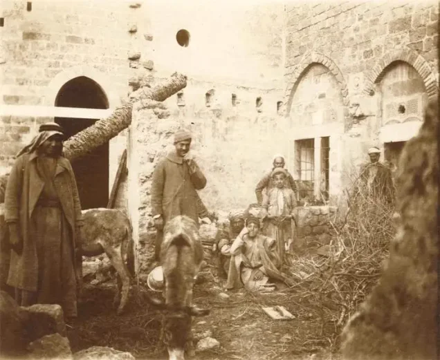
In the late nineteenth century, Umm al-Zinat was described as a stone-built village situated on a saddle-shaped hill, with approximately 350 inhabitants at the time.
During the British Mandate, it became one of the ten largest villages in the Haifa subdistrict in terms of both population and land area.
The village layout resembled a tennis racquet, with a narrow extension running toward the northeast, while its stone houses were clustered closely together.
The built-up area amounted to approximately 69 dunams in the 1944/1945 statistics.
Population
The official 1922 Census of Palestine recorded 787 inhabitants in Umm al-Zinat.
In the 1931 census, the population reached 1,029, living in 209 houses.
According to the 1944/1945 statistics, the population was 1,470, including 1,450 Muslims and 20 Christians.
The estimate of approximately 1,705 inhabitants for 1948 and 10,472 refugees and descendants in 1998, published by Palestine Remembered, are later estimates rather than official British Mandate censuses.
Population of Umm al-Zinat
- Late nineteenth centuryAbout 350Historical estimate
- 1922787Official census
- 19311,029Official census
- 1944/19451,470Government of Palestine statistics: 1,450 Muslims and 20 Christians
- 1948About 1,705Later estimate
- 199810,472Estimate of refugees and their descendants
Number of Houses
The 1931 census recorded 209 houses in Umm al-Zinat.
The figure of approximately 346 houses for 1948 found in later tables is an estimate rather than an official Government of Palestine count.
Education
A boys' elementary school was established in Umm al-Zinat around 1888 during the Ottoman period.
Local accounts provide additional details concerning seventh-grade education, the school's location in the area known as 'Arus al-Bayadir, and the subjects taught there. These details do not appear in the same form in the principal Walid Khalidi and PalQuest account and are therefore not presented here as fixed official statistics.
Land of Umm al-Zinat
According to the 1944/1945 statistics, Umm al-Zinat had a total land area of 22,156 dunams.
Arab ownership amounted to 18,684 dunams, Jewish ownership to 51 dunams, while 3,421 dunams were classified as public land.
Land Ownership in Umm al-Zinat in 1944/1945
- Arab ownership18,684 dunums84%
- Jewish ownership51 dunums<1%
- Public land3,421 dunums15%
Agriculture and Economic Life
The inhabitants of Umm al-Zinat depended on agriculture and the raising of livestock and poultry. They cultivated cereals, vegetables, and fruit trees and obtained domestic water from several wells.
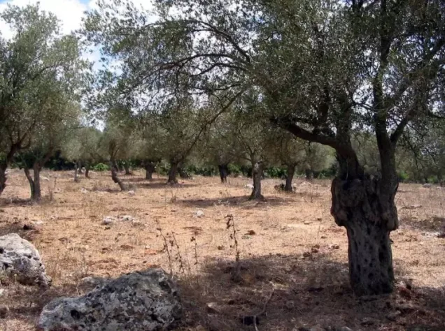
The village was particularly noted for olive cultivation. In 1943, approximately 1,834 dunams were planted with olive trees, which Walid Khalidi describes as the largest area devoted to olive trees in the Haifa subdistrict at the time.
Umm al-Zinat also had four manual olive presses.
According to the 1944/1945 statistics, cereal cultivation covered 9,920 dunams, including 9,879 Arab-owned dunams and 41 Jewish-owned dunams.
Irrigated and plantation land covered 1,742 dunams, all Arab-owned.
The 1,834 dunams planted with olives represent a crop category within the cultivated land and should not be added separately to the overall land-use totals.
Land Use in Umm al-Zinat in 1944/1945, in Dunams
- Arab
- Jewish
- Public
- Cereals9,920 dunums
- Irrigated and plantation land1,742 dunums
- Built-up area69 dunums
- Uncultivable land10,425 dunums
Archaeology
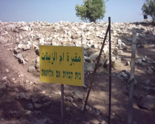
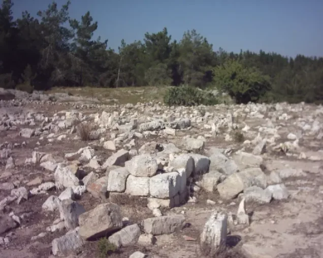
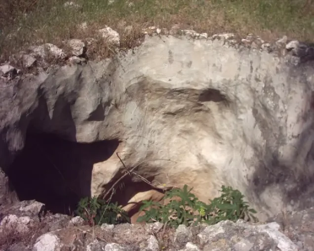
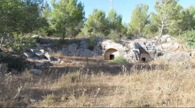
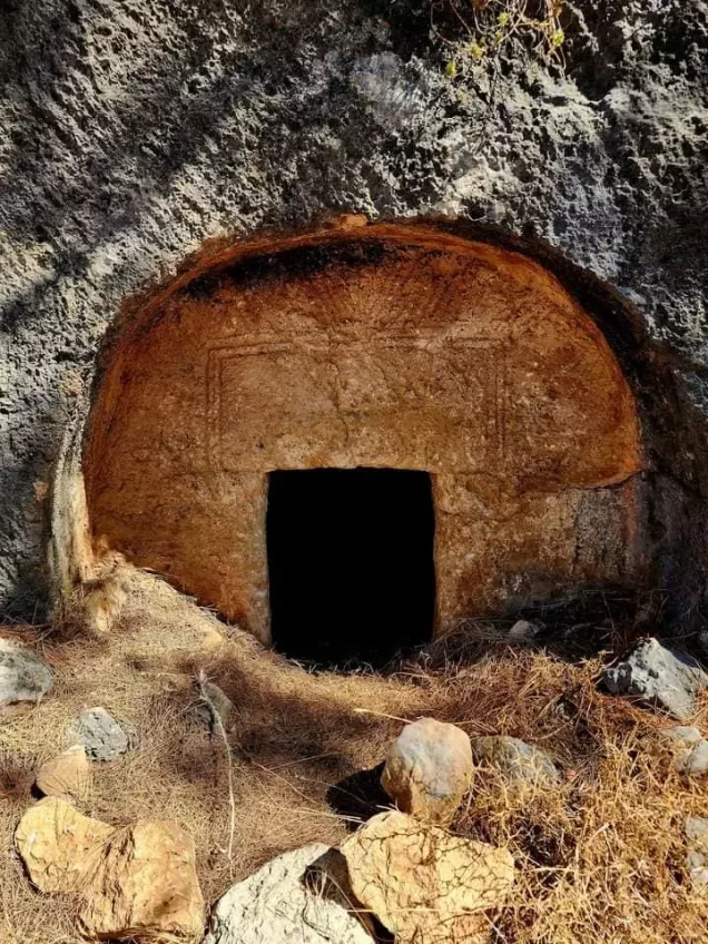
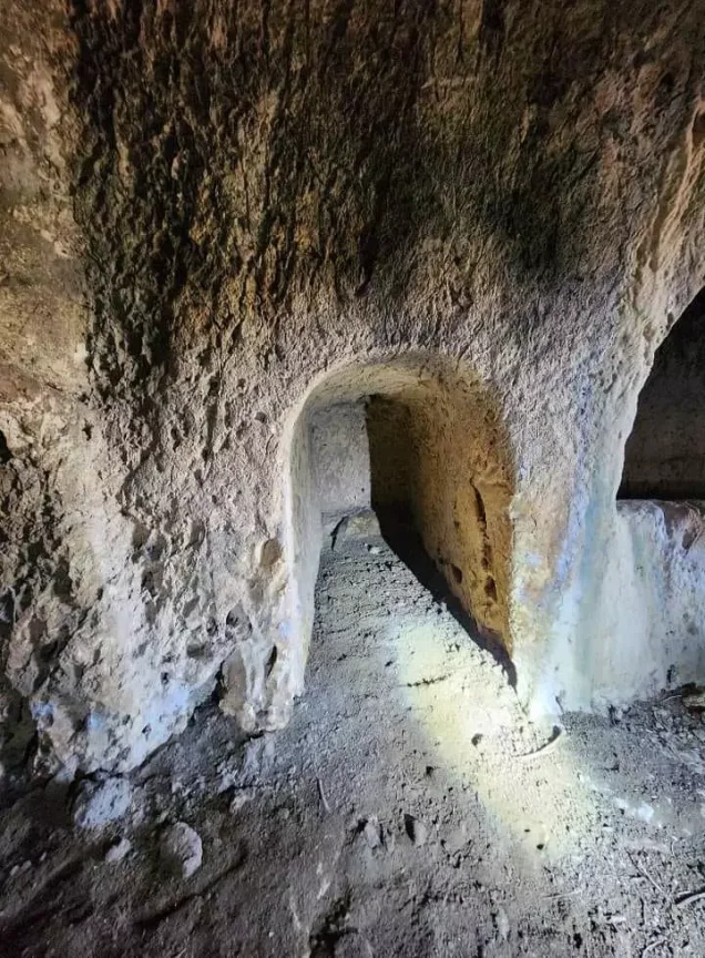
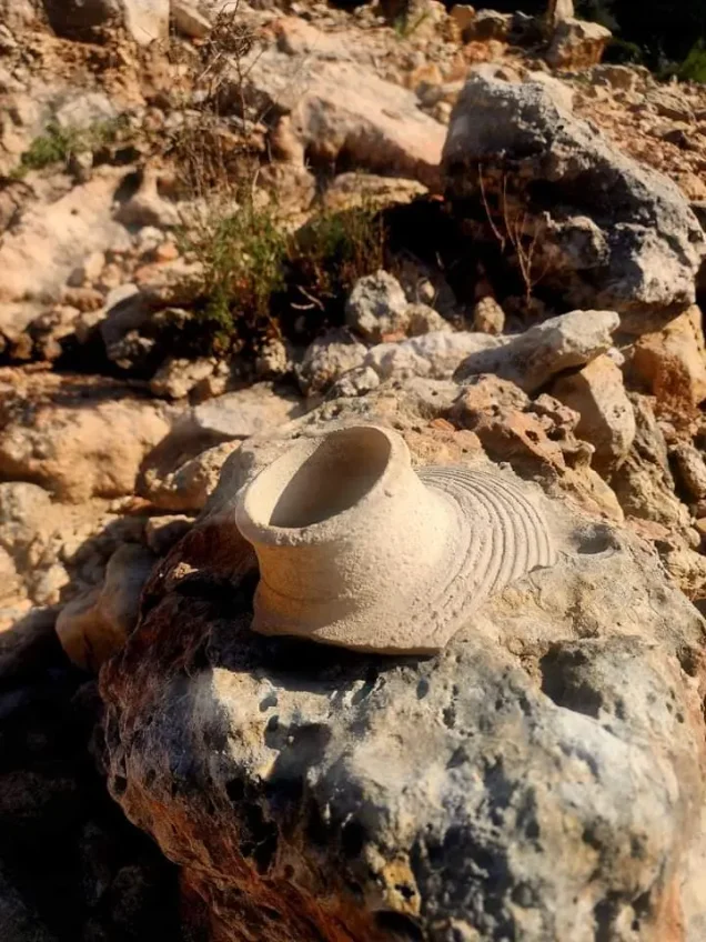
Umm al-Zinat contained archaeological remains indicating earlier settlement at the site, including building foundations, rock-cut tombs, and a stone sarcophagus in the eastern part of the village.
Khirbat al-Haramis lay approximately 1 kilometre south of the village and contained the ruins of an ancient settlement whose precise date is not established in the principal sources.
The Nakba and the Attacks on Umm al-Zinat
The January 1948 Raid
Umm al-Zinat was raided on the night of 19–20 January 1948 by a Zionist unit of approximately ten armed men wearing British military uniforms.
The Palestinian newspaper Filastin, as reproduced by Walid Khalidi and PalQuest, reported that the raid was repelled and did not mention casualties.
Operation Bi'ur Hametz
Following the fall of Haifa in April 1948, the Haganah carried out Operation Bi'ur Hametz between 22 and 24 April and occupied a number of villages and positions around Haifa.
Umm al-Zinat's final occupation occurred approximately three weeks after that operation had ended. It is therefore inaccurate to state that the village itself was captured directly during Operation Bi'ur Hametz.
The Occupation of Umm al-Zinat
The Fourth Battalion of the Golani Brigade occupied Umm al-Zinat on 15 May 1948.
Walid Khalidi and PalQuest transmit this information from the Israeli History of the War of Independence through the Palestinian source; this article does not rely directly on the original Israeli account.
The village stood along an inland route considered by the Haganah to be an alternative supply road to Haifa because the coastal road south of the city remained vulnerable to disruption by Palestinian resistance in the area known as the Little Triangle until late July.
The principal Palestinian sources reviewed do not identify a separate, conclusively documented named military operation for the final capture of Umm al-Zinat on 15 May.
Occupation and Depopulation Chronology
- 19–20 January 1948
First attack on the village
A Zionist unit of ten militiamen dressed in British army uniforms carried out a night raid on the village, a tactic commonly used to gain entry to Arab villages. The newspaper Filastin reported that the raid was driven back and did not mention any casualties.
- 22–24 April 1948
Beginning of the military operation
In the aftermath of the fall of Haifa, the Haganah carried out Operation Bi'ur Hametz, conducted mainly by Carmeli Brigade units, and occupied a number of villages in the surrounding area; PalQuest lists Umm al-Zinat among the villages affected by the operation. Umm al-Zinat itself was occupied on 15 May 1948.
- 15 May 1948
Final occupation
The Golani Brigade's Fourth Battalion occupied Umm al-Zinat, according to the History of the War of Independence as cited by Khalidi; the village lay on what the Haganah considered its 'alternate supply route' to Haifa. The New York Times reported on the same day, citing Haganah sources, that these forces had taken 'several' Arab villages on the slopes of Mount Carmel and near Afula.
- 1949
Settlement on village lands
Zionists established the settlement of Elyaqim on the southern side of the village site.
Displacement and Destruction
The occupation of Umm al-Zinat resulted in the displacement of most of its Palestinian inhabitants, who were not permitted to re-establish their village community.
Palestinian local sources state that several families remained on the outskirts of the village and in its surrounding groves after the occupation and that military forces expelled them on 8 August 1948, after which the village buildings were demolished the following day.
These specific dates of 8 and 9 August do not appear in the principal Walid Khalidi and PalQuest account and are therefore presented as a Palestinian local-source account rather than as a chronology agreed upon by all sources.
Israeli Settlement on the Lands of Umm al-Zinat
Elyaqim
The settlement of Elyaqim was established in 1949 on the southern side of the Umm al-Zinat village site and on its lands.
- 1949Elyaqim
Established on the southern side of the village site and on Umm al-Zinat's lands
The Site of Umm al-Zinat After the Nakba
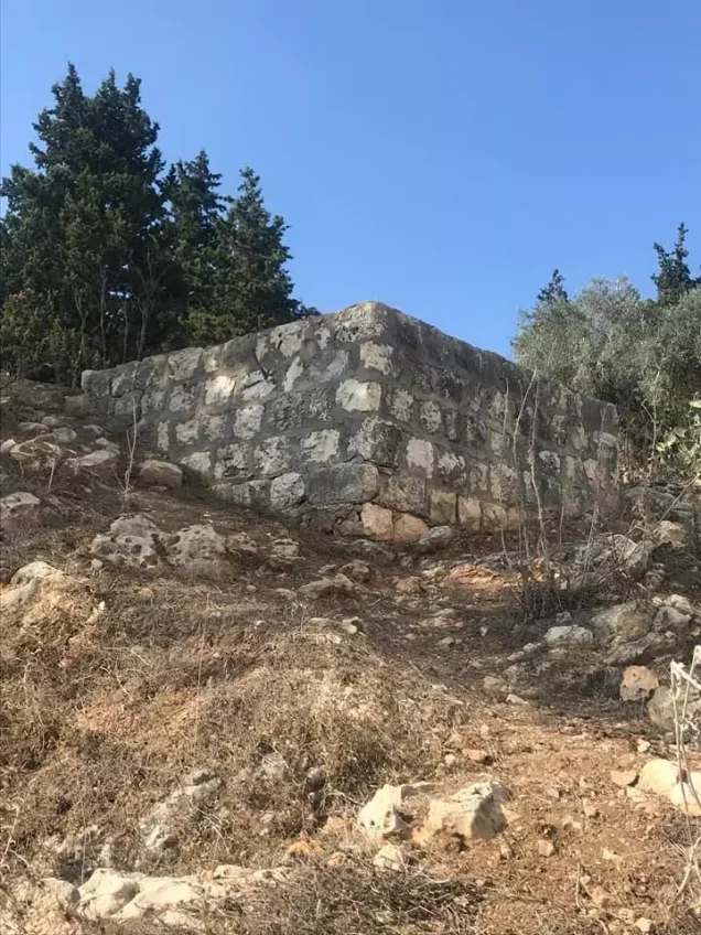
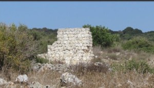
According to the field documentation relied upon by Walid Khalidi, the village houses were reduced to rubble scattered throughout the site.
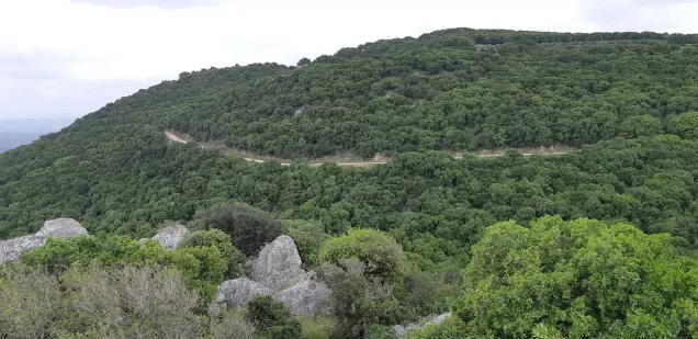
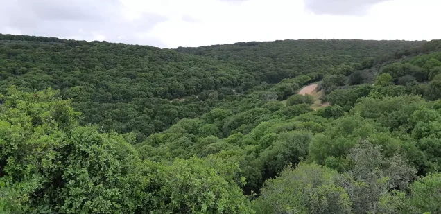
Thorns, shrubs, cactus plants, fig trees, and pomegranate trees covered the area, while a small forest grew over part of the site.
The village cemetery remained visible. Parts of the surrounding land were used as cattle pasture, while other areas were planted with fruit and olive trees.
This description reflects the condition of the site during the field documentation relied upon by Walid Khalidi and should not necessarily be interpreted as a comprehensive survey updated to 2026.
Sources
- PalQuest – Interactive Encyclopedia of the Palestine Question: Umm al-Zinat.
- PalQuest: Umm al-Zinat.
- PalQuest: Operation Bi'ur Hametz.
- Palestine Remembered: Umm al-Zinat, Haifa District.
- Walid Khalidi, All That Remains: Umm al-Zinat, as reproduced by Palestine Remembered.
- Land Research Center: Palestinian documentation concerning Umm al-Zinat and the later displacement.
- Walid Khalidi, All That Remains, entry on Umm al-Zinat.
- Government of Palestine, censuses of 1922 and 1931.
- Government of Palestine, Department of Statistics, Village Statistics, 1945.
Photo gallery



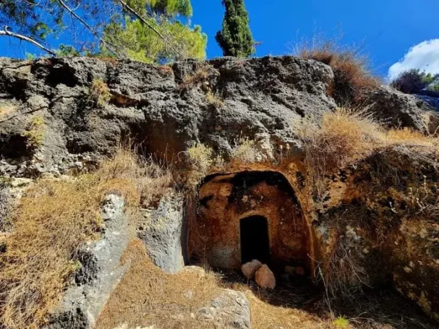
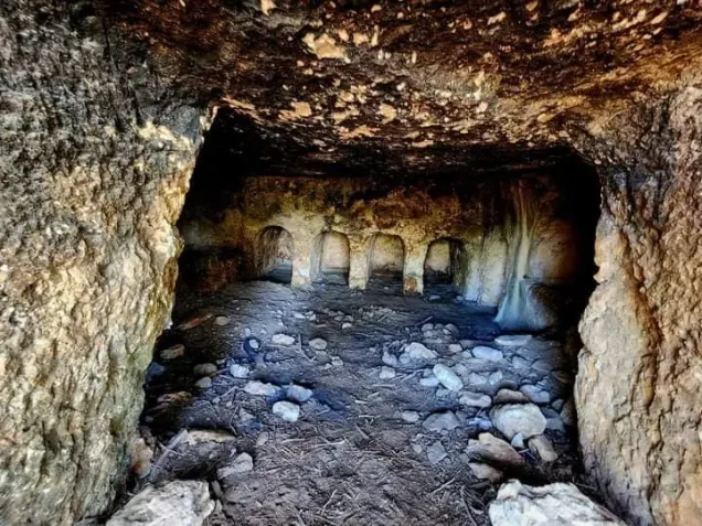
Photos from the village's people
Photos sent in by visitors and published after review.
Add a photo of this village
Log in to add photos of this village.
Other villages from Haifa
More from the archive



 Download Our Palestine App
The whole archive in the palm of your hand: depopulated villages, the Nakba, the massacres and Al-Aqsa — free, with no ads to erase the story.
Download Our Palestine App
The whole archive in the palm of your hand: depopulated villages, the Nakba, the massacres and Al-Aqsa — free, with no ads to erase the story.



Comments
No comments yet — be the first to write one.
Add your comment
Name and email are optional. Comments appear after review.