
The depopulated village of Kabara / District of Haifa
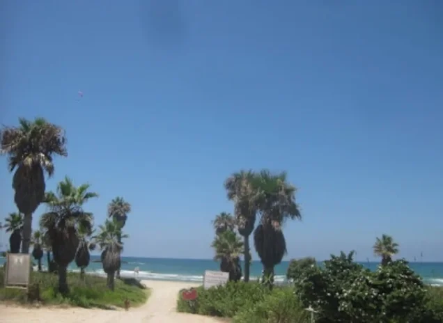
About the depopulated village of Kabara
- District
- Haifa
- Date Kabara was occupied
- 30 April 1948
- Population in 1948
- 140
- Military operation
- Coastal Clearing
- Distance from the governorate centre
- 30 (km) South East of Haifa
- Elevation above sea level
- 25 m
- Cause of displacement
- Expulsion by Zionist troops
- Extent of destruction
- The village has been completely destroyed, and only house rubble left behind.
- Ethnic cleansing
- Kabara inhabitants were completely ethnically cleansed.
Hover a dot to read the village name, or click to open its card.
Borders of the depopulated village of Kabara
Kabara – Depopulated Palestinian Village of the Haifa Subdistrict
Kabara was a depopulated Palestinian village in the Haifa Subdistrict, located approximately 30 kilometers southeast of Haifa. It stood on the coastal plain at the foot of the western slopes of Mount Carmel, at an average elevation of about 25 meters above sea level.
The village lay immediately east of the main coastal highway, close to the al-Zarqa River. Agriculture and animal husbandry formed the main basis of the local economy. The surrounding area also contained important natural and archaeological sites, most notably Mugharat al-Kabara on the slopes of Mount Carmel east of the village.
- District
- Haifa
- Distance from Haifa
- Approximately 30 km southeast of Haifa
- Elevation
- Approximately 25 m above sea level
- Natural Setting
- On the coastal plain at the foot of the western slopes of Mount Carmel, east of the coastal highway and near the al-Zarqa River
- Population in 1944/1945
- 120 inhabitants
- Estimated Population in 1948
- 139 inhabitants – a later estimate published by Palestine Remembered, not an official census
- Occupation and Depopulation Period
- Exact date unknown; Khalidi suggests April or the first half of May 1948, while allowing for the possibility that the village remained until late May
- Military Context
- The second campaign against Palestinian communities in the northern coastal plain; Palestine Remembered displays 30 April as an estimated date
- Military Unit
- Not documented at village level; the principal source does not identify a specific brigade or battalion that entered Kabara
- Total Land Area
- 9,831 dunums
- Settlements Established on Village Lands
- Ma'yan Tzevi (1938), Ma'agan Mikha'el (1949), and Beyt Hananya (1950)
The Name Kabara
Walid Khalidi suggests that the name Kabara was probably derived from the plural of kubri, a loanword related to the Turkish köprü, meaning “bridge,” referring to the numerous bridges built across the nearby al-Zarqa River.
Some researchers have also identified Kabara with the Crusader locality known as Pain Perdu. This identification is best treated as a historical interpretation rather than an archaeologically conclusive fact.
Location and Geography
Kabara stood on Palestine's coastal plain at the foot of Mount Carmel's western slopes, immediately east of the main coastal highway. The al-Zarqa River passed nearby and was associated with the interpretation of the village's name.
The village itself stood at a relatively low elevation of approximately 25 meters above sea level, while the slopes of Mount Carmel rose to its east.
Population of Kabara
Kabara's population figures require careful interpretation because the 1931 census combined the village with Jisr al-Zarqa, whereas the 1944/45 statistics again provide an independent figure for Kabara.
- 192273 Palestinian Muslims; 90 total in the Kabara census entry when 17 Jewish residents are includedOfficial Census of Palestine, 1922
- 1931572Official census figure combining Kabara and Jisr al-Zarqa; Kabara's population cannot be separated from the total
- 1944/1945120Official independent figure for Kabara; the population is classified as Arab
- 1948139Later estimate published by Palestine Remembered; not an official census
- 1998855 refugeesLater estimate of refugees and descendants; not an official census
Number of Houses
The official 1931 census recorded 117 occupied houses, but this figure covers Kabara and Jisr al-Zarqa together and should not be treated as the number of houses in Kabara alone.
Palestine Remembered also displays 117 houses for 1948. Because this is identical to the combined 1931 figure and is not independently documented as a Kabara-only estimate, it is not adopted here as a reliable 1948 housing figure.
Land Ownership in Kabara
The total land area of Kabara amounted to 9,831 dunums in the 1944/45 statistics. Palestine Remembered presents the simplified ownership categories as follows:
- Palestinian1,070 dunums11%
- Transferred to Zionists3,487 dunums35%
- Communal/Public5,274 dunums54%
The official 1944/45 Village Statistics use the categories Arab, Jewish, and Public: 1,070 Arab dunums, 3,487 Jewish dunums, and 5,274 public dunums, totaling 9,831 dunums.
Land Use in 1944/1945
- Arab
- Jewish
- Public
- Citrus and Bananas2 dunums
- Plantations and Irrigable Land20 dunums
- Cereals7,375 dunums
- Non-Cultivable Land2,434 dunums
Cultivated or cultivable land amounted to 7,397 dunums, approximately 75 percent of the total statistical land area, while 2,434 dunums, or about 25 percent, were classified as non-cultivable.
The simplified Palestine Remembered land-use table requires correction before reuse. It combines 3,309 public dunums of cereal land with the Arab category, producing 4,310 rather than the official Arab figure of 1,001. It similarly combines 1,965 public non-cultivable dunums with 47 Arab dunums, producing 2,012. This article therefore preserves the official Arab / Jewish / Public classification.
Economic Life in Kabara
The villagers depended on agriculture and animal husbandry. In 1944/45, 1,001 dunums of Arab-classified land were devoted to cereals, 20 dunums to plantations or irrigable cultivation, and 2 dunums to citrus and bananas.
Cereal cultivation therefore occupied by far the largest agricultural area within the Arab-classified land, while animal husbandry formed another principal component of the village economy.
Water and the Al-Zarqa River
Kabara's geographical setting was closely associated with the nearby al-Zarqa River. The bridges across the river are thought to have influenced the village's name.
The principal sources used here do not provide sufficiently detailed village-specific figures for wells or irrigation-water distribution, so no unsupported description of individual water sources is added.
Education and Religious Life
The principal sources reviewed for this article do not provide sufficiently documented information about an independent school in Kabara, its establishment date, or enrollment. They likewise do not provide a separately documented description of a village mosque. No unsupported details are therefore added merely to fill these sections.
Mugharat al-Kabara and Archaeology
Mugharat al-Kabara lies east of the village site on the slopes of Mount Carmel. It is an important prehistoric site that was discovered in 1929 and subsequently excavated by several archaeological teams.
According to Khalidi's account, the cave contained a deep Middle Palaeolithic deposit overlain by a Natufian layer. The English PalQuest entry dates the Natufian layer to approximately the ninth millennium BCE.
The Arabic PalQuest entry instead says “the ninth century BCE,” which does not match its English counterpart. This article follows the English version and uses “the ninth millennium BCE.”
Occupation and Depopulation of Kabara
Walid Khalidi does not provide an exact date or a detailed confirmed account of the occupation of Kabara. He explicitly states that no information could be found concerning the precise circumstances in which the village was occupied and then offers a chronology based on the wider military context.
Khalidi suggests that Kabara was probably occupied during what he describes as the second campaign to remove Palestinian communities from the northern coastal plain between Tel Aviv and Zikhron Ya'aqov south of Haifa. On that basis, he places its probable capture either in April or during the first half of May 1948.
He nevertheless leaves open the possibility that Kabara remained until late May, as did nearby al-Tantura.
Palestine Remembered displays 30 April 1948 as the occupation date, describes the operation as a possible “Coastal Clearing Operation,” and classifies the cause of departure as expulsion. Because these details are more definite than Khalidi's underlying historical account, they are presented here as database attributions rather than established village-level facts.
Occupation Chronology
- Spring 1948
Wider Military Campaign
Khalidi places Kabara within the second campaign against Palestinian communities in the northern coastal plain.
- April – first half of May 1948
Probable Occupation Period
This is the period Khalidi considers the most likely for Kabara's occupation based on developments in the surrounding area.
- 30 April 1948
Database Date
Palestine Remembered gives this specific date, but Khalidi's detailed village account does not independently establish it as certain.
- Until late May 1948
Possible Later Survival
Khalidi allows for the possibility that Kabara remained until late May, like neighboring al-Tantura.
- After depopulation; precise date unknown
Destruction
The village buildings were subsequently destroyed, but the principal sources do not establish a separate precise demolition date.
Military Operation and Unit
Military Operation: The principal sources do not identify a separately named operation specific to Kabara. Khalidi associates its fate with the second campaign against Palestinian communities in the northern coastal plain during the spring of 1948.
Military Unit: Not reliably identified at village level. The Kabara entry does not specify a particular brigade or battalion as the force that entered the village, so no unit is assigned without independent evidence.
Cause of Depopulation
Palestine Remembered classifies the villagers' departure as expulsion by Zionist forces. Khalidi, however, states that detailed information on the actual occupation of Kabara could not be found and reconstructs only its probable military context.
Kabara's depopulation can therefore be placed within the military campaign affecting Palestinian communities along the coastal plain, while the exact mechanism and date of the villagers' departure remain insufficiently documented for a definitive conclusion.
Destruction of Kabara
Khalidi's later field documentation indicates that Kabara's houses had been destroyed and that rubble from the buildings had been moved uphill. The principal sources do not provide a precise date for the demolition itself.
Settlements on Kabara Village Lands
Ma'yan Tzevi was established in 1938 on Kabara village lands north of the village site, before the Nakba.
Following the village's depopulation, Ma'agan Mikha'el was established on Kabara lands in 1949, followed by Beyt Hananya in 1950.
Kabara Today
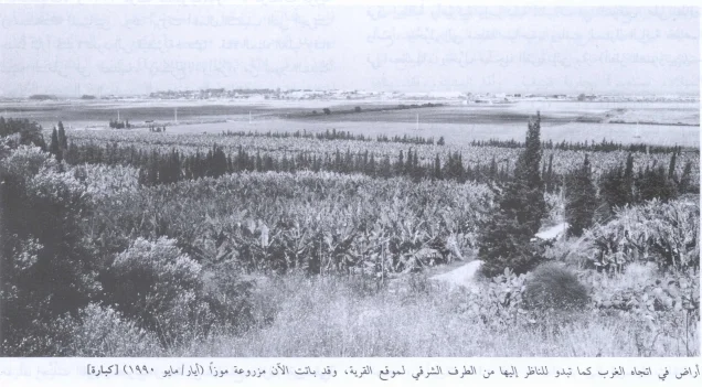
According to the field description documented by Walid Khalidi, rubble from Kabara's houses had been moved to a higher point on the slope, where it remained visible beneath a covering of soil.
Cactus and banana plants grew on the site, together with scattered fig, carob, and olive trees.
PalQuest publishes field documentation of the village site dated May 1990. This description therefore reflects documentation from the period preceding the publication of All That Remains in 1992 and should not be treated as a direct field verification of conditions in 2026.
Sources
- PalQuest – Interactive Encyclopedia of the Palestine Question: Kabara
- Palestine Remembered – Kabara, Haifa District
- Palestine Remembered – Historical account of Kabara from Walid Khalidi's All That Remains
- Government of Palestine – Census of Palestine, 1922
- Government of Palestine – Census of Palestine, 1931, E. Mills
- Village Statistics 1945 – Haifa Subdistrict population and land-ownership statistics, reproduced by Sami Hadawi
- Institute for Palestine Studies – Walid Khalidi, All That Remains
Photo gallery



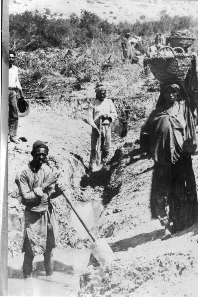

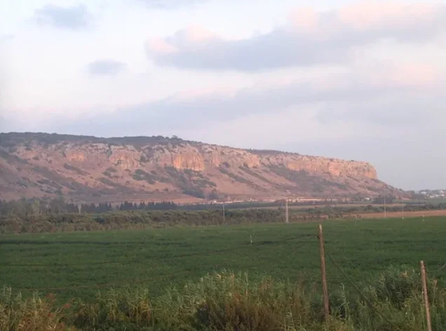
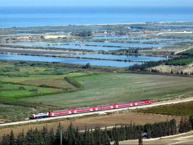
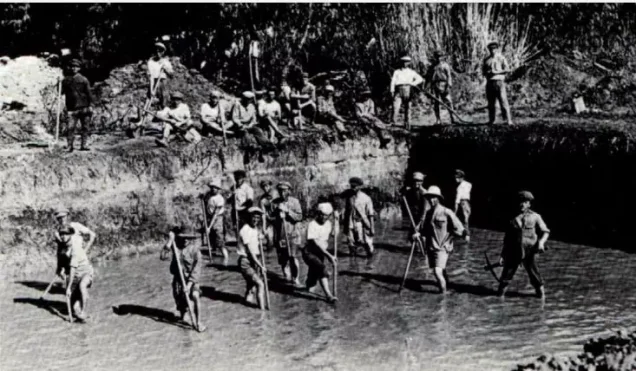
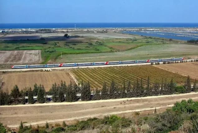
Photos from the village's people
Photos sent in by visitors and published after review.
Add a photo of this village
Log in to add photos of this village.
Other villages from Haifa
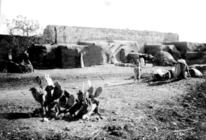

More from the archive


 Download Our Palestine App
The whole archive in the palm of your hand: depopulated villages, the Nakba, the massacres and Al-Aqsa — free, with no ads to erase the story.
Download Our Palestine App
The whole archive in the palm of your hand: depopulated villages, the Nakba, the massacres and Al-Aqsa — free, with no ads to erase the story.



Comments
No comments yet — be the first to write one.
Add your comment
Name and email are optional. Comments appear after review.