
The depopulated village of Khirbat Zakariyya / District of Ramla

Khirbat Zakariyya
About the depopulated village of Khirbat Zakariyya
- District
- Ramla
- Date Khirbat Zakariyya was occupied
- 13 July 1948
- Military operation
- Operation Dani
- Distance from the governorate centre
- 9 (km) East of al-Ramla
- Elevation above sea level
- 175 m
- Cause of displacement
- Military assault by Zionist troops
- Extent of destruction
- Khirbat Zakariyya was completely destroyed with the exception of its well.
- Ethnic cleansing
- Zakariyya, Khirbat inhabitants were completely ethnically cleansed.
Hover a dot to read the village name, or click to open its card.
Borders of the depopulated village of Khirbat Zakariyya
Khirbat Zakariyya – Depopulated Palestinian Village of the Ramla Subdistrict
Khirbat Zakariyya was a Palestinian village in the Ramla Subdistrict, approximately 9 kilometers east of Ramla. It stood on a westward-sloping hill at an average elevation of about 175 meters above sea level.
It must not be confused with the much larger village of Zakariyya in the Hebron Subdistrict. Khirbat Zakariyya of Ramla was a separate locality whose registered land area amounted to 4,538 dunums in the final Mandate years.
- Subdistrict
- Ramla
- Mandate District
- Lydda
- Distance from Ramla
- Approximately 9 km east
- Average Elevation
- Approximately 175 meters
- Total Land Area, 1944/45
- 4,538 dunums
- Population in 1931
- No independently verified village-specific figure established
- Population in 1945
- The population cells are blank in the official Village Statistics; the secondary figure of 510 is therefore not used as an official total
- Estimated Population in 1948
- No reliable independent estimate established; Abu Sitta's Register displays 0 in the population field, reflecting the absence of a separate figure rather than an uninhabited village
- Occupation / Depopulation Date
- Around 12 July 1948; sources vary within approximately 11–13 July
- Military Operation
- Operation Dani, around the transition between its first and second phases
- Military Unit
- No particular brigade or battalion is independently documented at village level
- Cause of Displacement
- Military assault in the context of Operation Dani and the fall of the Lydda–Ramla area
- Extent of Destruction
- Most of the village's built environment disappeared; stones, wells, and archaeological remains survived, but no reliable numerical destruction percentage is available
- Israeli Settlements on Village Land
- None documented; Mevo Modi'im lies northeast of the former village but outside its registered lands
Location
Khirbat Zakariyya stood on a hill sloping toward the west and overlooking a broad expanse toward the coastal plain.
Two wadis bordered the locality from the north and south and joined west of the village to form a shallow watercourse.
Secondary roads connected Khirbat Zakariyya with Lydda and Ramla, while dirt tracks linked it with surrounding Palestinian villages.
Built Environment
Most village houses were built of adobe brick.
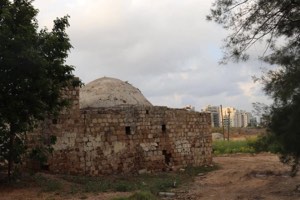
The site contained remains predating the modern village, including a vaulted structure, building foundations, rock-cut cisterns, and a press.
A maqam associated with Nabi or the pious figure Zakariyya stood south of the village center.
Population
Khirbat Zakariyya does not have the same independently documented population series available for many other villages of the Ramla Subdistrict.
Most importantly, the official 1945 Village Statistics list Khirbat Zakariya and its 4,538 dunums of land but leave the population columns blank.
The frequently repeated secondary figure of 510 inhabitants in 1945 is therefore not used here as an official Mandate figure because it does not appear in the table cited as its source.
| Year | Population | Qualification |
|---|---|---|
| 1931 | Not independently verified | No unsupported figure used |
| 1945 | Not listed | The official Village Statistics leave the population fields blank for Khirbat Zakariya |
| 1948 | Not established | Abu Sitta's Register displays 0 in the Population 48 field, reflecting unavailable independent demographic data rather than absence of inhabitants |
Land Ownership in 1944/1945
Khirbat Zakariyya's registered land area totaled 4,538 dunums.
The official Mandate categories were Arab, Jewish, and Public:
- Arab4,538 dunums100%
- Jewish0 dunums0%
- Public0 dunums0%
All registered village land was therefore classified as Arab-owned in the official table.
Land Use in 1944/1945
- Cereals2,161 dunums32%
- Total Cultivable Land2,161 dunums32%
- Non-Cultivable Land2,377 dunums35%
Cereal land accounted for approximately 48 percent of the total area, while approximately 52 percent was classified as non-cultivable.
Economic Life
The inhabitants depended on animal husbandry and rain-fed agriculture.
They cultivated cereals as well as fruit and vegetables. The official land-use statistics identify 2,161 dunums devoted to cereals in 1944/45.
Livestock raising formed another important part of the local economy.
Water
A spring at the northern edge of the village supplied water for domestic use.
The rock-cut cisterns and surviving wells also reflect the long history of local water collection and use.
Education and Services
The principal sources reviewed do not establish an independent school in Khirbat Zakariyya before the Nakba.
No school from a neighboring village is therefore reassigned to the locality without direct documentation.
Archaeological Remains and the Maqam
The village site contained several archaeological features, including:
- Remains of a vaulted structure.
- Foundations of older buildings.
- Rock-cut cisterns.
- A press.
- Wells and cut stone elements.
A maqam associated with Zakariyya stood south of the village center.
Operation Dani
Khirbat Zakariyya's depopulation was connected with Operation Dani, the major July 1948 offensive in the Lydda–Ramla region and the approaches to Jerusalem.
The operation ran from 9 to 18 July and consisted of two phases:
- First phase: 9–12 July, during which Lydda, Ramla, and surrounding localities were captured.
- Second phase: 13–18 July, when operations shifted eastward toward al-Latrun and the Ramallah road.
Har'el, Yiftach, the Eighth Armored Brigade, Kiryati, Alexandroni, and other forces participated on different axes.
Date of Occupation and Depopulation
The sources differ slightly over the precise day on which Khirbat Zakariyya was depopulated.
Palestinian official compilations give 12 July 1948, while other databases use 13 July.
Salman Abu Sitta's Register displays 11 July in one date field and 12–13 July in a comparative source field.
The most cautious formulation is therefore that Khirbat Zakariyya was occupied and depopulated between 11 and 13 July 1948, with 12 July the most commonly cited reference date.
First or Second Phase of Operation Dani?
Several secondary sources describe Khirbat Zakariyya as having been taken in the “second phase” of Operation Dani.
PalQuest, however, defines the first phase as 9–12 July and the second as 13–18 July.
If the village was depopulated on 12 July, this places the event on the final day of the first phase. If final occupation occurred on 13 July, it falls at the opening of the second.
This article therefore describes the event as occurring during Operation Dani, around the transition between its first and second phases.
Military Unit
No village-specific source reviewed here conclusively identifies one brigade or battalion as the force that entered Khirbat Zakariyya.
Several brigades operated in the area during Operation Dani, but participation in the wider operation is not sufficient evidence for assigning the village to a particular unit.
Military Unit: not independently established at village level.
Cause of Displacement
The available documentation associates Khirbat Zakariyya's depopulation with military assault during the Israeli offensive in the Ramla district.
The event took place amid the fall of Lydda and Ramla and the spread of Israeli forces through their eastern hinterland during Operation Dani.
The most supportable formulation is therefore military assault in the context of Operation Dani and the fall of the Lydda–Ramla area.
Occupation and Displacement Chronology
- Until July 1948
Village before Operation Dani
A small pastoral and rain-fed agricultural village east of Ramla.
- 9 July 1948
Beginning of Operation Dani
The major offensive against the Lydda–Ramla area and the Jerusalem corridor began.
- 10–11 July 1948
Capture of Lydda
Israeli forces expanded through the city's rural hinterland.
- 12 July 1948
Capture of Ramla
Israeli control widened around Khirbat Zakariyya's surrounding region.
- 11–13 July 1948
Depopulation of Khirbat Zakariyya
Sources differ by one or two days; 12 July is the most commonly cited reference date.
- 13–18 July 1948
Second Phase of Operation Dani
The offensive shifted eastward toward al-Latrun and the Ramallah road.
Extent of Destruction
Most of Khirbat Zakariyya's village structures disappeared after its depopulation.
The site was not stripped of every historical trace, however. Scattered stones, wells, their cut-stone coverings, and older archaeological remains continued to be visible.
No reliable numerical destruction percentage is available, so the article does not assign an unsupported figure such as 100 percent.
Israeli Settlements on Village Land
Walid Khalidi and PalQuest state that no Israeli settlement was established on Khirbat Zakariyya's registered village land.
Mevo Modi'im, established in 1964, lies northeast of the former village site but outside the village lands.
It should therefore be described as a nearby settlement rather than as a settlement built on Khirbat Zakariyya land.
Khirbat Zakariyya Today
The available site description derives mainly from historical fieldwork incorporated into Walid Khalidi's All That Remains, including documentation from around 1990. It is therefore not a direct 2026 field verification.
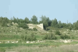
At the time of that documentation, the village appeared from a distance as a bare hill overgrown with thorns and wild vegetation.
Stones were scattered throughout the site, which was being used for grazing, making it difficult in places to distinguish natural stones from those that had once formed village houses.
The remains of village wells and the cut stones that covered them were still visible.
Sources
- PalQuest – Interactive Encyclopedia of the Palestine Question: Khirbat Zakariyya
- PalQuest – Operation Dani
- Institute for Palestine Studies – Walid Khalidi, All That Remains
- Palestine Remembered – Khirbat Zakariyya entry from All That Remains
- Palestine Remembered – Khirbat Zakariyya, Ramla District
- Village Statistics 1945 – Ramle Subdistrict: Khirbat Zakariya Land Ownership
- Village Statistics 1945 – Khirbat Zakariya Land Use
- Salman Abu Sitta – Register of Depopulated Palestinian Localities: Zakariya K / al-Ramla
Photo gallery


Photos from the village's people
Photos sent in by visitors and published after review.
Add a photo of this village
Log in to add photos of this village.

More from the archive



 Download Our Palestine App
The whole archive in the palm of your hand: depopulated villages, the Nakba, the massacres and Al-Aqsa — free, with no ads to erase the story.
Download Our Palestine App
The whole archive in the palm of your hand: depopulated villages, the Nakba, the massacres and Al-Aqsa — free, with no ads to erase the story.



Comments
No comments yet — be the first to write one.
Add your comment
Name and email are optional. Comments appear after review.