
The depopulated village of Bir Salim / District of Ramla
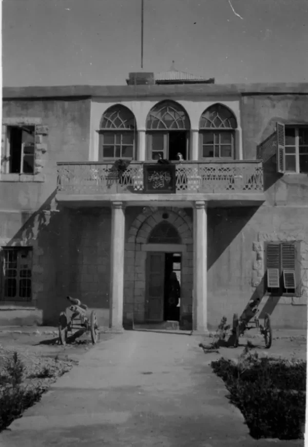
Bir Salim
About the depopulated village of Bir Salim
- District
- Ramla
- Date Bir Salim was occupied
- 09 May 1948
- Population in 1948
- 480
- Brigade that carried it out
- Givati Brigade
- Who defended the village
- Arab Liberation Army volunteers and local Palestinian militia organized by of Hasan Salameh (from Qula).
- Distance from the governorate centre
- 4 (km) West of al-Ramla
- Elevation above sea level
- 75 m
- Cause of displacement
- Military assault by Zionist troops
- Extent of destruction
- Bir Salem was mostly destroyed with the exception of its water tank remains standing.
- Ethnic cleansing
- Bir Salim inhabitants were completely ethnically cleansed.
Hover a dot to read the village name, or click to open its card.
Borders of the depopulated village of Bir Salim
Bir Salim – Depopulated Palestinian Village of the Ramla Subdistrict
Bir Salim, also rendered Bi'r Salim, was a Palestinian village in the Ramla Subdistrict. It lay approximately four kilometers west of Ramla on flat terrain in the central coastal plain, at an average elevation of about 75 meters above sea level.
A spur road connected the village to the Ramla–Jaffa highway and also served as its principal street. The Palestine Index Gazetteer classified Bir Salim as a hamlet or agricultural locality, but by the final years of the British Mandate it had developed into a settled village with several hundred inhabitants, closely spaced houses, and extensive citrus cultivation.
- Subdistrict
- Ramla
- District in PalQuest Classification
- Lydda
- Distance from Ramla
- Approximately 4 km west
- Average Elevation
- Approximately 75 meters
- Type of Locality
- Settled village/hamlet in the central coastal plain
- Population in 1931
- No independently verified village-specific figure established
- Population in 1944/1945
- 410, all Arab and Muslim
- Estimated Population in 1948
- 476 according to Salman Abu Sitta's Register – a later estimate rather than an official census
- Total Land Area in 1945
- 3,401 dunums
- Recorded Depopulation Date
- 9 May 1948; one updated Abu Sitta table gives 8 May
- Cause of Displacement
- Military assault; a contemporary intelligence report records an “attack on orphanage”
- Military Operation
- Operation Barak – the strongest immediate operational context
- Military Unit
- Giv'ati Brigade
- Extent of Destruction
- Most of the village's built environment was destroyed; later Palestinian field documentation differs regarding surviving structures
- Settlement on Village Land
- Netzer Sereni – established on Bir Salim land in 1948
Location
Bir Salim stood on flat land in the central coastal plain approximately four kilometers west of Ramla.
A spur connected it with the main Ramla–Jaffa highway and formed the village's principal street.
The village stood at an average elevation of about 75 meters and was situated near other Palestinian localities including Sarafand al-Kharab and Wadi Hunayn.
Built Environment
The Palestine Index Gazetteer classified Bir Salim as a hamlet or agricultural locality.
Its built-up area followed a northeast–southwest axis. Houses were closely spaced, with narrow lanes branching from the main road.
The houses were constructed mainly of adobe or cement, reflecting a relatively permanent pattern of settlement.
Arab Abu Zeid and Settlement at Bir Salim
Research on Bedouin sedentarization in the Ramla region associates Bir Salim with Arab Abu Zeid.
Permanent Bedouin settlement expanded around Ramla between the late 1920s and early 1940s.
This helps explain why no secure independent 1931 village population has been established here, whereas by 1945 Bir Salim appeared as an independent settled locality of 410 inhabitants.
British Military Presence
After the First World War, the British established a military headquarters in Bir Salim for General Edmund Allenby, who had commanded Allied forces against the Ottoman army in Palestine and Syria.
This was one of the village's distinctive historical features during the transition to British rule.
Population
All residents recorded for Bir Salim in the 1945 statistics were Muslims.
The village population was approximately 410 in 1944/45.
Salman Abu Sitta gives an estimated 476 people for 1948. This is a retrospective demographic estimate rather than an official census conducted that year.
| Year | Population | Nature of Figure |
|---|---|---|
| 1931 | Not independently verified | No unsupported village-specific figure is used |
| 1944/1945 | 410 | Government of Palestine statistics |
| 1948 | 476 | Later estimate in Salman Abu Sitta's Register |
Houses
No independently verified official 1931 occupied-house figure has been established for Bir Salim.
Later Palestinian community documentation describes the village as having approximately one hundred houses before the Nakba, but this should be treated as a local estimate rather than an official Mandate census figure.
Land Ownership in 1945
The total area of Bir Salim was 3,401 dunums.
The official Village Statistics use the ownership categories “Arab / Jewish / Public,” which are retained here without changing the terminology:
- Arab3,288 dunums97%
- Jewish0 dunums0%
- Public113 dunums3%
The overwhelming majority of village land was therefore recorded in the Arab category, while the official table recorded no land in the Jewish category.
Land Use in 1945
- Citrus and Bananas742 dunums12%
- Plantations and Irrigable Land510 dunums8%
- Cereals1,468 dunums24%
- Total Cultivable Land2,720 dunums44%
- Non-Cultivable Land681 dunums11%
Of the 681 dunums classified as non-cultivable, 568 were in the Arab category and 113 were public.
Economic Life
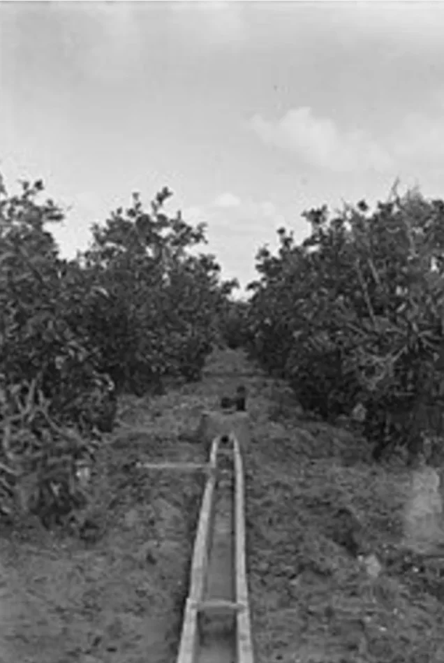
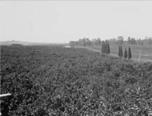
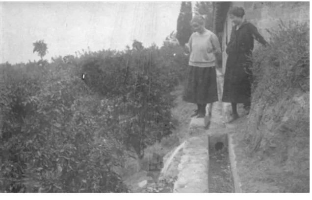
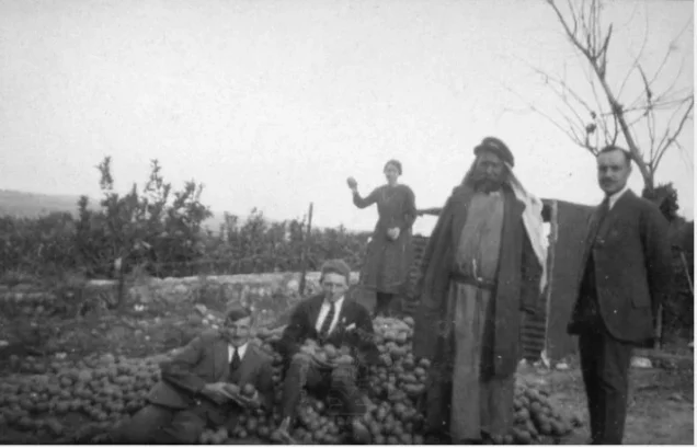
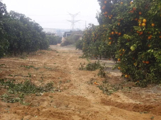
Agriculture formed the basis of Bir Salim's economy, with citrus cultivation playing an especially important role.
The villagers devoted 742 dunums to citrus and bananas, 510 dunums to plantations and irrigable land, and 1,468 dunums to cereals.
They also raised livestock.
Approximately four-fifths of the village's total land area was classified as cultivated or cultivable, reflecting the considerable agricultural importance of Bir Salim.
Education
No independent school inside Bir Salim has been verified from the principal sources reviewed.
The elementary school established at neighboring Sarafand al-Kharab in 1920, however, received pupils from Bir Salim as well as Wadi Hunayn and al-Nabi Rubin.
By the mid-1940s the Sarafand al-Kharab boys' school enrolled approximately 258 pupils, and a girls' school was opened there in 1945.
Military Situation before Depopulation
Bir Salim lay in a strategically important area west of Ramla, close to the transport routes connecting the coastal plain with the town.
During the spring of 1948, villages south and west of Ramla increasingly became targets of Haganah operations, particularly those conducted by the Giv'ati Brigade.
Operation Barak
Operation Barak began on 9 May 1948 and was led primarily by the Giv'ati Brigade, with the Negev Brigade participating farther south.
The operation was intended to extend military control south and west of Ramla before the end of the British Mandate.
PalQuest's condensed affected-localities list does not separately name Bir Salim, but the village's location, depopulation date, and documented attacking brigade make Operation Barak the strongest immediate operational context for its fall.
Occupation and Depopulation of Bir Salim
A contemporary intelligence report dated 30 June 1948 records Bir Salim as having been depopulated on 9 May 1948.
Its cause column records an “attack on orphanage”, and the report gives the Ramla–Lydda area as the direction of displacement.
The importance of this evidence is that it was compiled within weeks of the event rather than reconstructed decades later.
WAFA and Palestine Remembered likewise use 9 May 1948, and Palestine Remembered identifies the Giv'ati Brigade as the attacking formation.
One-Day Discrepancy in the Records
A minor chronological discrepancy exists in Salman Abu Sitta's published tables.
An updated version of the Register gives 8 May 1948 for Bir Salim, while another Palestine Land Society table gives 9 May.
Because the contemporary intelligence report explicitly records 9 May, this article adopts:
9 May 1948 as the best-supported date for Bir Salim's depopulation.
Military Unit
Palestinian village documentation identifies the Giv'ati Brigade as the force responsible for the attack on Bir Salim.
This is consistent with the opening of Operation Barak on 9 May and with Giv'ati's operational responsibility for the area west and south of Ramla.
The principal sources used here do not establish the particular battalion that entered Bir Salim, so the attribution is retained at brigade level.
Occupation and Displacement Chronology
- Until spring 1948
Pre-Nakba Village
A settled agricultural village of approximately 410 inhabitants in the 1945 statistics, known especially for citrus, cereals, and livestock raising.
- April–early May 1948
Escalation around Ramla
Haganah operations expanded around Ramla and the central coastal plain.
- 9 May 1948
Beginning of Operation Barak
The Giv'ati Brigade began its offensive south and west of Ramla.
- 9 May 1948
Attack on Bir Salim
A contemporary intelligence report records depopulation on this date and gives “attack on orphanage” as the immediate cause.
- 9 May 1948
Displacement of the Residents
The contemporary report records movement toward the Ramla–Lydda area.
- 1948
Establishment of Netzer Sereni
The settlement was established on Bir Salim land and later occupied the former village site according to Khalidi and PalQuest.
Cause of Displacement
The contemporary evidence identifies a military assault as the direct cause of Bir Salim's depopulation, specifically recording an “attack on orphanage.”
The event occurred in the immediate operational context of the Giv'ati Brigade's offensive west of Ramla.
The most supportable formulation is therefore: Bir Salim's residents were displaced following a military attack on 9 May 1948, during the opening phase of Operation Barak.
Bir Salim and Abu al-Fadl
A PalQuest account of neighboring Abu al-Fadl states that its inhabitants dispersed on 9 May during Operation Barak after the fall of a nearby village, most likely Bir Salim.
The fall of Bir Salim therefore appears to have influenced the wider chain of displacement among Palestinian localities west of Ramla.
Extent of Destruction
Bir Salim's built environment was extensively destroyed after depopulation.
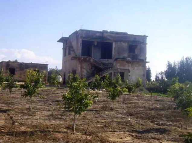
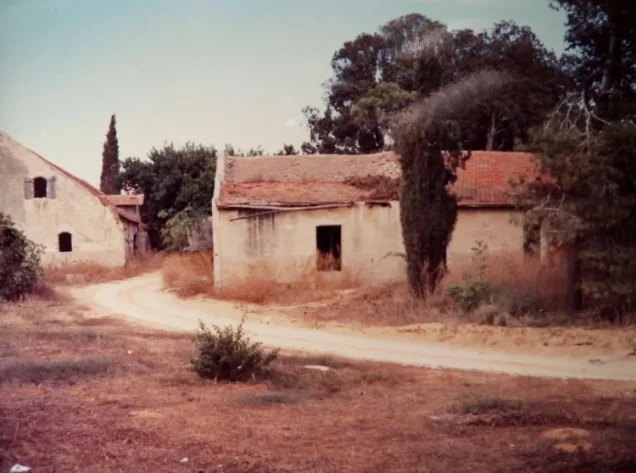
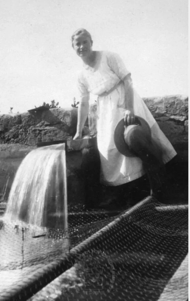
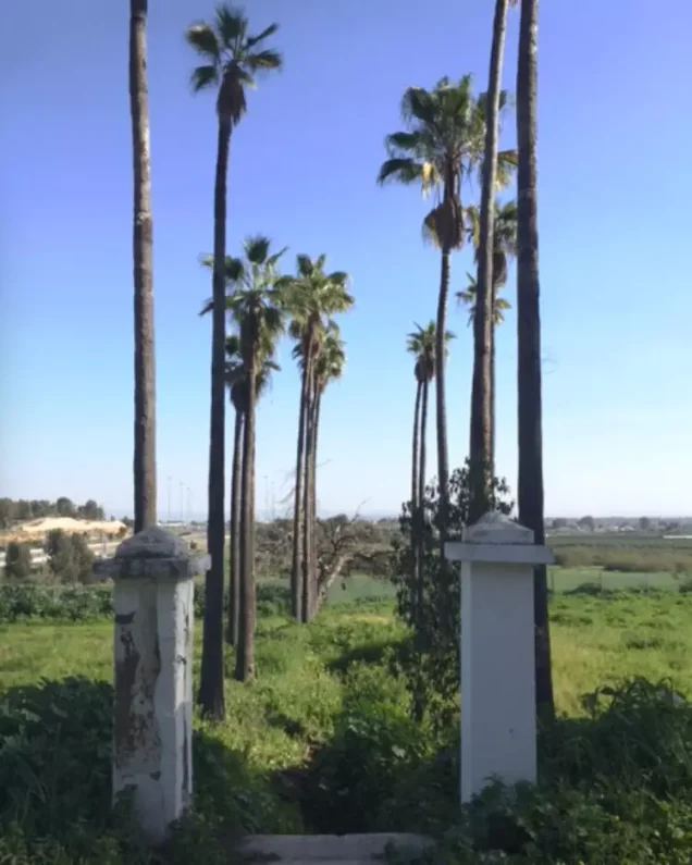
Walid Khalidi's historical field description states that the original village houses had disappeared while the old water tank and several pine trees remained.
A later Palestinian field visit in 2007, however, reported identifying the village mosque and a number of older houses among citrus groves.
No numerical destruction percentage is therefore supplied, and the article does not state categorically that every Palestinian structure disappeared.
Netzer Sereni on Bir Salim Land
Netzer Sereni was established in 1948 on Bir Salim land.
Walid Khalidi and PalQuest state that it later occupied the former village site.
No neighboring settlement is added to the list of settlements on village land without direct land-boundary evidence.
Bir Salim Today
Two historical descriptions of the remains should be distinguished. Neither constitutes direct field verification in 2026.
According to the field research incorporated into Walid Khalidi's All That Remains, Netzer Sereni occupied the village site, the original houses were gone, and the old water tank and several pine trees remained.
A Palestinian field visit reported in 2007, however, stated that the mosque and a number of older buildings were still identifiable among citrus groves, with the mosque's mihrab remaining visible despite substantial damage.
The difference may reflect the boundaries of the areas surveyed or later identification of structures not previously counted as surviving village houses.
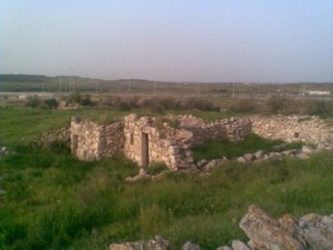
The most cautious present description is therefore that most of Bir Salim's original built environment was destroyed or incorporated into later land use, while Palestinian field documentation records some surviving architectural remains. Their exact condition in 2026 requires newer field verification.
Sources
- PalQuest – Interactive Encyclopedia of the Palestine Question: Bir Salim
- PalQuest – Intelligence Report on the Depopulation of Palestine, 30 June 1948: Bir Salim
- PalQuest – Operation Barak
- Institute for Palestine Studies – Walid Khalidi, All That Remains
- Village Statistics 1945 – Ramla Subdistrict: Bir Salim Cultivable Land
- Village Statistics 1945 – Ramla Subdistrict: Bir Salim Non-Cultivable Land
- Palestine Remembered – Bir Salim, Ramla
- Palestine Remembered – 2007 Field Report on Bir Salim Mosque and Surviving Structures
- Salman Abu Sitta – Register of Depopulated Palestinian Localities: Bir Salim
Photo gallery


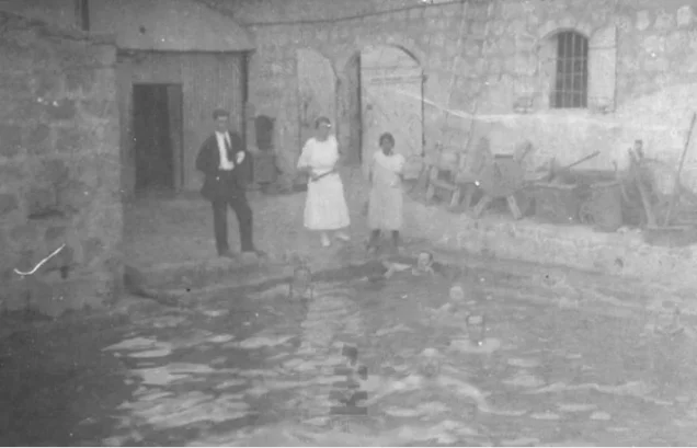

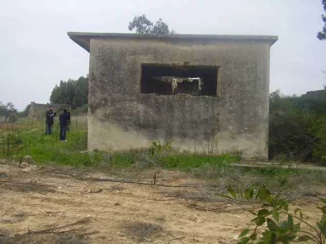
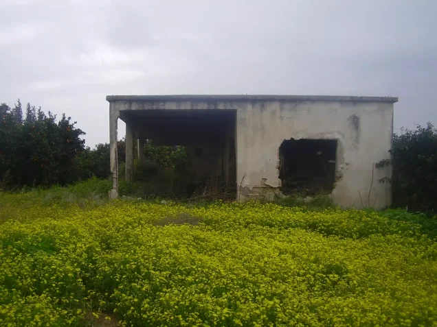
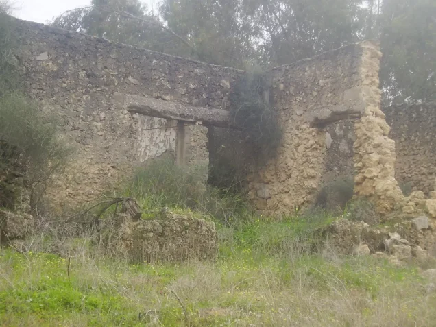

Photos from the village's people
Photos sent in by visitors and published after review.
Add a photo of this village
Log in to add photos of this village.
Other villages from Ramla
More from the archive



 Download Our Palestine App
The whole archive in the palm of your hand: depopulated villages, the Nakba, the massacres and Al-Aqsa — free, with no ads to erase the story.
Download Our Palestine App
The whole archive in the palm of your hand: depopulated villages, the Nakba, the massacres and Al-Aqsa — free, with no ads to erase the story.



Comments
No comments yet — be the first to write one.
Add your comment
Name and email are optional. Comments appear after review.