
The depopulated village of Bayt Shanna / District of Ramla

Bayt Shanna
About the depopulated village of Bayt Shanna
- District
- Ramla
- Date Bayt Shanna was occupied
- 15 July 1948
- Population in 1948
- 244
- Military operation
- Operation Dani
- Distance from the governorate centre
- 11.5 (km) Southeast of al-Ramla
- Elevation above sea level
- 240 m
- Cause of displacement
- Military assault by Zionist troops
- Extent of destruction
- Bayt Shanna was mostly destroyed with the exception of a small house on a hill.
- Ethnic cleansing
- Bayt Shanna inhabitants were completely ethnically cleansed.
Hover a dot to read the village name, or click to open its card.
Borders of the depopulated village of Bayt Shanna
Bayt Shanna – Depopulated Palestinian Village of the Ramla Subdistrict
Bayt Shanna was a Palestinian village in the Ramla Subdistrict, approximately 11.5 kilometers southeast of Ramla. It stood on the summit of a high hill surrounded by lower hills, at an average elevation of about 240 meters above sea level.
The village overlooked broad areas in most directions except the north. Its hill descended gradually southward toward a wadi separating Bayt Shanna land from neighboring Salbit. A secondary road linked it with the Jerusalem–Jaffa highway to the southwest, while dirt tracks connected it with nearby villages.
- Subdistrict
- Ramla
- Distance from Ramla
- Approximately 11.5 km southeast
- Average Elevation
- Approximately 240 meters
- Population in 1922
- 8 Muslims – official Census of Palestine
- Population in 1931
- No independent Bayt Shanna figure; 406 was the combined population of Bayt Shanna and Salbit
- Population in 1944/1945
- 210
- Estimated Population in 1948
- 244 according to Salman Abu Sitta's Register – a later estimate, not an official census
- Total Land Area
- 3,617 dunums
- Occupation / Depopulation Date
- 15–16 July 1948; several Palestinian sources use 15 July as the single date
- Military Operation
- Generally attributed to the second phase of Operation Dani
- Military Unit
- Not conclusively established at village level; some secondary sources name a Giv'ati–Kiryati force, but this attribution is not fully corroborated by the principal operation record
- Cause of Displacement
- Military assault
- Extent of Destruction
- Most of the village was destroyed; rubble and at least one small surviving structure were recorded in historical fieldwork
- Israeli Settlements on Village Land
- None documented; Sha'alvim was established on neighboring Salbit land
Name
The village name appears in several forms, including Bayt Shanna and Bayt Shinna.
Palestinian linguistic accounts connect the name with an Aramaic/Syriac root associated with a high place or rocky summit, a plausible interpretation given the village's elevated location.
Because historical forms of the name vary, this etymology is best treated as a linguistic interpretation rather than an undisputed fact.
Bayt Shanna in the Ottoman Period
Bayt Shanna appeared in the 1596 Ottoman records within the nahiya of Ramla in the Gaza district.
Its population was estimated at approximately 22 people, and taxes were levied on several agricultural and pastoral products, including:
- Wheat.
- Barley.
- Fruit trees.
- Vineyards.
- Goats.
- Beehives.
By the late nineteenth century the site was described as sparsely inhabited or ruined, before permanent settlement became clearer again during the modern period.
Village Layout and Buildings
Bayt Shanna stood on the summit of a hill surrounded by lower elevations and had a roughly crescent-shaped built-up plan.
The houses were closely grouped and were principally constructed of stone and adobe.
Fields spread across both level and undulating land, while rougher terrain was used for grazing.
Population in 1922
The official 1922 Census of Palestine recorded 8 Muslims at Bayt Shanna.
The locality was still extremely small at this stage compared with its later Mandate-era population.
Population and Houses in 1931
The frequently reproduced figure of 406 should not be presented as the population of Bayt Shanna alone.
The official 1931 census combined Bayt Shanna with neighboring Salbit:
| Item | Figure |
|---|---|
| Bayt Shanna + Salbit | 406 inhabitants |
| Occupied Houses | 71 |
No independent Bayt Shanna population or house count can therefore be extracted from these figures.
Population in 1945
By 1944/45 Bayt Shanna was listed separately and had 210 inhabitants, all Palestinian Arabs and Muslims.
Estimated Population in 1948
Salman Abu Sitta's Register gives an estimated 244 inhabitants for Bayt Shanna in 1948.
This is a retrospective demographic estimate rather than an official census conducted in that year.
| Year | Population | Nature of Figure |
|---|---|---|
| 1596 | Approximately 22 | Estimate derived from Ottoman records |
| 1922 | 8 | Official Census of Palestine |
| 1931 | Not independently available | 406 was the combined population of Bayt Shanna and Salbit |
| 1944/1945 | 210 | Official Mandate statistics |
| 1948 | 244 | Later estimate in Salman Abu Sitta's Register |
Refugees and Descendants
Salman Abu Sitta's Register estimated approximately 1,496 refugees and descendants in 1998 originating from Bayt Shanna.
This is a later demographic projection rather than a comprehensive official census of all village refugees.
Land Ownership in 1945
Bayt Shanna had a total land area of 3,617 dunums.
- Palestinian3,617 dunums100%
- Transferred to Zionists0 dunums0%
- Communal/Public0 dunums0%
In the official Mandate classification, all 3,617 dunums were recorded in the Arab category, with none in the Jewish or Public categories.
Land Use in 1945
- Cereals865 dunums19%
- Plantations and Irrigable Land44 dunums<1%
- Total Cultivated/Cultivable Land909 dunums20%
- Non-Cultivable Land2,708 dunums60%
The figures reconcile exactly: 909 dunums of cultivated/cultivable land plus 2,708 dunums classified as non-cultivable equal the village's total 3,617 dunums.
Economic Life
The inhabitants relied largely on rain-fed agriculture and livestock raising.
They cultivated cereals and several types of fruit and vegetables, including:
- Olives.
- Grapes.
- Figs.
- Apples.
- Almonds.
- Vegetables.
Rougher parts of the village land were used as pasture.
Water and Services
Bayt Shanna was a small locality with few public institutions and relied partly on neighboring villages for services and the marketing of agricultural produce.
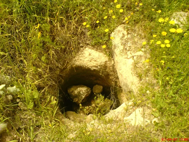
Local Palestinian sources mention a drinking-water reservoir near the northern end of the village and the maqam of Shaykh al-Shinnawi.
No sufficiently documented independent village school has been identified in the principal sources, so no school from neighboring villages is reassigned to Bayt Shanna.
Archaeological Remains
Bayt Shanna land contained several archaeological features.
Two khirbas were recorded, one west of the village and another northeast of it, containing remains including:
- Foundations of an old church.
- Building foundations.
- Cisterns.
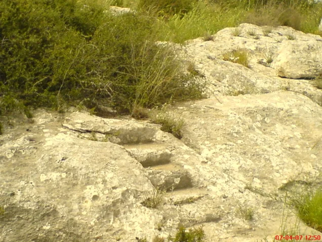
- Rock-hewn presses.
Operation Dani
Operation Dani began on 9 July 1948 and continued until 18 July.
It unfolded in two stages. The first resulted in the occupation of Lydda and Ramla, while the second stage, from 13 to 18 July, pushed eastward toward al-Latrun and the western approaches to the Jerusalem highlands.
On 15 July Israeli forces occupied several villages neighboring Bayt Shanna, including Barfiliya, Bir Ma'in, al-Burj, and Salbit.
Palestinian village documentation generally places the occupation of Bayt Shanna within this second phase of Operation Dani.
Occupation and Depopulation
Salman Abu Sitta records Bayt Shanna's occupation during 15–16 July 1948.
Other Palestinian sources use 15 July 1948 as the village's depopulation date.
Given the simultaneous fall of surrounding villages and Abu Sitta's date range, Bayt Shanna's final occupation clearly belongs to the mid-July fighting associated with the second phase of Operation Dani.
Military Unit
No single attacking formation can be established conclusively from the principal sources at the village-specific level.
The Encyclopedia of Palestinian Villages attributes the assault to a force drawn from the Giv'ati and Kiryati brigades.
PalQuest's general Operation Dani record, however, lists Har'el, Yiftach, Kiryati, Alexandroni, Etziyyoni, and other formations, but does not list Giv'ati among the operation's brigades.
PalQuest also does not explicitly include Bayt Shanna in its list of affected localities, although it documents the occupation of several neighboring villages on 15 July.
The most cautious formulation is therefore:
Military unit: not conclusively established at village level; Kiryati participated in Operation Dani, while some Palestinian secondary sources attribute the Bayt Shanna assault to a combined Giv'ati–Kiryati force.
Occupation and Displacement Chronology
- Until July 1948
Bayt Shanna before the Offensive
A small agricultural village with an estimated 244 inhabitants on the eve of depopulation.
- 9 July 1948
Beginning of Operation Dani
A major Israeli offensive began across the Lydda–Ramla region and the Jerusalem corridor.
- 13 July 1948
Beginning of the Second Phase
The offensive expanded eastward toward al-Latrun and the western approaches to the Jerusalem highlands.
- 15 July 1948
Occupation of Neighboring Villages
Barfiliya, Bir Ma'in, al-Burj, and Salbit were occupied.
- 15–16 July 1948
Occupation and Depopulation of Bayt Shanna
Abu Sitta records this date range, while several Palestinian sources use 15 July as the occupation date.
- 18 July 1948
End of Operation Dani
The operation ended with the beginning of the Second Truce.
Cause of Displacement
Palestinian sources attribute the displacement of Bayt Shanna's inhabitants to direct military assault during the mid-July 1948 fighting.
The sources reviewed do not provide a detailed family-by-family account of departure, so unsupported details about individual expulsion routes are not added.
Extent of Destruction
Most of Bayt Shanna's built-up area was destroyed after its inhabitants were displaced.
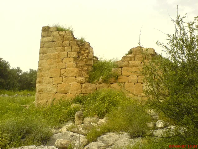
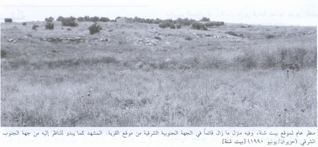
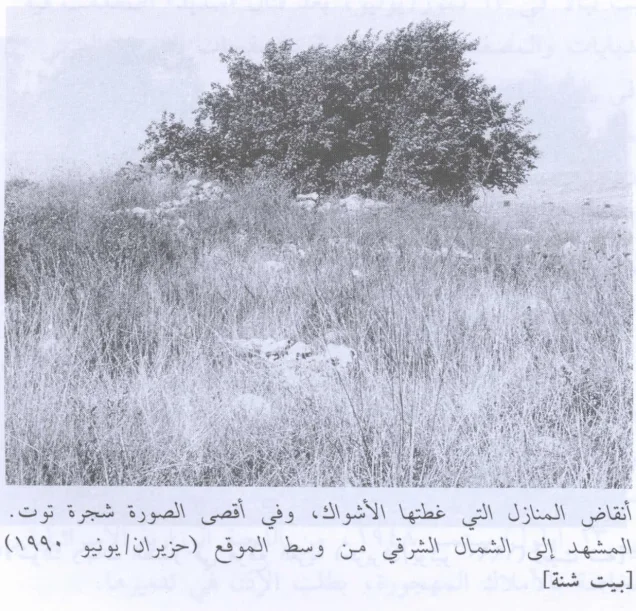
Historical descriptions record extensive stone rubble across the site, with a small room or structure surviving on the eastern hillside.
No official numerical destruction percentage is available, so the article does not use an unsupported figure such as 100 percent.
Israeli Settlements on Village Land
According to Walid Khalidi and PalQuest, no Israeli settlement was established on Bayt Shanna's own lands.
Sha'alvim, established in 1951, lies close to the village site but was built on land belonging to the neighboring depopulated village of Salbit.
Sha'alvim should therefore not be listed as a settlement established on Bayt Shanna land.
Bayt Shanna Today
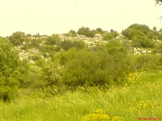
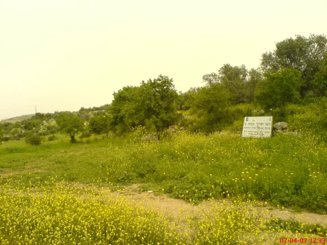
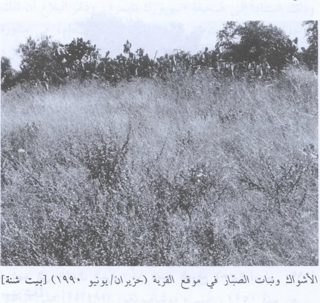
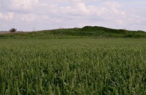
The available description of the village site is based on historical fieldwork used by Walid Khalidi, including photographs dated June 1990. It is therefore a historical description rather than direct 2026 field verification.
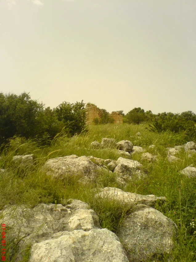
Stone rubble from demolished houses covered the village site, while large mulberry, olive, and almond trees grew among the ruins and wild vegetation.
The entire site was fenced and appeared to be used for grazing.
On the hillside east of the former village, a masonry room remained standing with fruit trees growing around it.
Sources
- PalQuest – Interactive Encyclopedia of the Palestine Question: Bayt Shanna
- PalQuest – Operation Dani
- Institute for Palestine Studies – Walid Khalidi, All That Remains
- Palestine Remembered – Bayt Shanna, Ramla
- Palestine Remembered – Bayt Shanna entry from All That Remains
- Salman Abu Sitta – Register of Depopulated Palestinian Localities: Bayt Shanna
- Government of Palestine – Census of Palestine, 1922: Bait Shanna
- Government of Palestine – Census of Palestine, 1931: Bayt Shanna and Salbit
Photo gallery


Photos from the village's people
Photos sent in by visitors and published after review.
Add a photo of this village
Log in to add photos of this village.
Other villages from Ramla

More from the archive


 Download Our Palestine App
The whole archive in the palm of your hand: depopulated villages, the Nakba, the massacres and Al-Aqsa — free, with no ads to erase the story.
Download Our Palestine App
The whole archive in the palm of your hand: depopulated villages, the Nakba, the massacres and Al-Aqsa — free, with no ads to erase the story.



Comments
No comments yet — be the first to write one.
Add your comment
Name and email are optional. Comments appear after review.