
The depopulated village of Al-Na'ani / District of Ramla
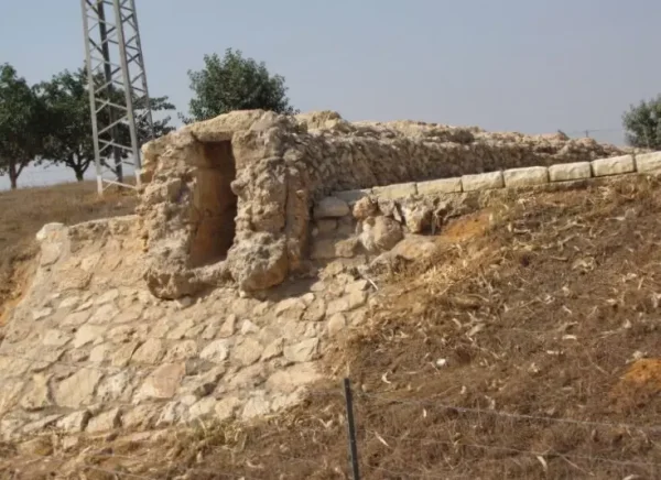
Al-Na'ani
About the depopulated village of Al-Na'ani
- District
- Ramla
- Date Al-Na'ani was occupied
- 14 May 1948
- Population in 1948
- 1,710
- Military operation
- Operation Barak
- Brigade that carried it out
- Givati Brigade
- Distance from the governorate centre
- 6 (km) South of al-Ramla
- Elevation above sea level
- 75 m
- Cause of displacement
- Fear of Jewish attack, or of being caught in the fighting
- Extent of destruction
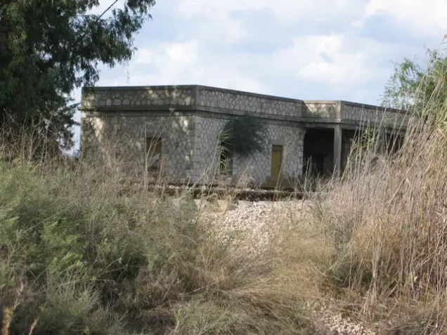
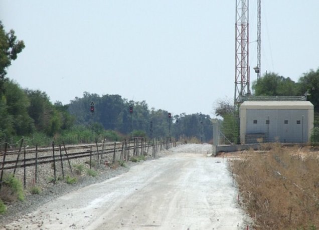
- al-Na'ani was mostly destroyed with the exception of the train station and couple of deserted houses (one of those houses belongs to Ahmad Jubayl).
- Ethnic cleansing
- On June 10th, 1948, al-Na'ani was completely ethnically cleansed.
Hover a dot to read the village name, or click to open its card.
Borders of the depopulated village of Al-Na'ani
Al-Na'ani – Depopulated Palestinian Village in Ramla Subdistrict
Al-Na'ani was a Palestinian village in the Ramla subdistrict of the Lydda district; it was not a village of the Tulkarm subdistrict. It stood on flat ground in the central coastal plain approximately 6 kilometers south of Ramla, at an average elevation of about 75 meters above sea level.
A network of secondary roads connected Al-Na'ani with Ramla and neighboring villages, and a station on the Jaffa–Jerusalem railway stood beside the village. In the official 1944/45 statistics, the Palestinian Arab population of Al-Na'ani was 1,470, consisting of 1,450 Muslims and 20 Christians.
The Haganah's Giv'ati Brigade occupied Al-Na'ani on 14 May 1948 in the context of Operation Barak. The military occupation did not immediately result in complete depopulation: a substantial number of villagers remained until around 10 June, when they apparently left after being ordered to depart or intimidated into leaving.
Key Facts about Al-Na'ani
| Field | Information |
|---|---|
| Name | Al-Na'ani |
| Subdistrict | Ramla |
| Distance from Ramla | Approximately 6 km south |
| Average elevation | Approximately 75 m above sea level |
| Palestinian Arab population, 1944/45 | 1,470: 1,450 Muslims and 20 Christians |
| Total statistical-unit population, 1944/45 | 2,060: 1,470 Arabs and 590 Jews |
| Houses, 1931 | 300 |
| Total registered land | 16,129 dunums |
| Occupation date | 14 May 1948 |
| Final depopulation | Around 10 June 1948, according to the account cited by Khalidi |
| Military operation | Operation Barak |
| Military unit | Giv'ati Brigade |
| Cause of depopulation | Military attack, pressure, and intimidation; some residents remained after occupation and left later |
| Extent of destruction | Most buildings were destroyed; the railway station, two houses, and parts of other structures survived in later documentation |
| Settlements on village lands | Na'an – 1930; Ramot Me'ir – 1949 |
Location of Al-Na'ani
Al-Na'ani stood on level ground in the central coastal plain south of Ramla and was connected to the district center and surrounding villages by secondary roads.
Its lands were bordered by those of 'Aqir, al-Qubayba, and Zarnuqa. A railway station on the Jaffa–Jerusalem line stood immediately beside the village.
The flat terrain, road network, and railway connection played an important role in the village economy and its access to Ramla and Jaffa markets.
Al-Na'ani before the Nakba
The late nineteenth-century Survey of Western Palestine described Al-Na'ani as a small adobe village situated on low ground.
Its houses were tightly clustered before the built-up area gradually expanded during the Mandate period as the population grew.
The village contained two mosques, one considerably older than the other, as well as a small marketplace, an elementary school, and a well.
Population of Al-Na'ani
- 19221,004Official census: 1,002 Muslims and 2 Orthodox Christians
- 19311,142Official census: 1,133 Muslims and 9 Christians, in 300 houses
- 1944/451,470 Palestinian Arabs1,450 Muslims and 20 Christians
- 1944/45 – complete statistical unit2,0601,470 Arabs and 590 Jews
- 19481,705Later Palestine Remembered estimate for the Palestinian population; the page also separately notes 590 Jews and the figure is not an official census
- 199810,472 refugeesLater estimate of refugees and descendants reported by Palestine Remembered
The 2,060 figure for 1944/45 should not be described as the population of the Palestinian village alone. The official statistical unit consisted of 1,470 Arabs and 590 Jews.
The 1948 and 1998 figures are later estimates and should not be attributed to British Mandatory census statistics.
Number of Houses
- 1931300Official census figure
- 1948447Later Palestine Remembered estimate, not an official census count
Land Ownership in Al-Na'ani
The total registered land area of the Al-Na'ani statistical unit in 1944/45 was 16,129 dunums.
- Palestinian9,768 dunums61%
- Transferred to Zionists5,832 dunums36%
- Communal/Public529 dunums3%
The figures balance correctly: 9,768 + 5,832 + 529 = 16,129 dunums.
The original official categories were 9,768 Arab dunums, 5,832 Jewish dunums, and 529 Public dunums.
Land Use in 1944/45
- Arab
- Jewish
- Public
- Cereals12,046 dunums
- Plantations and irrigable land998 dunums
- Citrus and bananas2,375 dunums
- Built-up land51 dunums
- Non-cultivable land659 dunums
The table balances exactly.
Palestine Remembered displays 634 dunums of non-arable land under the Palestinian column, but this combines 105 Arab dunums with 529 Public dunums. The Public category is therefore kept separate here.
Khalidi's narrative states that villagers cultivated citrus, while the official 1944/45 land-use table assigns all 2,375 dunums classified as citrus and bananas to the Jewish category. The official statistical classification has therefore been retained without attempting to redistribute the acreage by inference.
Economic Life
Agriculture formed the foundation of Al-Na'ani's economy.
The Palestinian villagers cultivated cereals, watermelons, and orchards. Arab cereal land totaled 9,277 dunums, while 335 Arab dunums were irrigated or used for plantations.
The nearby railway station and road network facilitated the movement of agricultural produce and access to Ramla and surrounding markets.
Water Resources
Residents obtained drinking water from an old well in the southwestern quarter of the village.
The existence of irrigated and plantation land also reflects the use of water for agriculture, although Khalidi's entry does not provide a longer independent list of village water sources.
Education
An elementary boys' school was established in Al-Na'ani in 1923.
By the 1947/48 school year it had approximately 208 pupils.
The school, together with the two mosques and small market, formed part of the village's developing local institutions during the Mandate period.
Mosques and Religious Institutions
Al-Na'ani contained two mosques, one considerably older than the other.
Palestine Remembered's automated statistics page also displays a church entry, but Khalidi's detailed village account does not identify a church among the village institutions. A church has therefore not been treated as independently documented here.
Archaeology
Al-Na'ani was built over an archaeological locality known as al-Khirba, where ancient pottery fragments and mosaic remains were found.
Tall Malat, also known locally as Tall al-Malat, stood approximately 1.5 kilometers southeast of the village. Khalidi records that scholars identified it with the ancient Canaanite site of Gibbethon.
Operation Barak
The Haganah launched Operation Barak in May 1948, principally through the Giv'ati Brigade, while the Palmach's Negev Brigade operated on another axis.
The operation targeted villages south and west of Ramla. PalQuest records that its orders included spreading panic, breaking morale, and driving large numbers of Palestinians from villages in the occupied area.
PalQuest contains a minor internal chronological inconsistency: its summary dates Operation Barak to 9–13 May, while the Al-Na'ani village entry states that the village was occupied on 14 May during the first stage, and the operation narrative says the second stage began on 15 May. Thus 14 May falls at the boundary between the two phases as presented by the platform, while the association of Al-Na'ani's occupation with Operation Barak and Giv'ati is clear.
Occupation of Al-Na'ani
On 14 May 1948, immediately before the end of the British Mandate, the Giv'ati Brigade reached Al-Na'ani during Operation Barak.
The village was surrounded and its residents were given an ultimatum to surrender their weapons. The account cited by Khalidi states that some villagers were taken hostage to ensure compliance.
Some weapons were eventually surrendered and the village was occupied.
Thus, 14 May is the documented date of military occupation, but not the date on which the village became completely empty.
Depopulation of Al-Na'ani
A substantial number of residents remained in Al-Na'ani after the 14 May occupation.
Khalidi records that some villagers stayed until approximately 10 June 1948, when they apparently left after being ordered to depart or were intimidated into leaving.
Palestine Remembered's summary table classifies the original cause of flight as fear of attack or of being caught in the fighting and describes the eventual outcome as complete depopulation.
The most precise chronology therefore distinguishes between initial flight during the attack, continued residence by part of the population after occupation, and final removal around 10 June under pressure or orders to leave.
Occupation Chronology
- May 1948
Operation Barak
Giv'ati carried out the campaign against villages south and west of Ramla.
- 14 May 1948
Encirclement and ultimatum
The village was surrounded, weapons were demanded, and some villagers were taken hostage to secure compliance.
- 14 May 1948
Military occupation
Some weapons were surrendered and Giv'ati entered the village.
- 14 May – approximately 10 June 1948
Continued Palestinian presence
A substantial number of villagers remained after the occupation.
- Around 10 June 1948
Final depopulation
The remaining villagers apparently left after being ordered to go or intimidated into leaving.
- Precise date not documented
Destruction
Most village buildings were destroyed, while the railway station, two houses, and portions of other structures survived.
Israeli Settlements on Al-Na'ani's Lands
| Settlement | Established | Relationship to Al-Na'ani |
|---|---|---|
| Na'an | 1930 | Established before the Nakba on land purchased from Al-Na'ani; its buildings stand on former village land |
| Ramot Me'ir | 1949 | Established on Al-Na'ani land west of the village site |
Some secondary sources name additional later localities in connection with Al-Na'ani's lands, but Khalidi and PalQuest do not list them in the village's settlement section. They have therefore not been added without independent cadastral verification.
Al-Na'ani Today
In Walid Khalidi's field description, eucalyptus and Christ-thorn trees and a variety of wild plants covered much of the site.
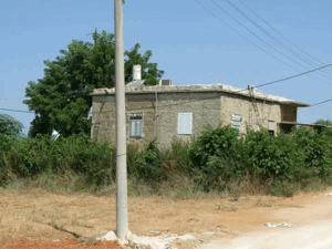
The railway station remained the principal surviving landmark. Two deserted Palestinian houses were also still standing, including one formerly belonging to Ahmad Jubayl, together with portions of other houses later used for storing agricultural equipment.
The surrounding land was cultivated.
Khalidi's description derives from fieldwork undertaken before the publication of All That Remains in 1992 and is therefore a historical site description rather than a comprehensive direct field verification of conditions in 2026.
Palestine Remembered also contains later community documentation of the railway station and village site, including photographs labeled 2000. These materials help document the survival of particular remains at a later date but do not constitute a comprehensive present-day survey.
Sources
- PalQuest – Interactive Encyclopedia of the Palestine Question: Al-Na'ani
- PalQuest – Operation Barak
- Palestine Remembered – Al-Na'ani, Ramla District
- Walid Khalidi – All That Remains: Al-Na'ani
- Government of Palestine – Census of Palestine 1922
- Institute for Palestine Studies – All That Remains, Walid Khalidi
Photo gallery

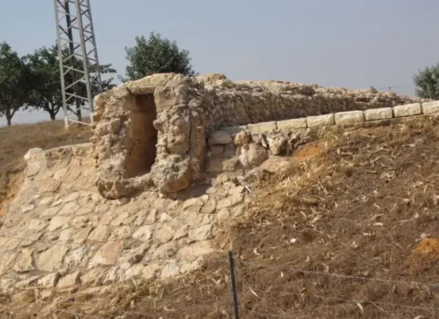
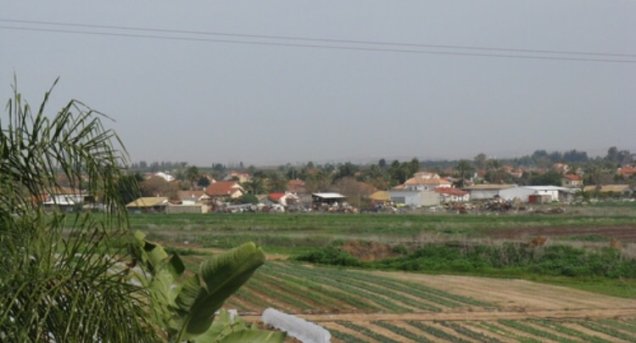
Photos from the village's people
Photos sent in by visitors and published after review.
Add a photo of this village
Log in to add photos of this village.
Other villages from Ramla
More from the archive



 Download Our Palestine App
The whole archive in the palm of your hand: depopulated villages, the Nakba, the massacres and Al-Aqsa — free, with no ads to erase the story.
Download Our Palestine App
The whole archive in the palm of your hand: depopulated villages, the Nakba, the massacres and Al-Aqsa — free, with no ads to erase the story.



Comments
No comments yet — be the first to write one.
Add your comment
Name and email are optional. Comments appear after review.