
The depopulated village of Saydun / District of Ramla

About the depopulated village of Saydun
- District
- Ramla
- Date Saydun was occupied
- 06 April 1948
- Population in 1948
- 240
- Military operation
- Operation Nachshon
- Distance from the governorate centre
- 9 (km) South of al-Ramla
- Elevation above sea level
- 150 m
- Cause of displacement
- Military assault by Zionist troops
- Extent of destruction
- The village was mostly destroyed with the exception of one house
- Ethnic cleansing
- Saydun inhabitants were completely ethnically cleansed.
Hover a dot to read the village name, or click to open its card.
Borders of the depopulated village of Saydun
Saydun – Depopulated Palestinian Village of the Ramla Subdistrict
Saydun was a Palestinian village in the Ramla Subdistrict, approximately 9 kilometers south of the town of Ramla. It stood on the eastern bank of Wadi Saydun, a tributary of Wadi al-Sarar, along the eastern edge of Palestine's coastal plain.
The village had an average elevation of approximately 150 meters above sea level and lay south of the southern branch of the Ramla–Jerusalem road. Local roads and paths connected it with neighboring villages.
- Subdistrict
- Ramla
- Distance from Ramla
- Approximately 9 km south
- Average Elevation
- Approximately 150 meters
- Population in 1922
- 124
- Population in 1931
- 174
- Population in 1945
- 210
- Estimated Population in 1948
- 244 – later demographic estimate, not an official 1948 census
- Occupied Houses in 1931
- 35
- Total Land Area in 1945
- 7,487 dunums
- Probable Occupation Date
- 3 April 1948 or shortly afterward; another Palestinian source gives 6 April
- Military Operation
- Operation Nachshon
- Military Unit
- No village-specific unit securely identified; the Giv'ati and Har'el brigades participated in Operation Nachshon generally
- Cause of Depopulation
- Military attack and takeover during Operation Nachshon; residents of the area left before or during the capture according to Khalidi's source
- Extent of Destruction
- Most of the village was destroyed; one stone house remained in the historical field description
- Post-1948 Settlements
- No Israeli settlements are documented on Saydun village land
Location
Saydun stood on the eastern bank of Wadi Saydun, a tributary of Wadi al-Sarar, on the eastern edge of the coastal plain.
It lay south of the southern branch of the Ramla–Jerusalem highway and was linked by local roads and paths with nearby villages including Khulda, Dayr Muhaysin, al-Mansura, Abu Shusha, al-Na'ani, Umm Kalkha, and al-Khalayil.
Saydun in the Nineteenth Century
Edward Robinson passed through Saydun in 1838 and described it as a large village.
Later nineteenth-century travelers and surveyors described it as a smaller settlement whose houses were largely constructed of adobe or mud brick.
The differing descriptions suggest changes in the size and built environment of Saydun during the nineteenth century.
Built Environment before the Nakba
Later village houses were constructed from mud, cement, and stone and were clustered along the road and paths leading toward neighboring villages.
The village contained several small shops, a maqam associated with a local religious figure, and a well on its northern side that supplied drinking water.
The Mandate antiquities authorities also recorded foundations of earlier structures at the site.
Population
Saydun's inhabitants were predominantly Muslim.
- 1922124Official Census of Palestine
- 1931174Official Census of Palestine
- 1945210Government of Palestine statistics
- 1948244Later demographic estimate, not an official census conducted in 1948
Houses
The 1931 census recorded 35 occupied houses in Saydun.
Some later databases estimate approximately 49 houses in 1948, but this is not an official 1948 building census and should not be treated as equivalent to the official 1931 figure.
Land Ownership in 1945
Saydun's land totaled 7,487 dunums.
- Palestinian6,099 dunums81%
- Transferred to Zionists1,221 dunums16%
- Communal/Public167 dunums2%
The official 1945 Village Statistics use the categories Arab, Jewish, and Public: 6,099 Arab dunums, 1,221 dunums in the Jewish category, and 167 public dunums.
Land Use in 1945
- Palestinian
- Transferred to Zionists
- Public
- Cereals6,345 dunums
- Plantations and Irrigable Land49 dunums
- Built-up Area15 dunums
- Non-Cultivable Land1,078 dunums
Approximately 6,394 dunums, or roughly 85 percent of the village land, were classified as cultivated or cultivable.
Economic Life
The inhabitants relied primarily on rain-fed agriculture and livestock raising.
Cereal cultivation dominated agricultural activity, while 49 dunums were irrigated or used for plantations.
Several small shops served the everyday needs of the village population.
Water
A well on the northern side of Saydun supplied drinking water.
Agriculture was predominantly rain-fed, consistent with the strong emphasis on cereal production.
Education
Walid Khalidi's village description does not identify an independent school in Saydun before the Nakba.
No school in a neighboring locality is therefore reassigned to Saydun without direct evidence.
Operation Nachshon
Operation Nachshon began in early April 1948 as an offensive intended to seize and control villages and strategic positions along the route from the coastal plain toward Jerusalem.
PalQuest explicitly lists Saydun among the villages affected by the operation.
The first-stage operational orders called for the capture of Saydun together with Khulda and Dayr Muhaysin in order to control the western entrance to the Jerusalem corridor.
Occupation and Depopulation
No detailed village-specific military report establishes the precise moment Saydun was occupied.
Walid Khalidi's account, as reproduced by PalQuest, considers it probable that Saydun fell on 3 April 1948 or shortly after the beginning of Operation Nachshon.
Palestine Remembered gives a different date of 6 April 1948.
The present article therefore treats 3 April as the probable date according to Khalidi/PalQuest while preserving 6 April as an alternative date found in another Palestinian source.
Military Unit
PalQuest identifies the Giv'ati and Har'el brigades as participants in Operation Nachshon at the operation-wide level.
The reviewed sources do not establish which one directly entered Saydun.
The most accurate formulation is therefore:
Executing unit: not independently established at village level; Giv'ati and Har'el participated in Operation Nachshon generally.
Occupation and Displacement Chronology
- Until early April 1948
Village before the Offensive
A small agricultural village south of Ramla, dependent mainly on cereals and animal husbandry.
- 3 April 1948
Beginning of Operation Nachshon
The operation began, and its first-stage orders called for Saydun to be captured.
- 3 April or shortly afterward
Probable Occupation
This is the chronology considered most likely by Khalidi/PalQuest, although no detailed village battle account survives in the source.
- 6 April 1948
Alternative Palestinian Date
Palestine Remembered uses this date for Saydun's occupation.
- Probably shortly after occupation
Destruction
Khalidi considers it likely that Saydun was destroyed soon after capture, as happened to nearby Khulda and Dayr Muhaysin.
- 15 April 1948
End of Operation Nachshon
By this stage control of several localities at the western entrance to the Jerusalem corridor had changed substantially.
Cause of Displacement
Saydun's depopulation was directly connected with the military offensive and seizure of the area during Operation Nachshon.
Khalidi's account states that inhabitants of the surrounding area left before or during the capture of their villages.
The reviewed sources do not provide a separate written expulsion order or a family-by-family account specific to Saydun.
The most supportable description is therefore flight and complete village depopulation under the pressure of military attack and conquest during Operation Nachshon.
Extent of Destruction
Khalidi considers it probable that Saydun was destroyed shortly after its occupation, as occurred in several neighboring villages in the Jerusalem corridor.
In the later historical field description, only one stone house remained.
No reliable numerical destruction percentage exists, so no unsupported percentage is provided.
Refugees and Descendants
Palestine Remembered gives an estimated 1,496 refugees and descendants in 1998 originating from Saydun.
This is a later demographic estimate rather than an official comprehensive census of all Saydun descendants.
Israeli Settlements on Saydun Land
Walid Khalidi and PalQuest state that no Israeli settlements were established on Saydun village lands.
Nearby settlements should therefore not be attributed to Saydun solely because of geographic proximity.
Saydun Today
The available description of the site is based on historical field research incorporated into Walid Khalidi's All That Remains and does not constitute direct field verification in 2026.
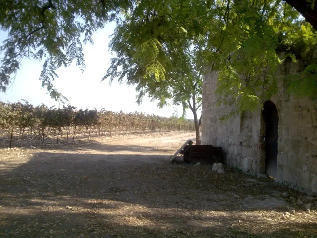
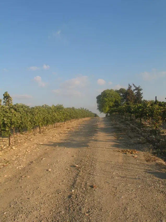
According to that description, cactuses and numerous grapevines grow across the village site.
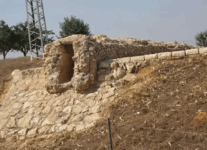
Only one stone house remained, with a flat roof and a round-arched doorway; it was being used for storage.
The surrounding village lands were being cultivated at the time of the historical field survey.
Sources
Photo gallery




Photos from the village's people
Photos sent in by visitors and published after review.
Add a photo of this village
Log in to add photos of this village.
Other villages from Ramla
More from the archive



 Download Our Palestine App
The whole archive in the palm of your hand: depopulated villages, the Nakba, the massacres and Al-Aqsa — free, with no ads to erase the story.
Download Our Palestine App
The whole archive in the palm of your hand: depopulated villages, the Nakba, the massacres and Al-Aqsa — free, with no ads to erase the story.



Comments
No comments yet — be the first to write one.
Add your comment
Name and email are optional. Comments appear after review.