
The depopulated village of Jilya / District of Ramla

About the depopulated village of Jilya
- District
- Ramla
- Date Jilya was occupied
- 09 July 1948
- Population in 1948
- 380
- Military operation
- Operation Dani
- Who defended the village
- Egyptian Army and some Palestinian militia
- Distance from the governorate centre
- 17 (km) South of al-Ramla
- Elevation above sea level
- 125 m
- Cause of displacement
- Influence of fall of, or exoduce from, neighboring town
- Extent of destruction
- Influence of fall of, or exoduce from, neighboring town
- Ethnic cleansing
- Jilya inhabitants were completely ethnically cleansed.
- Refugees' migration routes
- Most villagers sought refuge in the Hebron area.
Hover a dot to read the village name, or click to open its card.
Borders of the depopulated village of Jilya
Jilya – Depopulated Palestinian Village of the Ramla Subdistrict
Jilya was a Palestinian village in the Ramla Subdistrict, situated on gently rolling hills of the coastal plain approximately 17 kilometers south of Ramla and at an average elevation of about 125 meters above sea level.
A secondary road connected Jilya with the road leading southwest toward Gaza and with the Ramla–Jerusalem road to the northeast. Other local roads connected the village with neighboring Palestinian communities.
- Subdistrict
- Ramla
- Mandate District
- Lydda
- Distance from Ramla
- Approximately 17 km south
- Average Elevation
- Approximately 125 meters
- Population in 1922
- 269
- Population in 1931
- 271 in 63 occupied houses
- Population in 1944/1945
- 330
- Estimated Population in 1948
- 383 according to Salman Abu Sitta's Register – a later estimate, not an official census
- Total Land Area
- 10,347 dunums
- Occupation / Depopulation Date
- 9–10 July 1948
- Military Operation
- Operation An-Far / Giv'ati clearing operations south of Ramla in the Hebron foothills
- Military Unit
- Giv'ati Brigade
- Main Refuge Destination
- Hebron area
- Post-1948 Settlements
- No Israeli settlements are documented on Jilya village land
Name and Earlier History
Jilya may have been built on the site of an ancient settlement known in the Roman period as Galla.
In 1596, Jilya was recorded in the nahiya of Gaza in the liwa' of Gaza with an estimated population of 94.
The village paid taxes on wheat and barley as well as goats, beehives, vineyards, and other agricultural production.
Jilya itself should not be confused with ancient Ekron. Khirbat al-Muqanna', located a little over one kilometer northwest of Jilya, was identified with the ancient Philistine site of Ekron.
The Village in the Late Nineteenth Century
In the late nineteenth century Jilya was described as a village constructed of stone and mud.
Its built-up area was rectangular, extending from southeast to northwest.
During the later Mandate period, construction expanded toward the southwest along the road leading to al-Khayma.
Population
Jilya's Mandate-era population was Muslim.
- 159694Estimate derived from Ottoman records
- 1922269Official Census of Palestine
- 1931271Official Census of Palestine
- 1944/1945330Government of Palestine statistics
- 1948383Later demographic estimate in Salman Abu Sitta's Register
Number of Houses
The official 1931 Census of Palestine recorded 63 occupied houses in Jilya.
Some later databases estimate approximately 89 houses for 1948, but this is not an official housing census and should not be treated as equivalent to the 1931 figure.
Land Ownership in 1944/1945
Jilya's total land area was 10,347 dunums.
- Palestinian10,345 dunums100%
- Transferred to Zionists0 dunums0%
- Communal/Public2 dunums<1%
The official Government of Palestine categories were Arab, Jewish, and Public: 10,345 Arab dunums, zero in the Jewish category, and two public dunums.
Land Use in 1944/1945
- Citrus and Bananas40 dunums<1%
- Cereals7,677 dunums42%
- Total Cultivable Land7,717 dunums43%
- Built-up Area7 dunums<1%
- Non-Cultivable Land2,623 dunums15%
Palestine Remembered also lists 40 dunums of olive groves. That figure is treated as a separate thematic statistic and is not added again to the 7,717-dunum cultivable total, avoiding double counting.
Economic Life
Jilya's economy was based primarily on agriculture.
The villagers cultivated cereals, vegetables, and fruit, including citrus and bananas.
Fruit orchards to the north and west were irrigated from several wells, while most other crops depended on rainfall.
The hilly land east of the village was used as grazing ground for livestock.
Water
Several wells north and west of Jilya supplied irrigation water for the village's fruit orchards and contributed to local water needs.
An ancient well was also recorded among the archaeological remains at the site.
Mosque and Shops
Jilya had a mosque serving its Muslim population and several small shops.
These formed part of the social and commercial center of the compact village.
Education
In 1945 Jilya shared an elementary school with the neighboring villages of Qazaza and Sajad.
The shared school was an example of educational cooperation among several small rural communities during the final years of the British Mandate.
Archaeological Remains
Jilya contained archaeological remains including:
- Foundations of earlier buildings.
- Rock-cut tombs.
- An ancient well.
Khirbat al-Muqanna' northwest of Jilya was identified with ancient Ekron and was the subject of archaeological excavations beginning in 1981.
Military Situation before Jilya's Fall
Jilya lay among a group of villages south of Ramla and along the lower Hebron foothills that came under a major Giv'ati offensive after the end of the First Truce in July 1948.
The occupation of Tall al-Safi was particularly important because it severed several of these villages from Egyptian and Palestinian militia forces positioned to the east and south.
Operation An-Far
Operation An-Far began during the night of 8–9 July 1948 and continued until 15 July.
It was conducted by the Giv'ati Brigade on the southern front and aimed to expand Israeli-held territory eastward and southward and attempt to establish a connection toward the Jewish settlements in the Naqab.
The offensive included a series of village-clearing actions in the arc south of Ramla between the coastal plain and the Hebron hills.
Jilya fell within the same Giv'ati advance on 9–10 July.
Correcting the Confusion with Operation Dani
Some later databases classify Jilya under the first stage of Operation Dani and name the Yiftach Brigade as the attacking unit.
This conflicts with Walid Khalidi's account, PalQuest's Jilya entry, and Palestine Land Society documentation.
The stronger evidence identifies the Giv'ati Brigade as the force that overran Jilya on 9–10 July during its clearing operations south of Ramla.
Operation Dani was a separate offensive that began on 9 July and focused in its first stage on Lydda and Ramla. PalQuest's Operation Dani entry does not list Jilya among its affected villages.
This article therefore identifies Operation An-Far / associated Giv'ati clearing operations as the more accurate military context for Jilya.
Occupation and Depopulation
Jilya fell to the Giv'ati Brigade on 9–10 July 1948.
Khalidi's account states that residents of the area fled as Israeli columns approached, especially following the fall of Tall al-Safi and the resulting isolation from Arab forces to the east and south.
Most Jilya villagers subsequently sought refuge in the Hebron area.
Additional documentation published by Palestine Land Society, citing a Giv'ati Brigade report dated 16 July, records Jilya among villages whose inhabitants were expelled and where a number of houses were blown up and burned.
The available evidence therefore indicates both flight in the face of the advancing military forces and subsequent expulsion and destruction during Giv'ati's consolidation of the area.
Occupation and Displacement Chronology
- Until 1948
Pre-Nakba Village
A Palestinian agricultural village with 330 inhabitants in 1944/45 and 10,347 dunums of land.
- 8 July 1948
End of the First Truce
Fighting resumed on the southern front.
- Night of 8–9 July 1948
Beginning of Operation An-Far
The Giv'ati Brigade began its offensive south of Ramla toward the Naqab.
- 9–10 July 1948
Occupation and Initial Displacement
Giv'ati forces overran Jilya; most villagers eventually fled toward the Hebron region.
- 16 July 1948
Giv'ati Brigade Report
A brigade report listed Jilya among villages whose inhabitants had been expelled and where houses were blown up and burned.
Military Unit
Military Unit: Giv'ati Brigade.
The principal sources place Jilya within the Giv'ati offensive in the lower Hebron foothills south of Ramla during the Ten Days between the two truces.
There is insufficient evidence to identify the Yiftach Brigade as the unit that occupied Jilya despite that attribution appearing in some secondary statistical databases.
Cause of Displacement
Jilya's depopulation was connected with the advance of Israeli forces belonging to the Giv'ati Brigade and the collapse of the surrounding defensive position following the occupation of Tall al-Safi.
Some residents fled before the advancing columns, while Giv'ati documentation subsequently recorded the removal of inhabitants from the group of villages that included Jilya and the demolition and burning of houses.
The most accurate description is therefore flight under military attack combined with expulsion and clearing after Giv'ati forces entered the area.
Refuge Destination
The principal historical account states that most of Jilya's inhabitants sought refuge in the Hebron region.
Salman Abu Sitta estimated Jilya's 1948 population at 383, while an older demographic register reproduced an estimate of approximately 2,351 refugees and descendants in 1998.
These later figures are demographic estimates rather than comprehensive official refugee censuses.
Extent of Destruction
Military documentation records the blowing up and burning of a number of houses in Jilya following occupation.
The principal sources do not provide a complete postwar building inventory from which a precise percentage of destruction can be calculated.
No unsupported figure such as “100 percent destroyed” is therefore used.
Israeli Settlements on Jilya Land
According to Walid Khalidi and PalQuest, no Israeli settlements were established on Jilya village land.
Nearby settlements should therefore not be described as being “on Jilya land” solely because of geographic proximity.
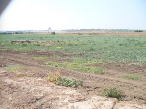
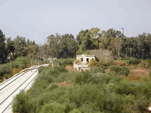
Jilya Today
The available description of the site comes from the historical field research incorporated into Walid Khalidi's All That Remains and is not a direct 2026 field verification.
According to that description, the area is fenced and inaccessible.
The restricted access prevented a complete field inventory of the village remains.
Historically documented archaeological features—including building foundations, rock-cut tombs, and an ancient well—remain part of Jilya's recorded landscape, but their precise current condition would require a new field survey.
Sources
- PalQuest – Interactive Encyclopedia of the Palestine Question: Jilya
- PalQuest – Operation An-Far
- Institute for Palestine Studies – Walid Khalidi, All That Remains
- Government of Palestine – Census of Palestine, 1922
- Government of Palestine – Census of Palestine, 1931: Jilya, 271 inhabitants and 63 occupied houses
- Government of Palestine / Sami Hadawi – Village Statistics 1945
- Palestine Remembered – Jilya entry from All That Remains
- Salman Abu Sitta – Register of Depopulated Palestinian Localities: Jilya
- Palestine Land Society – Documentation of Jilya's July 1948 expulsion and destruction
Photo gallery
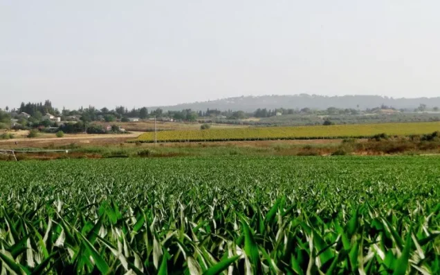

Photos from the village's people
Photos sent in by visitors and published after review.
Add a photo of this village
Log in to add photos of this village.
Other villages from Ramla

More from the archive

 Download Our Palestine App
The whole archive in the palm of your hand: depopulated villages, the Nakba, the massacres and Al-Aqsa — free, with no ads to erase the story.
Download Our Palestine App
The whole archive in the palm of your hand: depopulated villages, the Nakba, the massacres and Al-Aqsa — free, with no ads to erase the story.



Comments
No comments yet — be the first to write one.
Add your comment
Name and email are optional. Comments appear after review.