
The depopulated village of Sarafand al-Kharab / District of Ramla

Sarafand al-Kharab
About the depopulated village of Sarafand al-Kharab
- District
- Ramla
- Date Sarafand al-Kharab was occupied
- 20 April 1948
- Population in 1948
- 1,206
- Distance from the governorate centre
- 7 (km) West of al-Ramla
- Elevation above sea level
- 50 m
- Cause of displacement
- Fear of Jewish attack, or of being caught in the fighting
- Extent of destruction
- Sarafand al-Kharab was mostly destroyed with the exception of few houses remain standing and one of its schools.
- Ethnic cleansing
- Sarafand al-Kharab inhabitants were completely ethnically cleansed.
Hover a dot to read the village name, or click to open its card.
Borders of the depopulated village of Sarafand al-Kharab
Sarafand al-Kharab – Depopulated Palestinian Village of Ramla
Sarafand al-Kharab, also known as Sarafand al-Sughra, was a Palestinian village in the Ramla Subdistrict and the Lydda administrative district during the British Mandate. It stood on flat land in the central coastal plain approximately 7 kilometers west of Ramla and about 50 meters above sea level.
A spur road linked the village to a highway to the west that intersected the main Ramla-Jaffa road. Sarafand al-'Amar, or Sarafand al-Kubra, was a separate village to the northeast, and the two localities must be distinguished carefully in demographic and historical records.
Sarafand al-Kharab had 1,040 inhabitants in 1944/45: 930 Muslims and 110 Christians. Its statistical land unit covered 5,503 dunums. Agriculture dominated the economy, particularly citrus cultivation, supported by fertile soil and numerous artesian wells.
The Palestinian population began leaving during April 1948 amid growing fears of attack and the fighting around Ramla and the Jerusalem road. Khalidi places the principal flight on 20 April but states that the village itself may not have come under Israeli occupation until mid-May. Depopulation and military occupation should therefore be treated as distinct stages.
Basic Information
| Field | Information |
|---|---|
| Name | Sarafand al-Kharab |
| Arabic name | صرفند الخراب |
| Alternative name | Sarafand al-Sughra |
| Subdistrict | Ramla |
| Administrative district | Lydda |
| Location | Central coastal plain, west of Ramla |
| Distance from Ramla | Approximately 7 km west |
| Average elevation | Approximately 50 m above sea level |
| Palestine Grid | 131/149 |
| Population in 1922 | 385, all Muslims |
| Population in 1931 | 974; 971 Arabs and 3 Jews in PalQuest's classification |
| Houses in 1931 | 206 |
| Population in 1944/45 | 1,040: 930 Muslims and 110 Christians |
| 1948 population estimate | 1,206 – later estimate, not an official census |
| Total land area | 5,503 dunums |
| Principal depopulation date | 20 April 1948 according to the account used by Khalidi |
| Probable actual occupation | Mid-May 1948; exact date and direct occupying unit remain uncertain |
| Military context | Operation Nachshon and fighting around Ramla and the Jerusalem road contributed to displacement, but Nachshon ended before 20 April |
| Military unit | Giv'ati Brigade in the Operation Nachshon context; the unit that actually entered the village in mid-May is not independently documented |
| Cause of depopulation | Fear of military attack or of becoming caught in the fighting |
| Destruction | A large part of the village was destroyed, but multiple houses, a school, a pool, and a pump house survived |
| Settlements on village lands | Nes Tziyyona, founded before 1948 and later expanded onto village land; Yad Eli'ezer, founded in the early 1950s |
Sarafand al-Kharab and Sarafand al-'Amar
Two separate Palestinian villages in the Ramla area carried the name Sarafand.
Sarafand al-Kharab was also known as Sarafand al-Sughra, “the smaller Sarafand,” while Sarafand al-'Amar was known as Sarafand al-Kubra, “the larger Sarafand.”
Sarafand al-'Amar stood northeast of Sarafand al-Kharab.
The distinction is essential because some modern statistical pages confuse figures belonging to the two villages. The often-repeated figure of 862 inhabitants in 1922 belongs to Sarafand al-'Amar, not Sarafand al-Kharab.
Name and Earlier History
Khalidi suggests that the designation al-Kharab, “the ruined,” may reflect the condition of the site in the early nineteenth century.
When Edward Robinson travelled through the area in 1838, he recorded two villages called Sarafand, one inhabited and the other ruined. The ruined locality was probably Sarafand al-Kharab.
The site was repopulated in the late nineteenth century, as indicated by the Survey of Western Palestine maps.
Distinctive architectural remains, including vaults, have also led researchers to identify the site with an unnamed Crusader-period locality.
British-Period Burning
Khalidi records that British forces burned Sarafand al-Kharab in the late 1920s in retaliation following the killing of British soldiers after an incident with villagers.
Many inhabitants were displaced temporarily to neighboring villages, but the community later returned and rebuilt Sarafand al-Kharab.
Palestinian oral traditions preserve differing dates and details for this event.
It should not automatically be conflated with the separately documented December 1918 Surafend incident, which other historical records identify with Sarafand al-'Amar.
Built Environment
After the village was rebuilt, houses were arranged in attached rows.
Some were constructed from mud and straw, while others used cement.
The built-up area covered 33 dunums in the 1944/45 statistics.
The 1931 census recorded 206 occupied houses.
Population
- 1922385Official census; all Muslims
- 1931974Official census; PalQuest records 971 Arabs and 3 Jews
- 1944/451,040Official estimate: 930 Muslims and 110 Christians
- 19481,206Later demographic estimate, not an official census
- 19987,409Later Palestine Remembered estimate of refugees and descendants
Some Palestine Remembered and Palestinian village-encyclopedia pages display 862 inhabitants for 1922. That figure belongs to Sarafand al-'Amar; the official Sarafand al-Kharab census figure is 385.
Number of Houses
- 1931206Official census figure
- 1948255Later estimate, not a new official government house census
Land Ownership, 1944/45
The Government of Palestine used the categories Arab, Jewish, and Public. The project terminology is shown below alongside that official classification:
- Palestinian – official “Arab” category3,545 dunums64%
- Transferred to Zionists – official “Jewish” category1,611 dunums29%
- Public347 dunums6%
The figures balance exactly: 3,545 + 1,611 + 347 = 5,503 dunums.
Land Use, 1944/45
- Palestinian
- Transferred to Zionists
- Public
- Citrus and bananas4,235 dunums
- Cereals499 dunums
- Plantations and irrigable land64 dunums
- Built-up area33 dunums
- Non-cultivable land672 dunums
The land-use categories reconcile exactly with the total statistical village area.
Correction to Simplified Land Tables
Some simplified tables display 310 dunums of Palestinian cereal land, but that figure combines 268 Palestinian dunums with 42 Public dunums.
Likewise, the displayed 352 non-arable Palestinian dunums combine 47 Palestinian dunums with 305 Public dunums.
This article therefore keeps Public land as a separate category.
Economy and Agriculture
Agriculture formed the economic base of Sarafand al-Kharab.
The villagers drilled numerous artesian wells that supplied irrigation water, while fertile soil supported intensive cultivation of fruit and vegetables.
Citrus was the principal crop. In 1944/45, 3,148 Palestinian dunums and 1,087 dunums in the official Jewish category were planted with citrus and bananas.
Cereals, orchards, and irrigated crops provided additional agricultural income.
Water and Artesian Wells
Sarafand al-Kharab had abundant groundwater resources.
The villagers drilled numerous artesian wells, which were particularly important for irrigating citrus groves and vegetable plots.
The combination of fertile soil and accessible irrigation water made the village one of the strongly horticultural communities in the Ramla coastal plain.
Education
The villagers established a boys' school in 1920.
It later developed into a full elementary school with approximately 258 pupils in the mid-1940s.
Students also came from Wadi Hunayn, Bir Salim, and al-Nabi Rubin. Pupils from Wadi Hunayn alone represented roughly one quarter of the total enrollment.
A girls' school was established in 1945 and enrolled forty-six girls in its opening year.
Religious Buildings
The 1944/45 population included 930 Muslims and 110 Christians.
However, Khalidi's village profile and PalQuest do not independently document a specific mosque or church building at Sarafand al-Kharab.
No particular religious structure is therefore inferred from population affiliation alone.
Archaeological Remains
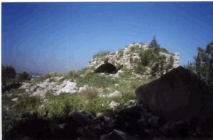
The village site contained older architectural remains, including vaults and traces of former structures.
These remains led researchers to identify Sarafand al-Kharab with an unnamed Crusader-period site.
The Survey of Western Palestine also recorded older structural remains and a stone-and-mortar reservoir or pool in the locality.
These features demonstrate an older history of occupation but do not justify assigning all visible remains to a single archaeological period.
Operation Nachshon and the Military Context
The Haganah conducted Operation Nachshon from 3 to 15 April 1948 using forces that included the Giv'ati and Har'el brigades.
The operation sought to seize and secure villages and positions along the Tel Aviv-Jerusalem road in order to open the route to Jewish traffic.
PalQuest includes Sarafand al-Kharab among the localities affected by Operation Nachshon.
However, the operation's impact on displacement should be distinguished from the village's actual occupation: Nachshon ended on 15 April, Khalidi dates the principal flight to 20 April, and he suggests that the village itself may not have been occupied until mid-May.
Possible Attack on 12 April 1948
A New York Times report cited by Khalidi stated that a Jewish unit struck deep into Arab-held territory and blew up twelve houses near Ramla and two neighboring villages.
Khalidi suggests that Sarafand al-Kharab may have been one of those villages.
The source is explicitly tentative, so this should not be converted into a categorical claim that Sarafand al-Kharab was definitely attacked or occupied on 12 April.
Principal Depopulation – 20 April 1948
Khalidi's account states that the villagers left on 20 April 1948 because they feared a military attack.
The broader atmosphere created by fighting along the Jerusalem road, the Deir Yasin massacre of 9 April, and the advance of Operation Nachshon contributed to insecurity throughout the area.
This article therefore treats 20 April as the principal depopulation date, not as a firmly established date of final military occupation.
When Was Sarafand al-Kharab Actually Occupied?
Khalidi notes that Sarafand al-Kharab may not have come under Israeli control until mid-May 1948, approximately when neighboring Sarafand al-'Amar and Bir Salim were occupied.
No exact day is provided.
The chronology should therefore distinguish three stages: military pressure and a possible raid during Operation Nachshon, the principal population flight on 20 April, and probable final occupation in mid-May.
Military Unit
The Giv'ati Brigade is clearly associated with Operation Nachshon and the military pressure surrounding Sarafand al-Kharab during April.
The village-level record does not, however, identify the brigade or battalion that physically entered the village when final control was probably established in mid-May.
The most accurate formulation is therefore: Giv'ati Brigade in the Operation Nachshon and pre-depopulation military context; the unit responsible for final occupation is not independently documented.
Cause of Depopulation
Palestine Remembered classifies the cause as fear of attack or fear of becoming caught in the fighting.
This is consistent with Khalidi's account that the villagers departed before final military control was established.
The principal village narrative does not document a collective expulsion order issued after troops entered Sarafand al-Kharab.
The most cautious formulation is therefore: flight under fear of military attack and of the fighting spreading to the village during the escalating operations around Ramla and the Jerusalem road.
Destruction
A large portion of Sarafand al-Kharab was demolished after its Palestinian community was displaced.
The village was not completely destroyed.
Khalidi's field survey documented a significant number of surviving houses, no more than six of which were occupied by Jewish families at the time of his survey.
The village school, a pool, and a pump house also survived.
No independently documented date is provided for the demolition of the other buildings, so depopulation, occupation, and later destruction should remain separate stages.
Ethnic Cleansing in Source Classification
Palestine Remembered classifies Sarafand al-Kharab using the term “complete ethnic cleansing.” The phrase is retained here only as an attributed source classification.
The more specifically documented facts are the villagers' departure under fear of attack and fighting, subsequent Israeli control of the village, the absence of permanent collective Palestinian return, and the destruction of a substantial portion of the built environment.
Occupation and Depopulation Chronology
| Date | Event |
|---|---|
| 3 April 1948 | Operation Nachshon begins with Giv'ati and Har'el forces participating. |
| 9 April 1948 | The Deir Yasin massacre increases fear among Palestinian communities in the wider region. |
| 12 April 1948 | A report describes houses blown up near Ramla and two neighboring villages; Khalidi states that Sarafand al-Kharab may have been one of them. |
| 15 April 1948 | Operation Nachshon formally ends according to PalQuest. |
| 20 April 1948 | Khalidi's principal date for the villagers' flight under fear of attack. |
| Mid-May 1948 | Probable actual Israeli occupation of Sarafand al-Kharab; exact day and village-level unit are not established. |
| Later period | A large part of the village is demolished, while numerous houses, the school, a pool, and a pump house survive. |
| Early 1950s | Yad Eli'ezer is established on village land; it later ceases to exist as a separate locality. |
Israeli Settlements Established on Sarafand al-Kharab's Lands
Nes Tziyyona was founded in 1882, decades before the Nakba. Khalidi states that many of its later buildings stand on Sarafand al-Kharab's lands. It should therefore be classified as a pre-1948 settlement that expanded onto village land rather than as a settlement founded after the village was depopulated.
Yad Eli'ezer was established on Sarafand al-Kharab's lands in the early 1950s. It later ceased to exist as a separate, distinct locality.
Beit Hanan, founded in 1948 west of the village site, was nearby but was not established on Sarafand al-Kharab's lands according to Khalidi.
Sarafand al-Kharab Today
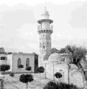
According to the field description used by Walid Khalidi before the publication of All That Remains in 1992, a major part of the village had been destroyed, but many houses remained.
No more than six of the surviving houses were occupied by Jewish families, including the former house of Muhammad Darwish.
Most surviving houses had gable roofs and rectangular doors and windows, while one substantial building had two storeys and a sloping roof.
The former village school was still standing and was being used by Israeli pupils.
A pool and pump house in the orchard of Mahmud Yusuf Darwish also remained intact.
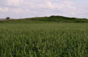
Castor-oil and mulberry trees grew around the village site, while cactus covered the cemetery and surrounding lands were under cultivation.
This description represents historical fieldwork conducted before the publication of Khalidi's book in 1992. It is not a comprehensive direct archaeological or cadastral survey of all former Sarafand al-Kharab lands in 2026.
Sources
Photo gallery


Photos from the village's people
Photos sent in by visitors and published after review.
Add a photo of this village
Log in to add photos of this village.
Other villages from Ramla

More from the archive


 Download Our Palestine App
The whole archive in the palm of your hand: depopulated villages, the Nakba, the massacres and Al-Aqsa — free, with no ads to erase the story.
Download Our Palestine App
The whole archive in the palm of your hand: depopulated villages, the Nakba, the massacres and Al-Aqsa — free, with no ads to erase the story.



Comments
No comments yet — be the first to write one.
Add your comment
Name and email are optional. Comments appear after review.