
The depopulated village of Ajanjul / District of Ramla
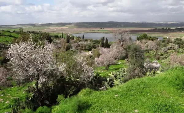
Ajanjul
About the depopulated village of Ajanjul
- District
- Ramla
- Date Ajanjul was occupied
- 12 July 1948
- Population in 1948
- 1,240
- Military operation
- Operation Dani
- Distance from the governorate centre
- 15 km southeast al-Ramla
- Elevation above sea level
- 275 m
- Extent of destruction
- Destruction, rubble identified
- Ethnic cleansing
- Completely ethnically cleansed
Hover a dot to read the village name, or click to open its card.
Borders of the depopulated village of Ajanjul
Ajanjul – Depopulated Palestinian Village of the Ramla Subdistrict
Ajanjul was a small Palestinian village in the Ramla Subdistrict, approximately 15 kilometers southeast of Ramla. It stood on low hills extending from north to south at an average elevation of about 275 meters above sea level.
The village was closely linked to neighboring Bayt Nuba. Some Bayt Nuba residents initially stayed at Ajanjul seasonally in order to cultivate the surrounding land and store crops. Permanent settlement gradually developed, and by the 1931 Census of Palestine Ajanjul was listed as an independent village.
- Subdistrict
- Ramla
- Mandate District
- Lydda
- Type of Locality
- Small settled village / hamlet historically connected with Bayt Nuba
- Distance from Ramla
- Approximately 15 km southeast
- Average Elevation
- Approximately 275 meters
- Population in 1931
- 19 – official Census of Palestine
- Occupied Houses in 1931
- 5
- Estimated Population in 1945
- Approximately 140 in around 30 houses according to Mustafa Murad al-Dabbagh
- 1945 Village Statistics Population
- 1,240 for Bayt Nuba and Ajanjul combined – not Ajanjul alone
- 1945 Land Area
- 11,401 dunums for Bayt Nuba and Ajanjul combined – no separate Ajanjul total
- Occupation / Depopulation Date
- Not conclusively established in the principal village source; later Palestinian sources give 12 July 1948
- Military Operation
- Operation Dani according to later Palestinian sources; not independently established in Khalidi/PalQuest's Ajanjul entry
- Military Unit
- No specific brigade or battalion is securely documented at village level
- Cause of Displacement
- Not described in detail by the principal source; later sources place it within Israeli military operations in July 1948
- Extent of Destruction
- The village buildings were destroyed and rubble remained; no reliable numerical destruction percentage exists
- Israeli Settlements on Village Land
- None documented
Location
Ajanjul stood on low hills extending north to south along the western foothills of the Ramallah highlands.
A dirt track connected it with the main roads leading toward Ramla to the northwest and Ramallah to the northeast.
Palestinian geographical sources also describe local paths connecting it with Yalu, Nitaf, Bayt Liqya, and neighboring Bayt Nuba.
Ajanjul and Bayt Nuba
The history of Ajanjul cannot be separated from that of Bayt Nuba.
Residents of Bayt Nuba initially used the site seasonally for cultivation, building scattered structures among the fields and using some of them to store agricultural produce.
Permanent settlement later developed, and Ajanjul was enumerated as a separate village in the official 1931 census.
In the 1945 Village Statistics, however, Ajanjul was combined with Bayt Nuba in one statistical unit. This is essential when interpreting the 1945 population and land figures.
Historical Name
Walid Khalidi records that Ajanjul was known as Bulbul during the Crusader period.
Nineteenth-century Survey of Western Palestine researchers described the site as an uninhabited ruin with visible remains.
During the Mandate period it was classified as a small hamlet in the Palestine Index Gazetteer.
The principal Palestinian sources used here do not provide a securely documented linguistic derivation for the modern name Ajanjul, so no speculative etymology is included.
Population in 1931
The official 1931 Census of Palestine recorded Ajanjul independently:
| Total | 19 |
|---|---|
| Category | Number |
| Males | 9 |
| Females | 10 |
| Occupied Houses | 5 |
All inhabitants were recorded as Muslims.
Population in 1945
Two different population figures appear in the sources and must be distinguished.
First: Mustafa Murad al-Dabbagh estimated Ajanjul itself at approximately 140 inhabitants living in around 30 houses in 1945.
Second: the official Village Statistics gave 1,240 inhabitants for Bayt Nuba and Ajanjul combined.
The 1,240 figure must therefore not be presented as Ajanjul's independent population.
| Year | Figure | Nature of Figure |
|---|---|---|
| 1931 | 19 | Official independent census of Ajanjul |
| 1945 | Approximately 140 | Mustafa Murad al-Dabbagh's estimate for Ajanjul itself |
| 1945 | 1,240 | Official combined figure for Bayt Nuba and Ajanjul |
Correction of the 1948 Population Figure
Some later Palestinian lists give 1,438 inhabitants for Ajanjul in 1948.
This number is inconsistent with the village's independent census history and appears to derive from demographic projection of the combined 1,240 figure for Bayt Nuba and Ajanjul.
It is therefore not used here as Ajanjul's 1948 population.
No sufficiently secure independent 1948 Ajanjul population estimate was identified in the principal sources reviewed.
Land of Bayt Nuba and Ajanjul in 1945
The 1945 Village Statistics combined Bayt Nuba and Ajanjul into one land unit totaling 11,401 dunums.
These figures must not be treated as Ajanjul's separate land area.
- Arab11,383 dunums100%
- Jewish0 dunums0%
- Public18 dunums<1%
This is a combined Bayt Nuba–Ajanjul table, not an independent Ajanjul ownership table.
Land Use in 1945
The combined Bayt Nuba–Ajanjul land unit contained approximately 7,999 dunums of cultivable land.
- Plantations and Irrigable Land1,002 dunums5%
- Cereals6,997 dunums36%
- Total Cultivable Land7,999 dunums41%
- Built-up Land74 dunums<1%
- Non-Cultivable Land3,328 dunums17%
These figures likewise apply to the combined statistical unit and do not permit Ajanjul's individual share to be calculated.
Economic Life
Ajanjul depended on rain-fed agriculture.
Its principal crops included:
- Cereals.
- Olives.
- Figs.
- Almonds.
Sources describing the combined Bayt Nuba–Ajanjul agricultural area also mention legumes, vegetables, and other fruit trees.
Water
Ajanjul relied principally on rainfall for water and was closely dependent on neighboring Bayt Nuba for some everyday needs.
No independently documented permanent spring or village water network has been identified in the principal sources reviewed.
Education and Services
Ajanjul did not have a separately documented school.
Village children attended the school in Bayt Nuba, which also provided other services to Ajanjul residents.
This reflects the close functional relationship between the two communities despite Ajanjul's independent census status in 1931.
Occupation and Depopulation
Walid Khalidi's and PalQuest's Ajanjul entry does not provide a specific account of how or exactly when the village was occupied and depopulated.
Several later Palestinian sources, however, give 12 July 1948 as the date of occupation and displacement.
The evidence should therefore be presented in two layers:
- Principal village source: no conclusive occupation and depopulation details are available.
- Later Palestinian sources: 12 July 1948 is given as the occupation/depopulation date.
Operation Dani
Palestine Remembered and several later village databases associate Ajanjul with Operation Dani.
Operation Dani lasted from 9 to 18 July 1948.
Its first phase, from 9 to 12 July, resulted in the occupation of Lydda and Ramla and surrounding localities.
Its second phase, from 13 to 18 July, pushed toward the Jerusalem corridor, al-Latrun, and the Ramallah road.
However, PalQuest's detailed list of villages affected by Operation Dani does not include Ajanjul, and the Ajanjul village entry itself does not explicitly connect the village to the operation.
The most accurate formulation is therefore: Operation Dani is attributed to Ajanjul's depopulation by later Palestinian sources, but it is not independently established in Khalidi/PalQuest's village documentation.
Military Unit
Operation Dani involved several formations, including the Har'el, Yiftach, Kiryati, Alexandroni, and armored forces.
No source reviewed here identifies a particular brigade or battalion as the unit that entered Ajanjul or directly displaced its inhabitants.
Military Unit: not independently documented.
Occupation and Displacement Chronology
- Before 1931
Permanent Settlement
Seasonal cultivation by Bayt Nuba residents developed into a permanent locality; the census recorded 19 people in five houses.
- By 1945
Village Growth
Mustafa Murad al-Dabbagh estimated about 140 residents in around 30 houses.
- 9 July 1948
Beginning of Operation Dani
A major Israeli offensive began across the Lydda–Ramla and Jerusalem corridor sectors.
- 12 July 1948
Later-Reported Ajanjul Occupation Date
This date appears in later Palestinian sources but is not documented as such in Khalidi's village entry.
- 13–18 July 1948
Second Phase of Operation Dani
Fighting shifted toward al-Latrun and the Ramallah road; no source used here identifies the exact force that operated at Ajanjul.
Cause of Displacement
The principal village source does not provide a detailed account of the immediate cause of Ajanjul's depopulation.
Later Palestinian sources place it in the context of Israeli military operations in July 1948, with some specifically identifying Operation Dani.
The most cautious description is therefore displacement during the Israeli military takeover of the Ramla–Latrun region in July 1948, while the precise village-specific circumstances remain insufficiently documented.
Extent of Destruction
Ajanjul's built-up area was destroyed after its depopulation.
Historical field documentation records only the stone rubble of demolished houses concentrated in a small area.
No reliable numerical destruction percentage is available.
Israeli Settlements on Ajanjul Land
Walid Khalidi and PalQuest state that no Israeli settlements were established on Ajanjul village land.
No neighboring settlement is therefore listed as being “on village land” without separate cadastral proof.
Ajanjul Today
The available site description is based on historical field research incorporated into Walid Khalidi's All That Remains and should not be treated as direct 2026 field verification.
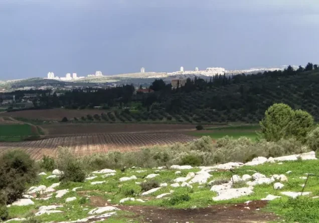
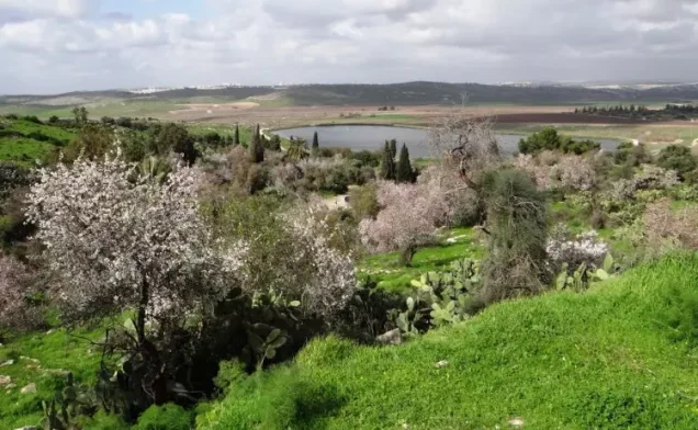
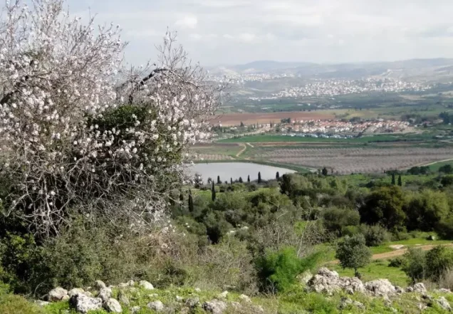
At the time of that documentation, only the stone rubble of the village houses remained, concentrated in a small area overgrown with wild vegetation.
Fig, almond, and mulberry trees continued to grow on and around the site.
A rocky structure containing two graves stood on the southern side of the village, while the village cemetery lay to the southwest with two visible stone graves.
The area was described as closed and situated along the former pre-1967 Jordan–Israel boundary.
Sources
- PalQuest – Interactive Encyclopedia of the Palestine Question: Ajanjul
- PalQuest – Operation Dani
- Institute for Palestine Studies – Walid Khalidi, All That Remains
- Palestinian Encyclopedia – Ajanjul, drawing on Mustafa Murad al-Dabbagh
- Palestine Remembered – Ajanjul, Ramla
- Palestinian Ministry of Foreign Affairs – List of Palestinian Localities Occupied and Depopulated in 1948
- Government of Palestine – Census of Palestine, 1931: Ajanjul
Photo gallery


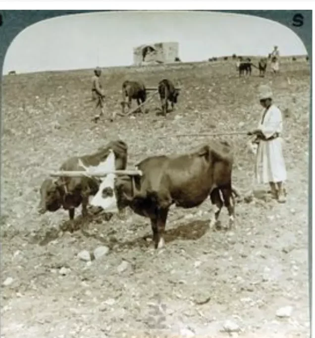
Photos from the village's people
Photos sent in by visitors and published after review.
Add a photo of this village
Log in to add photos of this village.
Other villages from Ramla
More from the archive



 Download Our Palestine App
The whole archive in the palm of your hand: depopulated villages, the Nakba, the massacres and Al-Aqsa — free, with no ads to erase the story.
Download Our Palestine App
The whole archive in the palm of your hand: depopulated villages, the Nakba, the massacres and Al-Aqsa — free, with no ads to erase the story.



Comments
No comments yet — be the first to write one.
Add your comment
Name and email are optional. Comments appear after review.