
The depopulated village of Umm Kalkha / District of Ramla

Umm Kalkha
About the depopulated village of Umm Kalkha
- District
- Ramla
- Date Umm Kalkha was occupied
- 07 April 1948
- Population in 1948
- 70
- Military operation
- Operation Nachshon
- Distance from the governorate centre
- 12.5 (km) South of al-Ramla
- Elevation above sea level
- 100 m
- Extent of destruction
- Umm Kalkha was completely obliterated and defaced.
- Ethnic cleansing
- Umm Kalkha inhabitants were completely ethnically cleansed.
Hover a dot to read the village name, or click to open its card.
Borders of the depopulated village of Umm Kalkha
Umm Kalkha – Depopulated Palestinian Village of the Ramla Subdistrict
Umm Kalkha was a small Palestinian village in the Ramla Subdistrict, approximately 12.5 kilometers south of al-Ramla. It stood on the northern bank of Wadi al-Sarar in the central coastal plain, at an average elevation of about 100 meters above sea level.
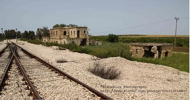
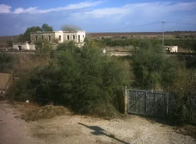
The village contained only a small number of mud- and stone-built houses. The main road connecting Gaza with the Ramla–Jerusalem highway passed to its south, while the nearby Wadi al-Sarar railway station connected the area with the railway line between al-Ramla and Jerusalem.
- Subdistrict
- Ramla
- Mandate District
- Lydda
- Distance from al-Ramla
- 12.5 km south
- Average Elevation
- Approximately 100 meters
- Population in 1931
- 24
- Occupied Houses in 1931
- 6
- Population in 1944/1945
- 60
- Estimated Population in 1948
- Approximately 70 – a later estimate, not an official 1948 census
- Total Land Area
- 1,405 dunums
- Occupation Date
- Uncertain; April or May 1948, with Walid Khalidi regarding Operation Barak as the stronger possibility for final occupation
- Military Operation
- Operation Nachshon is possible in the early phase; Operation Barak is the stronger possibility for final occupation
- Military Unit
- Not conclusively established at village level; Giv'ati participated in both possible operational contexts, Har'el in Nachshon, and Negev in Barak
- Cause of Displacement
- Military occupation and attack within the campaigns around the Jerusalem corridor and southern Ramla; the sources do not provide a detailed village-specific departure narrative
- Extent of Destruction
- The village no longer survives as an independent Palestinian built-up locality; Yesodot occupies the site
- Post-1948 Settlement
- Yesodot – 1948
Location
Umm Kalkha stood on flat land in the central coastal plain along the northern bank of Wadi al-Sarar.
The wadi carries seasonal runoff from the Jerusalem hills toward the Mediterranean, where its lower course is known as Nahr Rubin.
The main road linking Gaza with the Ramla–Jerusalem highway passed south of the village.
The nearby Wadi al-Sarar railway station connected Umm Kalkha with the railway between al-Ramla and Jerusalem, while local dirt tracks linked it with surrounding villages.
Origins of the Modern Village
Walid Khalidi suggests that the modern village of Umm Kalkha was established after 1881.
When the Survey of Western Palestine visited the area in that year, its authors recorded only visible ruins of an older settlement rather than the later inhabited village.
The modern Palestinian locality therefore appears to have developed or expanded during the final decades of Ottoman rule.
Built Environment
Umm Kalkha was very small and had no clearly defined street plan.
Its limited number of houses were built principally of mud and stone, with buildings clustered together and only narrow passages rather than a formal road system.
Population
All of Umm Kalkha's recorded residents were Muslims.
The official 1931 Census of Palestine recorded 24 inhabitants living in six occupied houses.
By 1944/45, the population had risen to 60.
- 193124Official Census of Palestine
- 1944/194560Late-Mandate official statistics
- 1948Approximately 70Later estimate, not an official census conducted in 1948
Number of Houses
The 1931 census recorded six occupied houses.
Some Palestinian databases estimate approximately 17 houses by 1948, but this is a later estimate and not a formal official 1948 housing census.
Land Ownership in 1944/1945
Umm Kalkha had a total land area of 1,405 dunums.
- Palestinian1,233 dunums88%
- Transferred to Zionists96 dunums7%
- Public76 dunums5%
The official Mandate statistics use the categories Arab, Jewish, and Public. The terminology above follows the project's standardized presentation while preserving the meaning of the official categories.
Land Use in 1944/1945
- Palestinian
- Transferred to Zionists
- Public
- Citrus and Bananas21 dunums
- Plantations and Irrigable Land93 dunums
- Cereals1,228 dunums
- Non-Cultivable63 dunums
Most of the village land was cultivated or cultivable, with cereal production representing the largest agricultural use.
Economic Life
The inhabitants depended primarily on agriculture, cultivating cereals, vegetables, citrus, and olives.
Some agriculture was rain-fed, while artesian wells supplied irrigation for portions of the orchards and vegetable plots.
The land-use figures indicate that farming was the principal economic activity of the village.
Water
The villagers obtained drinking water from a nearby well.
Artesian wells were also used to irrigate some agricultural land and orchards.
Education and Services
Because of its very small population, Umm Kalkha had few public facilities, and the principal sources reviewed do not document an independent village school.
Its proximity to the main roads and Wadi al-Sarar railway station facilitated travel to larger centers in the Ramla region.
Khirbat Umm Kalkha
An archaeological site known as Khirbat Umm Kalkha lay near the village.
Its remains included:
- Stone columns.
- Water cisterns.
- Rock-cut tombs.
- Caves.
These remains point to settlement at or near the site long before the establishment of the modern Palestinian village.
The Occupation of Umm Kalkha: Conflicting Chronologies
No single occupation date can be established with complete confidence.
Several Palestinian databases give 7 April 1948 and associate the village with Operation Nachshon.
Walid Khalidi, however, states that both the timing and circumstances remain uncertain and identifies three possibilities:
- Occupation during the first half of April in Operation Nachshon.
- Occupation during smaller follow-up operations from mid-April to early June in the Jerusalem corridor.
- The possibility Khalidi regards as stronger: occupation during Operation Barak in May 1948.
Operation Nachshon
Operation Nachshon lasted from 3 to 15 April 1948 and targeted villages and positions along the road corridor leading toward Jerusalem.
The Har'el and Giv'ati brigades participated at the operation-wide level, and PalQuest lists Umm Kalkha among the affected localities.
Its inclusion in the operational area, however, does not conclusively establish that the village was permanently depopulated on 7 April.
Operation Barak
Walid Khalidi considers Operation Barak the stronger possibility for Umm Kalkha's final occupation.
Operation Barak began on 9 May 1948 and targeted villages south and west of Ramla and across the southern sector.
The Giv'ati Brigade formed the principal attacking force, while the Negev Brigade participated from the south.
PalQuest explicitly lists Umm Kalkha among the localities affected by Operation Barak.
Military Unit
The principal sources do not conclusively identify one village-specific attacking unit.
The possibilities depend on the occupation chronology:
- If Umm Kalkha fell during Operation Nachshon: the operation involved the Har'el and Giv'ati brigades.
- If the village fell during Operation Barak, which Khalidi considers more likely: Giv'ati was the principal brigade, with the Negev Brigade participating in the wider offensive.
Giv'ati is the common formation in both operational contexts, but this does not by itself prove that a particular Giv'ati battalion captured Umm Kalkha.
The most accurate entry is therefore: military unit not conclusively established; Giv'ati was the most prominent formation across both possible operational contexts.
Occupation and Displacement Chronology
| Stage | Period | Details |
|---|---|---|
| Pre-Nakba Village | Until 1948 | A very small agricultural village with approximately 60 inhabitants in the final Mandate years. |
| Beginning of Operation Nachshon | 3 April 1948 | The offensive began against villages and positions along the Jerusalem road corridor. |
| Frequently Cited Date | 7 April 1948 | Several databases use this as Umm Kalkha's occupation date, but Khalidi does not regard it as conclusively established. |
| End of Operation Nachshon | 15 April 1948 | Smaller follow-up operations continued afterward in the Jerusalem corridor. |
| Follow-Up Operations | Mid-April – early June 1948 | Additional villages were occupied during these operations, and Umm Kalkha may have fallen during this phase. |
| Operation Barak | May 1948 | Khalidi regards this as the stronger context for the village's final occupation. |
| Establishment of Yesodot | 1948 | Yesodot was established on Umm Kalkha land and came to occupy the village site. |
Cause of Displacement
The displacement of Umm Kalkha's inhabitants was connected with Zionist military operations targeting the Jerusalem road corridor and villages south of Ramla during the spring of 1948.
Khalidi's account does not provide a detailed village-specific description of whether the inhabitants left during direct combat, immediately before occupation, or after the attacking forces entered.
The most supportable formulation is therefore displacement during military attack and occupation associated with Operation Nachshon and subsequent campaigns, with Operation Barak regarded as the stronger possibility for final occupation.
Extent of Destruction
No Palestinian village survives as an independent built-up locality at the site of Umm Kalkha.
Walid Khalidi states that Yesodot occupies the village site, while other Palestinian sources describe the original village fabric as effectively obliterated.
No documented building-by-building destruction percentage is available, so no unsupported numerical percentage is used.
Yesodot on Umm Kalkha Land
The settlement of Yesodot was established in 1948 on the lands of Umm Kalkha.
Walid Khalidi's site description states that the settlement occupies the village site itself.
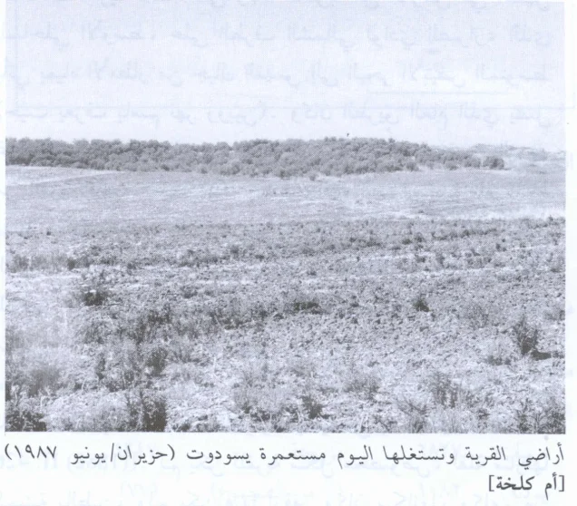
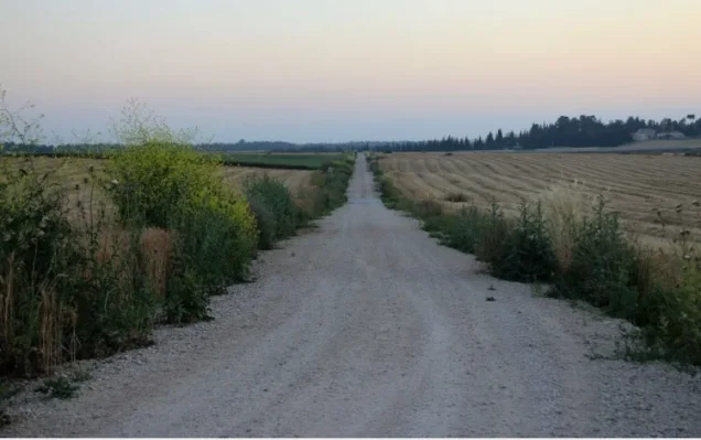
Umm Kalkha Today
According to the historical site description incorporated into Walid Khalidi's All That Remains, Yesodot occupies the former site of Umm Kalkha.
The original Palestinian village no longer survives as a distinct built-up settlement.
The surrounding geography of Wadi al-Sarar and the historic railway corridor still helps identify the former village area, but establishing any material remains that may survive today would require a current field survey.
This section relies on published historical descriptions and is not a direct 2026 field verification.
Sources
- PalQuest – Interactive Encyclopedia of the Palestine Question: Umm Kalkha
- PalQuest – Operation Nachshon
- PalQuest – Operation Barak
- Institute for Palestine Studies – Walid Khalidi, All That Remains
- Palestine Remembered – Umm Kalkha entry from All That Remains
- Palestine Remembered – Umm Kalkha: Population and Land Statistics
Photo gallery


Photos from the village's people
Photos sent in by visitors and published after review.
Add a photo of this village
Log in to add photos of this village.
Other villages from Ramla
More from the archive



 Download Our Palestine App
The whole archive in the palm of your hand: depopulated villages, the Nakba, the massacres and Al-Aqsa — free, with no ads to erase the story.
Download Our Palestine App
The whole archive in the palm of your hand: depopulated villages, the Nakba, the massacres and Al-Aqsa — free, with no ads to erase the story.



Comments
No comments yet — be the first to write one.
Add your comment
Name and email are optional. Comments appear after review.