
The depopulated village of Khirbat Bayt Far / District of Ramla
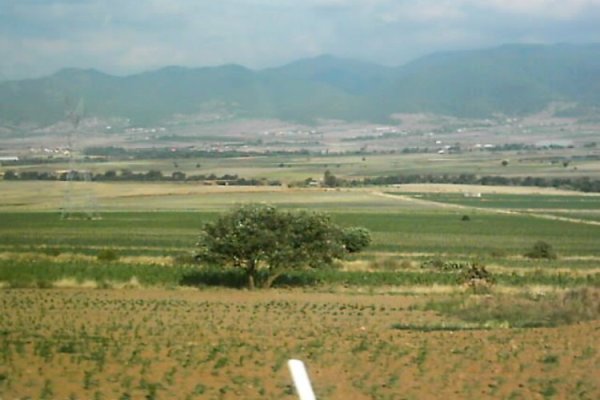
Khirbat Bayt Far
About the depopulated village of Khirbat Bayt Far
- District
- Ramla
- Date Khirbat Bayt Far was occupied
- 06 April 1948
- Population in 1948
- 350
- Military operation
- Operation Nachshon
- Distance from the governorate centre
- 14 (km) South of al-Ramla
- Elevation above sea level
- 125 m
- Cause of displacement
- Military assault by Zionist troops
- Extent of destruction
- Khirbat Bayt Far was completely obliterated, and only house rubble left behind.
- Ethnic cleansing
- Bayt Far, Khirbat inhabitants were completely ethnically cleansed.
Hover a dot to read the village name, or click to open its card.
Borders of the depopulated village of Khirbat Bayt Far
Khirbat Bayt Far – Depopulated Palestinian Village of the Ramla Subdistrict
Khirbat Bayt Far, also known as Bayt Far, was a Palestinian village in the Ramla Subdistrict. It stood on a flat elevated site at the eastern edge of the central coastal plain, approximately 14 kilometers from al-Ramla and at an average elevation of about 125 meters above sea level.
The village overlooked a broad hilly area bordered on the north and south by tributaries of Wadi al-Sarar. The main wadi passed approximately 1.5 kilometers southwest of the village. A secondary road of about the same length linked Khirbat Bayt Far with a highway connecting Gaza to the al-Ramla–Jerusalem road.
- Subdistrict
- Ramla
- Mandate District
- Lydda
- Alternative Name
- Bayt Far
- Distance from al-Ramla
- Approximately 14 km
- Average Elevation
- Approximately 125 meters
- Population in 1922
- 28 – all Muslims
- Population in 1931
- 26 – all Muslims
- Occupied Houses in 1931
- 11
- Population in 1944/1945
- 300
- Estimated Population in 1948
- 348 according to Salman Abu Sitta's Register – a later estimate, not an official census
- Total Land Area in 1945
- 5,604 dunums
- Occupation / Depopulation Date
- Disputed; Abu Sitta places it in the first half of April 1948, while Khalidi/PalQuest consider capture during Operation Makkabi in May more likely
- Military Operation
- Operation Nachshon is possible; Operation Makkabi is considered more likely by Khalidi/PalQuest
- Military Unit
- Haganah forces; the specific brigade responsible for entering the village is not conclusively established
- Cause of Displacement
- Military assault and capture in the course of operations aimed at controlling the Jerusalem corridor
- Extent of Destruction
- Extensive destruction; the historical field description records mainly rubble and metal girders
- Settlement on Village Land
- Beyt Pe'er – 1948, later renamed Tal Shahar
Location
Khirbat Bayt Far stood on a flat elevated site at the eastern edge of the central coastal plain.
It overlooked a broad hilly area bordered by two branches of Wadi al-Sarar, with the principal wadi passing about 1.5 kilometers to the southwest.
A secondary road linked the village with the main route connecting Gaza with the al-Ramla–Jerusalem highway, giving the surrounding area increasing strategic significance during the 1948 war.
Earlier History of the Site
The site appears to have experienced alternating periods of settlement and abandonment.
Edward Robinson described it during the nineteenth century as an abandoned village, while the Survey of Western Palestine later recorded walls and building foundations at the site.
A nearby khirba bearing the same name further suggests a longer history of habitation in the area.
The Village before the Nakba
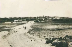
Khirbat Bayt Far had a roughly circular layout. Its houses were clustered together and separated by narrow alleys.
The buildings were constructed of cement and mud.
The entire population was Muslim.
Population
The 1922 Census of Palestine recorded 28 inhabitants at Bayt Far.
The official 1931 census recorded 26 inhabitants living in 11 occupied houses.
By 1944/45 the official population had increased substantially to 300.
- 192228Official Census of Palestine
- 193126Official Census of Palestine
- 1944/1945300Official Mandate statistics
- 1948348Later demographic estimate in Salman Abu Sitta's Register
Houses
The official 1931 census recorded 11 occupied houses in Khirbat Bayt Far.
Some later databases display a much higher estimated number of houses for 1948, but this is not a directly verified official building count and is therefore not used in this article.
1948 Population and Refugee Estimate
Salman Abu Sitta's Register estimates the village population at 348 people in 1948.
This is a retrospective estimate rather than an official census conducted in 1948.
The same Register estimates approximately 2,137 refugees and descendants in 1998 associated with Khirbat Bayt Far. This is likewise a demographic projection, not a comprehensive official census of all descendants.
Land Ownership in 1945
Khirbat Bayt Far had a total land area of 5,604 dunums.
- Palestinian5,457 dunums97%
- Transferred to Zionists0 dunums0%
- Public147 dunums3%
The original Mandate table uses the categories Arab, Jewish, and Public: 5,457 dunums were recorded in the Arab category, none in the Jewish category, and 147 as public land.
Land Use in 1945
- Cereals5,337 dunums49%
- Plantations and Irrigable Land19 dunums<1%
- Total Cultivated / Cultivable Land5,356 dunums49%
- Non-Cultivable and Other Public Land248 dunums2%
Approximately 96 percent of the village land was therefore classified as cultivated or cultivable.
Economic Life
The villagers depended mainly on rain-fed agriculture, animal husbandry, and poultry raising.
Cereal cultivation dominated land use, accounting for 5,337 dunums in 1944/45.
The inhabitants also cultivated vegetables and fruit, maintained a small area of irrigated or orchard land, and used parts of the village territory as pasture.
Education and Services
The principal sources used for this article do not document an independent village school at Khirbat Bayt Far before the Nakba.
Nor is there sufficient evidence to assign a separate mosque, clinic, or other public institution to the village with confidence, so unsupported facilities are not added.
The Jerusalem Corridor Operations
The area around Khirbat Bayt Far became strategically important in spring 1948 because of its proximity to roads leading toward Jerusalem.
The Haganah launched a series of operations to gain control of villages and routes along the Jerusalem corridor, including Operation Nachshon in April and Operation Makkabi in May.
Operation Nachshon
Operation Nachshon lasted from 3 to 15 April 1948 and involved the Har'el and Giv'ati brigades.
PalQuest lists Khirbat Bayt Far among the localities affected by the operation.
This leaves open the possibility that Haganah forces entered or depopulated the village during the first half of April, consistent with Salman Abu Sitta's chronology.
Operation Makkabi
Walid Khalidi nevertheless considers it more likely that Khirbat Bayt Far was occupied during Operation Makkabi.
The operation lasted from 8 to 31 May 1948 and involved the Giv'ati, Sheva', and Har'el brigades. It formed part of the military effort to control the Latrun sector and the Jerusalem corridor.
PalQuest explicitly includes Khirbat Bayt Far among the localities affected by Operation Makkabi.
Disagreement over the Occupation Date
No single occupation date can be presented without qualification.
Salman Abu Sitta's Register gives 6 April 1948 and also places the event in the first half of April.
Some Palestinian databases reproduce 7 April 1948.
Walid Khalidi, however, explicitly states that it is difficult to determine when Haganah forces first entered the village. He considers capture during Operation Nachshon possible but regards Operation Makkabi in May as more likely.
This article therefore does not present 6 or 7 April as a conclusively established final occupation date.
Occupation Chronology
- Until early April 1948
Village before the Major Operations
Khirbat Bayt Far remained a small agricultural Palestinian village with approximately 300 inhabitants in the final Mandate statistics.
- 3 April 1948
Beginning of Operation Nachshon
The Haganah launched a major offensive aimed at controlling the road toward Jerusalem.
- 6 April 1948
Date in Abu Sitta's Register
The Register places depopulation at this date and otherwise identifies the first half of April as the relevant period.
- 15 April 1948
End of Operation Nachshon
Capture during this operation remains possible but is not certain.
- 8–31 May 1948
Operation Makkabi
Walid Khalidi considers this the more likely operation during which Khirbat Bayt Far came under final Haganah control.
Military Operation and Unit
Military Operation: Operation Nachshon is possible, while Walid Khalidi considers Operation Makkabi more likely.
Military Unit: Haganah forces are established at the general level, but no village-specific evidence conclusively identifies one brigade as the executing unit.
The Har'el and Giv'ati brigades participated in Operation Nachshon; the Giv'ati, Sheva', and Har'el brigades participated in Operation Makkabi.
None should therefore be selected as the specific Khirbat Bayt Far occupying unit without more direct evidence.
Cause of Displacement
The depopulation of Khirbat Bayt Far was connected with military assault and the Haganah takeover of villages in the Jerusalem corridor.
The sources differ over the precise phase in which the village was finally emptied, but they place its depopulation within the spring 1948 military campaign in the area.
The most supportable description is therefore military assault and occupation in the course of operations to control the Jerusalem corridor.
Extent of Destruction
Walid Khalidi's historical field description records only rubble and metal girders piled within a small area of the former village site.
This indicates extensive destruction, but no reliable numerical destruction percentage is documented.
The village is therefore described as very extensively or almost completely destroyed, with rubble surviving, without assigning an unsupported percentage.
Settlements on Khirbat Bayt Far Land
The settlement of Beyt Pe'er was established on Khirbat Bayt Far land in 1948.
Its name was later changed to Tal Shahar.
This is the settlement directly identified by Walid Khalidi and PalQuest as having been founded on village land.
Khirbat Bayt Far Today
The available description of the village site is based primarily on historical field research published in Walid Khalidi's All That Remains and should not be treated as a comprehensive direct field verification for 2026.
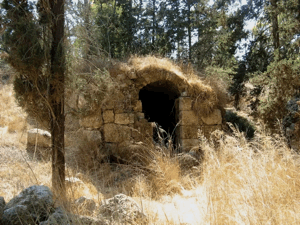
According to that description, only rubble and metal girders remained within a small area.
Carob trees formed a ring around the site, while the remains of an uprooted olive grove lay to the north and east.
Tal Shahar, originally established as Beyt Pe'er in 1948, stands on the lands of Khirbat Bayt Far.
Sources
- PalQuest – Interactive Encyclopedia of the Palestine Question: Khirbat Bayt Far
- PalQuest – Operation Makkabi
- PalQuest – Operation Nachshon
- Institute for Palestine Studies – Walid Khalidi, All That Remains
- Palestine Remembered – Khirbat Bayt Far, al-Ramla
- Palestine Remembered – Khirbat Bayt Far entry from All That Remains
- Salman Abu Sitta – Register of Depopulated Palestinian Localities: Khirbat Bayt Far
Photo gallery
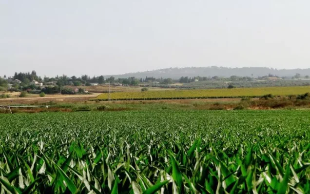

Photos from the village's people
Photos sent in by visitors and published after review.
Add a photo of this village
Log in to add photos of this village.
Other villages from Ramla
More from the archive



 Download Our Palestine App
The whole archive in the palm of your hand: depopulated villages, the Nakba, the massacres and Al-Aqsa — free, with no ads to erase the story.
Download Our Palestine App
The whole archive in the palm of your hand: depopulated villages, the Nakba, the massacres and Al-Aqsa — free, with no ads to erase the story.



Comments
No comments yet — be the first to write one.
Add your comment
Name and email are optional. Comments appear after review.