
The depopulated village of Al-Tina / District of Ramla

Al-Tina
About the depopulated village of Al-Tina
- District
- Ramla
- Date Al-Tina was occupied
- 08 July 1948
- Population in 1948
- 870
- Military operation
- Operation An-Far
- Brigade that carried it out
- Givati Brigade
- Distance from the governorate centre
- 20.5 (km) South of al-Ramla
- Elevation above sea level
- 75 m
- Cause of displacement
- Military assault by Zionist troops
- Extent of destruction
- The village was completely destroyed and defaced.
- Ethnic cleansing
- The village was completely ethnically cleansed on the commands of Shimon Avidon, the head of Giva'ti Brigade at the time.
- Refugees' migration routes
- The refugee movements in the area may have directed by the Giva'ti Brigade towards the Hebron hills.
Hover a dot to read the village name, or click to open its card.
Borders of the depopulated village of Al-Tina
Al-Tina – Depopulated Palestinian Village of the Ramla Subdistrict
Al-Tina was a depopulated Palestinian village in the Ramla Subdistrict, located approximately 20.5 kilometers south of Ramla. It stood on flat terrain in the southern coastal plain at an average elevation of about 75 meters above sea level.
The village was connected by roads to Gaza, Ramla, Jerusalem, and neighboring villages. A railway linking Bir al-Sabi' with Ramla also passed near al-Tina during the Ottoman period. Agriculture formed the main basis of the local economy, particularly cereal and citrus cultivation.
- District
- Ramla
- Distance from Ramla
- Approximately 20.5 km south of Ramla
- Elevation
- Approximately 75 m above sea level
- Natural Setting
- Flat terrain in the southern coastal plain, surrounded by level agricultural land
- Population in 1944/1945
- 750 inhabitants
- Estimated Population in 1948
- 870 inhabitants – a later estimate, not an official census
- Occupation and Depopulation Period
- 8–9 July 1948; Palestine Remembered gives 8 July, while Khalidi's account places the attack and occupation within 8–9 July
- Military Operation
- Operation An-Far
- Military Unit
- First Battalion of the Giv'ati Brigade
- Total Land Area
- 7,001 dunums
- Israeli Settlements Established on Village Lands
- None documented; nearby Kefar Menachem was established on the lands of Idnibba
The Name Al-Tina
The Arabic name al-Tina is associated with the fig tree. Historical foreign-language records and maps render the village name in several different transliterations.
Al-Tina Through History
In 1596, al-Tina was recorded in the nahiya of Gaza in the liwa' of Gaza. The historical material used by Walid Khalidi gives a population figure of approximately 55. This is an Ottoman-period historical figure rather than a modern population census.
The village paid taxes on wheat, barley, sesame, fruit, goats, beehives, and other forms of agricultural production. By the late nineteenth century, al-Tina was described as a village built mainly of adobe, with a well at its southern edge.
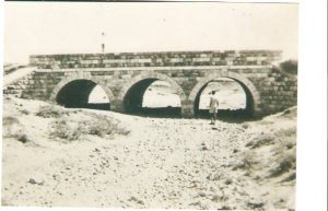
The railway between Bir al-Sabi' and Ramla passed south of the village during the Ottoman period, although service on this line was discontinued during the British Mandate.
Location and Built Environment
Al-Tina stood on flat ground and was surrounded by similarly level countryside. A road from the direction of Gaza linked the village with the Ramla–Jerusalem highway, while additional roads and dirt tracks connected it with neighboring villages.
The built-up area consisted of one main section and two smaller sections to the south and west. During the Mandate period, construction expanded along the roads leading toward three neighboring villages.
Most houses were built of adobe and were tightly clustered, separated by narrow alleys. A mosque stood in the northern part of the village, which also contained several small shops.
Population of Al-Tina
The village population grew during the British Mandate. Official censuses and Mandate statistics should be distinguished from later estimates of the 1948 population and refugee population.
- 159655Historical figure based on Ottoman-period records; not a modern census
- 1922396Official Census of Palestine, 1922; Palestine Remembered displays 386, which conflicts with the census figure
- 1931530Official Census of Palestine, 1931
- 1944/1945750Official British Mandate statistics
- 1948870Later estimate published by Palestine Remembered; not an official census
- 19985,343 refugeesLater estimate of refugees and descendants; not an official village census
The village population was entirely Muslim in the available Mandate-era records.
Number of Houses
- 1931131 housesOfficial census
- 1948215 housesLater estimate published by Palestine Remembered; not an official 1948 census figure
Land Ownership in Al-Tina
Al-Tina had a total land area of 7,001 dunums in the 1944/45 statistics. Palestine Remembered presents its simplified ownership categories as follows:
- Palestinian5,843 dunums83%
- Transferred to Zionists949 dunums14%
- Communal/Public209 dunums3%
The official 1944/45 Village Statistics use the categories Arab, Jewish, and Public, listing 5,843 Arab dunums, 949 Jewish dunums, and 209 public dunums, for the same total of 7,001 dunums.
Land Use in 1944/1945
- Arab
- Jewish
- Public
- Citrus and Bananas141 dunums
- Cereals6,597 dunums
- Built-up Area24 dunums
- Non-Cultivable Land239 dunums
The cultivable or cultivated area therefore amounted to 6,738 dunums, approximately 96 percent of the village's total land area.
A separate figure of 141 dunums for olives appearing in Palestine Remembered is not added again to the total here. The official land-use table reproduced by PalQuest records 141 dunums under citrus and bananas and does not include a separate olive category in al-Tina's total.
Economic Life in Al-Tina
Agriculture was the principal economic activity in al-Tina. Cereals occupied the largest cultivated area, while villagers also grew fruits and vegetables, especially citrus and bananas.
In 1944/45, 141 dunums were classified under citrus and bananas, while the official land-use categories together recorded 6,597 dunums under cereals.
Some agriculture was rain-fed, whereas citrus and other irrigated crops relied on well water. The village also contained several small shops serving local daily needs.
Water Resources
The inhabitants relied on wells for domestic water and irrigation. Late nineteenth-century descriptions also recorded a well at the southern edge of the village.
Education in Al-Tina
A village school was established during the 1946/47 school year. The surviving online versions differ over enrollment: the English PalQuest page and the English text reproducing Khalidi give 67 pupils, while other online fields display different numbers. This article therefore uses 67 while noting the discrepancy.
The Mosque and Religious Life
A mosque stood in the northern part of al-Tina and served its Muslim population. An isolated database field referring to a church has not been treated as sufficiently verified because it is not supported by the principal historical narrative or the available Mandate population data.
Notable People
Al-Tina was the birthplace of 'Abd al-Fattah Humud (1933–1968), a petroleum engineer who was among the figures involved in the founding of Fatah.
Occupation and Depopulation of Al-Tina
Al-Tina was occupied in the course of Operation An-Far, conducted by the Giv'ati Brigade on the southern front during the interval between the 1948 truces.
Walid Khalidi's account, as reproduced by PalQuest, states that al-Tina came under attack even before the truce had fully expired on 8–9 July 1948 and was among the first villages occupied during the operation, at roughly the same time as al-Masmiyya al-Kabira, al-Masmiyya al-Saghira, and al-Jaladiyya.
Palestine Remembered gives 8 July 1948 as the occupation date. This article therefore presents 8–9 July as the most cautious range rather than treating either date as uniquely certain.
Occupation Chronology
- 8 July 1948
Beginning of Operation An-Far
Operation An-Far began on 8 July. Khalidi's account indicates that the attack on al-Tina began even before the truce had fully expired.
- 8–9 July 1948
Attack and Occupation
Al-Tina was among the first villages occupied in the operation. Palestine Remembered specifies 8 July, while Khalidi's narrative places the attack within 8–9 July.
- 8–9 July 1948
Depopulation
The villagers' displacement was directly connected to the military assault and occupation of the village during Operation An-Far.
- After occupation; precise date undocumented
Destruction
The village was subsequently destroyed, but the principal sources used here do not establish a separate precise demolition date.
Operation An-Far
Operation An-Far began on 8 July 1948 and continued until 15 July according to PalQuest. It was carried out by the First Battalion of the Giv'ati Brigade on the southern front, with the aim of expanding the brigade's area of control toward the east and south.
The operation affected a broad zone where the Ramla, Gaza, and Hebron subdistricts met, resulting in the occupation and depopulation of a number of Palestinian villages. Al-Tina was among the villages affected during its opening phase.
Military Unit
Military Unit: First Battalion of the Giv'ati Brigade.
In this case, PalQuest's operation entry identifies the First Battalion as the force carrying out Operation An-Far, providing more specific documentation than merely naming the brigade associated with the broader campaign.
Cause of Depopulation
Palestine Remembered classifies the cause of al-Tina's depopulation as a direct military assault. Khalidi's historical narrative likewise places the villagers' displacement in the context of the attack and occupation during Operation An-Far in July 1948.
Destruction of Al-Tina
The principal sources do not establish a separate precise date for the demolition of al-Tina after its occupation, but they agree that the village's built-up area was subsequently almost entirely or completely erased.
Israeli Settlements on Al-Tina Village Lands
Walid Khalidi and PalQuest do not identify any Israeli settlement established on al-Tina's village lands.
Kefar Menachem, established in 1937, lies approximately three kilometers southeast of the former village site, but it was established on lands belonging to the depopulated village of Idnibba and should therefore not be listed as a settlement on al-Tina's lands.
Al-Tina Today
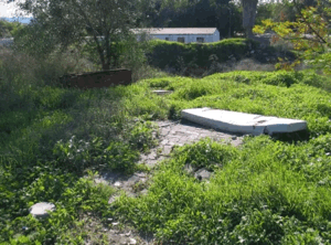
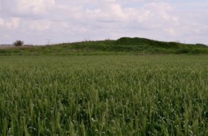
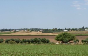
According to Walid Khalidi's field description documented before the publication of All That Remains in 1992, the village had been completely effaced. A broad area near the site was fenced on its southern side and overgrown with bushes and thorny vegetation.
An orange grove occupied the northern and western edges of the site. An east–west highway passed to the south, while a railway line ran approximately 100 meters east of the former village.
Palestine Remembered also hosts an image of the village lands identified as dating from 1990 and reproduced from Khalidi's documentation. The description should therefore be understood as historical field documentation from around 1990, not as a direct field verification of conditions in 2026.
Sources
- PalQuest – Interactive Encyclopedia of the Palestine Question: al-Tina
- PalQuest – Operation An-Far
- Palestine Remembered – al-Tina, Ramla District
- Palestine Remembered – Historical account of al-Tina from Walid Khalidi's All That Remains
- Government of Palestine – Census of Palestine, 1922, edited by J. B. Barron
- Government of Palestine – Census of Palestine, 1931, edited by E. Mills
- Village Statistics 1945 – Ramla Subdistrict population and land ownership data, reproduced by Sami Hadawi
- Sami Hadawi – Village Statistics 1945: A Classification of Land and Area Ownership in Palestine
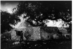
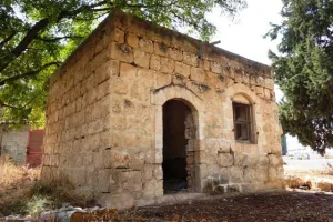
Photo gallery


Photos from the village's people
Photos sent in by visitors and published after review.
Add a photo of this village
Log in to add photos of this village.
More from the archive

 Download Our Palestine App
The whole archive in the palm of your hand: depopulated villages, the Nakba, the massacres and Al-Aqsa — free, with no ads to erase the story.
Download Our Palestine App
The whole archive in the palm of your hand: depopulated villages, the Nakba, the massacres and Al-Aqsa — free, with no ads to erase the story.



Comments
No comments yet — be the first to write one.
Add your comment
Name and email are optional. Comments appear after review.