
The depopulated village of Dayr Ayyub / District of Ramla
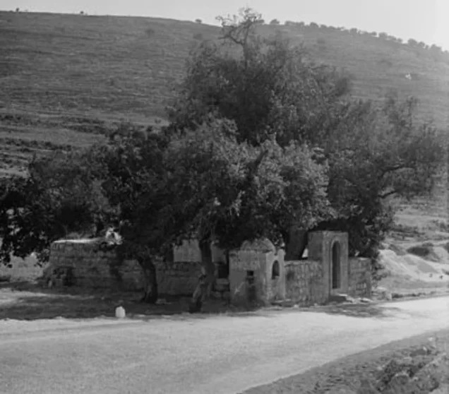
Dayr Ayyub
About the depopulated village of Dayr Ayyub
- District
- Ramla
- Date Dayr Ayyub was occupied
- 06 March 1948
- Population in 1948
- 370
- Military operation
- Operation Makkabi
- Brigade that carried it out
- Givati Brigade، The Seventh Brigade
- Who defended the village
- Jordanian Army
- Distance from the governorate centre
- 17.5 (km) Southeast of al-Ramla
- Elevation above sea level
- 325 m
- Cause of displacement
- Military assault by Zionist troops
- Extent of destruction
- Dayr Ayyub was mostly destroyed with the exception of few houses and the village cemetery.
- Ethnic cleansing
- Dayr Ayyub inhabitants were completely ethnically cleansed.
Hover a dot to read the village name, or click to open its card.
Borders of the depopulated village of Dayr Ayyub
Dayr Ayyub – Depopulated Palestinian Village in Ramla Subdistrict
Dayr Ayyub was a Palestinian village in the Ramla subdistrict of the Lydda district. It stood on southwest-facing slopes overlooking the Ramla–Jerusalem highway near Bab al-Wad and the Latrun area, approximately 17.5 kilometers southeast of Ramla, at an average elevation of about 325 meters above sea level.
The village had 320 inhabitants in the official 1944/45 statistics and a registered land area of 6,028 dunums. Agriculture was the principal source of livelihood, particularly cereals, fruit trees, and vegetables.
Because of its position overlooking the Jerusalem road, Dayr Ayyub became a repeatedly contested military site in 1948. Its Palestinian population appears to have been displaced during April, while the village site itself changed hands or was targeted repeatedly during the battles around Latrun in May and June.
Key Facts about Dayr Ayyub
| Field | Information |
|---|---|
| Name | Dayr Ayyub |
| Subdistrict in 1948 | Ramla |
| Earlier administrative affiliation | Part of the Jerusalem subdistrict before being transferred to Ramla in 1941 |
| Status | Depopulated Palestinian village |
| Distance from Ramla | Approximately 17.5 km southeast |
| Average elevation | Approximately 325 m above sea level |
| Population, 1944/45 | 320 |
| Houses, 1931 | 66 |
| Registered land area | 6,028 dunums |
| Population displacement | April 1948 according to the account cited by Khalidi; precise day unknown |
| First clearly documented military capture | 16 May 1948 |
| Operation during first capture | Operation Makkabi |
| Unit during first capture | Palmach's Har'el Brigade |
| Second capture | Late May 1948 during Operation Ben-Nun |
| Units during second capture | Elements of the Giv'ati and Sheva' / Seventh Brigades |
| Cause of depopulation | Military assault; no precise village-specific expulsion order or date is established |
| Israeli settlements on village land | None documented by Khalidi/PalQuest |
Location of Dayr Ayyub
Dayr Ayyub stood on mountainous slopes facing southwest and directly overlooked the main Ramla–Jerusalem highway through the strategic Bab al-Wad corridor.
A secondary road connected the village with the highway, giving its location considerable strategic importance for movement between the coastal plain and Jerusalem during the 1948 fighting.
Nearby localities included 'Imwas, Yalu, Bayt Nuba, al-Latrun, and Bayt Susin in the hill country at the western entrance to the Jerusalem corridor.
The Name and the Tradition of the Prophet Ayyub
The village name was associated with Ayyub, or Job. Villagers believed that a location northwest of the settlement contained the tomb of the Prophet Ayyub.
Khalidi records this as a local religious tradition rather than an archaeological identification. It should therefore not be treated as independent material proof that the tomb belonged to the historical or biblical Job.
Dayr Ayyub in the Ottoman Period
In 1596, Dayr Ayyub was a village in the nahiya of Ramla in the liwa' of Gaza, with a recorded population of 94.
Villagers paid taxes on wheat, barley, fruit, vineyards, goats, beehives, and other products, indicating a diversified agricultural economy.
By the late nineteenth century, the village was described as a small settlement on a hillside, with houses built of stone and mud.
Dayr Ayyub during the British Mandate
Dayr Ayyub belonged to the Jerusalem subdistrict during the earlier Mandate censuses. In 1941 it was administratively transferred to the Ramla subdistrict, where it appeared in the 1944/45 statistics.
The village expanded along roads connecting it with neighboring communities, while agriculture remained its principal economic activity.
Population of Dayr Ayyub
- 159694Historical Ottoman-era figure
- 1922215Official Mandate census; all Muslims
- 1931221Official Census of Palestine; all Muslims
- 1944/45320Official statistics; all Arabs and Muslims
- 1948371Later estimate reported by Palestine Remembered, not an official census
- 19982,280 refugeesLater estimate of refugees and descendants reported by Palestine Remembered
Some secondary sources incorrectly reproduce a figure of 229 for 1931. The original 1931 Census of Palestine lists Dayr Ayyub with 221 inhabitants—107 males and 114 females—all Muslims, living in 66 occupied houses.
The 1948 and 1998 figures are later estimates and should not be attributed to British Mandatory census statistics.
Number of Houses
- 193166Official Census of Palestine figure
- 1948110Later Palestine Remembered estimate, not an official census figure
Land Ownership in Dayr Ayyub
The total registered land area of Dayr Ayyub in 1944/45 was 6,028 dunums.
- Palestinian4,500 dunums75%
- Transferred to Zionists0 dunums0%
- Communal/Public1,528 dunums25%
The figures balance correctly: 4,500 + 0 + 1,528 = 6,028 dunums.
The original official classification records 4,500 Arab dunums and 1,528 Public dunums, with no land listed in the Jewish ownership category.
Land Use in 1944/45
- Arab
- Public
- Cereals2,769 dunums
- Plantations and irrigable land127 dunums
- Built-up land26 dunums
- Non-cultivable land3,106 dunums
The table balances correctly: 2,769 + 127 + 26 + 3,106 = 6,028 dunums.
Ten dunums of olives were included within the 127 dunums classified as plantations and irrigable land. They are therefore a subcategory and must not be added again when calculating the total.
Likewise, the figure of 2,896 dunums classified as cultivable land is the subtotal of 2,769 cereal dunums and 127 plantation/irrigable dunums, not an additional land-use category.
Economic Life
Agriculture was the principal source of livelihood and was predominantly rain-fed.
Cultivation was concentrated north and northwest of the village. Villagers grew cereals, vegetables, grapes, figs, pomegranates, olives, and other fruit crops.
The sixteenth-century tax records also document goats, beehives, and vineyards, indicating the long-standing importance of both agriculture and livestock-related activity.
Water Resources
Most agriculture was rain-fed, although the 127 dunums classified as irrigated land or plantations indicate the use of local water sources for part of the cultivated area.
Khalidi's later field description also records a spring at the southeastern edge of the village site.
Education in Dayr Ayyub
Villagers established an elementary school in 1947 through local subscriptions and paid the teacher's salary themselves.
The school opened with an enrollment of 51 pupils.
The initiative illustrates the community's efforts to provide local education despite the village's relatively small population.
First Attack on Dayr Ayyub
Military violence reached Dayr Ayyub several months before the first clearly documented occupation of the village site.
On 21 December 1947, a force of twenty-five men raided the village, according to the village mukhtar's account reported by the New York Times. Bombs were thrown at three houses, with no casualties reported in the account cited by Khalidi.
On 7 February 1948, British forces entered Dayr Ayyub and demolished two houses. The Palestinian newspaper Filastin cited a British communiqué stating that the buildings had been used to fire on Jewish convoys passing near the village.
Depopulation of Dayr Ayyub
Khalidi cites Israeli historian Benny Morris as stating that Dayr Ayyub was depopulated as a result of military assault in April 1948.
No precise April date or village-specific attacking formation is provided in this account. The 6 March 1948 date displayed in Palestine Remembered's summary table is therefore not treated as an established occupation or depopulation date.
Palestine Remembered classifies the cause of exodus as direct military assault, which is consistent with the April depopulation account.
An important distinction must be maintained between the departure of the civilian population and military control of the physical village site: Dayr Ayyub continued to change hands or face renewed attacks after its residents had left.
Operation Makkabi and the First Documented Capture
Operation Makkabi was one of several offensives directed at the Latrun area and the Jerusalem road during May 1948.
On 16 May 1948, units of the Palmach's Har'el Brigade captured Dayr Ayyub in the first clearly documented occupation of the village site.
The Har'el units did not retain permanent control and apparently withdrew later.
Operation Ben-Nun and the Second Capture
In late May 1948, another attempt to control Dayr Ayyub took place during Operation Ben-Nun, which aimed to capture Latrun and open the Jerusalem road.
A combined force made up of elements of the Giv'ati and Sheva' / Seventh Brigades entered the village. The account cited by Khalidi states that the force entered without resistance inside the village but soon withdrew under Arab fire from the surrounding area.
The principal Ben-Nun battle around Latrun took place on 25–26 May, followed by another phase on 30 May.
Operation Yoram and Later Attempts
Khalidi suggests that Dayr Ayyub may have been targeted again during the fourth Israeli assault on Latrun, Operation Yoram, on the night of 8–9 June 1948.
The village nevertheless appears to have remained outside Israeli occupation during the second truce.
On 15 August, the New York Times reported Arab Legion sources as saying that another Israeli attempt to occupy Dayr Ayyub in violation of the truce had been repulsed.
Dayr Ayyub's 1948 history therefore cannot accurately be reduced to a single “occupation date.” Its population was displaced at one stage, while military control over the site remained contested through several later operations.
Occupation Chronology
- 21 December 1947
First recorded raid
A force of twenty-five men attacked the village and bombed three houses; no casualties were reported in Khalidi's cited account.
- 7 February 1948
British demolition
British forces demolished two houses, stating that they had been used to fire on passing convoys.
- April 1948
Population displacement
Khalidi cites an account that villagers left as a result of military assault; the exact day and attacking unit are not specified.
- 16 May 1948
First documented capture
Har'el Brigade units captured Dayr Ayyub during Operation Makkabi and later withdrew.
- Late May 1948
Second capture
Giv'ati and Sheva' / Seventh Brigade units entered during Operation Ben-Nun but withdrew under fire.
- Night of 8–9 June 1948
Possible further attempt
Khalidi suggests another attempt may have occurred during Operation Yoram.
- Summer 1948
Second truce
The village appears to have remained outside Israeli occupation during this period.
- Around 15 August 1948
Another attempted occupation
Arab Legion sources reported that an Israeli attempt to take the village had been repulsed.
- 1949
Armistice
The village site ended up immediately adjacent to the armistice lines in the Latrun sector.
Destruction
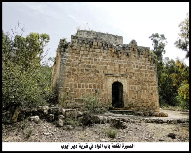
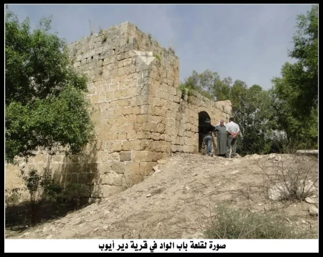
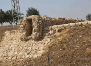
Dayr Ayyub was extensively destroyed. In Khalidi's later field description, the surviving evidence consisted largely of rubble, sections of walls, house remains, and the village cemetery.
The principal sources reviewed do not establish one precise demolition date, and the village's destruction should therefore not automatically be attributed in its entirety to any one of the several military operations that affected the site.
Israeli Settlements on Dayr Ayyub's Lands
Walid Khalidi and PalQuest state that no Israeli residential settlement was established directly on Dayr Ayyub's village lands.
| Settlement / Project | Established | Relationship to Dayr Ayyub |
|---|---|---|
| Mevo Horon | 1970 | Located north of the village site but not on Dayr Ayyub's lands according to Khalidi |
| Canada Park | Opened in 1978 | Its eastern section occupies part of the Dayr Ayyub site; it is a park rather than a residential settlement |
Palestine Remembered's automated table lists Mevo Horon as associated with village lands, but Khalidi's original village entry explicitly states that no Israeli settlement was established on Dayr Ayyub's lands and that Mevo Horon lies north of the site. This article follows Khalidi's more specific formulation.
Dayr Ayyub Today
According to Walid Khalidi's field description, the eastern section of Canada Park occupies the Dayr Ayyub site.
Rubble was scattered across the area, including wall fragments attached to iron beams, while the remains of village houses could be seen on a high hill to the south.
The village cemetery remained on the southeastern hill. Among the surviving stones documented by Khalidi was the grave marker of al-Hajj Muhammad 'Ulayyan Taha, who died on 6 April 1936.
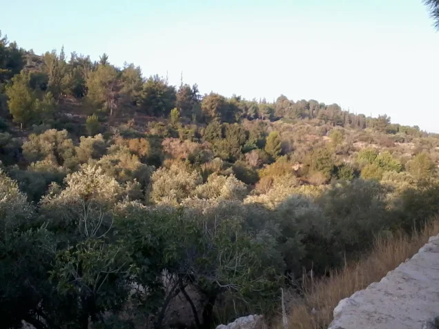
Large cypress, eucalyptus, carob, and fig trees dominated the site, together with fir trees planted later. The valleys were being used for fig cultivation, and a spring remained at the southeastern edge of the former village.
This description derives from fieldwork undertaken before the publication of Khalidi's All That Remains in 1992. It is therefore a documented historical description rather than a comprehensive direct field verification of Dayr Ayyub's condition in 2026.
Sources
- PalQuest – Interactive Encyclopedia of the Palestine Question: Dayr Ayyub
- PalQuest – Operation Makkabi
- PalQuest – Operation Nachshon
- PalQuest – al-Latrun and the Ben-Nun / Yoram battles
- Palestine Remembered – Dayr Ayyub, Ramla District
- Walid Khalidi – All That Remains: Dayr Ayyub
- Government of Palestine – Census of Palestine 1931
- Institute for Palestine Studies – All That Remains, Walid Khalidi
Photo gallery
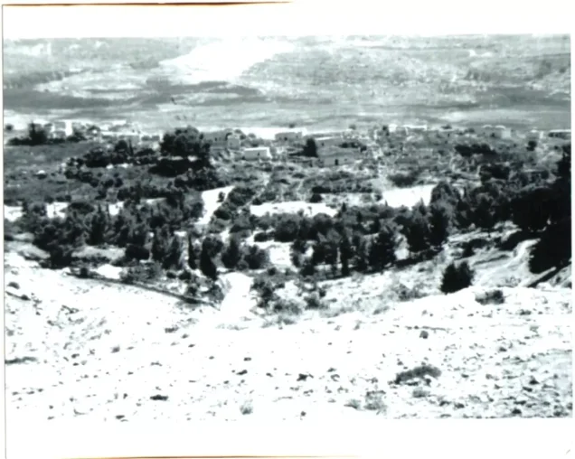


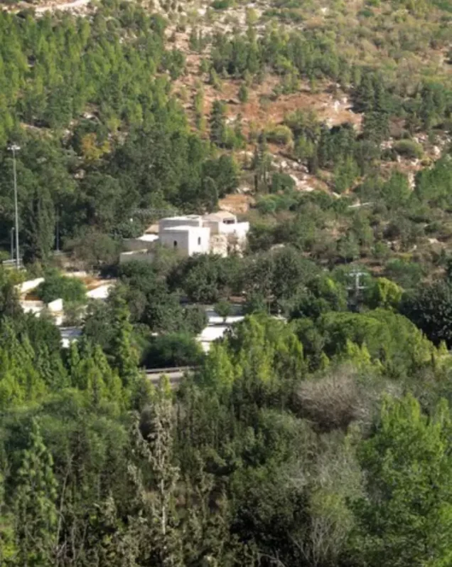
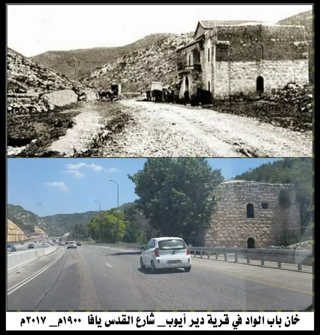





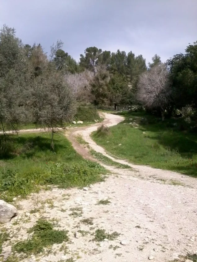


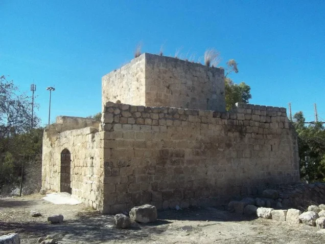
Photos from the village's people
Photos sent in by visitors and published after review.
Add a photo of this village
Log in to add photos of this village.
Other villages from Ramla

More from the archive


 Download Our Palestine App
The whole archive in the palm of your hand: depopulated villages, the Nakba, the massacres and Al-Aqsa — free, with no ads to erase the story.
Download Our Palestine App
The whole archive in the palm of your hand: depopulated villages, the Nakba, the massacres and Al-Aqsa — free, with no ads to erase the story.



Comments
No comments yet — be the first to write one.
Add your comment
Name and email are optional. Comments appear after review.