
The depopulated village of Imwas / District of Ramla
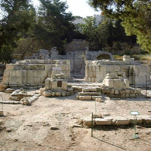
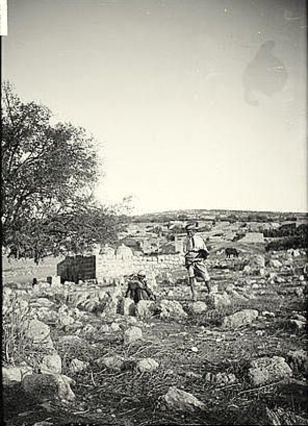
About the depopulated village of Imwas
- District
- Ramla
- Date Imwas was occupied
- 07 June 1967
- Population in 1948
- 1,955
- Military operation
- Six days war
- Who defended the village
- Jordanian Army and at the outbreak of the war some Egyptian commandoes.
- Distance from the governorate centre
- 12 (km) Southeast of al-Ramla
- Elevation above sea level
- 200 m
- Cause of displacement
- Expulsion by Zionist troops
- Extent of destruction
- The village has been completely obliterated and defaced by building on top of it the so called Canada Recreational Park.
- Ethnic cleansing
- The village was completely ethnically cleansed. It is very sad that some village inhabitants were ethnically cleansed twice; the first in 1948 and the second in 1967.
- Refugees' migration routes
- Like their predecessors, the refugees from al-Lydd and al-Ramla in 1948, the villagers fled towards the Ramallah area. Many slept in Ramallah's bus station for at least a week, until they were invited in by some of their relatives in the area. Some made it on foot across the bombed al-Lynbi bridge on the Jordan river to Amman, Jordan.
Hover a dot to read the village name, or click to open its card.
Borders of the depopulated village of Imwas
Imwas: A Depopulated Palestinian Village in the Latrun Area
Imwas was a Palestinian village that belonged to the Ramla Subdistrict during the British Mandate. Following the Nakba and the occupation of Palestine in 1948, it remained within the West Bank under Jordanian administration and became administratively associated with the Ramallah area. Israeli forces occupied the village in June 1967, expelled its residents, demolished most of its buildings, and prevented its inhabitants from returning.
- Subdistrict
- Ramla
- Distance from district center
- 12 km Southeast of al-Ramla
- Average Elevation
- 200 meters above sea level
- Population in 1931
- 1,021 inhabitants - Official British Mandate census
- Population in 1944/1945
- 1,450 inhabitants - Official population estimate
- Estimated Population in 1948
- No separate official 1948 count is documented; the village remained inhabited after the Armistice, and the Jordanian census recorded 1,955 inhabitants in 1961
- Total Land Area in 1945
- 5,167 dunams
- Attack and Depopulation
- Imwas remained outside Zionist control after the Nakba, then Israeli occupation forces seized it in the first days of June 1967, expelled its inhabitants, demolished most of its buildings, and barred their return
- Final Israeli Control
- 6-7 June 1967
- Cause of Depopulation
- Expulsion by Zionist troops
- Settlements Documented on Village Lands
- No Israeli residential settlement is documented on the village's officially recorded lands; Canada Park was later laid out over large parts of them
Location and Strategic Importance
Imwas was situated in the Latrun area, approximately 25 kilometres northwest of Jerusalem, 12 kilometres southeast of al-Ramla, and about 28 kilometres from Jaffa.
The village occupied a strategically important position overlooking the Jaffa–Jerusalem road. The Latrun area formed the western gateway to Jerusalem and was therefore crucial to controlling movement between the coastal plain and the city. Roads connected Imwas with Yalu, Bayt Nuba, al-Latrun, Dayr Ayyub, Bayt Susin, Salbit, and al-Qubab.
Imwas During the Nakba and the Occupation of Palestine in 1948
Residents of Imwas and the neighbouring Latrun villages participated in defending their area during the Nakba and the occupation of Palestine in 1948. Arab forces prevented Zionist forces from occupying the Latrun area, and Imwas consequently remained within the West Bank after the 1949 Armistice Agreements.
The claim that the principal Battles of Latrun were fought under the command of Abd al-Qadir al-Husayni is historically inaccurate. Al-Husayni was killed in the Battle of al-Qastal on 8 April 1948, whereas the principal Battles of Latrun took place later, with the Jordanian Arab Legion serving as the main regular force defending the area.
The armistice lines and the no-man’s-land created after the Nakba deprived the villagers of access to extensive agricultural lands they had traditionally used west of the village. Local accounts describe a broader historical territory than the area officially registered under the village’s name in the 1945 statistics.
Historical and Religious Significance
The Plague of Amwas
The village gave its name to the Plague of Amwas, which occurred in Greater Syria in 18 AH, corresponding approximately to 638–639 CE, during the caliphate of Umar ibn al-Khattab. Historical accounts indicate that the epidemic spread across extensive parts of Greater Syria and affected the armies stationed there.
Common historical estimates place the number of deaths across the wider region between 20,000 and 25,000. This figure should not be interpreted as the population of Imwas or as the number of people who died within the village alone. Prominent early Muslims reported to have died during the epidemic included Abu Ubayda Amir ibn al-Jarrah, Muadh ibn Jabal, Yazid ibn Abi Sufyan, and Shurahbil ibn Hasana.
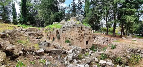
Two shrines traditionally associated with Abu Ubayda Amir ibn al-Jarrah and Muadh ibn Jabal survived at the village site, although reports have noted the deteriorating condition of the shrine attributed to Muadh ibn Jabal.
Imwas in Christian Tradition
A longstanding Christian tradition identifies Imwas with ancient Emmaus-Nicopolis and connects it with the Gospel of Luke’s account of the resurrected Jesus appearing to two disciples on the road to Emmaus. The precise location of the biblical Emmaus remains the subject of scholarly debate, and several possible sites have been proposed.
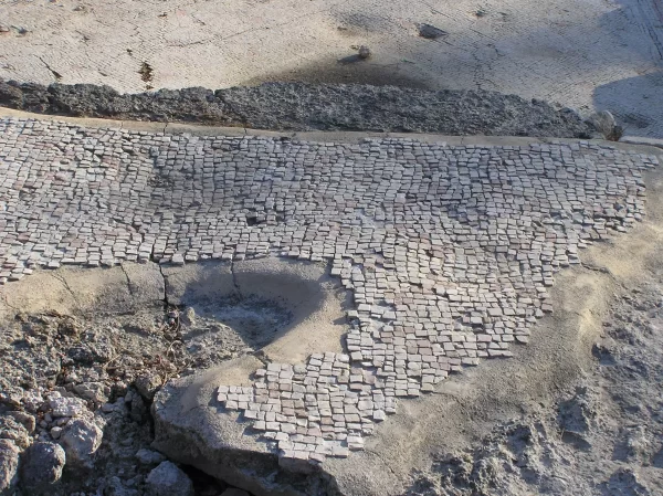
Archaeological remains in the area include the ruins of a Byzantine church whose site was rebuilt during the Crusader period. The nearby Latrun monastery was established by Trappist monks in 1890. The Trappists are a Roman Catholic monastic order whose name derives from La Trappe Abbey in France.
Land and Agriculture
According to the official Village Statistics of 1945, the registered land area of Imwas amounted to 5,167 dunams. Local accounts describe a considerably broader area of agricultural land traditionally used by the villagers west of the village before the establishment of the armistice lines. The officially registered area must therefore be distinguished from this broader traditional agricultural territory.
The villagers cultivated cereals, legumes, almonds, figs, grapes, olives, and cactus fruit. Imwas and its surroundings also contained springs and wells used for drinking, agriculture, and domestic needs. One of the best known was Bir al-Hilwa, near the Latrun monastery.
Land Ownership in 1945
Ownership of land in Imwas according to the British Mandate Village Statistics
- Palestinian ownership5,151 dunums100%
- Jewish ownership0 dunums0%
- Public land16 dunums<1%
Land Use in 1945
Use of land in Imwas according to the British Mandate Village Statistics
- Irrigated land and orchards606 dunums6%
- Olive cultivation15 dunums<1%
- Cereal cultivation3,612 dunums38%
- Built-up area148 dunums2%
- Cultivable land4,218 dunums45%
- Uncultivable land785 dunums8%
Population
The 1922 British Mandate census recorded 824 residents in Imwas. By 1931, its population had increased to 1,021 people living in 224 houses. The official Village Statistics of 1945 estimated the population at 1,450.
The Jordanian Population and Housing Census, conducted on 18 November 1961, recorded 1,955 inhabitants. This figure does not represent the village’s population in 1967, and no separate official census establishing its exact population at the time of occupation has been identified in the consulted sources.
Population censuses and estimates for Imwas
- 1922824Official British Mandate census
- 19311,021Official British Mandate census
- 19451,450Official population estimate
- 19611,955Official Jordanian census
Education and Social Life
Imwas had two mosques and a boys’ school founded in 1919, initially with one teacher. By 1947, it had become a complete elementary school staffed by six teachers and attended by 187 pupils.
Educational facilities expanded after the Nakba to include separate schools for boys and girls. In 1967, the boys’ school had 304 pupils and a library containing 376 books, while the girls’ school had 172 pupils.
Economic Life
The economy of Imwas was severely affected when the villagers lost access to much of the agricultural land they had traditionally used before the Nakba. Agriculture nevertheless remained an important part of village life, while increasing numbers of residents pursued education, skilled trades, construction work, and professional employment. The community included doctors, engineers, and teachers.
Approximately forty villagers worked at the nearby Latrun monastery. Before its destruction, Imwas had thirteen grocery shops, two bakeries, two barbershops, a butcher’s shop, a vegetable shop, and a hand-weaving workshop associated with a local development initiative.
The Occupation and Depopulation of Imwas in 1967
Date of Occupation and Expulsion
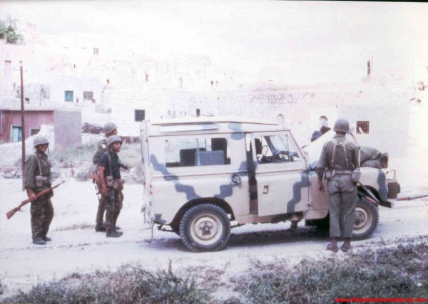
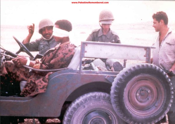
Israeli forces occupied Imwas during the Naksa of June 1967. Some sources state that the forces entered the village and expelled its residents on 6 June, while others date the expulsion and the beginning of systematic demolition to 7 June. It is firmly established that the occupation, expulsion, and destruction occurred during the first days of June 1967.
The selected Palestinian sources do not provide a consistently documented name for a separate military operation specifically directed against Imwas. They also do not conclusively identify the brigade or unit responsible for expelling the residents and demolishing the village. The event has therefore not been attributed here to a specific operation or military unit.
Expulsion of the Residents and Destruction of the Village
Israeli forces ordered the residents of Imwas to leave their homes, forcing most of them to walk eastwards towards Ramallah. Many displaced residents sought refuge in Ramallah, al-Bira, and other parts of the West Bank, while others continued to Jordan.
Bulldozers began demolishing buildings in Imwas, Yalu, and Bayt Nuba as early as 7 June 1967. Homes, schools, mosques, wells, and other public facilities were destroyed, and the residents were prevented from returning.
The available demographic and housing records do not support the claim that 3,200 houses were demolished in Imwas alone. No definitive and universally accepted figure exists for the number of buildings destroyed, but the sources agree that the village’s residential and public structures were almost entirely demolished.
The Fate of the Village Site
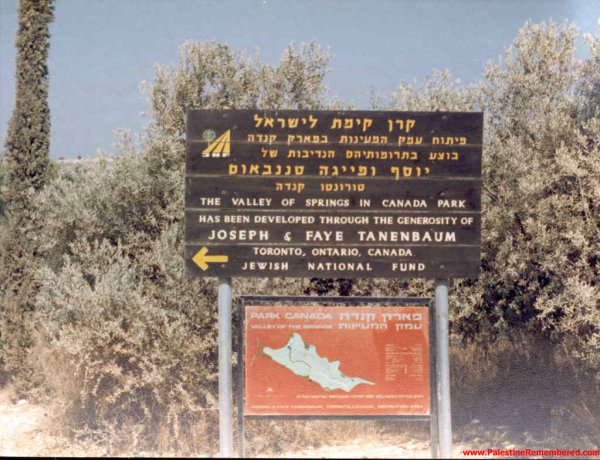
During the 1970s, Canada Park, also known as Ayalon Park, was established over extensive portions of the lands of Imwas, Yalu, and the destroyed Latrun villages. The project was financed by the Canadian branch of the Jewish National Fund; it was not a donation made by the Canadian government.
The consulted sources do not establish that a residential settlement was built within the 5,167 dunams officially registered as the lands of Imwas. Mevo Horon, which appears in studies of the wider Latrun area, is principally associated with the lands of Bayt Nuba and al-Latrun and should not be categorically listed as a settlement built on the registered lands of Imwas.
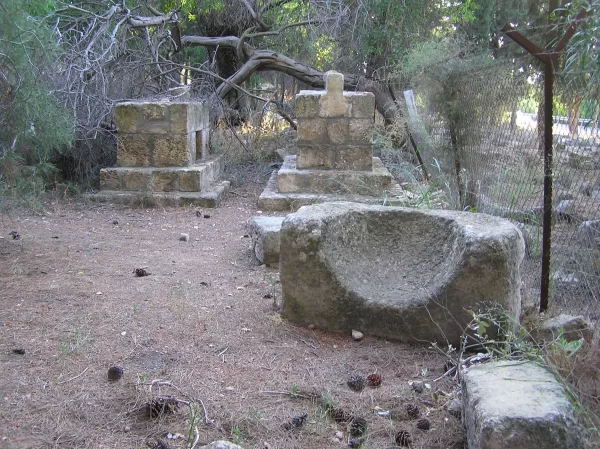
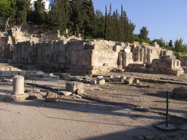
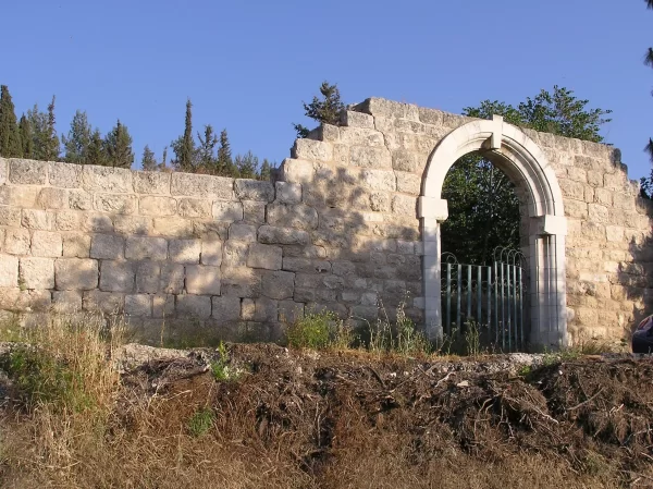
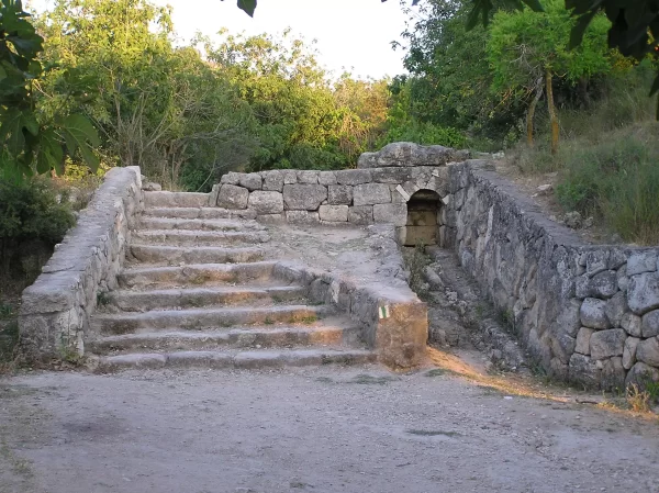
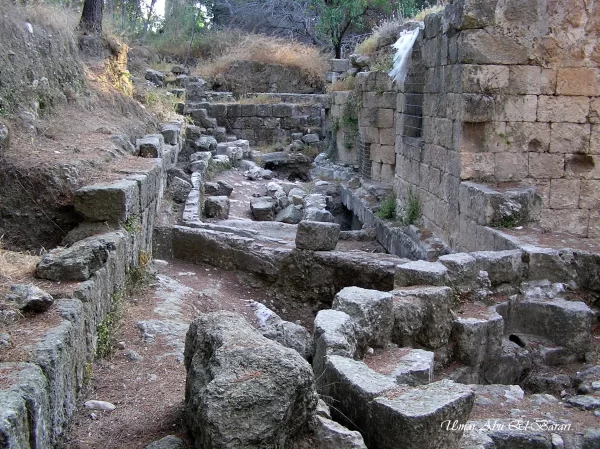
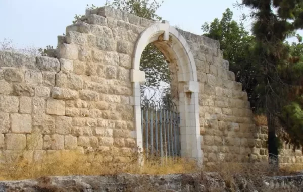
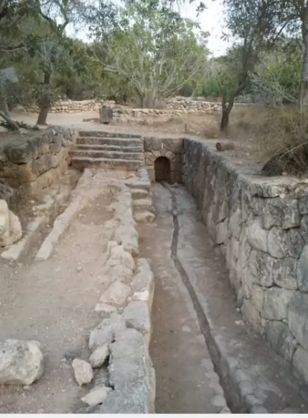
The village site now lies within the park, where planted trees and recreational paths cover large parts of its remains. Some trees, cemetery markers, and archaeological and religious remains have survived. These include the shrines traditionally attributed to Abu Ubayda Amir ibn al-Jarrah and Muadh ibn Jabal, together with remains associated with Emmaus-Nicopolis and the adjoining Latrun religious complex.
Occupation and Depopulation Chronology
- 8 April 1948
Imwas During the Nakba and the Occupation of Palestine in 1948
Residents of Imwas and the neighbouring Latrun villages participated in defending their area during the Nakba and the occupation of Palestine in 1948. The claim that the principal Battles of Latrun were fought under the command of Abd al-Qadir al-Husayni is historically inaccurate.
- June 1967
Date of Occupation and Expulsion
Israeli forces occupied Imwas during the Naksa of June 1967. Some sources state that the forces entered the village and expelled its residents on 6 June, while others date the expulsion and the beginning of systematic demolition to 7 June.
- 7 June 1967
Expulsion of the Residents and Destruction of the Village
Israeli forces ordered the residents of Imwas to leave their homes, forcing most of them to walk eastwards towards Ramallah. Many displaced residents sought refuge in Ramallah, al-Bira, and other parts of the West Bank, while others continued to Jordan.
Sources
- Interactive Encyclopedia of the Palestine Question – Places and the digitised edition of All That Remains
- Interactive Encyclopedia of the Palestine Question – al-Latrun
- Palestine Remembered – Imwas, Ramla District
- Institute for Palestine Studies – Walid Khalidi’s All That Remains
- BADIL – Imwas: Canada Park’s Concealed Crime
Photo gallery

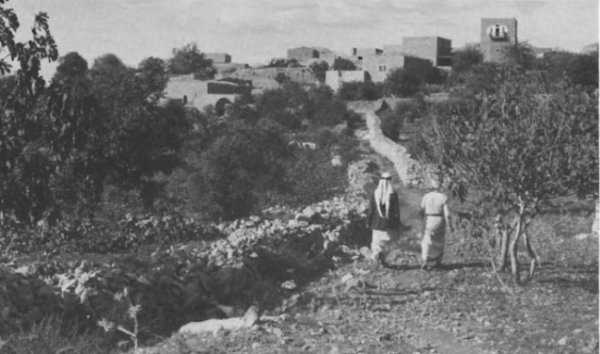


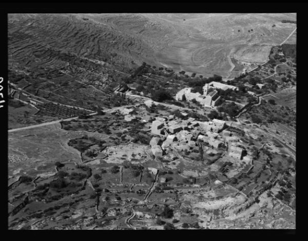
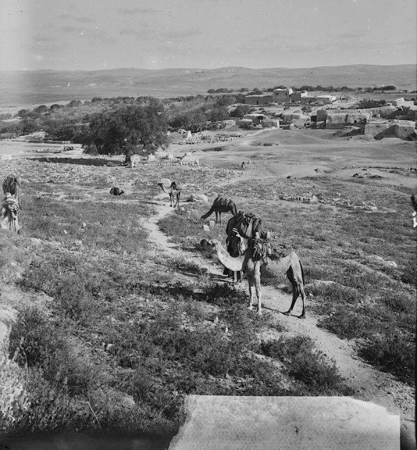

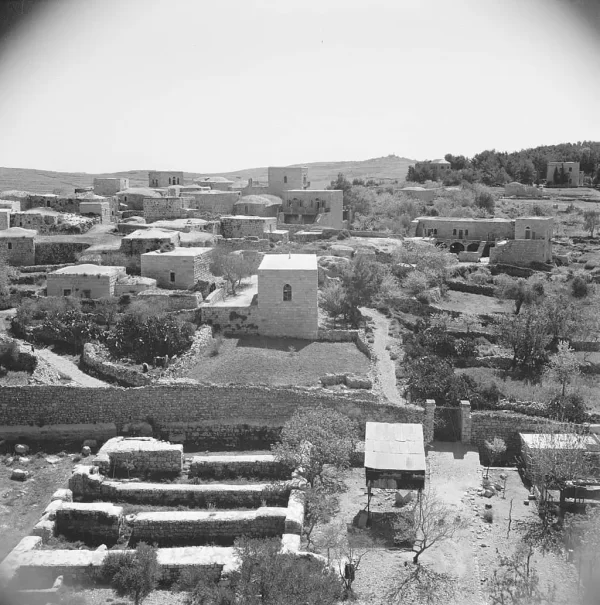


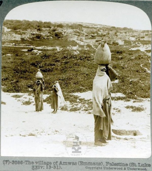
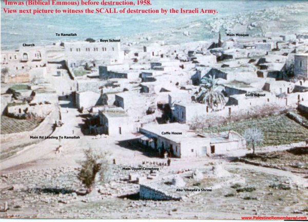
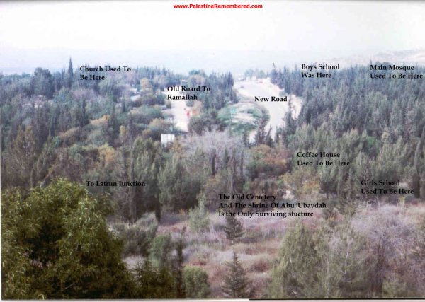
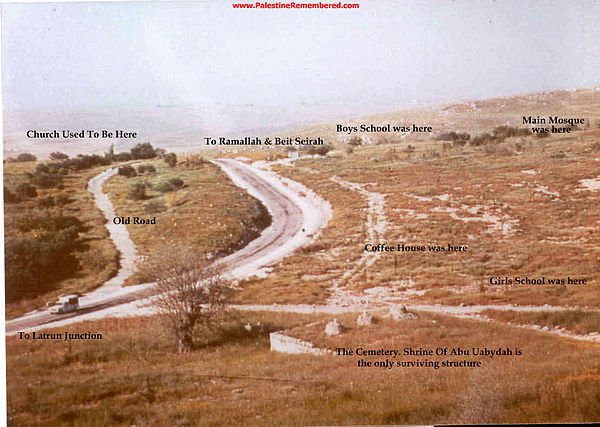








Photos from the village's people
Photos sent in by visitors and published after review.
Add a photo of this village
Log in to add photos of this village.
Other villages from Ramla

More from the archive


 Download Our Palestine App
The whole archive in the palm of your hand: depopulated villages, the Nakba, the massacres and Al-Aqsa — free, with no ads to erase the story.
Download Our Palestine App
The whole archive in the palm of your hand: depopulated villages, the Nakba, the massacres and Al-Aqsa — free, with no ads to erase the story.



Comments
No comments yet — be the first to write one.
Add your comment
Name and email are optional. Comments appear after review.