
The depopulated village of Bashshit / District of Ramla

Bashshit
About the depopulated village of Bashshit
- District
- Ramla
- Date Bashshit was occupied
- 13 May 1948
- Population in 1948
- 1,879
- Military operation
- Operation Barak
- Brigade that carried it out
- Givati Brigade
- Distance from the governorate centre
- 16.5 (km) Southwest of al-Ramla
- Elevation above sea level
- 50 m
- Cause of displacement
- Military assault by Zionist troops
- Extent of destruction
- Bashshit was mostly destroyed with the exception of few houses remain standing.
- Ethnic cleansing
- Bashshit inhabitants were completely ethnically cleansed.
Hover a dot to read the village name, or click to open its card.
Borders of the depopulated village of Bashshit
Bashshit – Depopulated Palestinian Village of Ramla
Bashshit was a Palestinian village in the Ramla Subdistrict, located on the central coastal plain approximately 16.5 kilometers southwest of Ramla and about 50 meters above sea level.
Wadi Bashshit, a tributary of Wadi al-Sarar, ran approximately half a kilometer east of the village. Bashshit stood among a network of Palestinian communities including Yibna, al-Maghar, Qatra, al-Masmiyya al-Kabira, Yasur, Barqa, 'Arab Suqrir, and al-Nabi Rubin.
The population reached 1,620 in the official 1944/45 statistics and the village lands covered 18,553 dunums. Agriculture formed the basis of the local economy, particularly cereal cultivation, together with orchards, citrus, olives, livestock, and poultry.
The Giv'ati Brigade occupied Bashshit on 12 or 13 May 1948 during the major offensive against villages south and west of Ramla that coincided with Operation Barak. Sources differ over the exact day and over whether the inhabitants began leaving immediately before or during the attack, but the Palestinian village community had been displaced by 13 May.
Basic Information
| Field | Information |
|---|---|
| Name | Bashshit |
| Arabic name | بشيت |
| Alternative English rendering | Bashshayt |
| Subdistrict in 1948 | Ramla |
| Administrative district | Lydda |
| Earlier subdistrict | Gaza until the end of 1931; transferred to Ramla in 1932 |
| Location | Central coastal plain, southwest of Ramla |
| Distance from Ramla | Approximately 16.5 km |
| Average elevation | Approximately 50 m above sea level |
| Population in 1922 | 936, all Muslims |
| Population in 1931 | 1,125 |
| Houses in 1931 | 333 |
| Population in 1944/45 | 1,620 |
| 1948 population estimate | 1,879 – later estimate, not an official census |
| Total land area | 18,553 dunums |
| Occupation date | 12–13 May 1948; 13 May is the most widely repeated date |
| Military context | Giv'ati offensive coinciding with Operation Barak against villages south and west of Ramla |
| Military unit | Giv'ati Brigade |
| Cause of depopulation | Military assault and collapse of local defense; sources differ on whether departure began immediately before or during the attack |
| Destruction | Most of the village was destroyed; three houses and a pool survived in Khalidi's field survey |
| Post-1948 settlements on village lands | Neve Mivtah, Meshar, Kfar Mordechai, Misgav Dov, Kannot, Shedema, and Aseret |
Administrative History
During the early British Mandate period, Bashshit was administratively included in the Gaza Subdistrict.
At the beginning of 1932 it was transferred to the Ramla Subdistrict together with Yibna, Qatra, and al-Maghar.
This explains why Bashshit appears in Gaza in the 1922 census but in Ramla in later Mandate statistics and in the village's 1948 administrative classification.
Name and Historical References
During the Crusader period the village was known as Basit.
The medieval Arab geographer Yaqut al-Hamawi mentioned Bashshit as a locality near Ramla.
Ibn al-'Imad al-Hanbali also recorded that the grammarian and chronicler Jamal al-Bashshiti, who died in 1417, was associated with the village.
Later Palestinian tradition connects the village name with the shrine of Nabi Shayt, although Khalidi does not offer a definitive linguistic derivation of the modern place-name.
Bashshit in the Late Nineteenth Century
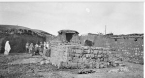
The Survey of Western Palestine described Bashshit as an adobe-built village with cultivated gardens nearby.
A three-domed shrine stood on elevated ground overlooking the settlement.
Palestinian local memory identifies this building as the shrine of Nabi Shayt, while Khalidi's account confirms the three-domed shrine without assigning a name to it.
Location and Geography
Bashshit stood on relatively level land in the central coastal plain.
Wadi Bashshit, a branch of Wadi al-Sarar, passed approximately half a kilometer to the east.
Neighboring Palestinian villages included Yibna and al-Nabi Rubin toward the north and northwest, al-Maghar to the northeast, Qatra to the east, al-Masmiyya al-Kabira and Yasur toward the south and southeast, and Barqa and 'Arab Suqrir toward the west and southwest.
Built Environment
The modern village had a rectangular plan extending along an east-west axis.
Older houses were constructed of adobe and stone, while newer buildings increasingly used stone and cement.
The built-up area covered 58 dunums in the 1944/45 statistics.
The mosque, elementary school, and several local buildings stood near the village center.
Population
- 1922936Official census; all Muslims, when Bashshit was administratively in the Gaza Subdistrict
- 19311,125Official census; all Muslims
- 1944/451,620Official Mandate-period estimate
- 19481,879Later demographic estimate, not an official 1948 census
- 199811,540Later Palestine Remembered estimate of refugees and descendants
Number of Houses
- 1931333Official census figure
- 1948556Later Palestinian estimate, not a new official government house census
Land Ownership, 1944/45
- Palestinian18,538 dunums100%
- Transferred to Zionists0 dunums0%
- Public15 dunums<1%
The figures balance exactly: 18,538 + 15 = 18,553 dunums.
No land was recorded in the Jewish ownership category in the 1945 statistics.
Land Use, 1944/45
- Palestinian
- Public
- Cereals17,558 dunums
- Plantations and irrigable land651 dunums
- Citrus and bananas66 dunums
- Built-up area58 dunums
- Non-cultivable land220 dunums
The land-use categories reconcile exactly with the total village land area.
Olive Groves and Double Counting
Approximately sixty-seven dunums were planted with olive trees.
This acreage is a subcategory within cultivated orchard land and should not be added again on top of the 651 dunums classified as plantations and irrigable land.
Economy and Agriculture
Agriculture formed the main economic base of Bashshit, supplemented by livestock and poultry raising and small-scale commerce and crafts.
Cereals dominated agricultural production, occupying 17,558 dunums in 1944/45.
The inhabitants also cultivated citrus, olives, vegetables, and other fruit trees. Orchards were particularly prominent west and northeast of the village.
A total of 18,275 dunums was classified as cultivated or cultivable land, representing almost the entire village territory.
Water
Several artesian wells supplied the inhabitants with drinking and domestic water and supported local agriculture.
Wadi Bashshit passed east of the village and formed a prominent part of the local landscape.
Education
A boys' elementary school was established in Bashshit in 1921.
By the mid-1940s it had approximately 148 pupils.
No independently documented girls' school or female enrollment figure was located in the principal sources reviewed.
Mosque and Shrine
A mosque stood in the center of Bashshit.
A three-domed shrine also occupied higher ground overlooking the village.
Palestinian local memory identifies this building as the shrine of Nabi Shayt.
It should be distinguished from the nearby archaeological site of al-Nabi 'Arafat, which was a separate locality.
Was There a Church?
An automated Palestine Remembered field lists a church.
However, the 1922 and 1931 censuses recorded the population as Muslim, while Khalidi's village description identifies a mosque and shrine but no church.
No church is therefore asserted without stronger independent evidence.
Archaeology
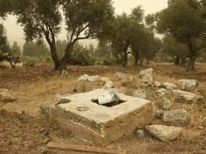
The village contained archaeological debris and remains described as an altar.
Nearby stood the archaeological site of al-Nabi 'Arafat, where columns, cisterns, and pottery were recorded.
Al-Nabi 'Arafat should not be confused with the three-domed shrine locally identified as Nabi Shayt.
Operation Barak and the Military Context
Operation Barak began on 9 May 1948 and was led principally by the Haganah's Giv'ati Brigade, with the Negev Brigade also participating in the broader offensive.
It targeted villages south and west of Ramla as part of the implementation of Plan Dalet before the end of the British Mandate.
The operation's first formal phase ended on 13 May, although Giv'ati military activity in the wider region continued afterward.
Palestine Remembered and the Palestinian Villages Encyclopedia explicitly associate Bashshit's occupation with Operation Barak. The PalQuest operation page does not list Bashshit among its abbreviated list of affected villages, even though the PalQuest village entry confirms Giv'ati's capture of Bashshit on 12 or 13 May.
The most precise description is therefore that Bashshit was captured during the Giv'ati offensive that coincided with Operation Barak and is directly associated with that operation in several Palestinian sources, while its name is absent from PalQuest's abbreviated affected-village list.
Attack and Occupation – 12–13 May 1948
The Giv'ati Brigade occupied Bashshit on 12 or 13 May 1948, immediately before the end of the British Mandate.
An Associated Press report stated that the Haganah claimed to have captured three villages in the area on 12 May, including Bashshit, which the communiqué described as a “strong Arab center.”
Khalidi also cites a chronology that places the occupation one day later, on 13 May.
The History of the Haganah attributes the attack to the Alexandroni Brigade, but Khalidi regards that attribution as probably incorrect. This article therefore identifies the Giv'ati Brigade as the best-supported attacking formation.
Cause of Depopulation and Conflicting Accounts
The sources differ over precisely when Bashshit's inhabitants left.
Palestine Remembered classifies the cause as direct military assault.
Khalidi cites another account claiming that the villagers had left before the assault, whereas Palestinian oral history records armed resistance in the village until ammunition ran low and describes the residents' departure as the defense collapsed.
The most cautious formulation is therefore: Bashshit was depopulated in the course of the Giv'ati assault of 12–13 May 1948, with disagreement over whether the population's departure began immediately before the attack or occurred during and after the collapse of local defense.
Local Account of Killings after the Fall
The Palestinian Villages Encyclopedia preserves local oral testimony stating that approximately ten men from Bashshit were killed after the defense collapsed on 13 May.
It names several of the reported dead, including Muhammad Nimr Hamdan, Salim al-Ja'bari, and 'Abd al-Qadir Abu 'Abdu and his brother, and also reports approximately ten wounded.
These details are not independently reproduced in Khalidi's village account or PalQuest.
They are therefore preserved here as local Palestinian oral testimony concerning killings after the village fell, rather than being presented as an independently verified massacre without qualification.
Destruction
Most of Bashshit's built environment was destroyed after its occupation.
The village was not physically erased in its entirety.
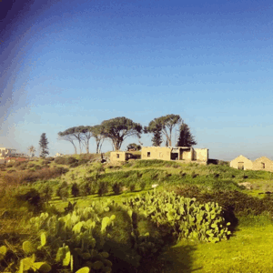
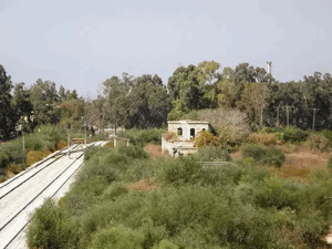
Khalidi's later field survey documented three surviving houses and a pool.
Two houses stood abandoned, while a Jewish family occupied the third, a two-storey concrete building.
The most accurate description is therefore extensive destruction of the village, with three houses, a pool, and other scattered physical traces surviving.
Ethnic Cleansing in Source Classification
Palestine Remembered classifies Bashshit using the term “complete ethnic cleansing.” The phrase is retained here only as an attributed source classification.
The more specifically documented sequence consists of the 12–13 May military assault, disappearance of the Palestinian community from the village, absence of permanent collective return, and later destruction of most of the village's built environment.
Occupation Chronology
| Date | Event |
|---|---|
| 9 May 1948 | Operation Barak begins under the principal command of the Giv'ati Brigade against villages south and west of Ramla. |
| 10–12 May 1948 | Giv'ati attacks expand throughout the area surrounding Bashshit and neighboring Palestinian villages. |
| 12 May 1948 | The Haganah announces the capture of three villages in the area, including Bashshit, according to an Associated Press report. |
| 13 May 1948 | Alternative and widely used date for the village's final occupation; Palestinian oral history associates this day with the collapse of local defense and departure of the villagers. |
| 13 May 1948 | The first formal phase of Operation Barak ends according to PalQuest. |
| Later period | Most village buildings are destroyed, while three houses and a pool survive. |
| 1950 | Neve Mivtah, Meshar, Kfar Mordechai, and Misgav Dov are established on Bashshit's lands. |
| 1952 | Kannot is established on village land. |
| 1954 | Shedema and Aseret are established on village land. |
Israeli Settlements Established on Bashshit's Lands
Walid Khalidi and PalQuest identify seven Israeli settlements established on Bashshit's lands after the Nakba.
Neve Mivtah, Meshar, Kfar Mordechai, and Misgav Dov were founded in 1950.
Kannot was founded in 1952.
Shedema and Aseret were founded in 1954.
Some other Palestinian references present slightly different locality lists, but this article follows the Khalidi/PalQuest village-specific identification.
Bashshit Today
According to the field description used by Walid Khalidi before the publication of All That Remains in 1992, three houses and a pool remained at the former village site.
Two of the houses were abandoned, while a Jewish family lived in the third.
One abandoned structure was a simple box-like house with a flat roof and a rectangular doorway framed in stone, while the occupied building was a two-storey concrete house with a flat roof.
Cactus, sycamore, and eucalyptus trees grew across the site, while the surrounding village lands were under cultivation.
Palestine Remembered contains later Palestinian community photographs of the shrine, houses, and site, as well as a video posted on 22 August 2026 documenting the mosque/shrine of Nabi Shayt and its condition at that time.
This recent material is useful community documentation but does not constitute a comprehensive archaeological or cadastral survey of Bashshit's entire territory. Khalidi's account likewise represents historical fieldwork conducted before 1992 rather than a complete direct survey of the site in 2026.
Sources
- PalQuest – Interactive Encyclopedia of the Palestine Question: Bashshit
- PalQuest – Operation Barak
- Palestine Remembered – Bashshit, Ramla Subdistrict
- Palestine Remembered – Bashshit entry from Walid Khalidi's All That Remains
- Palestine Encyclopedia – Bashshit
- Palestinian Villages Encyclopedia – Bashshit
- Our Palestine – Bashshit, Ramla Subdistrict
Photo gallery


Photos from the village's people
Photos sent in by visitors and published after review.
Add a photo of this village
Log in to add photos of this village.
Other villages from Ramla
More from the archive



 Download Our Palestine App
The whole archive in the palm of your hand: depopulated villages, the Nakba, the massacres and Al-Aqsa — free, with no ads to erase the story.
Download Our Palestine App
The whole archive in the palm of your hand: depopulated villages, the Nakba, the massacres and Al-Aqsa — free, with no ads to erase the story.



Comments
No comments yet — be the first to write one.
Add your comment
Name and email are optional. Comments appear after review.